- Home
- About
- Map
- Trips
- Bringing Boat West
- Migration West
- Solo Motorcycle Ride
- Final Family XC Trip
- Colorado Rockies
- Graduates' XC Trip
- Yosemite & Nevada
- Colorado & Utah
- Best of Utah
- Southern Loop
- Pacific Northwest
- Northern Loop
- Los Angeles to NYC
- East Coast Trips
- Martha's Vineyard
- 1 Week in Quebec
- Southeast Coast
- NH Backpacking
- Martha's Vineyard
- Canadian Maritimes
- Ocracoke Island
- Edisto Island
- First Landing '02
- Hunting Island '02
- Stowe in Winter
- Hunting Island '01
- Lake Placid
- Chesapeake
- Provincetown
- Hunting Island '00
- Acadia in Winter
- Boston Suburbs
- Niagara Falls
- First Landing '99
- Cape Hatteras
- West Coast Trips
- Burning Man
- Utah Off-Roading
- Maui
- Mojave 4WD Course
- Colorado River Rafting
- Bishop & Death Valley
- Kauai
- Yosemite Fall
- Utah Off-Road
- Lost Coast
- Yosemite Valley
- Arizona and New Mexico
- Pescadero & Capitola
- Bishop & Death Valley
- San Diego, Anza Borrego, Joshua Tree
- Carmel
- Death Valley in Fall
- Yosemite in the Fall
- Pacific Northwest
- Utah Off-Roading
- Southern CA Deserts
- Yosemite & Covid
- Lake Powell Covid
- Eastern Sierra & Covid
- Bishop & Death Valley
- Central & SE Oregon
- Mojave Road
- Eastern Sierra
- Trinity Alps
- Tuolumne Meadows
- Lake Powell Boating
- Eastern Sierra
- Yosemite Winter
- Hawaii
- 4WD Eastern Sierra
- 4WD Death Valley +
- Southern CA Deserts
- Christmas in Tahoe
- Yosemite & Pinnacles
- Totality
- Yosemite & Sierra
- Yosemite Christmas
- Yosemite, San Diego
- Yosemite & North CA
- Seattle to Sierra
- Southwest Deserts
- Yosemite & Sierra
- Pacific Northwest
- Yosemite & South CA
- Pacific Northwest
- Northern California
- Southern Alaska
- Vancouver Island
- International Trips
- Index
- Tips
- Books
- Photos/Videos
- Search
- Contact
Bishop, CA
Wednesday, February 7, 2024 - 4:45pm by Lolo
575 miles and 9.5 hours from our last stop - 6 night stay
Travelogue
Day 1 - Arrival
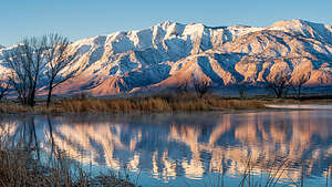 The Sierra at sunriseAs I have mentioned in the past, our son Andrew and his wife Celeste, moved from San Francisco to Bishop in 2019 to try out a less-urban lifestyle in what is a world-class rock climbing destination. They were fortunate enough to be able to take their San Francisco jobs with them - and this was before Covid.
Bishop and all of the Eastern Sierra is stunningly beautiful, so even though they are 6 ½ hours away from us now, it is not a hardship to go over the mountains to visit them. Their home is often the first or last stop on one of our road trips.
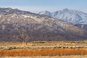 Along the Bishop Canal at sunriseCalifornia was experiencing multiple atmospheric rivers bringing heavy rain to the central and coastal parts of the state and lots of snow in the mountains. So, we had to look for a window of opportunity to get over the Sierra mountains.
There really wasn’t any day for the whole next week without forecasted snow along the mountain passes, so we decided to take the long journey south down I5 to Bakersfield, across Tehachapi pass, and then up 14 and 395 to Bishop, adding 2 hours to the our usual more direct route through South Lake Tahoe.
We arrived in Bishop right about dinner time, but Andrew and Celeste had a delicious dinner ready for us. They are incredible hosts and serve the best food in Bishop.
Day 2 - Cross Country Skiing at Rock Creek
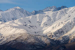 Snow-capped SierraWhen we lived on the East Coast, Herb and I loved to cross country ski, but since we moved to Sonoma Valley, where it never snows, we haven’t had as much opportunity.
However, although Bishop doesn’t get much snow, a mere 30-minute drive north up 395 can get you to tons of it.
So, since Andrew and Celeste had to work today, Herb and I decided to drive up to Rock Creek, a place where we have cross country skied in the past.
Wow! What a difference 30 miles can make. There was easily over 3 feet of snow.
Our first order of business was carrying our gear over a 6-foot pile of snow created by the snow plow. It was so deep on the other side that we were postholing up to our thighs, making putting our skis on extremely difficult. I had a new pair of skis that I was not used to, so it took Herb’s help and about 20 minutes to get them on me. He made me promise not to take them off until we were done.
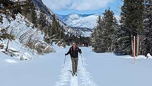 Rock CreekThe last time we skied here, the road was nicely groomed by a snowmobile making nice tracks for us to follow, but this time all there was was a Mish Mosh of tracks made by a few previous skiers. They were not nearly as easy to maneuver along as groomed tracks.
Spirits were high as we set off on the trail, which was really a snow-covered road, which just kept going up and up. Well, I thought, at least the way back would be easy.
One thing we had neglected to consider was that we were at an elevation of 9500 feet, and we had been near sea level yesterday, so no time to acclimate. No wonder why we were breathing heavy and feeling a bit light-headed.
 Along the Bishop CanalInstead of going all the way to Rock Creek Lake (an additional mile out), we decided to turn around at the 2.5 mile point.
I was psyched to enjoy the continuous downhill on the way back. Last time we had done this trail, I barely had to move my legs. Rather, it was like gliding along one of those moving walkways in an airport.
However, that was not to be my experience today. Because of warmer temperatures, snow clumps were clinging to the bottom of our skis, making gliding an impossibility. Plus like last time, there were no nicely groomed tracks to follow.
 Our wonderful hostsSo between the snow clumps on my skis, the messy tracks, and the lightheadedness from the altitude, I proceeded to fall about a dozen times. The falls weren’t bad, but getting up was extremely difficult. With one ski sprawled out behind me and the other to the front, I was so tempted to just take them off and start over, but I remembered my promise to Herb - who unfortunately was about 100 yards ahead of me. So, I stuck my pole in the snow to use as a lever up, but the snow was so deep that all that was above the snow was the top of the handle.
I called for him to help, but he told me I had to learn to get up myself. Well, usually that was not a problem but today everything was against me. After straining most of the muscles in my lower back and abdomen, I managed to right myself and continue on, only to repeat this debacle another half dozen times.
Eventually I made it back to the car wounded but intact. We agreed that next time we would only ski groomed or at least tightly packed snow trails.
I guess this story will get better with age. Andrew and Celeste already thought it was pretty amusing. A glass of wine and another delicious dinner made things much better.
Day 3 - Sunrise photoshoot and the Secret Petroglyph Sky Rock
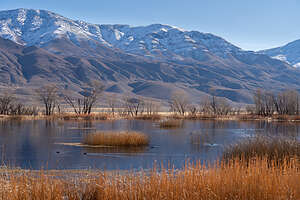 Morning photo shootEvery morning before sunrise, Herb would quietly get out of bed, make himself a cup of coffee, and head out with his 4Runner on the dirt roads east of Bishop. From here the views of the snow-capped Sierra to the west and the Whites to the west were stunning.
In the afternoon, we decided to head out on an exploratory hike in the Volcanic Tablelands in search of a hidden petroglyph called Sky Rock that we had heard about from two photographers we had met during a trip to Utah.
The Volcanic Tablelands are located just north of Bishop in a stunning area where the floor of the Owens Valley rises abruptly, forming a 300 foot-high volcanic plateau. It is a premier rock climbing destination for climbers from around the world.
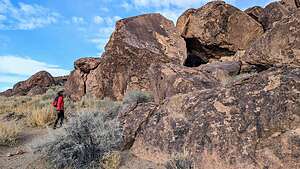 Looking for Sky RockHowever, long before climbers took over this area, it was home to the Paiute-Shoshone peoples, who carved numerous petroglyphs on the volcanic rock throughout the tablelands. Although the exact ages of the petroglyph panels is unknown, they are generally accepted as between 1000 and 8000 years old.
Today, our mission was to find the very secretive and well-hidden petroglyph panel known as Sky Rock. It is such a close-guarded secret for fear of vandalism of this very archaeologically-significant site.
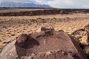 Sky Rock from aboveWhen we were in Goblin Valley we had met two photographers who told us about Sky Rock when they learned our son lived in Bishop. Even with the GPS coordinates they shared with us, it was still a challenge finding it, since, as its name implies, the panel faces the sky, so it is not visible from any trail. You have to climb above it to see it.
After much rock scrambling, we finally found it, covering the top surface of a boulder. It was amazing, especially in light of the fact that it was created thousands of years ago. There are still many Paiutes living in Bishop - perhaps the descendents of the artists the created these panels.
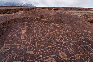 Sky Rock PetroglyphWe had to climb up pretty high on a nearby boulder to see as much of the extensive panel as we could. A drone certainly would have come in handy. It would be wonderful to know what the symbols mean. What story were they trying to tell?
This was worth every bit of scrambling to get to.
We learned later that there is another secret petroglyph in the area known as 13 Moons. That would give us something to look forward to on our next trip to Bishop.
When we got back to Andrew and Celeste’s, we were so excited to tell them about what we had discovered and encouraged them as Bishop residents to go out and do the same.
Then we ate another one of Celeste’s delicious dinners.
Day 4 - Hike through the Alabama Hills
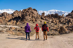 Alabama Hills HikeIt was Saturday, so Andrew and Celeste didn’t have to work and could spend the entire day with us.
At first we planned to do a hike in the nearby Druids, but then Andrew suggested that we try something new - a 6-mile hike through the Alabama Hills outside of Lone Pine, which he had found in an Eastern Sierra trail running guide.
We all loved the idea, especially me because I figured if it was supposed to be a trail run, there couldn’t be too much rock scrambling. I had had about enough of that yesterday when trying to find Sky Rock.
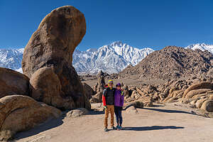 Alabama Hills HikeSo, we piled into Andrew’s car and drove for about an hour from Bishop, through Big Pine and Independence, past the Manzanar Historic Site (World War II Japanese internment camp), and into Lone Pine before turning right to get into the heart of the Alabama Hills, a range of hills and rock formations that lie at the foot of the eastern Sierra Nevada Mountains, with Mount Whitney, the tallest mountain in the continental U.S. towering above.
The outstanding and dramatic scenery of the hills also attracted Hollywood filmmakers from the 1920s to the present. Hundreds of movies (particularly westerns), TV shows, and commercials have been filmed here over the past century.
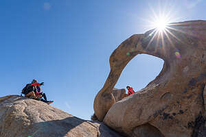 Mobius ArchThe Lone Pine Film History Museum is a great place to learn about the film history of the area. The 5.7-mile unpaved Movie Flat Road through the Hills goes past the filming locations for such greats as “How the West was Won,” “Rawhide,” and “Gunga Din.” A “Movie Road Touring Brochure,” is available online or at the museum.
The rocks in the Alabama Hills are very different from the boulders found in Bishop. They are much more rounded as the result of chemical weathering. When these hills were still covered with soil, percolating water rounded the granite blocks and sculpted the interesting arches and potato-shaped boulders that we would see along our hike today.
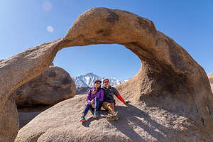 Mobius ArchOur hike began near a rock formation named Shark Fin, a 60-foot monolith shaped exactly like the fin of a shark. Like most of the boulders in the Alabama Hills, there is a climbing route up the fin, and I am proud to say that I actually climbed it a few years back.
From there we set out for a fantastic journey amongst the bulbous rocks of the Alabama Hills. Eventually, we came to the iconic Mobius Arch, through which you can see Mt. Whitney. Photographers love to take this photo, so, of course, we had to as well. Although this photo can be cliche, each photo can be different, based on weather conditions, time of day, and who’s posing in it.
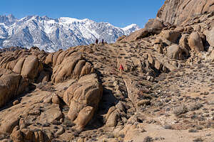 Alabama Hills HikeThe hike was more tiring than we all had expected - 6 ½ miles with about a 1,000 foot of elevation gain, with the occasional rock scrambling when we wandered off route.
What a wonderful day, an awesome hike with fabulous views and great company along the way. We all (except Andrew) fell asleep on the hour-long drive back to Bishop.
Back home, we spent the rest of the day just enjoying each other’s company and sitting down to another one of Celeste’s delicious dinners.
Day 5 - Super Bowl Party
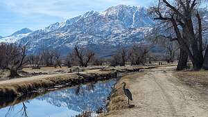
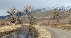 Stroll along the Bishop CanalSince the Super Bowl was this afternoon, we didn’t wander too far, but just took a nice long walk along the Bishop Canal.
I love this walk, threading our way through the cows with the snow capped Sierra mountains to the West and the White Mountains to the East. Andrew and Celeste are so lucky to have this so close to their home.
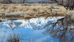 Stroll along the Bishop CanalAround 3:00, Andrew and Celeste’s friends started arriving, bearing lots of food to munch on through the game. Meanwhile, Celeste had a Crock Pot full of beef chili ready for half time.
Andrew and Celeste have met some really great people since their move to Bishop, and it was so much fun spending time with them. Being so far away from us, it’s nice to know that they have such a good group of caring friends.
The game, as you all know, was an exciting one. However, being from the Bay Area, we were all disappointed at the 49er’s loss.
Day 6 - More 4WD exploring of areas around Bishop
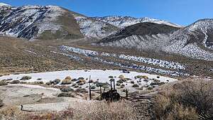 The Bishop"Beach"This was our last day with Andrew and Celeste in Bishop before we would set out for four days into Death Valley, one of Herb and my favorite places.
We still had a few hours to spare while the kids were working, so we decided to go to the “Beach,” a large bright patch of white in the foothills of the White Mountains northeast of Bishop in an area known as Gunter Canyon.
It definitely was an oddity. What was a beach doing out in the hills below the Whites? And why were their old abandoned rusty cars and machinery.
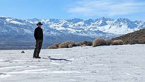 Herb at the "Beach"We had been here a few times before, but never really took the time to research the history behind this unique landscape.
Well, as it turns out, the white stuff spread across the ground is not sand at all, but rather fine-grain pumice tailings, remnants from the old Hidecker Pumice Mine that used to operate here.
It seems like you can’t go too far offroad in the Eastern Sierra (especially in Death Valley) without running across an old mining area. I think there are so many minerals to mine in this area because of all the volcanic activity that occurred in its distant past.
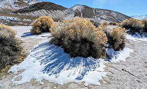 Some snow and sandOf course, now I had to know what pumice is, how it got here, and what commercial uses it has that would make someone go through the trouble of mining here.
Pumice is a type of extrusive volcanic rock, produced when lava with a very high content of water and gasses is discharged from a volcano. As the gas bubbles escape, the lava becomes frothy. When this lava cools and hardens, the result is a very light rock material filled with tiny bubbles of gas.
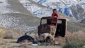 Car shoppingLong ago, people found that this very porous, froth-like volcanic rock is very abrasive and very useful as a cleaning, polishing, and scouring compound.
In fact, Martha Stewart even wrote an article about the “Seven Surprising Uses for a Pumice Stone,” some of which include: making your toilet bowl sparkle, cutting through greasy deposits on stove grates, removing pet hair from furniture, and on and on.
In fact, now I remember that Herb has this giant orange bottle of hand cleaner in the garage that is extremely effective. Guess what? It’s made from pumice.
All that, and being able to create the illusion of being on a white sandy beach in the middle of a canyon.
Day 7 - Drive to Death Valley
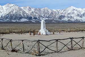 Manzanar MemorialThe drive along 395 from Bishop to Lone Pine is always a treat, especially when the surrounding mountain tops are covered with snow.
Although we had been to the Manzanar National Historic Site in Lone Pine before, I asked Herb if we could take a quick drive through to the poignant obelisk memorial that stands at the far edge of the camp, before the dramatic backdrop of the Sierra.
Unlike most of the Historic Sites we have had the privilege of visiting, this is not one that we as Americans can be proud of. This particular facility was one of ten relocation centers set up by the U.S. Government during World War II to forcibly intern Japanese American citizens. During the three years it was in operation, more than 10,000 people were sent to this center alone to be housed and held against their will for the duration of the war.
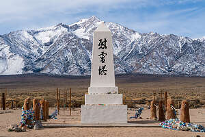 Manzanar MemorialThree large characters on the front of the memorial translate to “Soul Consoling Tower.” Colorful ribbons and scarves and other assorted offerings, like coins and even sake, adorn the posts around the obelisk.
Every last Saturday in April, hundreds of former internees, their families and friends, and a growing number of young people take a pilgrimage to this site to remember, honor, and reflect on the experiences of the people that were unjustly interned in this camp.
I highly recommend that anyone visiting Manzanar stop at this cemetery for a moment of reflection.
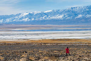 Owens Lake with waterAfter leaving Manzanar we continued south on 395 and then turned left on Highway 136 which would link us up with Highway 190, the major road into Death Valley.
As we were driving along 136, we couldn't help but stop to see the long dried up Owens Lake replete with water from the continuous atmospheric rivers hitting California.
Owens Lake has basically been a dry lake bed since the 1920s when the streams feeding it were diverted to quench the growing city of LA’s thirst for water.
The problem with dry lake beds is that when the wind blows the dust on their surface into the air, it creates a dangerous air pollution and health problem.
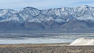 Owens Lake with waterTo make amends, LA has spent billions of dollars building infrastructure to keep the dust down on the lake. Ironically, the water that is filling the lake (which would naturally keep the dust down) is threatening to damage that expensive equipment that has been installed to keep the dust down.
The erratic swings in the California weather from too dry to too wet make managing these areas very difficult.
However, for today we were just happy to have had a chance to see how beautiful this lake once was before it was sacrificed for the growth of LA.
Now, onto Death Valley
- 1 of 2
- next ›
