- Home
- About
- Map
- Trips
- Bringing Boat West
- Migration West
- Solo Motorcycle Ride
- Final Family XC Trip
- Colorado Rockies
- Graduates' XC Trip
- Yosemite & Nevada
- Colorado & Utah
- Best of Utah
- Southern Loop
- Pacific Northwest
- Northern Loop
- Los Angeles to NYC
- East Coast Trips
- 1 Week in Quebec
- Southeast Coast
- NH Backpacking
- Martha's Vineyard
- Canadian Maritimes
- Ocracoke Island
- Edisto Island
- First Landing '02
- Hunting Island '02
- Stowe in Winter
- Hunting Island '01
- Lake Placid
- Chesapeake
- Provincetown
- Hunting Island '00
- Acadia in Winter
- Boston Suburbs
- Niagara Falls
- First Landing '99
- Cape Hatteras
- West Coast Trips
- Utah Off-Roading
- Maui
- Mojave 4WD Course
- Colorado River Rafting
- Bishop & Death Valley
- Kauai
- Yosemite Fall
- Utah Off-Road
- Lost Coast
- Yosemite Valley
- Arizona and New Mexico
- Pescadero & Capitola
- Bishop & Death Valley
- San Diego, Anza Borrego, Joshua Tree
- Carmel
- Death Valley in Fall
- Yosemite in the Fall
- Pacific Northwest
- Utah Off-Roading
- Southern CA Deserts
- Yosemite & Covid
- Lake Powell Covid
- Eastern Sierra & Covid
- Bishop & Death Valley
- Central & SE Oregon
- Mojave Road
- Eastern Sierra
- Trinity Alps
- Tuolumne Meadows
- Lake Powell Boating
- Eastern Sierra
- Yosemite Winter
- Hawaii
- 4WD Eastern Sierra
- 4WD Death Valley +
- Southern CA Deserts
- Christmas in Tahoe
- Yosemite & Pinnacles
- Totality
- Yosemite & Sierra
- Yosemite Christmas
- Yosemite, San Diego
- Yosemite & North CA
- Seattle to Sierra
- Southwest Deserts
- Yosemite & Sierra
- Pacific Northwest
- Yosemite & South CA
- Pacific Northwest
- Northern California
- Southern Alaska
- Vancouver Island
- International Trips
- Index
- Tips
- Books
- Photos/Videos
- Search
- Contact
Exit Glacier - Kenai Fjords National Park, AK
Wednesday, July 26, 2006 - 3:30am by Lolo
15 miles and 0.5 hours from our last stop
Travelogue
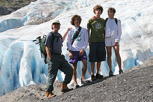
 Family at Exit GlacierSince the weather had thwarted our attempts to see the glaciers of Kenai Fjords by boat, we decided to at least see them by land. So, after leaving Seward we turned off on Exit Glacier Road, a 9-mile paved road along the pretty Resurrection River to the Exit Glacier Nature Center, the only section of the Park in which glaciers are accessible by foot. As we approached the end of the road, we began passing signs with numbers on them, like 1943, 1956, 1978, etc. At first we thought they were altitude measurements, but then we realized that they were years. These signs marked where the foot of the glacier had been in each of those years. It was surprising, and somewhat disconcerting, to see just how much this glacier had receded over the past few decades. We better see it while we still can.
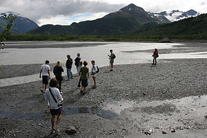
 Gang hiking on the flat outwash plainWith more time, and a little less muddy conditions, it would have been great to do the 7-mile Harding Icefield Trail, the premier hike in the park, which climbs 3,000 feet above the valley floor to the Harding Icefield. However, since we were pretty anxious to move on to the Russian River to do some salmon fishing later that day, we settled for some short meanders around the valley. We took the Lower Loop Trail from the Nature Center through a forest, across a creek, and then ¼ mile uphill to the 150-foot face of Exit Glacier. Unfortunately, unlike Byron Glacier at our earlier Portage Glacier stop, we weren't allowed to climb up and play on it. It was very impressive, but not nearly as much fun.
We hiked down by way of the outwash plain where the ice cold melt from the glacier flowed. Now there was something to play in. The kids rolled up their pant legs and ran back and forth through the frigid water. Tommy was the most crazed and soon found himself all alone out on a little spit of sand quite a distance away. You could tell his feet were numb, but he had no choice but to brave the ice cold waters once again to get back to us. His feet were lobster red, but I think he had a good time.
Description
Kenai Fjords is the smallest national park in Alaska. The crowning feature of the park is the 700 square mile Harding Icefield, which feeds over 30 glaciers flowing out of the mountains. As impressive as the Harding Icefield is, however, it is only a mere vestige of the massive ice sheet that carved out the Kenai fjords millions of years ago. The fjords serve as habitats for puffins, bald eagles, harbor seals, sea lions, sea otters, moose, black bears, mountain goats, and much more.
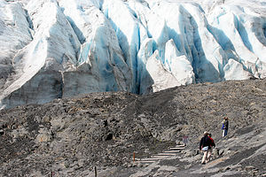
 Lower Loop TrailExit Glacier is the only part of Kenai Fjords National Park that is accessible by road. To get to Exit Glacier, head 4 miles north from the town of Seward and turn left onto the access road. The 9-mile paved road runs along the Resurrection River and ends at the Exit Glacier Ranger Station.
There are several hikes that start at the Exit Glacier Nature Center. A ¾-mile nature trail is an easy walk through a forest. The ½-mile Lower Loop Trail starts at the Nature Center, crosses a creek, and then climbs a steep ¼ mile up to the 150-foot face of Exit Glacier. The steep and winding Upper Trail continues another ¼ mile, offering views across the glacier and of several ice caves.
A much longer and more strenuous hike is the 7-mile round trip Harding Icefield Trail (allow 6-8 hours). The trail begins at the valley floor, winds through forests and meadows, and then climbs above to the tree line to breath-taking views of the Icefield. This hike has an elevation change of about 3,000 feet and there are several rocky sections in the first mile that require scrambling.
- ‹ previous
- 9 of 12
- next ›
Exit Glacier - Kenai Fjords National Park location map
Javascript is required to view this map.
