- Home
- About
- Map
- Trips
- Bringing Boat West
- Migration West
- Solo Motorcycle Ride
- Final Family XC Trip
- Colorado Rockies
- Graduates' XC Trip
- Yosemite & Nevada
- Colorado & Utah
- Best of Utah
- Southern Loop
- Pacific Northwest
- Northern Loop
- Los Angeles to NYC
- East Coast Trips
- Martha's Vineyard
- 1 Week in Quebec
- Southeast Coast
- NH Backpacking
- Martha's Vineyard
- Canadian Maritimes
- Ocracoke Island
- Edisto Island
- First Landing '02
- Hunting Island '02
- Stowe in Winter
- Hunting Island '01
- Lake Placid
- Chesapeake
- Provincetown
- Hunting Island '00
- Acadia in Winter
- Boston Suburbs
- Niagara Falls
- First Landing '99
- Cape Hatteras
- West Coast Trips
- Burning Man
- Utah Off-Roading
- Maui
- Mojave 4WD Course
- Colorado River Rafting
- Bishop & Death Valley
- Kauai
- Yosemite Fall
- Utah Off-Road
- Lost Coast
- Yosemite Valley
- Arizona and New Mexico
- Pescadero & Capitola
- Bishop & Death Valley
- San Diego, Anza Borrego, Joshua Tree
- Carmel
- Death Valley in Fall
- Yosemite in the Fall
- Pacific Northwest
- Utah Off-Roading
- Southern CA Deserts
- Yosemite & Covid
- Lake Powell Covid
- Eastern Sierra & Covid
- Bishop & Death Valley
- Central & SE Oregon
- Mojave Road
- Eastern Sierra
- Trinity Alps
- Tuolumne Meadows
- Lake Powell Boating
- Eastern Sierra
- Yosemite Winter
- Hawaii
- 4WD Eastern Sierra
- 4WD Death Valley +
- Southern CA Deserts
- Christmas in Tahoe
- Yosemite & Pinnacles
- Totality
- Yosemite & Sierra
- Yosemite Christmas
- Yosemite, San Diego
- Yosemite & North CA
- Seattle to Sierra
- Southwest Deserts
- Yosemite & Sierra
- Pacific Northwest
- Yosemite & South CA
- Pacific Northwest
- Northern California
- Southern Alaska
- Vancouver Island
- International Trips
- Index
- Tips
- Books
- Photos/Videos
- Search
- Contact
Sebastopol and Side Trips to San Francisco, Sonoma, Napa, and Marin Counties, CA
Wednesday, August 26, 2015 - 9:00am by Lolo
285 miles and 5.5 hours from our last stop - 8 night stay
Travelogue
Sonoma County is such a beautiful place with so many things to do, so we decided to head back to our base camp at the Petaluma KOA, where we would be in striking distance to the boys and lots of great activities.
Baker Beach, Planet Granite, and Pizzetta 211
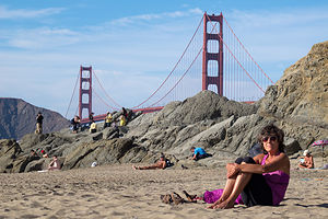 Lolo at Baker BeachWe had made arrangements with Andrew, Tommy, and Celeste to meet them at Planet Granite after they got out of work, but it was such a beautiful day that we decided to head down to San Francisco early and take a walk along the beach.
It is still so amazing to me that there can be such a beautiful beach within the limits of a major city. Being from New Jersey, we still have an issue with the Pacific Ocean water being so cold compared to the Atlantic, but the views definitely compensate. Its setting alone beneath the eucalyptus-covered rugged cliffs of the Presidio would be incredible enough, but the views of the Golden Gate Bridge and the Marin Headlands beyond it make it truly astounding.
Unlike our last time here, it was very warm, so people were actually frolicking in the water. It was such a lovely sunny day that it seemed like much of the city was out enjoying the beach in their own way – children frolicking in the water, couples walking hand in hand along the shoreline, nude volleyball players leaping around the sand – this is San Francisco after all.
Herb and I spent a pleasant hour soaking up the sun and the activity on the beach before heading out to Planet Granite.
Herb has been an avid rock climber for decades, but I am a rather recent and reluctant convert to the sport. However, now I absolutely love it and am usually the driving force for getting down to Planet Granite as often as possible when we are in the San Francisco area. It is an absolutely beautiful gym, with 50-foot high, floor-to-ceiling windows overlooking the Golden Gate Bridge, Alcatraz, and Crissy Fields. Plus, there are so many climbing routes of various difficulty levels that I could climb here for a week and never repeat a climb. It’s like a giant jungle gym for adults.
After a really fun and challenging two hours of climbing, we decided that 8:00 was about the time to quit and find some dinner. Rather than go out and sit in a restaurant when we were all sweaty, we picked up several pizzas from Pizzetta 211, one of their favorite pizza establishments in the Richmond district. I used to think that New York City had a monopoly on great pizza, but the artisan, thin-crusted pies with so many creative toppings at this place and so many others in San Francisco are truly amazing. For example, one of the pies we ordered was Farm Egg, Shiitake Mushrooms, Butter Braised Leeks, Truffled Pecorino, and Hazelnut Picada. A far cry from the pepperoni and peppers we normally add to our pie back in New Jersey.
Lake Berryessa and Napa Valley
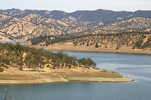 Lake Berryessa in DroughtAs I mentioned, we plan to move to Sonoma County once our house in New Jersey sells, so we are always on the lookout for how we can transition our old lives into new surroundings. One of the challenges in that transition is what to do about our 20-foot Grady White. Currently, we store it in our backyard and trailer it to destinations such as the Hudson River, Long Island Sound, the Connecticut River, Martha’s Vineyard, etc. The East Coast has so many great nooks and crannies that it is truly a boater’s paradise, and we were concerned about losing that when we move west, especially when California is in such an historic drought. We had seen firsthand just how devastating the drought was when we hiked near Lake Sonoma last year and saw how low the lake had become.
I had been told that Lake Berryessa in Napa County was one of the best places to boat, so we decided to take a drive to check it out – besides, I wanted an excuse to drive through Napa Valley.
However, although Sonoma and Napa Valleys are near each other as the crow flies, they are separated by the Mayacamas Mountains, so there are not many roads connecting the two, and those that do are usually quite steep and windy. However, at the southern end of the valleys, relatively flat Route 12 connects the two, so we began our drive north through Napa Valley in the town of Napa.
Another factor in our transitioning to a new home is proximity to a climbing gym. Strangely enough, at this point in my life, climbing a few times a week has become not just a luxury, but more of a necessity for my mental and physical well-being. So, just in case we expanded our eventual house search to Napa Valley, we stopped in the appropriately named Rockzilla gym in the town of Napa to make sure it would fit our needs. It was a really good gym, and the only one we have ever been to that has indoor chimney routes.
From there, instead of taking Route 29 through the Valley – we would save our vineyard tour for later -- we drove northeast on Highway 121 towards Lake Berryessa. The road got steep quite quickly and we climbed about 1,200 feet in the first 5 milea. For the next 40 miles it was pretty much up and down the whole way. I knew exactly what Herb was thinking – would we really want to trailer our Grady up and down this road?
When we got to our first view point of the lake near the Soda Creek Inlet, we were shocked. The Inlet was completely dry from the drought. Despite that, we could envision just how beautiful this lake would be, if only it had water.
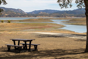 Lake Berryessa Dry Boat Launch RampWe continued driving on the Berryessa Knoxville Road, which traced the western shore of the lake, stopping first at the Bureau of Reclamation Field Office where we spoke to a ranger about the condition of the lake. It was, as she said, pretty dire and desperately in need of rainfall. At full capacity it is 23 miles long, 3 miles wide, and has 165 miles of shoreline. With such beautiful surroundings, this lake had such potential for some very awesome boating. Hopefully, the rains would come.
After this depressing stop, we continued on to the Oak Shores Day Use Area to have a picnic lunch. Once again, we could envision what a great place this would be to swim or launch or kayak, but the water was just too far away.
Spirits were a little low, as we seriously doubted this would be a good place for our boat – both in terms of the drive to get to it and the lack of water. We drove back down along the western shore, but instead of heading back towards the town of Napa, we took Route 128 west towards the town of Calistoga at the northern end of Napa Valley.
When we came to it, we took the alternative Silverado Trail, which parallels the section of 128 which goes through the valley, but is higher up and has much better views.
Calistoga is a very cute town, as our most of the towns in both Sonoma and Napa Valleys. Many of the names of the towns definitely let you know that you are in wine country – like Zinfandel and Kenwood.
From Calistoga, we could have taken one of the windy roads over the Mayacamas Mountains back to Petaluma – as was recommended as the shortest route by Google Maps – but we wanted to do the entire drive from Calistoga to Napa through the Valley. Also, we were pretty much done with roads that looked like intestines on the map and preferred using the flat Route 12 to get back to Sonoma.
So we spent an enjoyable 45 minutes driving past vineyards as far as the eye could see, avoiding the temptation – at least for now – of stopping in for a tasting.
My first Sonoma running club race and chillin’ in Sebastopol
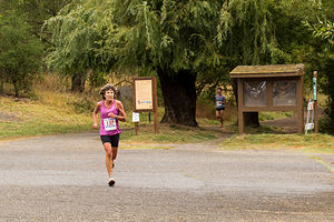 Lolo Racing with Empire RunnersWe are pretty much a family of runners. The boys ran cross country and track in both high school and college, and Herb and I run at least 3 or 4 times a week and compete in an occasional 5 or 10K race. However, my biggest love in recent years has been watching them run rather than participating myself, with the exception of an annual Turkey Trot.
When Andrew moved to San Francisco two years ago, he joined the running club that Celeste and her dad belonged to, which runs cross country and track races throughout the year. Tommy joined it as well when he moved there in August. Now that we were talking about moving to the area, they were very much pushing for us to join as well. I have been pretty competitive at the local level in the past, so they had high hopes of me running really fast – at least in the old lady class. Great.
So, I agreed to run in a 6K Empire Runners Club race in Spring Lake Park. This would be the first cross country race (as opposed to road race) of my life. I am not sure why at the tender age of 59 I am taking up rock climbing and cross country racing, but what the heck.
Not to make excuses, but my training had been rather light the last few months because of an ankle which I rolled while running behind Herb on the edge of a road. This happened the day after Andrew convinced me to register for the famous, and expensive, Bay to Breakers race in San Francisco on my upcoming visit.
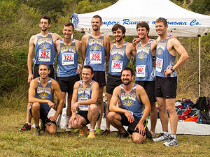 Andrew and Tommy with Empire Runners Club MensPushed by my rather obsessively competitive spirit, coupled with Andrew’s rather unrealistic faith in me being able to run 7 minute miles (which I hadn’t done in some time), I jumped back into training before the swelling even went down, and proceeded to sprain it again about a month ago.
Okay, enough with the excuses. Needless to say, it wasn’t my finest race, but it was fun nonetheless and made me want to train harder to get back to where I once was, and to not have Andrew ask me questions at the end of the race like, “What the heck happened to you? You looked like you were out for an afternoon jog.” Next time, I would show him.
The best part about racing is when it’s over, especially when followed by a big, delicious breakfast, which we had at the very popular Parkside Café in Santa Rosa.
Andrew, Tommy, Celeste, and Paul had raced very well, so they were rather uncharacteristically ready for a day of just relaxing and eating throughout the day. Great way to spend a day – if only we didn’t have to do that racing stuff first to earn it.
Point Reyes National Seashore
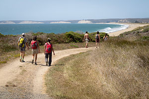 Hiking at Point ReyesThe Point Reyes National Seashore is an unbelievable treasure to have so close by. Just 40 miles north of San Francisco and 55 miles south of Sebastopol, it is an easy daytrip from either. Within its 71,000 acres, it has 110 miles of sandy beaches, over 150 miles of hiking trails, viewpoints for watching migrating whales and elephant seals breeding, and even a Tule Elk Reserve. Herb was especially excited about watching the elephant seals breed, but he was just going to have to wait until next winter.
On our last visit to Point Reyes, we had hiked in the Tule Elk Reserve, on sandstone cliffs high above the sea, but this time we (meaning our family and Celeste’s) chose to do the 5.5-mile Laguna Loop Trail, which would bring us out onto beautiful Limantour Beach.
After stopping briefly at the informative Bear Valley Visitor Center, we continued on to the trailhead, which was located right near the Hostel, just off Limantour Road.
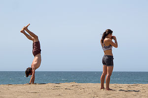 Andrew and Celeste at Point ReyesWe set off on the Laguna Trail which immediately began to climb for the next mile through coastal scrub and grassland before descending to the Fire Lane Trail. From here the trail remained pretty flat and at about the 2 ½ mile point, we found ourselves on a beautiful south-facing beach on Drakes Bay.
One of Herb and my fears of moving from New Jersey is replacing the beautiful beaches along the Jersey shore that we frequent so often, so we were delighted to find such a lovely one not too far from where we intended to move. A major difference though is that the Pacific is just too cold to swim in comfortably without wetsuits, so I don’t think we would be frolicking in the waves like we do back east. However, the incredible aesthetics certainly make up for it.
We made a note to return soon with beach chairs and books to spend a leisurely day in the sun. In fact, if you continue reading, you’ll see that we actually come back the very next day. Fortunately, there is a road and parking lot at the beach, so a 2 ½-mile hike laden with beach paraphernalia is not required.
This section of beach is part of the 16-mile Coast Trail, Point Reyes longest trail, which extends for 16 miles to the east to Palomarin Beach, near the southern tip of Point Reyes. However, we headed west along the Coast Trail, tracing the shoreline before it veered north back towards our cars.
Back at the trailhead, we played good Samaritans to a confused looking couple who had inadvertently hiked here rather than to where their car was parked back at Limantour Beach. Paul and Hilda kindly gave them a ride to their car before we proceeded to a late lunch at the Station House Café in the quaint town of Point Reyes Station, population 350.
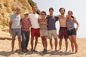 Happy Hikers at Point ReyesPoint Reyes Station is one of the many picturesque towns along the Northern California coast that cater to the crowds that leave the city and make the exodus up the coast each weekend to hike, bike, beach, shop, dine, and drink at these idyllic towns.
Although there were inside tables at the Station House Café, we decided to take one in their lovely patio garden, despite the warning that there might be some issues with bees. Fortunately, we didn’t encounter any, and we had a lovely, delicious lunch al fresco.
After lunch we said our goodbyes to Andrew, Tommy, and Celeste who headed down the coast back to the city where they went back to work the next day. They grumbled a bit about wanting to retire like we were, so they could do this kind of fun stuff every day, but we reminded them that they had a few more years of working life ahead of them before they got to that point.
Back to Limantour Beach
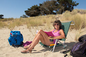 Lolo at Limantour BeachThis time we drove to the beach rather than hike and Herb loaded up his “system,” which consists of a large red backpack, stuffed with towels, books, and cooler and two wind guards attached to each of its sides, with the beach chairs draped over the poles. In all our times to various beaches, we have never seen this “system” duplicated. I am not sure if that is a good or bad thing.
Well, there’s not much to say about a day of sunning and reading at the beach, but let’s just say that it was really, really good.
I was just so happy that my sun-worshipping husband had found a place that made him happy.
North Sonoma Mountain Hike
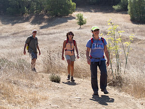 North Sonoma Mountain HikersSonoma County encompasses such an extraordinary geographical diversity – oceans, rivers, lakes, beaches and coastal cliffs, mountains and valleys, redwood forests, and more – and thankfully it has been blessed with some very forward-thinking land-use planning and conservation efforts, which have resulted in a majority of its acreage being preserved as open space for the public to enjoy.
There are 11 state parks in Sonoma County, ranging from beaches to mountains to redwood forests and historical sites, and I am proud to say that we have already been to 5 of them. It's nice to know that there are 6 more out there waiting for us to explore.
In addition to the state parks, there are 49 Sonoma County Regional Parks running the length of the county from Bodega Bay to Gualala on the coast, and from the Pacific to Sonoma Valley wine country. The parks encompass nearly 60,000 acres and have over 140 miles of hiking trails. We have already been to many of them, but it is nice to know that there are so many more to see.
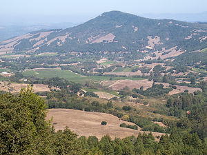 View from North Sonoma Mountain Regional ParkCeleste’s parents (Paul and Hilda) know the Sonoma area so very well, that they have pretty much been to all its park and hiked all its trails. That is why it was so nice to accompany them on a hike they had never been on before in the newly created North Sonoma Mountain Regional Park.
The vision for this park’s creation was connecting Sonoma Mountain with Jack London State Historic Park via a 4.5-mile multi-use trail. However, due to time constraints, we turned around after 3.3 miles and an elevation gain of 1,000 feet, with the promise of returning in the future to make the entire 9-mile, out-and-back trek to and from Jack London State Park.
Sonoma Plaza and Sonoma State Historic Park
We are quite enthusiastic history buffs, and being from the East Coast, we know our American Revolutionary War and Civil War history well, as there as so many wonderful historic sites to visit. However, we have a lot to learn about California’s history – from its period of Mexican influence to its brief independence to statehood.
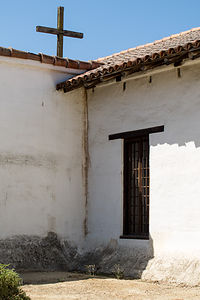 Mission San Francisco Solano de SonomaThe Sonoma State Historic Park, the site of the last of the 21 Spanish missions to be established and the place where the Bear Flag Revolt occurred, seemed as good a place as any to get up to speed on our California history.
We began our tour at the Visitor Center in the Sonoma Plaza, which was designed in the 1830s by Mexican Governor Mariano Guadalupe Vallejo. It is the largest Plaza in California and still serves as the town’s focal point today.
Our first stop was the Bear Flag Revolt monument in the northeast corner of the plaza, commemorating California’s short-lived history as an independent nation – in fact, it lasted less than a month. Briefly, this is how it went down.
During the early 1840s, many American settlers came to Alta Vista, but were prohibited by the Mexican government from owning land or holding office. Finally fed up, on June 14, 1846 they rode into Sonoma, arrested General Vallejo, and hoisted a hastily made Bear Flag right on this very spot in the Plaza. Without firing a single shot, they declared California an independent republic. However, less than a month later, an American naval vessel captured the Mexican capital at Monterey and claimed California for the United States. The Bear Flag was lowered from the Plaza and the Stars and Stripes rose in its place. Not completely forgotten though, the Bear Flag is the still the official flag of the state of California.
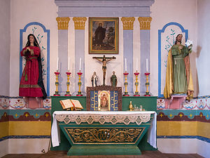 Mission San Francisco Solano de Sonoma AltarFrom there, we crossed the street to the Mission San Francisco Solano de Sonoma, founded in 1823 by Father Jose Altimira, This mission, which is the last and northernmost of the 21 missions in Alta California, was the only one to be built after Mexico had gained its independence from Spain. Like the other missions, its purpose was to convert Native Americans to Christianity. Unfortunately, this also seemed to involve using them as a cheap labor source.
The exterior of the Mission is made of white adobe with a plain wooden cross at the apex of its roof. There is a small museum inside with exhibits of mission life, religious paintings, and watercolors off all the California missions.
After viewing the exhibits, we entered the Mission’s most splendid room – the simplistically beautiful chapel. The long, narrow room, with white adobe walls like the exterior, is mostly empty, except for the raised colorfully painted wooden pulpit at the far end. A brightly painted green gate prevents visitors from entering the altar area. The soft choir music, sung in Latin, in the background added to the solemnity of the experience.
Our next stop was the Sonoma Barracks (or Presidio of Sonoma). In the 1830s, Mexican Governor Mariano Vallejo began construction of the Presidio of Sonoma as a way of countering the presence of Russians at Fort Ross. After its completion, Mexican soldiers were transferred from San Francisco to Sonoma and housed in this two-store, adobe building. Later in 1846 after the successful Bear Flag Revolt, the Barracks became the headquarters of the short-lived California Republic.
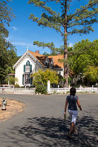 Lolo Approaching Lachyrma MontisOur final stop in Sonoma State Historic Park required a pleasant half-mile walk along a bike path northwest of the Plaza. The lovely path led us to Lachyrma Montis, the home of General Vallejo, whom you might remember as the Mexican Governor before the Bear Flag Revolt. Well, he stayed around afterwards and became both a U.S. General and a California State Senator. He embraced the American way of life and built a classic, Yankee-style, two-story Gothic home beside a spring. He named in Lachryma Montis (mountain tear), which is the Latin translation for Chiucuyem (crying mountain), the name of the free-flowing spring on the property. Vallejo and his family live in Lachryma Montis for 35 years.
On your way back to the Plaza, be sure to peek into the Toscano Hotel, an 1850s hotel and bar. We missed it on our way to Lachryma Montis. It is furnished with beautiful 19th-century period furniture. The bar downstairs is set up with old card tables and chairs, with antique photos and memorabilia on the walls. The kitchen and dining room, which are in a separate building behind this one, have blue-and-white checked tablecloths and a menu board listing the day’s specials.
The whole afternoon was an incredible, and very educational, trip back in time.
Description
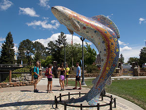 Santa Rosa Trout SculptureSebastopol is a charming town in Sonoma County, 52 miles north of San Francisco and about a 20-minute drive to the coast. Sebastopol is known for its apples and hosts an annual Apple Blossom Festival in April and the Gravenstein Apple Fair in August. Today, however, the apple orchards are becoming vineyards as wine-making moves more and more into the region.
Every Sunday, from April to mid-December, there is a Farmers market in the downtown plaza,
where people congregate to enjoy delicious fresh regional food, live music, and dancing.
Sebastopol is home to the artist, Patrick Amiot, known for his whimsical, cartoon-like, junk-art sculptures. There are over 200 of his wacky, found-object works scattered throughout Sebastopol, especially on Florence Street.
Two interesting side trips we took from Sebastopol:
Point Reyes National Seashore
The Point Reyes National Seashore is a 71,000-acre park preserve located on the Point Reyes Peninsula, about 40 miles north of San Francisco. It has 110 square miles of sandy beaches and over 150 miles of hiking trails.
Some interesting things to do within the park include:
- Bear Valley Visitor Center – exhibits and ranger-led programs
- Point Reyes Beach (Great Beach) – 11 mile expanse of Pacific shoreline
- Limantour Beach = sheltered beach with great birdwatching
- Mission Vision Overlook – panoramic view of Point Reyes Peninsula
- Point Reyes Lighthouse – great place to spot migrating gray whales in winter
- Chimney Rock – great viewing spot to watch elephant seals as they breed and molt
- Drakes Beach – sheltered beach beneath sandstone cliffs
- Abbotts Lagoon – 1.5-mile trail to diverse bird habitat and nesting area of snowy plover
- Tule Elk Reserve – hunted to near extinction in the 1800s, Tule elk were reintroduced in 1978 to this designated wilderness
Historic Sonoma Plaza
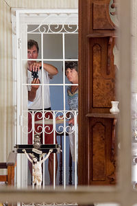 Herb and Lolo in Lachyrma MontisIn the 1830s, Mexican Governor Mariano Vallejo began construction of the Presidio of Sonoma as a way of countering the presence of Russians at Fort Ross. After its completion, soldiers were transferred to Sonoma from San Francisco. Vallejo also designed the Sonoma Plaza, which today is the largest Plaza in California. Today the plaza is a National Historic Landmark and still serves as the town’s focal point.
The eight-acre park is surrounded by many historical buildings and sites, including:
- The Mission San Francisco Solano de Sonoma
Founded in 1823 by Father Jose Altimira, this mission was the last and the northernmost mission in Alta California. It was the only mission built after Mexico had gained its independence from Spain.
- The Sonoma Barracks (or Presidio of Sonoma)
Mexican Governor Mariano Guadalupe Vallejo had this two-story, adobe building facing the central plaza built to house the Mexican soldiers transferred from San Francisco.
After the successful Bear Flag Revolt of 1846, in which a group of American immigrants took over the Pueblo of Sonoma and established their own California Republic, the Barracks became the headquarters of this short-lived insurrection.
- Site of the Bear Flag Revolt
During the early 1840s, many American settlers came to Alta Vista, but were prohibited by the Mexican government from owning land or holding office. Finally fed up, on June 14, 1846 they rode into Sonoma, arrested General Vallejo, and hoisted a hastily made Bear Flag at the northeast corner of the plaza. Without firing a single shot, they declared California an independent republic. The Sonoma Barracks became their headquarters.
The newly established California was very short lived. Less than a month later, an American naval vessel captured the Mexican capital at Monterey and claimed California for the United States. The Bear Flag was lowered from the Plaza and the Stars and Stripes rose in its place.
Today the Bear Flag is the official flag of the state of California. The monument to the Bear Flag can still be found in the northeast quadrant of the plaza.
- Lachryma Montis
After California became part of the United States, in 1849 General Vallejo embraced the American way of life and built a classic, Yankee-style, two-story Gothic beside a spring about a half mile northwest of Sonoma Plaza. He named in Lachryma Montis (mountain tear), which is the Latin translation for Chiucuyem (crying mountain), the name of the free-flowing spring on the property. Vallejo and his family live in Lachryma Montis for 35 years.
- ‹ previous
- 6 of 8
- next ›
Sebastopol and Side Trips to San Francisco, Sonoma, Napa, and Marin Counties location map in "high definition"
Javascript is required to view this map.
