- Home
- About
- Map
- Trips
- Bringing Boat West
- Migration West
- Solo Motorcycle Ride
- Final Family XC Trip
- Colorado Rockies
- Graduates' XC Trip
- Yosemite & Nevada
- Colorado & Utah
- Best of Utah
- Southern Loop
- Pacific Northwest
- Northern Loop
- Los Angeles to NYC
- East Coast Trips
- Martha's Vineyard
- 1 Week in Quebec
- Southeast Coast
- NH Backpacking
- Martha's Vineyard
- Canadian Maritimes
- Ocracoke Island
- Edisto Island
- First Landing '02
- Hunting Island '02
- Stowe in Winter
- Hunting Island '01
- Lake Placid
- Chesapeake
- Provincetown
- Hunting Island '00
- Acadia in Winter
- Boston Suburbs
- Niagara Falls
- First Landing '99
- Cape Hatteras
- West Coast Trips
- Burning Man
- Utah Off-Roading
- Maui
- Mojave 4WD Course
- Colorado River Rafting
- Bishop & Death Valley
- Kauai
- Yosemite Fall
- Utah Off-Road
- Lost Coast
- Yosemite Valley
- Arizona and New Mexico
- Pescadero & Capitola
- Bishop & Death Valley
- San Diego, Anza Borrego, Joshua Tree
- Carmel
- Death Valley in Fall
- Yosemite in the Fall
- Pacific Northwest
- Utah Off-Roading
- Southern CA Deserts
- Yosemite & Covid
- Lake Powell Covid
- Eastern Sierra & Covid
- Bishop & Death Valley
- Central & SE Oregon
- Mojave Road
- Eastern Sierra
- Trinity Alps
- Tuolumne Meadows
- Lake Powell Boating
- Eastern Sierra
- Yosemite Winter
- Hawaii
- 4WD Eastern Sierra
- 4WD Death Valley +
- Southern CA Deserts
- Christmas in Tahoe
- Yosemite & Pinnacles
- Totality
- Yosemite & Sierra
- Yosemite Christmas
- Yosemite, San Diego
- Yosemite & North CA
- Seattle to Sierra
- Southwest Deserts
- Yosemite & Sierra
- Pacific Northwest
- Yosemite & South CA
- Pacific Northwest
- Northern California
- Southern Alaska
- Vancouver Island
- International Trips
- Index
- Tips
- Books
- Photos/Videos
- Search
- Contact
Grindavik
Sunday, June 11, 2023 - 5:30pm by Lolo18 miles and 0.5 hours from our last stop - 2 night stay
Travelogue
.thumbnail.jpg) Papa's RestaurantGrindavik, the end of the road - our final destination before flying back to the states. This, and Reykjavik, are the places that most travelers to Iceland’s journeys start and/or end.
Papa's RestaurantGrindavik, the end of the road - our final destination before flying back to the states. This, and Reykjavik, are the places that most travelers to Iceland’s journeys start and/or end.
It’s the closest town to Keflavik, the airport we would be flying out of, and it is also home to the famous Blue Lagoon geothermal spa, which we thought would be a nice way to wrap up our trip.
It was already late afternoon when we arrived in Grindavik, so after checking into the campground, we headed to town (on foot) with the intention of having dinner at Bryggjan Grindavik Netagerðin, a cafe and restaurant right on the harbor.
Unfortunately, only the restaurant was already closed for the day, and the cafe only served soup. The hostess was kind enough to recommend the nearby Papa’s as a very good alternative.
.thumbnail.jpg) My fresh Icelandic trout at Bryggjan Grindavik NetagerðinIt looked promising as the sign by its door read: “Probably” the best fish in the world. Not just good fish, but the best fish. Having not had fish everywhere in the world, I can’t vouch for it being “the best,” but it was definitely very good and very fresh. The fact that almost all the other customers in the restaurant were locals also vouched for its probably being the best fish in the world.
My fresh Icelandic trout at Bryggjan Grindavik NetagerðinIt looked promising as the sign by its door read: “Probably” the best fish in the world. Not just good fish, but the best fish. Having not had fish everywhere in the world, I can’t vouch for it being “the best,” but it was definitely very good and very fresh. The fact that almost all the other customers in the restaurant were locals also vouched for its probably being the best fish in the world.
Grindavík is still very much a fishing town with most of its inhabitants working in the fisheries. There is still an active fishing fleet in Grindavík and most of their catches go to the local factory that specializes in processing salted fish for export.
The town even has a museum called the Icelandic Saltfish Museum which explains how saltfish is produced and the essential role it played in Icelandic people’s survival during the country’s difficult past.
.thumbnail.jpg) Bye Bye IcelandUnfortunately it was closed when we were there.
Bye Bye IcelandUnfortunately it was closed when we were there.
The next morning, all we needed to do was pack and clean up the van, and soak in the Blue Lagoon at 6:00 pm (the only time we could get because we waited too long to book).
That wouldn’t take all day, so we squeezed in a morning 3.5-mile hike to the Fagradalsfjall volcano (which is the one that is currently erupting in Iceland, just 2 weeks after we left). I felt that Fagradalsfjall was pretty awesome and worthy of a Trip Stop of its own.
.thumbnail.jpg) The way I feel about IcelandAfter our hike, we finalized our packing and went out for a late lunch/early dinner at Bryggjan Grindavik Netagerðin, the restaurant that thwarted us yesterday. As we climbed the stairs to the restaurant upstairs, a large group of about 20 men and women dressed in orange (Coast Guard? Or fishermen) were just leaving. So, this must be the place.
The way I feel about IcelandAfter our hike, we finalized our packing and went out for a late lunch/early dinner at Bryggjan Grindavik Netagerðin, the restaurant that thwarted us yesterday. As we climbed the stairs to the restaurant upstairs, a large group of about 20 men and women dressed in orange (Coast Guard? Or fishermen) were just leaving. So, this must be the place.
The restaurant is also a fishnet making shop, because in Grindavik it's perfectly normal to have gourmet cooking and net making going on at the same time. There was a large glass window at one end of the restaurant through which we could observe the net making facility.
I can’t vouch for their net making, but the food was excellent. I had the fresh Icelandic trout, probably caught about an hour ago on the boat outside our window, served with melted butter, fried almonds, raisins, butter fried potatoes, and a light salat. Herb had the boring, but delicious fish and chips
Now it was time for our last event of the trip - our highly anticipated visit to the Blue Lagoon, also worthy of its own Trip Stop:
What an amazing trip it had been. Weeks later, I am still smiling!
Seltún Geothermal Area
Sunday, June 11, 2023 - 11:00am by Lolo128 miles and 2.75 hours from our last stop
Travelogue
 Gas Station $3 hot dogAs we left the Snæfellsnes Peninsula and headed south to Grindavik, the realization hit that our trip was soon coming to an end.
We had accomplished an awful lot and seen so much of the beauty and culture of Iceland. However, there was one important part of Icelandic culture we had not experienced yet - the $3 gas station hot dog.
Iceland’s gas stations don’t just sell fuel. They also serve as a combination coffee shop, restaurant, grocery store, retail store and community center. Some even sell knitting supplies and farm implements.
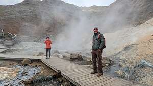 Seltún Geothermal AreaA whole culture has developed around these stations and most locals have no problem dining out at the local N1. With the price of food at restaurants in Iceland, it’s a bargain, especially the $3 hot dogs.
I love immersing myself in the culture of a country. It's natural beauty isn't good bad either.
On our way to Grindavik, we decided to stop at the colorful Seltun Geothermal Area, not as large and dramatic as the Hverir Geothermal Area in Lake Myvatn, but still it has its fair share of steaming volcanic vents, fumaroles, mud pots and boiling hot springs.
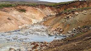 Seltún Geothermal AreaIts close proximity to Reykjavik (just 25 miles), and to the parking lot, makes it a popular place to visit, as it was today.
After parking we headed out along a boardwalk that wound its way through the bubbling and hissing field. These are necessary to keep foolish people from stepping on the volcanic crust, breaking through, and scalding their feet - which as happened. The steam from a fumerole can well exceed 200 °F.
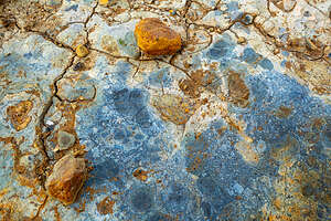 Colors of the Seltún Geothermal AreaI love the colors from the rich variety of minerals found in geothermal areas, especially the blues, greens, oranges, and yellows.
There were some whites and browns mixed in as well. Those are the sulfates but when it rains, they dissolve in water while the other minerals don't, leaving the brighter colors behind like at artist's palette.
 Climbing the hill above the Seltun Geothermal AreaWe left the safety of the boardwalk and began climbing through the steam up a steep, rocky hill of lava rocks to the 400-foot summit.
The view from the top was definitely worth the climb. The hills were painted in earthy hues of golden brown, red, yellow, white, and gray, with Lake Kleifarvatn in the distance.
 View from the hill above the Sulten Geothermal AreaThe lake lies on the fissure zone of the Mid-Atlantic Ridge, so this is still a very active geothermal area.
The way back down across the rough path was like walking through an alien landscape of jagged moss-covered lava rocks.
In 1999 an explosion occurred near here when an experimental drill hole from 1948 got clogged up with deposits and blew up, creating a beautiful little geothermal pond. The explosion was so massive that it destroyed the coffee shed by Seltún.
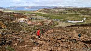 Back down through the lava fieldIn 2010 another drill hole near the path started spouting hot mud, so it was tightly closed. The moral of the story is this is still an active volcanic area, and you don’t mess with that.
Now it was on the Grindavik where we would spend the last two nights of our Icelandic adventure - packing up, prepping the camper van for return, and, of course, visiting the famous Blue Lagoon.
Surprisingly Grindavik is much closer to the Keflavik Airport (Iceland's International Airport) than Reykjavik is.
Snæfellsnes Peninsula - Búðakirkja
Sunday, June 11, 2023 - 9:30am by Lolo12 miles and 0.3 hours from our last stop
Travelogue
 BúðakirkjaOur final stop on the Snæfellsnes Peninsula was Búðakirkja (Black Church), known for its simplistic beauty, both the church and its remote surroundings.
The small hamlet of Búðir was once a prosperous fishing village and one of Snæfellsnes' most active trading posts until it was abandoned in the early 19th century. Today, all that remains of Búðir’s once thriving community is the black wooden church Búðakirkja, one of the most photographed churches in Iceland.
The original church in this location was a small turf chapel built in 1703 by a merchant named Bent Lárusson.
According to lore, when it came to deciding a location for the parish church, an old woman suggested making a man spin around in circles until he became dazed and then have him shoot three arrows into the air. Wherever the third arrow landed, that is where the church should be built. Makes sense.
 BúðakirkjaThe original turf church was demolished in 1816 by orders of the Danish King. In 1848, the church was rebuilt by Steinunn Sveinsdóttir. Not sure what parishioners did in the long gap in between.
In 1984, the church was moved to its current location and some renovations were done to restore it to its original Danish design.
The church, which is now owned by the National Museum of Iceland, still has some artifacts dating back to the 1700s.
Snæfellsnes Peninsula - Arnastapi
Saturday, June 10, 2023 - 5:45pm by Lolo10 miles and 0.25 hours from our last stop - 1 night stay
Travelogue
 BárðurAfter leaving Djúpalónssandur, we continued along Útnesvegur (the road around the western half of the Snæfellsnes peninsula) just a few miles to Arnarstapi, a village on the southern side of the peninsula, with access to a beautiful coastal walk to the tiny village of Hellnar.
We checked into the Arnarstapi Campground, which is located close to the start of the coastal walk. The village is so small that it is pretty much close to everything. I couldn’t find the campground office at first, so I went into a pizza place to ask, only to find out that this also served as the campground office.
 Off to Hellnar we goRight next to the campground was the Jules Verne Monument. I didn’t realize that “Journey to the Center of the Earth” took place on the Snæfellsnes Peninsula, and Arnastapi played an important role. It was the last stop on the route Professor Otto Lidenbrock and his crew took before they climbed Snæfellsjökull and entered the interior of the planet through a tunnel in the crater.
 Along the Arnastapi to Hellnar hikeThe plaque reads, ‘Here begins The Voyage to the Centre of the Earth, which lies 6,371 kilometres below.”
Iceland’s dramatic scenery certainly does make one believe that fantastical things can happen here.
Speaking of fantastical things, when I asked the campground/pizza host how to get to the trail to Hellnar, she pointed out the window and said, “Head to the big troll, and turn right.” Where else but in Iceland would directions include a troll as a landmark.
 Hellnahraun lava field with Mt. Stapafell in backgroundSo we set off for the large stone Troll, whose name is Bárður. Bárður is not just any old troll but rather he is an important figure in the Icelandic Sagas and the guardian spirit of the Snæfellsnes peninsula.
Made out of stone sourced locally, it was designed and created by a sculptor called Ragnar Kjartansson to represent the story that has captured the minds of locals and tourists alike for hundreds of years.
 Approaching the Fjöruhúsið CaféAccording to the ancient sagas, Bárður was the first settler of this area of Iceland (back in the 9th century) and gave the peninsula its name Snæfellsnes, which in Icelandic directly translates to Snow Mountain Peninsula.
Oh, and he was half man and half troll.
When he decided that he could no longer live with humans, he went up into the mountain to live in the Snæfellsjökull glacier, where he still roams to this very day. Bárður is still very important to Icelandic culture, and has become a nature spirit that local people often ask for help in matters large and small.
 Fjöruhúsið CaféHmm…I wonder if Professor Otto Lidenbrock ever ran into Bárður before his descent into the volcano on this way to the center of the Earth. We have been so immersed in this way of thinking, that I would believe anything at this point
Anyway, on to Hellnar. After saying hello to Bárður, we turned right along the coastal trail towards Hellnar. The scenery along the way was breathtaking - with lots of unique, moss-covered rock formations and sea stacks along the coast.
 Beach below the Fjöruhúsið CaféAs we continued towards Hellnar, the terrain became rockier and more volcanic as we crossed the Hellnahraun lava field, where there were volcanic rocks of all sizes covered in a vibrant green moss.
Meanwhile on the right, pyramid-shaped Mount Stapafell, rose 1,700 feet above us, seemingly rising out of the lava field.
 Valasnös basalt cliffBesides the incredible scenery, another reason to hike to Hellnar is the Fjöruhúsið Café of Hellnar, a picturesque Cafe on the Hellnar harbor, surrounded by rocks and bird cliffs. I had been dreaming of having coffee at this cafe even before we left for the trip. That’s why I was devastated when I saw on Google that the cafe closed at 5:00 and it was already 5:30.
But what should we see as we approached the tiny Fjöruhúsið Café, but a group of people still sitting on the outdoor deck. So we hadn’t missed out after all. I have a feeling that the closing hours are quite flexible, and that it stays open as long as there are still customers.
 Running out of suppliesSo we did get to have a cup of coffee there after all, in lovely old-fashioned porcelain cups, overlooking the water and rocky cliffs. Why is it that how good a coffee tastes is highly correlated to the beauty of the surrounding scenery? So, in this case, it was a 10.
After our coffee break, we explored the beach area below the cafe, in an attempt to find Baðstofa, a sea cave in the center of Valasnös (a basalt cliff face), famous for displaying changing colors as the sun and sea reflect off its walls. Unfortunately, we weren’t there at the right time of day for that, but still the basalt cliff and surrounding beach were quite interesting.
 Morning walk to Arnarstapi HarboThe beach was composed of a mix of black and white polished rocks, formed from different periods of the same volcanic eruptions. Apparently, it’s pretty rare to see them together like this on a beach. They were a bit tricky to walk over.
If ever there was a place that looked like a troll’s home, Valasnös was it.
From there, we turned around and walked back from whence we came - across the lava field, along the beautiful coastline, past Bárður, and back to the campground.
 Gatklettur - Arch RockThat night we had dinner in the van again - Herb’s pylsurs, Idahoan powdered potatoes, and carrots.
I could tell we were nearing the end of our trip, as we ran out of supplies (such as paper towels) and improvised with what we had (6 rolls of toilet paper). I think this is how anarchy begins. We still did have a nice bottle of Cab left, so it wasn’t a total loss of civilization.
The next morning before leaving Arnarstapi, the plan was to walk the coastal trail in the other direction, towards the Arnarstapi Harbor.
 Eystrigjá, the famous natural stone bridgeHerb was awake before the rest of us, so he took his camera and went on a stroll down to the coast. He wasn’t gone long before he returned somewhat flustered and said that he had been attacked by some very aggressive birds. Attacked might have been a bit of a hyperbole, as when further questioned it turned out to be more of a warning divebomb.
 The grotto below the Stone BridgeAfter I stopped laughing, I told him that I thought that I read somewhere about aggressive birds in Arnarstapi. I googled it and sure enough there was an entire article about Arctic Terns dive bombing and pooping on people. At least he hadn’t been shat upon I told him. He was not amused.
 Arctic Terns in GrottoI have to admit though that I was a bit frightened about going out there. Fortunately, they were gone by the time we left on our hike.
This time, when we got to the Troll, we turned left (north) along the coastal trail.
This way was equally beautiful as our walk yesterday in the other direction. All along the coast there were small rocky islands and reefs called “skerries,” after the Old Norse word “sker.” They are also known as sea stacks and are usually found in clusters.
 Herb's vantage point from the other side of the grottoWe soon came to a rock named Gatklettur, famous for its natural rock arch formation. The circular arch was formed by centuries of waves eroding away at it, causing beautiful swirl patterns. This is probably the most iconic and photographed rock formation in Arnarstapi.
As I continued on merrily walking along a grassy path in search of Eystrigjá, the famous natural stone bridge that you can walk across, Herb yelled to me to be careful because I was about to walk out on it. What???
 Amtmannshúsið black house across the pondOh wow!
The natural bridges and arches I knew, protruded above the ground, but this one's top was at ground level and the narrow grassy path I was about to continue on had a big dropoff on one side to a water-filled grotto about 40 feet deep
Herb was all the way on the other side of the grotto when he saw me and Hilda unknowingly stepping out on the bridge.
 Amtmannshúsið houseThe vertical walls of the grotto below us were adorned with hexagonal basalt columns, many of which had arctic tern (or seagull?) nests atop them. There was lots of bird activity going on below.
On top of each of the column, a pair of Arctic Terns build a nest. One parent remains with the chick, while the other flies out to sea, hunting to provide precious calories for their newly hatched chicks.
 Arctic Tern colonyThese harmless looking birds, which actually look very much like regular seagulls, are quite amazing. Every year they migrate from the Arctic to Antarctica and back, traveling 44,300 miles. No other known animal on the planet has a regular migration route that comes even close to being as long.
 Arnastarpi Natural HarborEach year, these birds, who generally mate for life, return to the same mating grounds. That is the only time they come in contact with humans - hence the aggressive dive bombing and pooping Herb had experienced this morning. They were just being good parents protecting their young. I would do the same.
 Refinding the Stone BridgeWe came to a pond, across which sat a picturesque dark wooden house called Amtmannshúsið, with pyramid-shaped Stapafell rising above it. Everything in Iceland seems to be given a name - houses, rocks, trolls, etc. - not of which are pronounceable.
This house was built in the 1770’s when Iceland was under the control of Denmark, and served as the official residence of the Danish regional governor. Iceland did not win its independence from Denmark until 1944.
As we approached the Arnarstapi Harbor, we looked down from a bluff at a rocky promontory covered with arctic terns. Thousands of them nest in Arnarstapi every summer after their long migration.
 Goodbye BárðurFishing and trade are still important to the economy of Arnarstapi, but they now play second fiddle to tourism, as Iceland has definitely been discovered by travelers from around the world.
On our way back to the campground, we tried to find the Stone Bridge again, but it wasn't so easy. Perhaps, if it was more accurately called the "grassy path across a hidden grotto" it would have been more obvious. Finally, we figured if we went back to the spot where Herb took the photo of me about to step on the bridge, we could find it.
Well, we got close. The first time Herb had sat near the edge of the grotto. This time there was a small pond separating him from the grotto's edge. But we could see the bridge across the way, so Herb stayed here while I walked around the edge of the grotto to get to the bridge.
What a beautiful hike it had been, both yesterday afternoon's and this morning's. Goodbye Bárður. Thanks for looking after us while we visited your beautiful land.
Snæfellsnes Peninsula - Djúpalónssandur Beach
Saturday, June 10, 2023 - 3:15pm by Lolo16 miles and 0.5 hours from our last stop
Travelogue
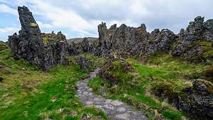 Djúpalónssandur lava fieldOur next stop was Djúpalónssandur Beach, also known as Black Lava Pearl Beach, on the southern coast of the Snæfellsnes Peninsula.
After parking the van, we walked through an incredible field with huge lava formations, which seemed right out of a scene from Game of Thrones.
If ever there was a world elves and trolls would inhabit, this was it.
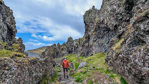 My little trollIn fact, many Icelandic sagas are strongly connected with this dramatic black pebble beach, and it is considered to be one of the most famous elves and trolls locations in Iceland.
As the lava field path came to an end, we found ourselves on Djúpalónssandur Beach, covered with small, smooth, black stones.
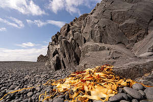 Polished black stones of DjúpalónssandurThese stones have been polished by Atlantic Ocean waves since the last eruption of Snæfellsjökull in 200 AD. Locals call them Djúpalónsperlur (Pearls of Djúpalón) - hence the name Black Lava Pearl Beach.
These “pearls” are protected and not allowed to be removed from the beach. Remember, trolls are always watching
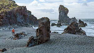 Troll woman KerlingThe beach itself is surrounded by a rugged and dramatic landscape, with rocky cliffs and weird rock formations. .
According to the ancient sagas, most of the large stones rising from the sand on this beach are trolls that were turned into stone when they saw daylight, as this is what happens to trolls in Iceland.
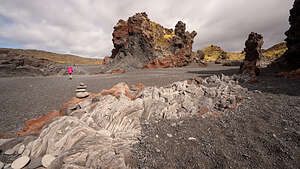 Söngklettur - the Singing Rock (Church of the Elves)The tallest one in the back is a Troll woman named Kerling that made the mistake of staying out past sunrise. Not sure what trolls are supposed to do in summer when there is always daylight.
And it’s not just trolls that inhabit these rocks. Elves live here as well. The large reddish lava rock that I am walking towards in this photo is Söngklettur - the Singing Rock. It is said to be the Church of the Elves! Local people have claimed to hear singing and beautiful organ music coming from this rock.
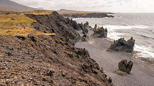 The ridge above DjúpalónssandurUnlike trolls, which can usually be quite evil, the elves that inhabit this rock are good. They are called "huldufólk" - the Hidden People of Iceland.
However, if you don't respect their homes or churches, they can get a little feisty.
From the beach, we took a trail up along a ridge overlooking the beach and followed it a little over a mile across a lava field to another beach on Dritvik cove
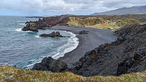 Dritvik HarborDritvík has a natural harbor encircled by high lava walls. From the 16th century until the mid 19th century, it was the largest seasonal fishing station in Iceland, with 40-60 boats and 200-600 seasonal fishermen. All that remains of that time is an orange structure, which served as a refuge for the fishermen.
On the way back to the parking lot, we passed a set of four stones of various weights and sizes, ranging from 23 kg (about 50 lbs) to 154 kg (about 340 lbs).
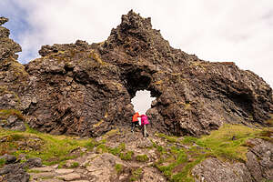 Two little troublesome elvesThey are called Aflraunasteinar - Steinatök or the lifting stones, and they were once used to measure the strength of Icelandic fishermen. The more they could lift, the better position they got on the ship and the more respect they earned.
I wanted to have Herb take a photo of me lifting the smallest one, but he ran off thinking I was trying to get him to test his strength and determine his position in the camper van. Herb has a bad back, so his excuse was that no good could come of this and he did not want to rely on me having to drive the camper van after he pulled his back out.
Instead, Hilda and I tried to show our agility and strength by climbing through an arch in a rock. We looked like two little elves up to no good. This place was starting to rub off on us.
Snæfellsnes peninsula - Skarðsvík Beach and Svörtuloft lighthouse.
Saturday, June 10, 2023 - 10:15am by Lolo10 miles and 0.5 hours from our last stop
Travelogue
 Skarðsvík BeachWe haven’t visited that many lighthouses in Iceland, so we left the main road around the Snæfellsnes Peninsula to drive to the Svörtuloft lighthouse.
Just before the road turned to rough gravel, we pulled into a small parking lot for Skarðsvík Beach.
This was unlike any beach we had seen in Iceland so far, in that it was a golden sandy beach rather than a black sand one. It’s like the Riviera of Iceland - well not exactly, but the closest to it in the last few weeks. It even had aquamarine, turquoise water.
The beach is surrounded by a dark black volcanic landscape, including this large chunk just sitting there by itself in the middle of the beach. Volcanic rock is so easy to climb because it has so many things to hold onto.
 Skarðsvík BeachThe contrast between the black of the lava and the yellow sand was stunning. Despite its beauty, Skarðsvík Beach is one of the least crowded beaches in Iceland, because of its remoteness.
After every trip, before writing it up for the website, I do some additional research and find some really interesting things that I wish I had known about when I was there.
The following is one of them:
 Skarðsvík Lava FieldsIn 1962 when the asphalt road to the beach was being built, a bulldozer operator discovered a skeleton by Skarðsvík cove. What was remarkable was that it was below the lava, meaning it was very very old.
Archaeologists concluded that it was a pagan Viking grave from the 10th century and the bones belonged to a young man aged 18 - 25 at the time of his death.
 Skarðsvík Lava FieldAs was customary with Vikings, some of his earthly possessions were buried with him, including a long sword, a broken knife, pieces of iron, an elaborate boss from his shield, a spearhead, and a pin made of bone.
The well-preserved skeleton and his belongings are now preserved at the National Museum of Iceland.
 Svörtuloft lighthouseWow! That was over a thousand years ago.
Across the road from the beach there is a lava field created from an ancient lava flow about 3,000 to 4,000 years ago. The lava is covered in a soft green moss with vibrant hues of red and orange.
Another nice bit of contrast is the black of the lava flow and the purple flowers, which I think are purple saxifrage. After a lava flow, there is a whole sequence of plant life beginning after a volcanic eruption, but moss seems to always come first.
 Svörtuloft Cliffs (Black Ceiling)This lava flow was old enough to support higher plant forms such as flowers.
When looking at this otherworldly landscape, it was easy to understand why the Icelandic people believed in magical creatures. Obviously elves and trolls must have lived here, and maybe they still do.
We continued on for several miles on a bumpy gravel road to the Svörtuloft lighthouse, perched on the westernmost point of the Snæfellsnes peninsula in West-Iceland
I Arch near Svörtuloft lighthouset was probably the most beautiful lighthouse we had seen so far in Iceland. Most of the lighthouses in Iceland are orange, because that stands out well against black lava cliffs, but lots of them were short and stubby. At 42-feet high, this one was much more impressive.
It was built in 1931 out of concrete to make it as durable as the steep rock faces surrounding it.
Svörtuloft's name, which means Black Ceiling, comes from the pitch-black cliff it stands on.
Here the lava flow didn't stop until it reached the cold sea. It looked like it had been cut and made into a massive, sheer black wall, almost 2.5 miles long.
The surf has eroded the pitch black lava through the centuries creating a beautiful arch.
Snæfellsnes peninsula - Hellissandur
Saturday, June 10, 2023 - 9:15am by Lolo22 miles and 0.5 hours from our last stop
Travelogue
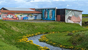 Hellisandur Street ArtAlthough known mostly for its dramatic natural landscape, our first stop along the northern coast of the Snæfellsnes Peninsula was the tiny village of Hellissandur, which has gained a reputation as the street art capital of Iceland. Pretty impressive considering all the wonderful street art we have already seen along the way.
Once an important fishing village, tracing back to the 16th century, it has shifted its economy toward tourism, and the street art is drawing people into this tiny village of 544 people.
So how did this all come about?
 Hellisandur Street ArtIn the summer of 2018, Kári Viðarsson, owner of the The Freezer hostel in the nearby town of Rifi, envisioned a massive, colorful transformation of the bleak, declining town of Hellissandur.
He summoned a team of international artists to Hellissandur to transform an abandoned fish factory into large works of art.
 Hellisandur Street ArtThe event was dubbed a ‘Street Art Festival’ and the artists did come, completing over 30 major murals that first summer and in subsequent years.
The townspeople loved it and the fact that their depressing old abandoned fish factory is now a cultural attraction for visitors from around the world.
So now, instead of just passing by the village on their way to the Snæfellsjökull National Park, people have a reason to stop and spend some time (and money) in town.
While Reykjavik has much more street art - larger and more impressive - the tiny little town of Hellissandur bills itself as the "street art capital of Iceland."
Snæfellsnes Peninsula - Grundarfjörður (Kirkjufell)
Friday, June 9, 2023 - 10:15am by Lolo135 miles and 2.75 hours from our last stop - 1 night stay
Travelogue
 StykkishólmskirkjaToday, Day 9 on the Ring Road, we began our exploration of the beautiful Snæfellsnes Peninsula, a large peninsula extending from West Iceland, nicknamed ‘Iceland in Miniature’ due to the rich diversity of its natural features.
However, first we had to get there. We had learned our lesson yesterday that we should look first to see if a road is gravel before taking it, so this time when Google suggested we take Road 54 to Grundarfjörður, we checked and sure enough it was gravel.
Although Road 54 was a straight line to Grundarfjörður, we decided to take a longer V-shaped route along paved roads. Even if it took longer, we didn’t care.
Our destination for the evening was the Grundarfjörður campground, located very near to the iconic Kirkjufell mountain, the most photographed mountain in all of Iceland.
 Interior of StykkishólmskirkjaBefore getting there, we made a short detour to the small town of Stykkisholmur on the northern shore of the Snæfellsnes Peninsula to see its famous church Stykkishólmskirkja, a futuristic church with a sweeping bell tower that looks like a whale vertebra, or some say, a spaceship. It was a far cry from the tiny sod-roofed church we had visited what seemed like a month ago
The interior of Stykkishólmskirkja features hundreds of suspended lights and a painting of the Madonna and child floating in the night sky.
Like all Lutheran churches it is much simpler and less ornate than Catholic churches.
 View of Kirkjufell from our campgroundAlso, unlike Catholic Churches, there was no fee to enter. In fact, our entire time in the church we saw absolutely no one. Iceland is so safe and trusting that they don’t feel the need to watch over you to make sure you are not doing something inappropriate.
After the church, we continued on to the Grundarfjörður campground. We couldn’t find anyone to check us in, so we drove around the campground and noticed that the grassy field that we were supposed to camp on was full of deep tire tracks from people getting stuck in the mud. This wasn’t good. Plus, there didn’t seem to be any place to check in.
 Iconic view of KirkjufellWe decided to go directly to the Sundlaug Grundarfjarðar (swimming pool) first as we were badly in need of a shower since none of us wanted to use the horrible one in the Búðardalur campground last night.
This pool is actually not part of the Grundarfjarðar campground, but it serves as their shower facility. Every town and small village in Iceland has a heated swimming pool for its residents and hot tubs as well. The costs are usually quite reasonable. According to their website the price was 1,000 ISK ($7.67). We would have paid $20 for a shower and a pool at this point.
 KirkjufellsfossWe wondered why there was no one else in the parking lot, but we soon found out why. When we went to try to open the door to the facility, a gentleman came over to us and said that the pool was closed, because the federation of public worker unions in Iceland, which included pool employees, was out on strike, affecting 37 pools throughout Iceland.
We could have cried. That would mean two days without a shower. Technically, our van had a shower, sort of like the kind in a boat, that wets the entire bathroom. Desperate times call for desperate measures, so we took very quick showers in the van.
 Now all we needed was a rainbowSo far, this campground was not living up to expectations - muddy fields to risk getting stuck in and no pool. It did, however, have a wonderful side view of Kirkjufell and the fjord beyond it.
As there was not much to do in the campground since the pool was closed, we headed over to the Kirkjufellsfoss parking lot, just 5 minutes away. We were definitely not the only ones with this idea, so it took a bit of patience and jockeying for position to get a well-composed photo.
 And what a rainbow it wasThis is not the kind of photography Herb likes, where everyone sort of lines up to take the classic shot, which is Kirkjufell with the lovely Kirkjufellsfoss (waterfall) in the foreground.
He much prefers wandering around on his own, finding his own satisfying compositions, sort of what we did at Vestrahorn.
Still, the composition of the mountain with the waterfalls in the foreground was stunning. We could see why it is the most photographed mountain in Iceland.
 Dinner at BjargarsteinnKirkjufell means Church Mountain, because it resembles a church steeple. Danish sailors called it a Sugar Top. When seen from other angles, the peak looks like a witch's hat or a scoop of ice cream.
Its isolated position, rising 1,519 feet from the sea, make it extremely photogenic.
 Bjargarsteinn hand-drawn menuThen as if by magic, a long rainbow appeared over the mountains to the right of Kirkjufell, giving us the chance to take a more unique photo than the standard shot.
All our previous rainbows were in the sprays of waterfalls. This one hugged the top of a mountain range
Maybe our luck was turning after a rough 24 hours of mis-navigating on gravel roads, horrible showers in last night’s campground, and a pool workers strike thwarting our efforts to swim and soak today.
 Random couch with sideview of KirkjufellNo Herb's Pylsurs or Hilda’s tortellini in the van tonight, but rather we went out on the town to Bjargarsteinn, a cozy yet elegant restaurant with delicious traditional Icelandic food, and magnificent views of Kirkjufell. The menu was even hand drawn.
Dining out in Iceland can be very expensive, and the entrees here were in the $40 to $50 range, but if you don’t order all the extras, like appetizers and dessert, it is no more expensive than dining out at home. Plus, there is no tipping or sales tax so it makes a big difference.
Hilda and I both had the fish of the day, which was some white fish that I never heard of, and Herb and Paul had a lamb dish. It was absolutely delicious.
 Early morning empty parking lotFor a village of less than 900 people, this was quite a wonderful restaurant - terrific ambience, delicious food, great service, and views of Kirkjufell.
After dinner, we took a walk along the Grundarfjörður fjord. Right behind the restaurant we came across a rather randomly placed couch, but it did have a great view of Kirkufell. It was soaking wet from the rain, but fortunately Herb stopped me mid-air before my butt reached it.
 Kirkjufell to ourselvesContinuing along, we came across a guide with a tour group getting ready to go out in kayaks. We were not envious at all as it was cold and windy, making the water quite choppy. The clincher was when the sky opened up and it began to hail. Weather can be quite changeable in Iceland. We ran back to our vans, so I’m not sure if they ever really went out. I highly doubt it.
The next morning we set out to explore the rest of the Snæfellsnes peninsula, but first, a quick stop to see Kirkjufell in the morning light. As we have learned throughout the trip, if you can get to a popular stop by 8 am, you can pretty much have it to yourself. Sure enough, we were the only ones in the parking lot,
Búðardalur
Thursday, June 8, 2023 - 6:00pm by Lolo170 miles and 3.5 hours from our last stop - 1 night stay
Travelogue
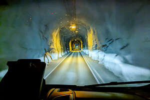 Scary tunnelDay 8 on the Ring Road was definitely our most challenging.
We had spent a nice morning at the Herring Era Museum in Siglufjörður before continuing around the tip of the Trollaskagi Peninsula and south down its western side.
The big winds that McRent had warned us about were upon us at last, making it a tough drive for Herb, as big gusts would actually move the van, sometimes too near a precarious edge. Plus, there were more of those two-way, one-lane tunnels, which were frightening in their own right.
We were hoping to make it a short driving day, staying in the town of Hofsós, where there is a beautiful infinity pool set at the edge of the sea, looking out over Skagafjörður and the islands of Drangey and Málmey, creating the illusion of it being an infinity pool.
 Tortellinis in the vanWhen we got there, the winds were whipping so hard we could hardly open the doors of the van. It was pretty cold and unpleasant. Unlike the thermal baths which are about 100 degrees Fahrenheit, this was a heated pool, set at about 87 degrees.
We stared at the pool for a while, trying to size each other up, as to whether anyone wanted to go in it, but there were no takers.
Damn. This was my plan for today. Now I wasn’t sure what to do except just head to our next known destination which was Kirkjufell on the Snaefellsnes Peninsula, about 4 and a half hours away. There was no way we were going to make it all the way there today, so we figured we would just start driving towards it and find somewhere to stay along the way.
In about an hour, we were back on the Ring Road in the town of Blönduós, at the mouth of a glacial river. In hindsight, we should have stopped there. It had already been a long day, and this town did have a campground.
 Trampoline FunI don’t know why but we decided to continue on.
Then things got even worse. For some reason, Google had us turn off the Ring Road on Road 59 and start heading north along the western edge of a fjord that we had just come down along the east side of.
Still things seemed pretty okay, until the road turned to gravel and continued to be gravel for the next 20 miles or so. Sometimes Google seems to think that the best route is the shortest one, without taking into consideration the road quality. We should have just stayed on the Ring Road even though that would be more miles to our planned destination.
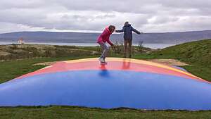 Where you going Paul?I was really upset that with all my planning I had gotten us into this mess. Everything had gone so perfectly up until now. If I had only used the Nat Geo map rather than Google, I would have seen that this was a gravel road.
All I knew was that we were headed towards a village called Búðardalur, population 266, but it did have a campground and other services like gas. Seemed like the only option for us at this point.
The town was situated on the Hvammsfjörður at the north-eastern end of the Snæfellsnes Peninsula, putting us in good position for our drive to Kirkjufell tomorrow.
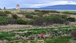 Across the heath to HvammsfjordurWe got in around 7:00 and found that the campground's grassy field had been blocked off because it was too wet and campers might get stuck, so we parked in the gravel parking lot instead. Hilda and I went to check out the showers, or more correctly shower, and it was very dark and depressing. We decided we were clean enough and went back to the van to cook dinner.
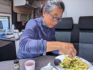
It was tortellinis with pesto and some veggies that night, which was actually quite good.
After dinner, I felt unsatisfied with our action level for the day. All we did today was a Herring Museum and lots of stressful driving. I suggested we go for a walk, even if it was already close to 10 pm. It never gets dark here in the summer, so what the heck.
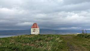 Must be a troll's housePlus, I needed to pull myself out of my bad mood from feeling that I had screwed up today, so I tried to put things in perspective. What would I be doing if I was home now. Probably cleaning up the kitchen and watching some TV. Instead here we were in a tiny Icelandic village about to wander across a heath to a fjord in the land of the midnight sun. Not bad.
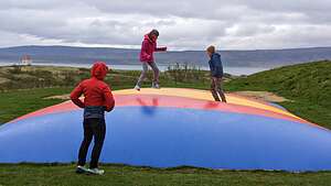
Not long into our walk we discovered a large trampoline. It was the birthday party Paul and I had dreamed of. Paul and I hopped around like we were eight year olds and managed miraculously to not hurt ourselves.
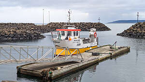 Búðardalur HarborNow that we were all fired up, we couldn't just go to bed, so we decided to hike to that amazing little red-roofed structure in the distance, even if we had to trudge across some pretty marshy land. I have no idea what the purpose of this tiny structure was, but it sure was picturesque.
10:15 and still light out. I guess it hadn't been such an uneventful day after all.
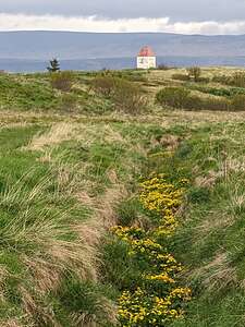 One more walk to the Troll HouseBefore leaving Búðardalur the next morning, we took one more walk out on the heath to the bluff overlooking the Hvammsfjordur fjord.
That little red-roofed structure at the top of the bluff kept drawing me in. Three of the main Icelandic Sagas (Laxdæla Saga, Saga of Eric the Red, and Eyrabyggja Saga), which were written way back in the 12th century, are all set in Búðardalur. I bet a troll lives in that building and has cast a spell drawing me back to it.
So, what I thought was going to be a real dud of a stop, turned out to be really fun. When would I ever again wander around in broad daylight at 10 pm and jump like I was a kid again on a trampoline in some remote tiny Icelandic village, or wander through a marshy landscape to a picturesque structure overlooking a beautiful fjord.
Up to today, everything had gone so perfectly, right down to the fantastic weather and the magical appearance of rainbows whenever we needed them, but sometimes it’s the unexpected, unplanned bumps in the road that can turn out to be pretty damn fun.
Siglufjörður
Wednesday, June 7, 2023 - 4:00pm by Lolo50 miles and 1.25 hours from our last stop - 1 night stay
Travelogue
 SiglufjörðurAfter leaving Akureyri, we left the Ring Road and headed up the beautiful Trollaskagi Peninsula towards the quaint fishing village of Siglufjörður, the northernmost settlement in Iceland, less than 25 miles from the Arctic Circle.
The peninsula has the tallest mountains outside the Highlands, meaning it also has tunnels to cut through those mountains. In fact, there are three tunnels along the 50 miles from Akureyri to Siglufjörður. Some of them are as much as 7 miles long. Unlike the one we took into Akureyri, these were toll-free.
 SiglufjörðurThey were pretty scary though in that although they were two-way, they had only one lane, so if there was another car coming in our direction, we had to quickly get over to one of the pull-outs on our side.
However, whenever we weren’t inside a tunnel, the scenery along the drive was stunning.
 Sorting the day's catchBefore these tunnels were built in 2010, Siglufjörður was pretty much cut off from the rest of Iceland during the winter.
We pulled into Siglufjörður campground late afternoon. What a location!! Set at the end of a fjord 25 miles from the Arctic Circle, with colorful buildings and the harbor on one side, and amazing mountains on the other.
 SiglufjörðurThere was only one other camper there, a very friendly man from a village outside Reykjavik who loved coming here in the summer. He said he was originally from the island of Heimaey, off the southern coast of Iceland, or at least until the 1973 eruption of the Eldfell volcano, which destroyed 400 homes on the island, including his. Everyone was evacuated, and he never returned to the island.
 Artic Herb's PylsursWow! How do you top that story? All we had to offer was we are originally from New Jersey. Not quite as dramatic.
We strolled down to the harbor to watch the fisherman unload their catch for the day. It was fun watching them fling the fish through the air as they sorted them into various crates.
 Dining alfresco near the Arctic CircleSiglufjörður is still very much a fishing village, but it has declined significantly from its glory days of being the herring capital of the world back in the early 1900s.
During its heyday, it was a thriving boomtown of 10,000, and its herring accounted for over 20% of all of Iceland’s exports. it grew so rapidly that it was compared to the California Gold Rush, and it was even given the name the "Atlantic Klondike".
 Siglufjörður However, overfishing resulted in the almost disappearance of herring by the late 1960s and the town fell into decline. The processing plants were closed and many people left. Today the population is a little over 1,200.
Today the town remains dependent on fishing and is trying to promote tourism. The building of the tunnels through the mountains on the peninsula has helped make it more easily accessible. Still, it is not quite there yet in terms of crowds of tourists, but that’s why we liked it so much.
 Herring Era MuseumIt has become a bit more discovered though. The Netflix series Entrapped, about the mysterious murder of a cult victim was filmed in this tiny village.
There weren't that many options for dining and we had had a big lunch in Akureyri, so once again opted for Herb's famous German interpretation of Icelandic Pylsurs (in other words, bratwurst). Surprisingly, we weren’t getting tired of them yet.
 Herring Era MuseumIt was so scenic around our campsite, that we even convinced my desert-loving Herb to eat alfresco surrounded by the beauty of this lovely village. It was a bit chilly though. After all, this was the closest we had ever been to the Arctic Circle, and the closest we ever will be if it’s up to Herb.
The next morning on our walk over to have breakfast at Aðalbakarí, we passed the village church with a bright blue house in front of it.
.thumbnail.jpg) Grana - the reduction factoryWe later found out that Herb's Icelandic friend John, who he went to Stevens Tech with, spent summers in that house. His parents owned it and his mom was a teacher's aid in the Siglufjordur elementary school. It sure is a small world.
Grana - the reduction factoryWe later found out that Herb's Icelandic friend John, who he went to Stevens Tech with, spent summers in that house. His parents owned it and his mom was a teacher's aid in the Siglufjordur elementary school. It sure is a small world.
Before leaving Siglufjordur, we visited the Herring Era Museum, considered one of the best museums in Iceland - although I had a hard time believing it was going to beat the Phallological Museum in Reykjavik. Herring are not as funny as phalluses, but I’ll keep an open mind.
 The museum buildings along the shorelineThe museum, which is a tribute to the town’s glory days as the herring capital of the world, is made up of three separate buildings. The first is the Boathouse in which there is a recreation of the town’s once bustling port, complete with dock and 11 boats of various types and sizes, which we were allowed to board and clamber about.
As we strolled along the pier, boarding various ships at the dock, we were transported back in time to this tiny village’s days as a bustling port with over 10,000 workers catching and processing herring. For a brief moment, I was a herring fisherman
 Herring Girls QuartersThe second building we went into was the Grana, a model of the original reduction factory that operated in Siglufjordur between 1919 and 1950. This is where men and machines transformed the herring into oil and fish-meal. The oil was used to light homes and streets before mineral oil was discovered and the fish-meal was an important component of animal feed (fodder for livestock) and an agricultural fertilizer
That’s when I turned to Herb and said, “Call me fish meal.” It took a minute before he realized my rather silly reference to the opening of Moby Dick.
 Herring Girls QuartersThe last building we entered was the Roaldsbrakki, a former Norwegian salting station built in 1907. This was where the herring that did not go to the reduction factories went to be salted to become human food, especially for the hungry European countries during the two World Wars.
On the 3rd floor of the Roaldsbrakki (salting station building) were the living quarters for the “herring girls,” the women that came from all across Iceland and other Scandinavian countries to take jobs gutting, cleaning, and salting barrels of freshly caught fish.
 Herring Girls QuartersAll the men were either out at sea fishing or working in one of the reduction plants, so the herring girl fulfilled a role that was so crucial that the herring industry could not have succeeded without them. Go Herring Girls!!
The rooms of the Róaldsbrakki, as part of the Herring Era Museum, have been restored, and the decor and personal items donated either by the former herring girls or their families.
 View from their windowThis was my favorite part of the entire museum. I’d much rather see how people of a bygone age lived than look at a fish meal producing machine.
The rooms they slept in were very neat and cozy (aka small), with painted bunk beds, an ironing board, and a closet full of skirts, slips, stockings, and bathrobes.
Off the bedroom there was what I guess was a laundry room, with a tub to wash the clothes in and a clothes line with nylon stockings and other assorted clothing items.
In the kitchen there were coffee urns and teapots, flour and sugar tins, cups, toaster, a floral-painted bread box.
 Herring Girls quartersSpread out on top of several portmanteaus were album covers of Nordic troubadours of the time—and also of Harry Belafonte and Elvis Presley.
The walls were decorated with photos of various film stars, such as Cary Grant, which made me nostalgic because he was my mom’s favorite.
It felt as if the girls had just temporarily stepped out and would be coming back soon, finding us snooping around their quarters.
But sadly, they won’t be coming back. The herring girl era ended in the summer of 1969 when the boats came back empty of herring.
What an informative and interesting museum, far exceeding our expectations, possibly ranking even higher in our minds than the penis museum in Reykjavik. Well, maybe I wouldn’t go that far.
