- Home
- About
- Map
- Trips
- Bringing Boat West
- Migration West
- Solo Motorcycle Ride
- Final Family XC Trip
- Colorado Rockies
- Graduates' XC Trip
- Yosemite & Nevada
- Colorado & Utah
- Best of Utah
- Southern Loop
- Pacific Northwest
- Northern Loop
- Los Angeles to NYC
- East Coast Trips
- Martha's Vineyard
- 1 Week in Quebec
- Southeast Coast
- NH Backpacking
- Martha's Vineyard
- Canadian Maritimes
- Ocracoke Island
- Edisto Island
- First Landing '02
- Hunting Island '02
- Stowe in Winter
- Hunting Island '01
- Lake Placid
- Chesapeake
- Provincetown
- Hunting Island '00
- Acadia in Winter
- Boston Suburbs
- Niagara Falls
- First Landing '99
- Cape Hatteras
- West Coast Trips
- Burning Man
- Utah Off-Roading
- Maui
- Mojave 4WD Course
- Colorado River Rafting
- Bishop & Death Valley
- Kauai
- Yosemite Fall
- Utah Off-Road
- Lost Coast
- Yosemite Valley
- Arizona and New Mexico
- Pescadero & Capitola
- Bishop & Death Valley
- San Diego, Anza Borrego, Joshua Tree
- Carmel
- Death Valley in Fall
- Yosemite in the Fall
- Pacific Northwest
- Utah Off-Roading
- Southern CA Deserts
- Yosemite & Covid
- Lake Powell Covid
- Eastern Sierra & Covid
- Bishop & Death Valley
- Central & SE Oregon
- Mojave Road
- Eastern Sierra
- Trinity Alps
- Tuolumne Meadows
- Lake Powell Boating
- Eastern Sierra
- Yosemite Winter
- Hawaii
- 4WD Eastern Sierra
- 4WD Death Valley +
- Southern CA Deserts
- Christmas in Tahoe
- Yosemite & Pinnacles
- Totality
- Yosemite & Sierra
- Yosemite Christmas
- Yosemite, San Diego
- Yosemite & North CA
- Seattle to Sierra
- Southwest Deserts
- Yosemite & Sierra
- Pacific Northwest
- Yosemite & South CA
- Pacific Northwest
- Northern California
- Southern Alaska
- Vancouver Island
- International Trips
- Index
- Tips
- Books
- Photos/Videos
- Search
- Contact
Hana
Friday, December 6, 2024 - 4:00pm by Lolo65 miles and 3 hours from our last stop - 2 night stay
Travelogue
Day 5 - The Drive to Hana
 Twin Falls - Lower FallsTo truly experience Maui you have to drive the famous Road to Hana, a 64-mile scenic drive along a narrow, twisting road connecting the towns of Kahului and Hana.
There are over 600 curves, but that isn’t even the worst part. As you come around one of the curves, you are often confronted with a single-lane bridge (there are 46 of them), forcing a sort of game of chicken scenario where one driver relents (usually us) and backs up far enough to allow the other car to squeeze by.
 Twin Falls - the Lower FallsSo why do people put themselves through this? Because it’s incredibly beautiful and I think people actually like the challenge of completing it without damaging their rental car.
But its stunning natural beauty comes with problems. The road has been marketed heavily since 1926 and now averages 400 to 600 people every day, causing traffic congestion, llegal parking, and trespassing.
 The rough trail to Caveman FallsIf you drive straight through, it probably takes about 3 hours, but there are so many beautiful stops along the way that it is more of an all-day thing.
Many people do it as an out and back in one day, but we thought that would be a death march, so we booked a place to stay for two nights in Hana at the lovely Hana Kai Maui. That way we could take our time along the way.
Before getting to the start of the Hana Highway we stopped at Hana Picnic Lunch in the town of Paia to pick up sandwiches for the drive. While waiting, I took advantage of the unlimited free samples of their delicious gelato. The owner also gave us some free advice as to the best stops along the way.
 Twin Falls - Caveman FallsTime to hit the road. The Hana Highway has mile markers along the way that can be used to track your progress and finds interesting stops along the way.
The mile markers restart at 0 when the highway changes from Route 60 to Route 360. It is past this point that the real twisties and narrow one-lane bridges begin. From 0 it’s about 34 miles (that feel like 100) to the town of Hana, where there was a lovely lanai overlooking Hana Bay awaiting us.
 Twin Falls - Caveman FallsWe only got to Mile Marker 2 before making our first stop at Twin Falls. This is the first of many waterfalls along the way, so many people stop here. I think a lot of them are locals that come here to hang out for the day and swim in the pools below the falls.
We were lucky to find a parking spot because this is a very popular stop. After paying our $20 parking fee, the woman taking our money gave us a brief description as to how to get to the three waterfalls.
 Stream crossing near Caveman FallsThe first one, Lower Falls, is pretty close to the parking area and easy to access. There were several people with chairs and coolers that looked like they were going to spend the day here. The falls, while small, are quite beautiful and there is a pool to swim in beneath it.
I’m not sure, but I think this is the one that gave Twin Falls its name, because at certain water levels there are two streams of water.
We continued on from there through a bamboo forest and came to a second waterfall, which I believe is Upper Falls.
 Bamboo ForestAfter a quick peek at that one, we continued on through what seemed like a tropical jungle and crossed two streams before arriving at Caveman Falls, a hidden oasis tucked away in a jungle setting - and there actually was what looked like a cave behind the falls.
Not sure exactly how “hidden” it is anymore, as there were dozens of people there ahead of us.
On the way back, we stopped in a lovely garden area with bright green ruffled fan palms and Red Ti plants.
 Fan Palms and Red Ti plant gardenOkay, it was time to make a little more progress as we had another 32 miles or so to go until we reached the Hana Kai Maui, our home for the night, and at this rate we wouldn’t get there until midnight. Besides any places we skipped today, we could see on the way back.
At Mile Marker 9.5 we stopped to hike the Waikamoi Ridge Trail, but no-see-ums biting every bit of our exposed skin coupled with missing the turn-off to the look-out made this less than a trip highlight.
We continued on past the Garden of Eden Arboretum at Mile Marker 10 with the plan of stopping here on our drive back in a few days.
.thumbnail.jpg) Christmas at Aunty Sandy's Banana Bread StandJust after Mile Marker 16, we made the turnoff onto the Ke’anae Peninsula, a dramatic half-mile long massive finger of lava sticking out from the cliffs along the Hana Highway.
Christmas at Aunty Sandy's Banana Bread StandJust after Mile Marker 16, we made the turnoff onto the Ke’anae Peninsula, a dramatic half-mile long massive finger of lava sticking out from the cliffs along the Hana Highway.
This lava is quite young geologically speaking. It was created a few centuries ago in a massive flow from Haleakala, where we had been hiking just a few days ago.
Besides its incredible natural beauty, what draws drivers along the Hana Highway to this peninsula is the famous Aunty Sandy’s banana bread stand.
 The waves of Ke’anae PeninsulaThere really is an Aunty Sandy, and she has been making and selling hot, fresh baked banana bread 6 days a week since 1983. Aunty Sandy’s has even been featured on Gordon Ramsey’s ”Unchartered” television series.
Although we intended to save it for tomorrow’s breakfast, we couldn't help pulling off pieces of it to enjoy while it was still hot. Delicious and definitely worth the stop.
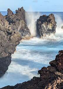
We continued on to the Ke'anae Lookout at the tip of the peninsula where we were mesmerized by the huge waves crashing over the lava.
 The Waves of Ke’anae PeninsulaSadly, this small village was almost completely destroyed in 1946 by a tsunami’s 35-foot waves, generated by an 8.6 magnitude earthquake off the coast of Alaska, killing 20 children and four teachers. The only building left standing was the small church built in 1856.
Ocean waves are a beautiful, yet powerful and sometimes a destructive force.
 Hana Sweet HanaWe were very excited about the place we would be staying in for the next two nights, so from the Ke'Anae Peninsula we drove straight through to the little town of Hana where we had reserved a room overlooking Hana Bay.
The Hana Kai Maui did not disappoint. We had Room #201, an upper floor corner unit with great views from our lovely spacious, covered lanai. Their was a well-stocked kitchen with a Koa wood bar with a pass-through window out to the lanai. We slept that night to the sound and feel of the tradewinds flowing through to our bedroom.
I never wanted to leave.
Day 6 - Pipiwai Trail and Red Sands Beach
 Hana SunriseI awoke while it was still pitch black out, thinking it was the middle of the night, but when I glanced at my phone, I saw that it was already 6:00 am.
Now I am not usually a morning get-up-for-the sunrise person, but since sunrise wasn’t until 6:50, I got up quietly (Herb was still sleeping), and sat out on my lanai and waited for the sun to rise. Herb joined me for the grand finale.
It was such a lovely experience that I vowed to repeat it the next morning.
Although I would have been perfectly content to just stay here all day reading a book, after breakfast, we headed out to hike the Pipiwai Trail.
 Still smiling after all the twistiesBefore leaving on this trip, I had researched best hikes on Maui, as we often base our travels around hiking. Pipiwai Trail came up high on the list. In fact, it was one of the reasons (although there were others) that we chose to stay for 2 nights in Hana rather than drive the Road as an out-and-back in one day.
 Makahiku FallsWe had heard that it’s a very popular hike, so we left early to ensure getting a parking spot. Hahaha. We were the first ones in the lot.
Of course getting there consisted of driving 12 more miles of narrow, twisty roads.
The Pipiwai trail is actually part of the Kipahulu District of Haleakala National Park. We had visited the Summit District a few days back where we had hiked the Sliding Sands trail down into the Haleakala Crater - a very different scenery and type of beauty than we would experience today.
 Pipiwai Banyon TreeIt was pretty nice getting there early enough to have the entire trail to ourselves. In fact, we didn’t see any people at all until the turnaround point at the Waimoku Falls gate. The way back was a different story, as we passed a stream of people coming our way.
Starting at the coast, the trail heads inland. In just a half mile we came to the Overlook for 200-foot Makahiku Falls. The odd thing about this waterfall is that there is a pool both above it and below it.
.thumbnail.jpg) Through the bamboo forestI later read that there is a spur trail right after the lookout that leads to the top of Makahiku Falls, where people were once allowed to swim in what was referred to as the Makahiku “infinity pool,” because it gives the illusion of going on forever into the sky. Unfortunately, the pool is now permanently closed for swimming.
Through the bamboo forestI later read that there is a spur trail right after the lookout that leads to the top of Makahiku Falls, where people were once allowed to swim in what was referred to as the Makahiku “infinity pool,” because it gives the illusion of going on forever into the sky. Unfortunately, the pool is now permanently closed for swimming.
Soon after the overlook we came to a beautiful banyan tree, which is over 100 years old and spreads over a 60-foot diameter. It is just a tiny bit smaller than the famous banyan tree in Lahaina. I felt so small and insignificant standing beneath it.
 Waimoku FallsBanyan trees are pretty amazing. Although this looks like a clump of trees, it is actually only one tree, which spreads by producing aerial roots that hang down and take root wherever they touch the ground. It was probably one of the most beautiful trees I have ever seen.
Continuing on, we entered a bamboo forest, which went on for about a half mile. It was magical. As we stood quietly amongst the bamboo, the breeze knocked the stalks together creating a sound similar to wind chimes. I took a video to capture their song.
.thumbnail.jpg) Waimoku FallsWow! A few days ago we heard whales singing and now a bamboo forest.
Waimoku FallsWow! A few days ago we heard whales singing and now a bamboo forest.
After emerging from the bamboo forest, we climbed a few more sets of stone steps and crossed a few more bridges before coming to the end of the trail, where there was a view of 400-foot tall Waimoku Falls, cascading over a sheer lava wall. It is one of the tallest waterfalls in Maui.
Unfortunately, the trail all the way to the falls was closed, so this was as close as we could get.
There were some trees blocking our view, so we crossed over a stream to get just beyond them in order to have an unobstructed view.
 One of the Seven Sacred PoolsFrom there we hiked back from whence we came - through the bamboo forest and past the banyan tree, stopping this time to climb up and sit on one of its branches.
Once back by the Visitor Center we continued onto the trail to the Pools of ‘Ohe’o (aka Seven Sacred Pools), which, unfortunately, are now closed to swimming.
Too bad, because these cascading waterfalls and pools were once one of Maui’s most popular attractions. All we were able to do was get a glimpse of the upper pool through a fence. Oh well.
 Garlic Shrimp from Joel's Food TruckOnce back in Hana, we stopped at Joel’s food truck to get some lunch. Herb had a pork roast plate and I had the garlic shrimp. It was delicious.
Hana doesn’t have many sit down restaurants but they do have about half a dozen food trucks to choose from.
We picked up some mahi mahi poke bowls to bring back for dinner on our lanai.
 Red Sand BeachOur last event of the day was a hike down to Red Sand Beach (also known as Kaihalulu Beach), a beautiful and dramatic, hidden crescent-shaped beach cut into the side of Ka-uki Head, a cinder cone south of Hana Bay.
It is these rust-red lava cinder cliffs that supply the beach with its deep red-black sand.
With its deep red sand and black lava rock sea wall it is absolutely stunning.
The ocean beyond the sea wall is a deep, almost surreal cobalt blue that relentlessly crashes against the seawall.
.thumbnail.jpg) End of a good dayI was a little nervous about the hike down to the beach, as there have been several accidents and deaths resulting from people falling off the eroding cliff trail onto the rocks below.
End of a good dayI was a little nervous about the hike down to the beach, as there have been several accidents and deaths resulting from people falling off the eroding cliff trail onto the rocks below.
However, it wasn’t as scary as they made it out to be.
My only regret is that we were here when the beach was in the shade, as I’m sure its red color would have been more vibrant in the sun.
What a great day it had been!! And the evening eating our poke bowls on our lanai wasn't so bad either
Day 7 - Waianapanapa State Park (Black Sands Beach), the Garden of Eden Botanical Garden, and back up the Road to Hana
 Black Sand BeachOnce again, I awoke while it was still pitch black out, glanced at my phone to make sure it was after 6, and then headed out onto the lanai to watch another day begin. It was so so peaceful.
Today we would drive back along the Road to Hana (or in this case “The Road from Hana”) to the Wailea Beach Resort where we would spend the next 5 nights.
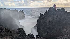 Waianapanapa BlowholeBut first, there was one more thing we wanted to do before leaving Hana and that was a hike along Hana’s famous Black Sand Beach and the lava cliffs of Waianapanapa State Park.
Fortunately, I had learned that entering this park requires a reservation, so a few days ago we booked one for the 7:00 am - 10 am time slot. This would allow us to go there and come back in time to pack up and leave before check out.
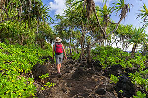 Waianapanapa Park - Kipapa O Kihapiilani TrailOriginally, we expected it to just be a black sand beach, because that’s what the park was more frequently called. However, what we would learn this morning is that it was that and so much more.
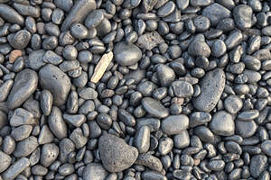
The translation for Wai'anapanapa is "glistening water" or "water flashing rainbow hues", both of which accurately describe the powerful contrast between the glistening black pebbles, black lava fields, bright green naupaka, and the deep blue-greens of the ocean.
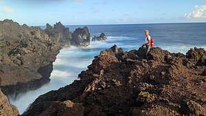 Waianapanapa Park - Kipapa O Kihapiilani TrailAs promised, the hike did begin by climbing down onto a beautiful black sand beach, which is the biggest draw for visitors to this park.
The name Black “Sand” beach is a bit of a misnomer as most of the beach is not sand but rather small black pebbles that glisten when wet.
 Waianapanapa State Park - Kipapa O Kihapiilani TrailAlso, it is not the type of beach you swim at as there is a vicious undertow and powerful rips. In fact, the official name of the beach is Pa’iloa, which means ‘always splashing.” People have drowned here. Plus, jellyfish and Portuguese man o’ war often frequent this cove.
From the beach, there is a choice of two directions to go. South went go along the coast back towards the town of Hana, and north headed up along the lava cliffs to Pukaulua Point, and beyond. We chose to go north.
 Lava and Napuaka PlantsAfter climbing up from the beach, it was only a short distance before we walked out onto a rocky lava outcropping and looked down at a massive blowhole in a V-shaped cove.
These “blowholes” form as sea caves grow towards the land (as they do here) and upwards creating a vertical shaft that goes up to the surface. When waves move into the sea cave with enough force the seawater gets compressed and releases through a port at the top of the blowhole, gushing out like a geyser. How high the spray goes depends on the geometry of the sea cave and the strength of the wave entering it.
 Waianapanapa Park - Kipapa O Kihapiilani TrailThis one shot pretty high and we could actually feel its spray.
A lot of the best viewpoints, including this blowhole, were off the main trail out onto rocky outcrops. Fortunately, we were using Gaia (a mapping app) to guide us along the trail. Scenic viewpoints were marked on the trail with a little binocular icon.
We might have missed this one if it wasn’t for that app, especially since the main trail is pretty much lava.
 Along the Kipapa O Kihapiilani TrailThere were four of these binocular icons on the trail north of Black Sands Beach that we hopefully would have enough time to get to.
There were more than just ocean views along the trail. The contrast of bright green napauka plants growing amongst the stark black lava fields was stunning.
The trail continued on along rooty paths and lava fields, where it was often less of a trail and more of clambering over lava.
 Lava, lava, and more lavaThe portion of the trail from Black Sands Beach to Pukaulua Point, which we were traveling on, follows a portion of the ancient Hawaiian Kings Highway, which was once a vital footpath reserved exclusively for Hawaiian royalty.
This section of the Kings Highway is called the Kipapa O Kihapiilani Trail. We would be walking on another section of the Kings Highway later in our trip when we hiked the Hoapili Trail south of Wailea.
 Ancient Hawaiian burial siteSo we were treading on sacred ground steeped in centuries-old legends and stories of the ancient Hawaiians that once called this area home.
There are over 34 ancient sites in this park, including cave shelters, house platforms, a pictograph, a heiau (temple), and several burial sites.
When we got to Pukaulua Point, we saw one of these burial sites. A simple white unmarked stone stood at the head of an area of medium-sized gray and black pebbles, surrounded by lava rocks and napauka plants.
 Waianapanapa Park - Kipapa O Kihapiilani TrailWe still had some time, so we continued on past Pukaulua Point, where the trail became more difficult to follow, as we were now pretty much just finding the path of least resistance across a vast lava field.
There was one more Gaia binocular icon we wanted to get to, and it did not disappoint - more lava rock outcrops looking over waves crashing over more lava rock.
 Waianapanapa Park - Kipapa O Kihapiilani TrailAccording to the Gaia map, we could have continued on for about another half mile but there were no more binocular icons and the trail was labeled as a boulder field. If what we just hiked through was not considered a boulder field, I didn’t want to go on what they considered one.
Plus, we were running out of time. Our reservation was over at 10:00 and we had to go back and pack and check out of our room by 11:00.
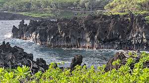 Looking back to Black Sands Beach CoveSo, we retraced our steps as best we could back to Black Sands Beach where our hike began.
When we got back to the Beach we had a pleasant surprise - a monk seal lounging on the rocks.
This hike far exceeded expectations. Originally, I thought it was just going to be a beach, but it was so much more.
 Monk Seal on Black Sand BeachWe got back to our room in time to pack up and barely get out by the 11:00 check out time. I was sad to leave this place as it had been such a peaceful, relaxing, and beautiful setting.
Then it was off to once again drive the twisty, narrow Hana Highway towards our next destination - the Wailea Beach Resort in southwest Maui. So we would be shifting from beautiful sunrises back to beautiful sunsets. Gee, life is tough.
Our first planned stop on the drive up was Aunty Sandy’s Banana Bread stand on the Ke’anae Peninsula to pick up another warm, delicious loaf of banana bread. I was practically salivating as we approached it, only to be disappointed by the sign saying “Closed Sundays.” What a blow.
 Upper Puohokamoa Waterfall.Oh well. We forged on towards our next destination - the Garden of Eden Arboretum & Botanical Gardens (between Mile Markers 10 and 11).
The arboretum stretches across 26 acres and showcases over 700 species of tropical and subtropical plants, including rare orchids, ret Ti plants, rainbow eucalyptus, a 100-year-old mango tree, and a bamboo forest.
There are three parking lots and about two miles of walking trails. We parked in the third lot and walked to the Waterfall Lookout for a view of Upper Puohokamoa Waterfall.
.thumbnail.jpg) Keopuka Rock OverlookWhile once a popular place for swimming the landowners closed down access to it in 2007 for liability reasons. Now it can only be viewed from this lookout in the Garden of Eden.
Keopuka Rock OverlookWhile once a popular place for swimming the landowners closed down access to it in 2007 for liability reasons. Now it can only be viewed from this lookout in the Garden of Eden.
So many of Maui’s pools and waterfalls have been closed down over the last decade because of accidents and drownings - the Olivine Pools, the Seven Sacred Pools, the Nakalele Blowhole, and Puohokamoa Waterfall. And these are just the ones I know of.
 Rainbow EucalyptusFrom there we continued on to the Keopuka Rock Overlook where we looked out at the large rock just off the coastline that made the Garden of Eden famous. This is the rock that a helicopter passes over in the opening scene of “Jurassic Park” on its way to land on a tropical island that has been populated by dinosaurs created from prehistoric DNA.
No dinosaurs for us today, just beautiful tropical plants. My favorite was the rainbow eucalyptus tree, whose bark is so brightly colored that I couldn’t believe it was natural. But it was! It looked more like an abstract painting than a tree.
.thumbnail.jpg) Bamboo huggerThe reason the bark looks the way it does is that as the tree sheds its bark, it reveals a neon green inner layer. Over time, as this layer is exposed to air, it ages into different colors—bright reds, oranges, blues, pinks and purples. The different colors appear as different layers fall off, while other exposed areas begin aging.
Bamboo huggerThe reason the bark looks the way it does is that as the tree sheds its bark, it reveals a neon green inner layer. Over time, as this layer is exposed to air, it ages into different colors—bright reds, oranges, blues, pinks and purples. The different colors appear as different layers fall off, while other exposed areas begin aging.
They are absolutely beautiful.
The Garden of Eden Arboretum was a very pleasant way to spend an hour or so, while taking a break from the somewhat stressful driving on the Hana Highway.
 Our new home in WaileaThe Road to Hana and all the stops along the way was definitely worth it, but I am so glad we didn’t try to do it as an out-and-back in one day. We would have missed so much.
Plus, the Hana Kai Maui Resort, which we stayed at for two nights, was really special.
But now, we were headed to the Wailea Beach Resort for 5 nights, where we would have another lovely balcony overlooking the ocean, with a beautiful 50-meter infinity pool right below us.
This was definitely a much fancier place than we were used to, but we would do our best to cope.
 Herb copingThe first indication that we were not your typical “resort” types was our dinner that night. We are much more used to sleeping in the back of our 4Runner out in the middle of a desert somewhere.
I had told Herb that since we were tired from our long day, I would rather just pick us something for dinner to eat on our balcony. So we stopped at Safeway and got some salads from the deli, including a beef and green beans dish, thinking we would have a microwave in our room.
 Sunset from our balconyWhen it came time to eat, we discovered that we in fact did not have a microwave. Undaunted, Herb filled the bathroom sink with the hottest water he could and placed the beef and green beans container in it.
While we waited for it to warm up, we went out on the balcony and drank a glass of the complementary champagne that we found in the refrigerator.
 Wailea Beach Resort infinity poolI can pretty much guarantee that we were the only ones in this entire resort sipping champagne and eating luke-warm beef and green beans on our balcony.
We would have to transition gradually, but we would get there.
Wow! What a beautiful sunset from our balcony. I definitely could do this!
Kihei
Monday, December 2, 2024 - 10:00am by Lolo15 miles and 0.5 hours from our last stop - 4 night stay
Travelogue
Day 1 - Arrival on Maui, Stocking Up at Costco and Safeway, and checking into our condo at Hale Kamaole in Kihei
 Hale KamaoleWe arrived in Maui around 1:00 pm, giving us plenty of time to stock up on food and supplies at both the nearby Costco and Safeway. Our first 4 nights would be in a condo with a full kitchen, so we could make some meals, if we were so inclined.
Still, we had to control ourselves in Costco this time so as not to buy more than we could eat over the next 4 days, which basically meant beer, wine, non-perishable snacks, and a chicken alfredo dinner (which would be good for 2 nights), and a big salad.
Safeway was definitely a better option for items for breakfast and lunch.
 Hale KamaoleIt was perfect timing for our 4:00 check-in at Hale Kamaole, a large condominium complex in South Kihei, right across the street from Kamaole Beach Park III. Our son and daughter-in-law had stayed here last year and highly recommended it as a lovely, reasonably-priced vacation rental in a great location.
The condo was well-equipped and spacious with a lovely patio overlooking the well-manicured lawn and pool and the ocean if I stood on my tip toes.
 Hale Kamaole sunsetIt was getting near 5:15 and sunset was at 5:30, so we grabbed two beach chairs, which the condo owner kindly had in the storage closet, and headed across the street to the grassy Hale Kamaole Beach Park III.
It was the first of many lovely sunsets we would enjoy during our 11-day stay on Maui. Funny how something so predictable and repetitive never gets old and always feel so special. .
Back at the Condo we cooked our Chicken Alfredo alla Costco and then called it a night.
Day 2 - Makena Beach and Herb’s Birthday Dinner (not from Costco)
 Makena (Little) BeachToday was Herb’s 69th birthday, so he got to choose how we would spend it. Herb loves a good beach day, so we headed to one of Maui's finest - Makena Beach, with its beautiful crescent of golden sand almost two-thirds of a mile long. It’s the type of beach most people think of when they think of Hawaii.
There are actually two beaches at Makena - Big Beach and Little Beach. Big Beach is the one closest to the parking lot, and Little Beach is reached by climbing over a rocky lava rock promontory at the northern end of Big Beach.
 Makena (Little) BeachWe headed over the rocks to Little Beach, which is as its name suggests, “littler” than Big Beach. The water is calmer than on Big Beach, because it is tucked between two rocky lava outcrops creating a small cove.
It was a pretty hot day, so we grabbed a spot under a tree, which would give us shade for at least an hour or two.
The waves were a little more feisty than I like, but it was still fun getting plowed down by them and pretending I was body surfing. Herb went out a bit further than I liked and kept drifting towards the lava rocks, so I kept gesturing at him to turn back.
 Another Hale Kamaole sunsetI wasn’t sure if I was embarrassing him, but felt better when a little later a young girl was doing the same thing to try to keep her boyfriend from straying onto the lava rocks. I told Herb that I probably saved his life. He just laughed.
By mid-day our shade was gone, so we went in and out of the water more often to keep cool. I love the feeling of water evaporating on my skin on a hot day.
 The Birthday BoyDespite my poor attempts at body surfing, it was lots of fun.
Since it was Herb’s birthday, there would be no Costco reheat for him tonight, but rather some fine dining at Cafe O'Lei Kihei, a highly rated restaurant known for its fresh seafood and fresh locally-sourced cuisine.
Plus, it was within walking distance from our condo, which was great.
I wanted something special for Herb’s birthday, and this place was perfect, a bit more elegant than most of the other restaurants along this strip.
We both had the Macadamia Nut Crusted Mahi Mahi with lemon-caper butter, steamed rice and local farm vegetables. It was absolutely delicious. That plus a fancy tropical cocktail hit the spot.
What a birthday bash!!
Day 3 - Haleakala National Park
 Haleakala CraterOur absolute #1 reason for going back to Maui was to revisit and hike the Sliding Sands Trail down into the Haleakala Crater, which we had found so stunningly beautiful when we were here back in 2018.
The drive up to the summit of Haleakala summit, and the start of the Sliding Sands Trail, is an endless series of steep, nausea-inducing switchbacks. If you’ve ever seen Hawaii travel footage of cyclists careening down a steep, windy road requiring no pedaling for miles, this is the place. However, it's not like the old days where cyclists started their descent from the 10,000-foot Haleakala summit. The Park banned commercial cycling back in 2007, so now biking tour companies have to drop bikers off at 6,500 feet, outside the boundaries of the National Park.
 Haleakala CraterThere are two Haleakala Crater viewpoints along the drive up that are worth the short walk: Leleiwi Lookout and Kalahaku Lookout. We stopped at both, but nothing compares to hiking down the Sliding Sands Trail from the Summit, even if only to the first lookout about a quarter of a mile down.
Unlike the last time we were here, when we arrived at the Visitor Center on top, the skies were clear, which is great for not getting soaked as we did last time, but a lot less dramatic in terms of clouds and weather. Blue skies can be boring.
 Haleakala CraterHowever, under any conditions, Haleakala Crater is awe-inspiring, humbling, and as Mark Twain once said, “the sublimest spectacle” he had ever seen.
Haleakala Crater, which is actually a giant, majestic shield volcano, is huge, taking up 75% of Maui’s 727 square miles.
 Haleakala SilverswordsAt a little over 10,000 feet above sea level, it’s one of the highest peaks in the Pacific Ocean. However, it’s actually much taller than that if you measure it from its base on the Pacific Plate from which it rises 28,000 feet, making it 675 feet taller than Mount Everest. Only about 5% (just its top) is above sea level.
However, the part that is above sea level is absolutely stunning with numerous multi-colored cinder cones tinted by red, orange, yellow, green, and blue volcanic ash and rock, and shimmering silverswords dotting the landscape like blotches of paint.
 Haleakala CraterThese cinder cones, called pu’u in Hawaiian, were formed during an eruption when gas became trapped in the lava, forcing it to eject like a fountain of sticky cinders around the base of the fountain, forming a steep conical hill with a prominent crater on top.
To hike down and amongst this surreal,multi-colored stunning landscape was why we came back to Maui, and it didn’t disappoint.
 Haleakala CraterThe Sliding Sands, or Keonehe’ehe’e Trail, is the premier access to Haleakalā Crater. The trail departs from the summit of 10,023’ Haleakalā volcano and descends 4 miles to the crater floor 2,400 feet below.
What makes this hike particularly difficult is the inability to acclimate to the 10,023 foot summit, when driving up to it from sea level in just a little over an hour.
 Lolo of HaleakalaOn my last hike down into the crater along the Sliding Sands Trail in 2018, I suffered a terrible bout of altitude sickness on my way back up the trail. I was nauseous and felt like there was an ice pick in the back of my head.
This time I would be smarter - take Ibuprofen ahead proactively and stop every half hour or so to drink water.
So off we went down into a surreal world of multicolored cinder cones, tinted by red, orange, yellow, green, and blue volcanic ash and rock, constantly changing with the light.
It was breathtaking. Actually, on the way up, it would be literally breathtaking.
 The long slog upOne of the main dangers of this hike is the false sense that you get when descending into the crater, as it is much more difficult to climb back up on the return, so you have to be careful to not get in over your head. We had done this hike before, so we knew what to expect.
Plus, we were reminded of that by the strained faces of the hikers we were passing on their way back up. At this point, we were feeling quite chipper.
Adding to the already colorful palette of colors were the shimmering silverswords dotting the landscape like blotches of paint.
 Haleakala SilverswordThese lovely plants are known for their striking appearance, with long, slender leaves and a silver-white color. Their Hawaiian name is ʻāhinahina,” meaning "very gray."
They are an endangered species and are only found on the cinder cone slopes of Haleakala Crater.
The most fascinating thing about silverswords is that they only flower once in a lifetime. When they are somewhere between 10 and 30 years old, thousands of aromatic flowers erupt from their human-sized stalk and are pollinated by native Hylaeus bees. After it has finished flowering, it dies. Fortunately, the thousands of seeds it produces will start the cycle all over again.
 Young SilverswordBoy, that would have been something to see.
3.7 miles into the hike, we got to the point where we could see the crater floor. Although it was only about a third of a mile away, it was 600 feet below us at the end of a very steep and rocky section of trail.
We both looked at each other and said, “Why?” The most beautiful part of the trail was behind us and we knew the hike out was already going to be tough. Plus, we had been to the crater floor before.
 My favorite cinder coneSo, rather than continuing on just for the sake of touching the crater floor, we turned around and headed back up what would already be a strenuous hike, stopping along the way to take photos.
By now clouds were moving in and settling atop the crater rim behind us, where Maui meets the trade winds. It was hard to tell whether they were clouds or giant waves. In either case, they added to the awe-inspiring beauty of the landscape.
 Almost backThe hike up was tough and I imagined our faces looked more like the ones on the people we passed coming up while we were going down, but it was nothing compared to the way I felt in 2018 when I got altitude sickness.
When we finally got to the top, we were greeted by a Partridge, with its distinctive white face with black band across its eyes down to its neck, and a gray-brown back striped in black and white feathers.
 Chukar PartridgeHe was adorable and quite willing to have his photo taken. This little guy (or gal) is not native to Hawaii, but was introduced in 1923 as a game bird. They are native to Asia and eastern Europe.
I had taken so many photos on this hike that I had to force myself to not look at them when driving down the long twisty road back to sea level or I would have escaped altitude sickness and replaced it with car sickness.
There would be time for that later when eating the second half of our Costco Chicken Alfredo dinner back at the condo.
Herb and I have hiked on a lot of incredible trails in our lifetime, but the Sliding Sands Trail is definitely in our top 10.
Day 4 - PacWhale Adventures Molokini Island Snorkeling Tour
 Lolo of the Ocean VoyagerYou can’t go to Maui and not snorkel, so based on a recommendation from our son and daughter-in-law, we booked a Molokini Island Snorkeling Tour with PacWhale Adventures.
While a lot of companies offer snorkeling tours to Molokini Island, PacWhale is the most environmentally and ecologically focused and is staffed by Certified Marine Naturalists with degrees in marine biology.
PacWhale Eco-Adventures is wholly owned by nonprofit Pacific Whale Foundation, founded in 1980 with the mission of protecting the declining humpback whale population from global threats such as commercial whaling and climate change.
 Snorkelers by Malokini CraterProfits from their tours help fund the Pacific Whale Foundation’s research and conservation projects, so we felt good that the cost of our trip was going to a good cause.
8:00 am sharp, we and our fellow snorkelers boarded the Ocean Voyager in Māʻalaea Harbor and cruised 3 miles over to Molokini Island for our first snorkeling stop.
Molokini Island (or more correctly Crater) is actually what's left from an eruption that occurred around 230,000 years ago. Once a cinder cone, thousands of years of erosion has reduced it to a crescent atoll, making it a perfect place for marine life and, therefore, snorkeling.
 Lolo ready to go snorkelingThe island stretches over 20 acres and rises 160 feet above a coral reef with more than 250 species of tropical fish.
The entire island is a protected marine conservation area, so there are lots of rules. Firstly, it is only accessible by boats with certified tour operators, so everyday there is a line up of at least half a dozen anchored offshore. Secondly, snorkelers are not allowed to even touch the crater, which would result in a $10,000 fine. So let’s just say that they are very serious about protecting this unique and special place.
 Ok, I'm in the waterAfter anchoring, we were all let loose to explore the crystal clear waters above the coral reef. I recognized many of the fish as those that inhabited Herb’s dad’s tropical fish tank, like yellow tang and parrot fish.
From Molokini Crater we moved on to our second snorkeling destination for the day, a turtle cleaning station in an area called Coral Gardens just north of Maalaea Bay.
Along the cruise there we were told to keep our eyes out for whales, but unfortunately it was a little early in the season for them to be here, so all we saw was a spout.
 School of Black TriggerfishHowever, our crew knew there were plenty of them below us, so even if we couldn’t see them, they would try to let us hear them.
Apparently humpback whales are quite the singers and are known to actually create “songs” that can last up to 23 hours. They are not just random noises but a pattern of regular and predictable sounds that are considered by some to be the most beautiful music on earth.
So, the crew stopped the boat and lowered an underwater microphone called a hydrophone into the water. Sure enough, one was singing. We spent an incredible 10 minutes sitting quietly and listening to a humpback’s song, which was more like a series of moans, snores, and cries.
 On our way to our next snorkeling destination - Turtle HoPretty amazing!
We continued on and anchored at a place the crew said was near a turtle cleaning station, where we were very likely to see turtles.
I had never heard of a turtle cleaning station before, so I was intrigued.
Apparently turtle’s shells get pretty covered in algae that can be itchy and slow them down, so they need to find a way to get that algae off.
So, they have developed a symbiotic relationship with the local algae-eating fish (tangs, angelfish, etc.). The turtles get cleaned and the fish get fed. Nature is pretty amazing.
 Sea TurtleCleaning stations are often the focal point of every turtle community, so they select them wisely. First, the reef has to have adequate food and shelter to attract fish. Then the turtle sets himself (or herself) on a conspicuous coral head where the fish can easily find him. Then the turtle presents himself to the fish for a picking over.
Pretty awesome day, and I would highly recommend a PacWhale snorkel tour for seeing and learning about Maui’s incredible marine life.
We wrapped up our stay in Kihei with dinner at Moose McGillycuddy’s, a lively pub with good food. We had the Mahi Mahi Macademia, which was good but not quite as good as Herb’s birthday dinner at the more elegant Cafe O'Lei Kihei.
Tomorrow we would hit the Road to Hana.
Death Valley National Park
Monday, October 14, 2024 - 6:15pm by Lolo360 miles and 8 hours from our last stop - 3 night stay
Travelogue
Day 1 - Along the Harry Wade Road - Saratoga Springs Marshland and Ibex Dunes
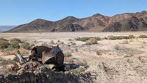 Along the Saratoga Springs RoadAfter Mojave, we headed towards Ibex Dunes in the remote and scarcely visited southeastern corner of Death Valley. Since Ibex was a literal food desert, we stopped in Barstow along the way to pick up sandwiches at Jersey Mike’s and some healthy salads to eat for dinner at Staters Grocery Story.
From Barstow, we continued north on I15, and then in the town of Baker, we took Route 127 north for 30 miles to the barely obvious Harry Wade Historical Monument, and the start of the Harry Wade Road.
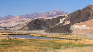 Saratoga SpringsWe stopped at the historical marker to read the tale of Harry Wade, who with his family and 100 other wagons, was part of the Death Valley ‘49ers, a group of pioneers from the East who foolishly tried to take a short cut through Death Valley to get to the Sutter’s Fort gold prospecting area in the Central Valley.
Well, things didn’t go so well for the party in Death Valley, which is often the case, so Harry set out and found an exit route for his ox-drawn wagon, saving his and his family’s lives. Today that exit route is known as the Harry Wade Road. It was designated a California Historic Landmark in 1957.
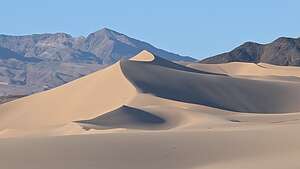 Ibex DunesWell, if it was good enough for Harry, it was good enough for us, so we turned left on Harry Wade Road and drove along a well-graded road with lovely views of colorful rocks to our right. I named them “Charlie Brown” rocks because of the zig-zagging pattern of their colorful layers, similar to the shirt Charlie Brown always wore.
At 2.7 miles, we passed the turnoff for the Ibex Dunes (for now) and continued on to the turnoff for the Saratoga Springs marshland at mile 5.8, another lesser-known Death Valley destination that we had read about in our “The Explorer’s Guide to Death Valley National Park.” From there it was a 3.9 mile drive to the parking area.
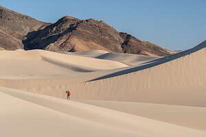 Lolo on Ibex DunesI assume this area was named for the more famous Saratoga Springs in New York, but the similarities ends with the fact that they both have springs. The New York version doesn’t even have any pupfish inhabiting its spring.
The Death Valley version is an extremely isolated and lovely marshland, set at the base of a colorful brown, tan, and white rock formation. It is home to the Saratoga Springs pupfish, or Cyprinodon nevadensis to be exact, one of nine pupfish species that have evolved separately in the springs of Death Valley and the Owens Valley, and the first to have been discovered.
.thumbnail.jpg) Lolo atop Ibex DunesAfter parking the car, Herb and I set off on separate hikes, as we had different photographic interests. Herb, who has come to enjoy more detail and abstract shots, took off for the marsh, while I, who am more interested in landscape subjects, headed up the road leading up the side of the interesting, colorful rock formation to the right of the marsh.
Lolo atop Ibex DunesAfter parking the car, Herb and I set off on separate hikes, as we had different photographic interests. Herb, who has come to enjoy more detail and abstract shots, took off for the marsh, while I, who am more interested in landscape subjects, headed up the road leading up the side of the interesting, colorful rock formation to the right of the marsh.
Once we convened back at the car, we drove back out to the Harry Wade Road and retraced our route back for about 3 miles to the Ibex Junction and turned left onto a rocky but very passable road to get to the Ibex Dunes.
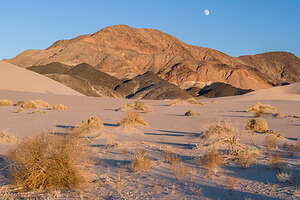 MoonriseThe last time we were here, we actually drove too far on the Ibex Dunes road and missed the dunes, which are actually quite small. This time we knew exactly where to find them.
We found a good spot to camp for the night from which we could hike to the dunes. There really is no set trail to the dunes, but rather we just found good terrain, weaving amongst the sagebrush and across some shallow washes, and set our sights on an easily visible goal - the dunes.
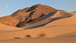 Golden Hour on IbexHowever, the dunes are a couple miles long, so we had to pick which section we wanted to visit, as there was not enough time, or desire, to do the whole thing.
There are two distinct sections to the dunes. The ones on the left (north) are higher, while those on the left have a scattering of smaller ones leading more gently along the ridge to the top.
We hiked in the direction of the one at the very right end, which was also the most brightly lit, but switched directions when the one to the left of it assumed that honor. It felt like we were racing the ever changing light.
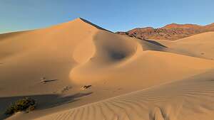 Golden hour on IbexAn added bonus was that these dunes are so pristine and remote that there was not another footprint on them, and there probably hadn’t been any in days. We had this amazing landscape all to ourselves.
As the golden hour approached, the dunes began to put on their evening show, as their dull monotone tans turned to bright beige with deep shadows in their nooks and crannies.
A surprise treat was the rising of a full moon rising over the Saddle Peak Hills behind the dunes, which were now taking on a reddish glow.
 Moonrise at IbexWe got so wrapped up taking photos of the moonrise that by the time we got back to the car the sun had already dipped behind the hills and the dunes reverted to their flatter monotone tan.
Ibex Dunes might not be the tallest in Death Valley - that honor goes to the Eureka dunes - but I do think they very well might be the most stunning.
Oh, one thing that was very different from our last visit here, was the traffic along the Ibex Dune road. Last time, we probably only saw a vehicle or two all day, but this time there was a fairly steady stream of 4WD vehicles decorated with stickers and banners, coming towards us from the mountains to the north.
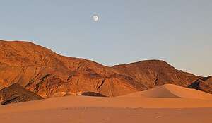 Moonrise at IbexAs they passed us, we waved and noticed that each vehicle was driven by a woman, and the co-pilot in the passenger seat was also a woman.
Only later did we find out that we were right along the route of the 2024 Rebelle Rally, an all-women annual off-road rally that is not focused on speed, but rather on navigating precisely using maps, compasses, and road books over 8 grueling days.
It is the longest competitive off-road rally in America, and it just happens to be for women.
Wow! First the Badlands Off-Road Adventures 4WD course, which was dominated by women, and now this! Women Rule!!
Day 2 - Ibex Dunes to Stovepipe Wells
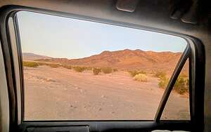 Morning view from my bedOne of my favorite things about sleeping in the 4Runner is looking out the window in the morning and trying to remember where the heck I am.
The next morning the early morning commute of the Rebelle Rally girls began, and we watched and waved at a steady stream of 4WD vehicles came down from the mountains to the north of us. I wonder where they were headed next? They probably have already spent a few hours plotting their course, as the checkpoints for each day's destination are released every morning at 4:30 am.
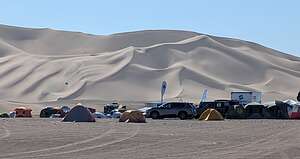 Dumont Dunes OHV AreaPlotting our day was a bit easier - we had Google Maps and a reservation at the Stovepipe Wells Village Motel that night. Since it was only a 3-hour drive, we might even be wild and crazy and take a side trip through Tacopa.
Back on Highway 127, we made a quick detour into the Dumont Dunes Off-Highway Vehicle (OHV) Area, a sand dune system with 7,620 acres of public land in the Mojave Desert for motorized recreation. These OHV areas are very popular in this area of the country.
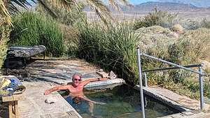 Tecopa natural springWe were thinking that this might be the Rebelle Rally girls home for the night?
This one was very different than the Jawbone Canyon OHV Area that we had played in during our Badlands Adventure off-roading course in that it was entirely sand dunes, and lots of them.
From there we continued on to the tiny town of Tecopa, which we had heard a lot about, both on YouTube and from our son. It’s just a funky little desert town (population 150), with natural hot springs and hot spring resorts, located just outside Death Valley National Park near the village of Shoshone.
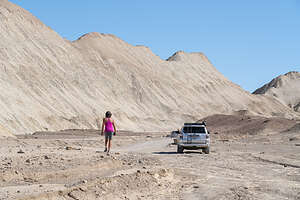 Twenty Mule Team Canyon RoadOur son and daughter-in-law had recently been there and told us how much they enjoyed the brewery there.
Unfortunately for us, we didn’t realize that this tiny town had two breweries and we went to the one that was permanently closed. When I later found out that we should have actually gone to the Death Valley Brewing Company rather than the defunct Tecopa Brewing Company, I wanted to cry.
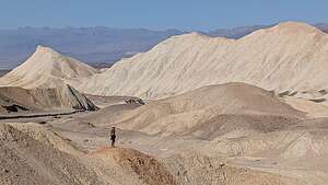 View along 20 Mule Team RoadI really was in the mood for pizza and beer. It’s supposed to be a really cool place with great wood-fired pizza and a tasty selection of craft beers.
Before leaving town though, we did find a natural hot spring to take a soak in. It kind of seemed like someone might use this place as their home, as there was a lawn chair and a cot. Well, if they did, they were out for now, so we took advantage of having the spring to ourselves.
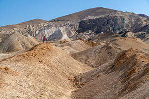 Lolo atop the ridgeAfter about a half hour, a car came, and a guy just sat in his car. Ok, time to move on.
Then it was on to the main part of Death Valley. We entered the park at the Death Valley Junction and turned left onto Highway 190, which is the main road through the park.
.
After about 20 miles on Highway 190, we decided to take the Twenty Mule Team Canyon Loop, a 2.7-mile well-maintained dirt road that twists and winds its way between, around, and over beautiful yellow hills. The landscape is incredible.
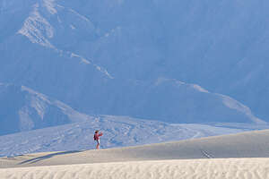 Hiking on Mesquite DunesBesides its scenic beauity, this road also has a lot of human history, as it played a large part in the mining history of Death Valley. It is named for the teams of mules that back in the 1880s used to pull wagons loaded with borax mined in these canyons from Death Valley 165 miles away to Mojave CA, where we had just been 2 days ago. So we were doing the Borax route in reverse just like the old wagon drivers - minus the Borax and the mules.
Borax was big business in Death Valley at that time. Death Valley has a rich mining history that went on from the 1850s through 1915, and in some cases even later. Of all the minerals and dreams of riches, borax and talc, rather than the more glamorous gold and talc, produced the most wealth.
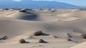 Mesquite Sand DunesBack out on 190, we continued north. We didn’t stop at Zabriskie Point, which has one of the best views of Death Valley, because we wanted to get to Stovepipe Wells in time to do a sunset hike on the Mesquite Dunes. Besides, we had been to Zabriskie Point at sunrise so many times in the past, that the lighting at midday just wouldn’t be able to compare. I guess we are getting to be a bit of “good lighting” snobs.
Then it was on to the Stovepipe Wells Village Hotel, which we like because of its location right across from the Mesquite Sand Dunes.
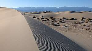 Mesquite DunesPlus, for being smack in the middle of a desert, it has a good restaurant on site called the Badwater Saloon, and we needed it because we were starving since we couldn't find the Tecopa brewery with the great wood-fired pizza.
After our late lunch we set out for a late afternoon hike on the Mesquite Sand Dunes. The lighting on the dunes is dependent on the season. In the winter time, which we were now closest to, sunrise is best on the front side of the dunes (by the main parking lot), but sunset is best on the back side, reached via a longer walk from the Historic Stovepipe Well, just off Scotty’s Castle Road, a few miles north of the junction with 190.
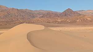 Golden Hour on MesquiteSo to the back side we would go. After parking near the Historic Stovepipe well, we started walking out towards the dunes which were much lower than the ones seen from the main parking lot.
It was close to a one-mile walk just to get to the beginning of the back side of the dunes. Walking was easy however, as much of the surface was hard packed dirt rather than deep sand. We could pick and choose whenever we wanted to go up and over a small dune.
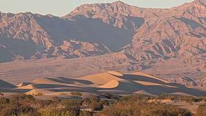 View of Mesquite DunesThe sand dunes stretch over 7 miles long, so we knew we were not going to get to the main dune area and the tallest “Star Dune.”
However, these smaller dunes are beautiful in their own way - less dramatic, but more intimate and peaceful. There wasn’t another soul to be seen for miles. I think very few people explore this section of the dunes.
After about 2 miles of wandering around the dunes, we turned around so we could get back before dark.
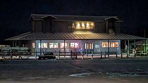 Stovepipe Wells General StoreAnother thing about hiking in dunes is that it is easy to get lost if you don’t have a specific landmark in mind to head for. We were also assisted by Strava and Gaia, which we were using to record our hike. Both of these apps provide tracks which allow you to sort of follow the breadcrumbs back home.
It was a great hike. We felt like we were the only people in the world, or at least our small part of it.
Back at Stovepipe Wells, we headed back to the Badwater Saloon for dinner, as it was the only game in town - but at least it was a good one.
Day 3 - Wildrose Charcoal Kilns and the Eureka Dunes
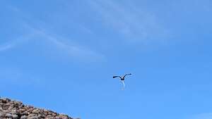 Falcon with BreakfastThis morning before heading to Eureka Dunes to camp, we decided to take a drive to the Wildrose Charcoal Kilns, a remnant from Death Valley’s mining past.
Yesterday, on the Twenty Mule Team Canyon Road, we learned about the back end of mining - the delivery of product (Borax) to Mojave. Today, at the kilns we would learn about one of the steps in the mining process itself.
.thumbnail.jpg) Wildrose Charcoal KilnsThis was one of the few places in Death Valley that we had never seen, but always heard about, so we figured it was worth the one hour drive from Stovepipe wells to finally check it out.
Wildrose Charcoal KilnsThis was one of the few places in Death Valley that we had never seen, but always heard about, so we figured it was worth the one hour drive from Stovepipe wells to finally check it out.
To get to the kilns, we drove West on Highway 190 and then took a left onto Emigrant Canyon Road. The scenery along the way is spectacular, and we even saw a falcon high above us with a big snake dangling from its talons.
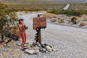 Crankshaft JunctionThe last 2 miles to the kilns is on gravel road, suitable for all vehicles.
Wow! The kilns looked like a well-curated outdoor art exhibit. There were ten of them, laid out in a perfect line, oriented northwest to southeast. They were built in 1877 from local stone, with a mortar made from a lime, sand, and gravel mix.
They looked like giant upside-down beehives, and were quite beautiful.
.thumbnail.jpg) Flat monotone dunesThe kilns were built to supply charcoal for smelters for nearby lead-silver mines.
Flat monotone dunesThe kilns were built to supply charcoal for smelters for nearby lead-silver mines.
During their short two years in operation, pinion pines were harvested from the surrounding hillside and loaded into the kilns, Then they were burned to produce charcoal.
Charcoal was the preferred fuel source for use in mining furnaces because it burns more slowly than wood and produces much greater heat, which is essential for refining ores.
.thumbnail.jpg) Settled in waiting for the sunThen the charcoal was transported by pack animals, and possibly wagons to be used in smelters for lead-silver mines.
Settled in waiting for the sunThen the charcoal was transported by pack animals, and possibly wagons to be used in smelters for lead-silver mines.
Besides its rich history, it is also a popular photography destination, especially at night when there is a crescent moon.
We, unfortunately, were there in the morning, but it was still fun to wander around them. There is a faint photographer’s trail starting up the hill that leads behind the kilns.
.thumbnail.jpg) Ok, good ideaOn the way to Eureka Dunes we had to drive through Stovepipe Wells, so we stopped for the third time this trip for a meal at the Badwater Saloon. I fully expected for them to start greeting us by name, like in the old TV Series Cheers.
Ok, good ideaOn the way to Eureka Dunes we had to drive through Stovepipe Wells, so we stopped for the third time this trip for a meal at the Badwater Saloon. I fully expected for them to start greeting us by name, like in the old TV Series Cheers.
From there we headed north on Scotty’s Castle Road and at the junction for Scotty’s Castle/Ubehebe Crater, we took a left towards the crater. Then, rather than going all the way to the crater, at about 2.8 miles after the junction we turned right onto the Death Valley / Big Pine Road, a well-maintained, dirt and gravel road, suitable for 2WD vehicles.
.thumbnail.jpg) Entertaining ourselvesAt about the 18 mile point, we came to our first landmark – Crankshaft Junction, named for the castoff engine parts that less-fortunate travelers left at this remote site. Presumably, someone once had serious engine trouble here and started the tradition of leaving broken car parts. Thankfully, we didn’t have any donations to make today.
Entertaining ourselvesAt about the 18 mile point, we came to our first landmark – Crankshaft Junction, named for the castoff engine parts that less-fortunate travelers left at this remote site. Presumably, someone once had serious engine trouble here and started the tradition of leaving broken car parts. Thankfully, we didn’t have any donations to make today.
We continued on for another 12 miles before turning left onto the South Eureka Road to the dunes. From there, it was another 10 miles along the 4WD South Eureka Road to the primitive campground near the base of the impressive Eureka Dunes. At 700 feet, it is the largest dune in California and the second largest in the entire U.S.
.thumbnail.jpg) Some light!The campground was dry (no water or flush toilets) and had only four designated sites, all of which were already taken.
Some light!The campground was dry (no water or flush toilets) and had only four designated sites, all of which were already taken.
Thankfully, further down the road there were more dispersed campsites, so we grabbed one not far past the official primitive one, with the outhouse. Last time we were here, there were 3 other campers here, but this time we had the area to ourselves.
Unfortunately though, there was a very thick cloud cover making for less than ideal lighting conditions. Without the shadows, everything just looks kind of flat.
.thumbnail.jpg) Stripes of Last Chance MountainsI decided to go for a walk anyway, but not my usual scrambling up the dunes so Herb could use me as a sense of scale in a dramatic dune photo. Today just wasn’t the day for that.
Stripes of Last Chance MountainsI decided to go for a walk anyway, but not my usual scrambling up the dunes so Herb could use me as a sense of scale in a dramatic dune photo. Today just wasn’t the day for that.
Instead, I headed west alongside the base of the dunes and in about a half mile, I rounded a turn and started heading south along the dune’s edge, occasionally climbing up a bit onto them.
.thumbnail.jpg) Last Chance Mountains at SunsetAt this point, I foolishly thought that I could walk around the entire dune back to our campsite, but it seemed to go on and on forever - well, maybe not forever, but far too long for an evening hike. Herb later laughed when I told him my intentions as he knew that circumnavigating the entire dune is about 8 miles, as it is 3 miles long and 1 mile wide.
Last Chance Mountains at SunsetAt this point, I foolishly thought that I could walk around the entire dune back to our campsite, but it seemed to go on and on forever - well, maybe not forever, but far too long for an evening hike. Herb later laughed when I told him my intentions as he knew that circumnavigating the entire dune is about 8 miles, as it is 3 miles long and 1 mile wide.
So instead, I walked about a mile and a half out and a mile and a half back. Well, at least it was more than he did. When I got back to the campsite, I found him happily perched in a beach chair on top of our picnic table with beer in hand, with the mpressive colorfully striped limestone walls of 4,000-foot high Last Chance Mountains rising above him. Nice backdrop.
.thumbnail.jpg) Morning trail maintenanceIt looked pretty fun up there, so I joined him. We had quite an enjoyable time up there until the weather began to take an ugly turn. First, some pretty serious winds, and then it began to drizzle.
Morning trail maintenanceIt looked pretty fun up there, so I joined him. We had quite an enjoyable time up there until the weather began to take an ugly turn. First, some pretty serious winds, and then it began to drizzle.
We gathered our stuff as fast as we could and loaded it and us in the back of the truck for the night.
Herb built out the 4Runner with two cozy beds in the back, so we were very safe and comfy for the night.
.thumbnail.jpg) Here comes the sun!During the night, the wind was really howling. I was very glad we were not camping in a tent tonight.
Here comes the sun!During the night, the wind was really howling. I was very glad we were not camping in a tent tonight.
We woke up to clear skies, so we took a drive around the southern end of the dunes where the lighting is best in the morning.
Mornings have their golden hour too, as the dull monotone tans turn to bright beige with deep shadows in their nooks and crannies.
The road on the southern end of the dune eventually comes to a dead end, except for the most hardy 4WD vehicles that take on the challenge of Steele Pass.
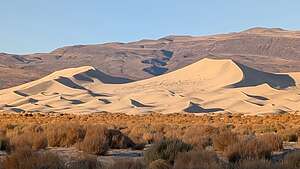 Morning lightWe wanted to at least see the start of Steel Pass (after all we had just come for a 4WD-offroading class in Mojave), so we continued driving along the sandy road, which was now covered with tumbleweed from last night's winds.
Tumbleweed can be pretty prickly, so Herb donned a pair of gloves and went to work hurling big bundles of it off of the road. It was quite entertaining to watch.
After pruning the tumbleweed, we proceeded on to Dedeckera Canyon, which is the beginning of a classic and extremely challenging 36-miles 4WD route from the Eureka Dunes over Steele Pass and into Saline Valley.
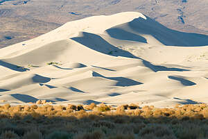 And more lightIt is definitely not for the feint of heart.
The first half mile through Dedeckera Canyon is the most challenging. There are four “stairs” to climb, and I don’t mean the kind of stairs in your house, but rocky stairs two-feet high or more.
The 4WD books recommend walking it first to determine the best lines for your vehicle to take. Having just come from a 4WD course it was actually interesting to try to visualize how, if we were crazy enough and had high enough clearance, we would navigate up the series of steps.
 Dedeckera Canyon (Steele Pass)Wow! Well, that wasn’t happening today, or probably any time in my future, but kudos to those that have the vehicle and the skills to do so. It must be quite an adrenaline rush.
For us, driving off-road is about being able to get to beautiful remote locations rather than the rock crawling over trails such as Dedeckera Canyon. To each his own, but the most important thing is just getting out in the wilderness and enjoying these wonderful spaces.
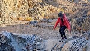 I can't even walk down this thingNow it was on to Bishop to visit our adorable little 2 ½-month old grandson.
Bishop is actually not that far from Eureka Dunes, so it is often our last Death Valley stop before visiting our son. The Death Valley / Big Pine Road takes you right from the South Eureka Road into the town of Big Pine, just 15 minutes south of Bishop.
.thumbnail.jpg) Bye for now Eureka DunesThe ride is quite scenic. This time we noticed something strange along the Death Valley / Big Pine Road - a series of probably a dozen high dirt and rock mounds spaced about a ¼-mile apart along the north side of the road.
Bye for now Eureka DunesThe ride is quite scenic. This time we noticed something strange along the Death Valley / Big Pine Road - a series of probably a dozen high dirt and rock mounds spaced about a ¼-mile apart along the north side of the road.
Of course we had to stop and climb one. We tried to figure out what they might be and the best guess we could come up with was that they were old mining shafts covered over for safety.
Back in Big Pine, we headed north on 395 towards Bishop. We were very, very excited to see little Walker Gaidus again. Now this, rather than Dedeckera Canyon is the kind of adrenaline rush I’m looking for.
Mojave
Friday, October 11, 2024 - 9:30pm by Lolo283 miles and 5 hours from our last stop - 3 night stay
Travelogue
 Mojave 4WD CourseIt was quite a contrast coming from Carmel to the small desert town of Mojave, where we would partake in a 2-day 4WD off-roading class.
There’s not much to see and do in Mojave. The whole town is pretty much based around the 3,300-acre Mojave Air and Space Port, a world-renowned flight research centering, hosting the latest and most advanced aeronautical designs. It is the leading aerospace test center for commercial operations in North America.
It was in this facility that our class would start at 7:30 am the next morning.
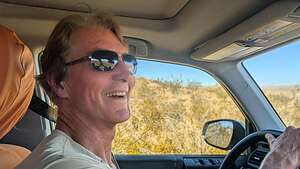 Excited HerbBesides being a real desert, Mojave was also a bit of a food desert, and since Herb did not take my advice of buying a sandwich in Paso Robles, we found ourselves in a gas station Subway ordering multiple sandwiches to get us through tonight and the next day. I hoped this was a learning experience for Herb, but I doubt it..
I tried not to gloat too much as I ate my delicious leftovers from Paso Robles - pasta with veal, duck, beef, chicken. It was very delicious.
 Hill ChallengeWe then checked into our home for 3 nights - the Best Western Desert Winds. There probably couldn’t have been a greater contrast to our previous stay in Carmel.
However, we are very flexible, so we placed our beach chairs outside our room, and used the room’s garbage can flipped upside down as a table to hold our cheese and crackers.
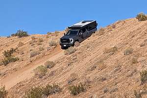 The BeastFrom our perch on the second floor, we peered down at what looked like a pretty nice hot tub beside the pool, but decided to skip that for tonight. I didn’t have the energy or lack of dignity to squeeze into my “comp” suit tonight. Maybe tomorrow night.
Then the next morning at 7:30 on the dot, we arrived at our classroom in the Mojave Air and Space Port. Before going inside, one of the instructors inspected our vehicle and made sure we had all the required safety and recovery equipment.
.thumbnail.jpg) How far can we tip?The course was to be given by a well-acclaimed organization called Badlands Off-Road Adventures, whose mission was to provide training clinics in which inexperienced SUV & 4-Wheel Drive (4WD) owners gain expertise required to safely and confidently negotiate their vehicle off-road.
How far can we tip?The course was to be given by a well-acclaimed organization called Badlands Off-Road Adventures, whose mission was to provide training clinics in which inexperienced SUV & 4-Wheel Drive (4WD) owners gain expertise required to safely and confidently negotiate their vehicle off-road.
It was billed as a beginner course, so I was a little concerned that we might be wasting our money, because Herb has quite a bit of off-roading experience, but this is the class they suggest you start with.
Well, boy was I wrong. When we showed up for the first morning of class, we were surprised to find that the group consisted of 10 women and 5 men.
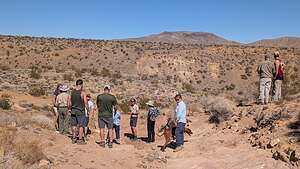 Scouting out our lineTwo of the women were a little older than us and much more badass. The 75-year-old one (whose name was Velvet) had a $100K Ford Raptor and thought that anything less than Moab slickock was no fun. Also, there was a group of four women from LA with three very tricked out four-wheel drive vehicles and quite capable and confident. They were moms that met at a fitness center and decided they deserved a Mom's weekend in Mojave.
Then there was a couple (plus a dog) with a 13,000 lb. brandy-new diesel truck with a pop-up camper on top, which we nicknamed "the Beast."
They had just purchased it and never taken it off road before. They planned to live in it for 2 years while their new home was being built.
.thumbnail.jpg) Not sure what Herb is doing?The first morning consisted of four hours of classroom review, which involved a lot of technical talk about things like transmissions and the engaging and disengaging of the differential, which caused me to totally zone out. However, Herb seemed to be learning something, so that was good.
Not sure what Herb is doing?The first morning consisted of four hours of classroom review, which involved a lot of technical talk about things like transmissions and the engaging and disengaging of the differential, which caused me to totally zone out. However, Herb seemed to be learning something, so that was good.
After lunch, we drove to the Jawbone Canyon OHV Area where we did some practice loops on various terrain, including rocks, gullies, hills, etc.
Then we moved on to a more challenging test - practicing driving about three quarters of the way up a very steep hill and then backing back down it. Herb handled it like a champ. Each group got to do it twice so they could switch drivers if they wanted to. I decided it was best if I let Herb do it twice.
.thumbnail.jpg) Instructor guiding usIt was pretty terrifying for some of the others in the group. This was not a “beginner” type of challenge. The poor woman in the large pickup truck with camper on top (which was to be their home for the next 2 years), was brave enough to give it a try. She told us later that she had never experienced such pains in her stomach before. I do give her credit though for trying it. I felt like a weenie, but a weenie without stomach pains.
Instructor guiding usIt was pretty terrifying for some of the others in the group. This was not a “beginner” type of challenge. The poor woman in the large pickup truck with camper on top (which was to be their home for the next 2 years), was brave enough to give it a try. She told us later that she had never experienced such pains in her stomach before. I do give her credit though for trying it. I felt like a weenie, but a weenie without stomach pains.
Other fun things that we did that day was see how far we could tilt our vehicle by placing the right side of the truck on a hill. I think we tilted about 30 degrees. It did feel like we could tip over.
Herb did seem to be learning a lot, and I too was learning things, such as “I don’t want to be in the vehicle when it is tilting 30 degrees.”
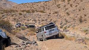 This is funAt the end of that day’s adventures, we regrouped back at the Jawbone Visitor Center where Herb noticed that we had a stick jutting out from the sidewall of our front passenger side tire, which was causing a slow leak. With the help of the instructors, and boy scout Herb having the proper tire repair stuff, we managed to put a plug in that got us back to our hotel and would even get us through the rest of our trip.
Even worse than the flat tire was finding out that the “good” Thai restaurant in town was closed on Saturdays because their usual clientele were workers who were only in town on weekdays. Now what?
Fortunately we had some backpacking meals in the truck so Herb and I enjoyed a wonderful fettuccine and chicken meal out of a bag in our room. I am one lucky gal.
The next day we awoke to two bits of good news: our tire was holding air and we were able to find a bit of fruit in our hotel breakfast bar.
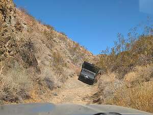 Tipping? Fortified (kind of), we headed back up to Jawbone Visitor Center to meet up with the gang again. The four moms from LA had only signed up for the first day of class so we were down to 11 people.
We went first to the Jawbone OHV area first and practiced placing our front and back tires on a series of boards - easier said then done. Herb, however, did very well. I think he was becoming the teacher's pet.
After a little more practice of various skills we headed up the highway to the El Paso Mountain area where we navigated through some pretty challenging terrain including rocky terrain, deep gullies, and very narrow canyons where the sides of our vehicle were scraping.
.thumbnail.jpg) Driver relaxingWe already have so many scratches on our truck from previous off-roading adventures, but I don't think the couple with the shiny new 13,000 lb truck (which was going to double as their home) were particularly thrilled.
Driver relaxingWe already have so many scratches on our truck from previous off-roading adventures, but I don't think the couple with the shiny new 13,000 lb truck (which was going to double as their home) were particularly thrilled.
Somewhere along the line we lost Velvet, who decided to cut out early - not sure why. I wish I had gotten her email, because she was one cool lady.
Our final lesson was practicing recovering a vehicle that was stuck in the sand. Unbeknownst to them, the instructors tried to get the couple with "the Beast" into a "stuck" situation, but when they realized what was happening, they politely declined. They managed to get one of the younger couples in a Rubicon to volunteer to be the victim.
.thumbnail.jpg) Spotter relaxingThen we watched as one end of a "snatch strap" was attached to the front of the "stuck" vehicle and the other end to a hook on the rear of the "rescue" vehicle. Using radios to communicate, on the count of 1, 2, 3 the rescue vehicle accelerated full speed, taking up the slack on the snatch strap, stretching, and magically and seemingly effortlessly, yanking the stuck vehicle out of its predicament. Wow, it's amazing what a giant bungee cord can do.
Spotter relaxingThen we watched as one end of a "snatch strap" was attached to the front of the "stuck" vehicle and the other end to a hook on the rear of the "rescue" vehicle. Using radios to communicate, on the count of 1, 2, 3 the rescue vehicle accelerated full speed, taking up the slack on the snatch strap, stretching, and magically and seemingly effortlessly, yanking the stuck vehicle out of its predicament. Wow, it's amazing what a giant bungee cord can do.
This was a good skill that I hoped to never have to use.
Around 3:30 or so we made it back out to the area to inflate our tires again, said our goodbyes, and went our separate ways.
We had a very nice evening in Mojave - really good food Mojave Thai cuisine, followed by a soak in the motel hot tub.
.
Carmel
Wednesday, October 9, 2024 - 3:15pm by Lolo182 miles and 3.5 hours from our last stop - 2 night stay
Travelogue
 Point LobosThe main reason we wanted to stay in Carmel was to revisit the Point Lobos State Natural Reserve, probably the most beautiful and photogenic section of the California coast, which is saying a lot. The
Before getting to Carmel, we stopped for lunch at the Alta Bakery and Cafe located in downtown Monterey at the Historic Cooper Molera Adobe. We had stopped here on our last trip to Carmel and liked it so much, we thought it deserved a return visit.
 Point LobosManaging to bypass its beautiful display of pastries and assorted treats, we ordered a Cavolo Nero pizza (Kale, red onion, kalamata olive, marinara, and mozzarella) and happily ate it out on the lovely patio. The pizza was delicious and Herb discovered that he actually does like olives.
Unfortunately clouds were starting to move in, so we decided to check into our room at the Carmel Bay View Inn first before heading out to Point Lobos. As with the Alta Bakery and Cafe, the Carmel Bay View Inn was another repeat from our previous visit to the area.
 Pelicans of Bird IslandWe liked this hotel mainly because of it's location right in the heart of Carmel, in walking distance to everything. Plus it had a cozy gas fireplace.
Despite the questionable weather, we headed to the Point Lobos State Natural Preserve, just 4 miles south of us. Hopefully, things would clear before sunset, which is absolutely stunning at Weston Beach.
The reserve contains 550-acres of dramatic rocky coastline, coves, and rolling meadows.
 Point LobosThe offshore area forms one of the richest underwater habitats in the world, with seals, sea lions, sea otters and migrating gray whales that visit these waters from December to May.
In fact, the name Point Lobos is short for Punta de los Lobos Marinos, which means Point of the Sea Wolves, referring to the sea lions you can find resting on its rocky points and nearby islands.
 Weston BeachSince it was already close to 4:00, meaning we had only about 2 more hours left before sunset, we headed directly to our favorite spot in Point Lobos - lovely Weston Beach, named after Ed Weston, the famous early to mid-20th century photographer, best known for his beautiful landscapes.
He was a friend of Ansel Adams and with him, one of the founders of the f/64 club, a group of 11 San Francisco Bay Area-based photographers that shared a common photographic style, based on precisely exposed, sharply detailed, un-manipulated images of natural forms.
 Weston BeachEd Weston lived (and died) in Carmel and spent much of his time photographing this beach.
While not as dramatically beautiful as sandy, emerald-green China Cove, it has lots of texture and plenty of opportunities for the sharply detailed images of natural forms that Edward Weston loved.
.thumbnail.jpg) Weston BeachThere is no sand on this beach, but rather very unique rock textures that provide for very interesting foregrounds. It is also known for its tide pools.
Weston BeachThere is no sand on this beach, but rather very unique rock textures that provide for very interesting foregrounds. It is also known for its tide pools.
It was perfect for Herb’s new-found love for photographing detailed shots of various rock textures, colors, moss, and reflections.
Plus, it was a great base camp for me to wander along the beautiful rocky coastline looking for landscape compositions of my own.
 Weston BeachSo, I left Herb happily bent over photographing pebbles and moss, and headed off on the South Shore Trail towards Bird Island, the trail for which began from the parking lot at the end of the road.
From the parking lot the Bird Island Trail loops out onto a peninsula between China and Gibson coves on its way to Pelican Point.
Halfway around the loop is Pelican Point, where I got a close look at the large colony of pelicans on Bird Island. There were even several pelicans along the path. It was amazing!
 Weston BeachAfter finishing the Bird Island Loop, I headed back north on the South Shore trail, going right past Weston Beach, where I saw a happy Herb with his camera and tripod, and continued north to the Sea Lion Loop before heading back to Weston Beach to join Herb for sunset.
The rock formations on Weston Beach brilliantly light up during the golden hour in vibrant blues, yellows, greens, and yellows. It was beautiful. I could understand Herb’s attraction to photographing the details of the lovely textures and colors of these rocks.
We spent the rest of the remaining daylight scampering around its rocks looking for interesting compositions and waiting for sunset, which never came because of the cloud cover. However, it was still very lovely and photogenic.
 Lolo having fun at Weston BeachBack in our hotel room, we ate the salads I had brought from home on the table by the fireplace. It was very cozy.
The next morning we awoke to blue skies - much better weather than we expected. Great morning for a run, so I set off from the hotel and ran down Ocean Avenue, past the quaint homes ranging from Spanish colonial homes to Tudor-like cottages to fairy-tale gingerbread houses with stone chimneys and pitched roofs.
In less than a mile I arrived at Carmel Beach and the Scenic Bluff Path that runs along scenic drive, starting at Carmel Beach’s northern end and winding along the ocean around Carmel Point all the way to Carmel River State Beach.
 Along my running routeAs pretty as the beach was, the houses along Scenic Drive were the real points of interest, including one near Carmel Point that was designed by Frank Lloyd Wright in the 1950s.
After rounding Carmel Point, I headed inland past the Tor House, the historic house and tower built of sea-tossed granite of the famous poet Robinson Jeffers, known for his work about the central California coast as well as being an icon of the environmental movement.
 Carmel MissionFrom there I continued away from the beach up 15th Street and Deloros towards the Carmel Mission, passing Clint Eastwood’s Mission Ranch Hotel and Restaurant, which he bought and rescued from condo developers, along the way.
No tour for us today, just a quick photo through the bars of the locked gate. However, we had taken a tour the last time we were here, and it was definitely worth it.
 Lunch at the Treehouse CafeOf the half dozen or so missions that we have visited along El Camino Real, this is probably my favorite.
From the Mission, I ran straight back to the Carmel Bay View Inn.
Before heading back out to Point Lobos for the afternoon, we went for lunch at the Treehouse Cafe, a very highly rated restaurant that we had eaten dinner at on our last visit. It was bustling, but we managed to get there just in time to grab one of its last remaining tables on its lovely outdoor patio.
The setting was lovely and the food was delicious. Herb had a Gyros Platter and I had a Salmon Burger. We skipped the wine this time, as they serve such a generous pour that we would have been done for the day, and we wanted to go back to Weston Beach, since the weather was a lot better today than yesterday.
 Cypress Grove TrailWe had about 2 hours before we needed to be at Weston Beach for the golden hour, so we parked at the Sea Lion Point parking area where the Cypress Grove Trail begins.
With its old-growth cypress trees, bright orange/red moss, and stunning coastal views, it is considered one of the most beautiful trails in the park - and that is saying a lot.
 Cypress Grove TrailWhen we came to the beginning of the loop in the trail, we went left which took us into the cypress trees, one of the last of two naturally growing stands of Monterey cypress trees on Earth. The other grove is across Carmel Bay at Cypress Point.
Thousands of years ago, these cypresses extended over a much wider range, but climate change has forced these trees to withdraw to these fog-shrouded headlands.
 Cypress Grove TrailFearful that they would be lost forever, the Point Lobos State Natural Reserve was created to protect them.
After hiking through the trees, the path opened up to a stunning view of coastal rocks - my kind of view!!! We spent a bit of time photographing there, trying to do it justice.
Tearing ourselves away from the coastal view, we re-entered a grove of trees, noticing that many of them were covered in a velvety orange-colored moss. Ah yes, we were on the north-facing side of the loop.
 Cypress Grove TrailI later found out that this colorful moss isTrentepohlia, an algae whose orange color comes from carotene, a pigment which also occurs in carrots. Like Spanish moss, its growth does not harm the trees. It just makes them look prettier.
We were now hiking above Pinnacle Cove. Across the cove there was a beautiful cliff, with half a dozen tiny waterfalls popping up and disappearing with each wave that entered the cove.
Before we knew it, we were back at the parking lot. That one-mile loop gave us quite a lot of bang for our buck.
 Cypress Grove TrailNext, on to Weston Beach for the Golden Hour when what looked like fairly ordinary rocks during the day lit up in brilliant hues of blue, yellow, green, and orange as the sun began to set.
I made Herb walk to Weston Beach along the North Trail, which I had done yesterday, while I drove the car, so he could see this beautiful section of the coastline too.
Weston Beach did not disappoint, and unlike last night, we actually had a good sunset.
 Point LobosWhile watching the sunset, we noticed a couple that had scrambled across and up the rocky beach to a high point overlooking the sea. It looked like a great photo op, so as soon as they left, I charged up there, not realizing how difficult and precarious it was - and sometimes the waves were almost coming over the top.
Once on top, I stopped very briefly (it was pretty scary), and Herb took a few shots. He likes when I pose like a puffin - long story from our Iceland trip.
Then it was back to the hotel to eat our sandwiches by the cozy fireplace in our room.
 Sunset at Weston BeachI think Herb was pretty happy that I crashed his 4WD Offroading Course getaway or he would be sleeping in his truck in the Mojave Desert somewhere without his “puffin.”
Now onto Herb’s event - an off-road training clinic with Badlands Off-Road Adventures in the town of Mojave, California.
Since we knew that a lot of these desert towns were “food deserts” as well, we decided to have a last meal (lunch) in Paso Robles at Buona Tavola that served Northern Italian Cuisine, something we were pretty sure we wouldn’t find in Mojave.
 Lolo thinking thinking she's a puffinIt was very elegant with great service and food. We both had the pasta with veal, duck, beef, chicken. It was very delicious. I saved half of mine so that I could have Northern Italian Cuisine later in my hotel in Mojave.
On the way to Mojave, I realized that I had forgotten to pack a bathing suit, which was bad because we had some hot springs planned for later in the trip. After some googline, I found that there was a Dick’s sporting goods store in Bakersfield, right on route.
 Sunset at Weston BeachWhen we got there, we grabbed about eight “comp” suits and brought them (and Herb) into the dressing room. For the next 20 minutes, Herb helped me squeeze into various suits, noting that there were things sticking out of them. I thought he meant tags, but then realized he meant my back fat. Finally, we found where the fat was only slightly oozing and purchased it. I sincerely doubt that this suit will ever see the light of day.
Okay, on to Mojave.
Day 14 (The Finale) - Mile 216 Camp to Diamond Creek
Monday, June 10, 2024 - 7:00pm by Lolo10 miles and 1 hour from our last stop
Travelogue
.thumbnail.jpg) Last dayI couldn’t believe this was it - the final morning waking up on the river - the last call for Coffee, the last delicious meal cooked by our amazing guides, the last time taking down our tents, the last fire line to load bags onto the boat (Thank God), the last run to the groover, and the last time one of our guides would gather us together for a river story or poem, a plan to run a rapid, or just general words of wisdom.
Last dayI couldn’t believe this was it - the final morning waking up on the river - the last call for Coffee, the last delicious meal cooked by our amazing guides, the last time taking down our tents, the last fire line to load bags onto the boat (Thank God), the last run to the groover, and the last time one of our guides would gather us together for a river story or poem, a plan to run a rapid, or just general words of wisdom.
This morning before departing downriver for the last time, Robin, our trip leader, read us a very humorous, and far too real, description of how to prepare for a 14-day rafting trip through the Grand Canyon. I wish we had known this before we signed up for the trip - just kidding. I wouldn't have missed this trip for the world.
I won’t read all of them, but here are a select few:
 The Lower Canyon Gang
- One week before the trip, have a yard of sand delivered to your house. Sprinkle liberally in bed, dresser drawer, kitchen and bath counters. Fill your salt shaker, cereal boxes, sugar bowl and use as usual. Place a garbage can lid with sand in front of fans and run them continually at maximum speed.
- Have your friends form a long line and systematically pass the contents of your home out the front door of your house. Later on, repeat the entire process in reverse.
- Between your mattress and boxspring, place 2 or 3 medium-sized rocks. Try to sleep as usual for 14 nights
- Sit on the hood of your car while driving through the carwash
- Twice a day practice changing while your neighbors watch.
- With 22 friends standing in the shallow end of a swimming pool, practice looking nonchalant as you carry on a conversation and pee simultaneously
.thumbnail.jpg) Leonard in the doryThat pretty much sums it up.
Leonard in the doryThat pretty much sums it up.
Ok, time to get on the boats and cover those last 10 miles.
Oh, but first, the group photo, or more correctly second group photos, since half our group had been “exchanged” at Phantom Ranch. Herb, the appointed photographer, lined everyone up on the beach, set up his tripod, hit the timer photo button and ran into the picture. We had to repeat it several times to get it right, but I think we finally got a good one.
.thumbnail.jpg) Me in dory and Diamond PeakSince this was Herb’s and my last chance to ride in the dory, I asked Leonard, who had taken over the dory after Wes’s evacuation, if we could ride with him today. He gladly accepted us as passengers. Wes would have been proud of me.
Me in dory and Diamond PeakSince this was Herb’s and my last chance to ride in the dory, I asked Leonard, who had taken over the dory after Wes’s evacuation, if we could ride with him today. He gladly accepted us as passengers. Wes would have been proud of me.
Despite Leonard telling me it was a very chill day in terms of rapids (apparently “chill” is in the eye of the beholder, we did have to run a 6 called 217 Mile Rapid, which can get pretty dicey with rocks at this water level. Leonard handled it like a pro.
Funny how at the beginning of this trip, these would have been scary for me. Now, I actually rode through some of them in the dory yelling the occasional “WooHoo!”
.thumbnail.jpg) Cleaning the raftsWe knew we were definitely close to the end, when Diamond Peak came into view, a beautiful 3,512-foot-high, pyramid shaped peak that reminded me of a cinder cone (but it wasn’t).
Cleaning the raftsWe knew we were definitely close to the end, when Diamond Peak came into view, a beautiful 3,512-foot-high, pyramid shaped peak that reminded me of a cinder cone (but it wasn’t).
It looks tempting to climb, but the approach to the summit consists of sharp bands of unreliable limestone, making reaching the top very difficult. It was sure nice to look at though.
It’s located at the mouth of Peach Springs Canyon, where Diamond Creek meets the Colorado River, which is also where we would be meeting our bus to take us back to civilization, also known as Flagstaff.
.thumbnail.jpg) Loading the truckWhen we got to Diamond Creek there was a lot of work to do unloading all the equipment and supplies from the boats, dismantling and cleaning them, and loading them onto a truck where they would be brought to a warehouse until the next trip down the river.
Loading the truckWhen we got to Diamond Creek there was a lot of work to do unloading all the equipment and supplies from the boats, dismantling and cleaning them, and loading them onto a truck where they would be brought to a warehouse until the next trip down the river.
I can’t believe all the stuff that came off those boats. Apparently, a lot of stuff is needed to keep 20 passengers and 8 guides fed, entertained, and safe for 14 days on the river.
Once everything from the boats was loaded, we were loaded onto a bus which would take us back to Flagstaff. The first half hour of our 3 hour drive, which took us through the Hualapai Indian Reservation was very bumpy and slow. Then we were back on I40 (Route 66).
.thumbnail.jpg) ice Cream stop in civilizaitonIt was a bit of culture shock for us after being in peace and solitude with incredible natural beauty for 14 days. Not so sure if I was ready for civilization yet.
ice Cream stop in civilizaitonIt was a bit of culture shock for us after being in peace and solitude with incredible natural beauty for 14 days. Not so sure if I was ready for civilization yet.
However, the ice cream stop in Seligman reminded me that civilization did have some benefits.
I had many mixed emotions about ending our life on the river. It was really only hitting me now what an incredible, life-changing experience it had been.
Now the challenge was going to be to keep that spirit of the river with us after we returned to our “normal” lives.
Day 13 - Mile 190 Camp to Mile 216 Camp
Sunday, June 9, 2024 - 4:30pm by Lolo25 miles and 5 hours from our last stop - 1 night stay
Travelogue
.thumbnail.jpg) Time to hit the riverBetween Wes’s evacuation last night and our reaching Diamond Creek (the end of our river journey) tomorrow, the mood had become more subdued and reflective.
Time to hit the riverBetween Wes’s evacuation last night and our reaching Diamond Creek (the end of our river journey) tomorrow, the mood had become more subdued and reflective.
Since we were now short a guide, a lot of reshuffling as to who would row which boats had to be done. Leonard took over the dory, Robin the paddle boat, Kayla and Daniel remained in their oar boats, Ivan was promoted to being allowed to take passengers in the third oar boat, and Olivia and Mitchell (assistants who were not allowed to take passengers) took the gear boat by themselves.
 Our assistants now with their own boatWes had been asking Herb and me all along the way, when were we going to ride with him in the dory. Figures, I finally told him that today would be the day, and then he goes and gets evacuated. Leonard was now in charge of the dory, but I wasn't sure just how much experience he had in one, so I chickened out. Maybe tomorrow.
It was a pretty mellow day in terms of rapids. The only ones of note were 205 Mile Rapid (a 7) and 209 Mile Rapid (another 7). At this point 7’s were becoming less intimidating and more fun.
.thumbnail.jpg) Formations like templesAs we got further down the river, the canyon began to widen and open up.
Formations like templesAs we got further down the river, the canyon began to widen and open up.
Many of the rock formations looked like ancient temples
We pulled over to camp on a nice beach around Mile 216, which meant we only had 10 miles to go before reaching our take-out point at Diamond Creek tomorrow. Wow! The end of this trip was starting to feel real, just when I was really getting into the groove of river life.
From camp we had a lovely view of the canyon walls lighting up at golden hour.
Day 12 - Tuckup Camp (Mile 165) to Camp near Mile 190
Saturday, June 8, 2024 - 8:45am by Lolo25 miles and hours from our last stop - 1 night stay
Travelogue
.thumbnail.jpg) Morning stirrings in campToday was going to be a very big day, as we would be running Lava Falls (a Grand Canyon 10+), the most famous and challenging rapid on the Grand Canyon. Even the guides seemed nervous. I know I certainly was.
Morning stirrings in campToday was going to be a very big day, as we would be running Lava Falls (a Grand Canyon 10+), the most famous and challenging rapid on the Grand Canyon. Even the guides seemed nervous. I know I certainly was.
To make matters worse, Herb had convinced me last night to sleep out in the open for the first time. Most of our group didn't set up tents, but just slept on their mat out under the stars. I had been very reluctant to do this for so many reasons: critters, privacy, etc.
So, I did and it went okay, but I still prefer having a structure of some sort around me when I sleep. Well, I was probably right because at coffee that one of our friends, who had slept out in the open every night, was bitten on the toe by a scorpion during the night. The numbness was already moving up his leg. Apparently no medical attention is needed for a scorpion bite. You just have to wait it out.
.thumbnail.jpg) Wes drawing Lava Falls RapidI told Herb that under no uncertain terms that the tent was going back up tonight.
Wes drawing Lava Falls RapidI told Herb that under no uncertain terms that the tent was going back up tonight.
But scorpions were the least of my worries today, as today we would be running Lava Falls, a rapid that I had been obsessed with ever since Herb booked this trip over a year ago.
Whenever we had a big, challenging rapid in store for us that day, one of our guides would draw the "features" of the rapid in the sand and tell us their plan for running it. This morning it was Wes’s turn and, as usual, he was quite entertaining and dramatic in his presentation.
.thumbnail.jpg) Getting ready!Rapids can have different “features," which are to be avoided. This one had all more “features” than a multiplex cinema in summer time: a huge hole to avoid at the top, followed by the infamous V-wave which flips 18-foot rafts like bath toys, and ending with two static 10-feet-tall static waves known as the Big Kahunas.
Getting ready!Rapids can have different “features," which are to be avoided. This one had all more “features” than a multiplex cinema in summer time: a huge hole to avoid at the top, followed by the infamous V-wave which flips 18-foot rafts like bath toys, and ending with two static 10-feet-tall static waves known as the Big Kahunas.
As we got ready to take off, everyone (including the guides) seemed a little quieter and more tense this morning, and rightly so.
.thumbnail.jpg) The calm before the stormWe chose to ride in Robin’s raft today, as she was the trip leader and had been down the river over 40 times. She could play the features of this rapid in her head with her eyes closed.
The calm before the stormWe chose to ride in Robin’s raft today, as she was the trip leader and had been down the river over 40 times. She could play the features of this rapid in her head with her eyes closed.
As we set off down the river, Herb tried to act nonchalant to keep my fear levels down. It wasn't working. I wanted to smack that smug grin off his face - just kidding
Well before we could see Lava Falls, we began to hear its thunderous roar.
When we did, we pulled the boats quickly over to a small beach on the right side of the river, so that we could hike up above it to scout the river.
.thumbnail.jpg) Scouting Lava FallsI’m sure the guides didn’t need our input, but it was nice of them to invite us along, so that we could learn their plan and know what to expect.
Scouting Lava FallsI’m sure the guides didn’t need our input, but it was nice of them to invite us along, so that we could learn their plan and know what to expect.
As the guides observed the rapid and confirmed their plans for how they wanted to run it, we just gazed down in awe at what is the most famous and challenging rapid in the Grand Canyon and possibly even the world. It’s even listed by the Guinness Book of World Records as the fastest navigable water in all of North America at 20 m.p.h.
Okay, enough spectating. It was time to get this over with.
.thumbnail.jpg) Maybe a little too nonchalantWe were in the lead boat with Robin, our trip leader, at the oars. As we approached, she let out her usual cry, "READY? HOLD ON!"
Maybe a little too nonchalantWe were in the lead boat with Robin, our trip leader, at the oars. As we approached, she let out her usual cry, "READY? HOLD ON!"
It was probably one of the most exciting 20 seconds of my life, because that’s all it lasts, if you do it right. Since we were the lead boat, we got to sit back and watch the other five boats in our fleet come through. Everyone ran it perfectly - right to plan.
.thumbnail.jpg) Running Lava Falls RapidIt had been exhilarating and in retrospect, so much fun! However, I was glad the scariest rapids of the trip were behind us.
Running Lava Falls RapidIt had been exhilarating and in retrospect, so much fun! However, I was glad the scariest rapids of the trip were behind us.
Immediately after getting through Lava Falls, we pulled over to a small beach, where the guides, who had just successfully navigated us through one of the most challenging rapids in the world, were now slicing and dicing vegetables for our healthy lunch.
They truly are amazing.
.thumbnail.jpg) Our amazing chefsThat evening at camp, we got the disheartening news that Wes, our most experienced guide (over 50 runs down the river) had to be evacuated because he had a "bat encounter."
Our amazing chefsThat evening at camp, we got the disheartening news that Wes, our most experienced guide (over 50 runs down the river) had to be evacuated because he had a "bat encounter."
It had actually happened last night, but there was no way he was going to miss rowing his dory for the first time through Lava Falls. He knew he had 72 hours before needing to start the rabies shots.
It was a very sad evening as we watched the helicopter make its approach. The pilot has to zig zag up and down the canyon as they can't approach too quickly.
.thumbnail.jpg) Wes's evacuationWe had already set up camp, so we had to take everything down and tie it together, as the winds from the helicopter would have blown everything around.
Wes's evacuationWe had already set up camp, so we had to take everything down and tie it together, as the winds from the helicopter would have blown everything around.
It kicked up so much sand that we had to huddle together and cover our eyes.
Then off he went..
We collected ourselves and all kicked into gear working together as a team - setting up the tents again and helping the guides put the kitchen back together.
 Bye bye WesUndeterred by whatever hits them, they cooked us a delicious steak dinner, which we ate in the dark that night. We were all pretty solemn.
We would miss Wes’s entertaining stories, dramatic simulations of the rapids we would face, and his skill and calmness running the mightiest of rapids.
But the show must go on. We still had 2 more days and 46 river miles to go.
Day 11 - Olo Canyon (Mile 156) to Tuckup Canyon (Mile 165)
Friday, June 7, 2024 - 7:30pm by Lolo miles and 2 hours from our last stop - 1 night stay
Travelogue
 Good morning Grand Canyon!I was still a little bit shaken from our frightening experience in Bedrock Rapid two days ago when we actually slammed into the large rock dividing the rapid, so I asked Daniel if we could ride with him in his boat again today.
All the guides were really great, but Daniel had a very comforting way about him. Plus he could read the river really well and was very strong, which I felt might be an advantage in getting out of a bad situation.
 Havasu CreekSo after breakfast, we loaded the boats and set off once more down the river.
About four miles down the river, we came to our only challenging rapid of the day. It was called Upset Rapid (a Grand Canyon 8), named in 1923 when the head boatsman in a U.S. Geological Survey Expedition, dropped into the steep “hole” at the bottom of the rapid and “upset” his wooden boat.
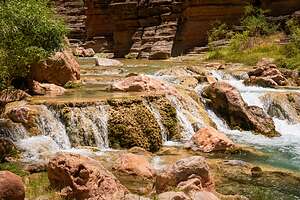 Havasu CreekIt was Daniel’s job to run either left or right of that hole, but not into it, where it could possibly flip our boat.
He and the other boats in our group ran it perfectly. It was actually quite fun.
From there, it was pretty much flat water for the next seven miles where we beached for our main stop of the day, Havasu Creek (Mile 157), another side canyon similar to the Little Colorado River in that it had beautiful warm turquoise water.
 Hanging out on the ledgesFor over 700 years, this creek has been the home of the Havasupai, the “People of the Blue-Green Water.” Approximately 450 Havasupai still live along the creek, mostly upstream in the tiny village of Supai, which is located 2,000 feet below the South Rim, a short distance from famous Havasu Falls.
It was a very popular stop for pretty much all of the river trips, so it was a bit difficult finding a place to squeeze our six rafts in near the mouth of the creek.
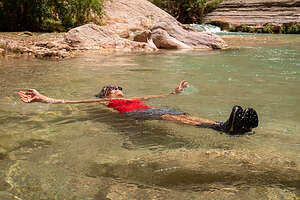 Cooling off in Havasu CreekOnce we did, we all piled out of the rafts and headed up the creek for about a mile to a series of lovely pools in which we could swim and frolic for an hour or two.
Its beautiful cobalt blue water was very much like that of the Little Colorado River, but a little more on the green side of the blue-green spectrum.
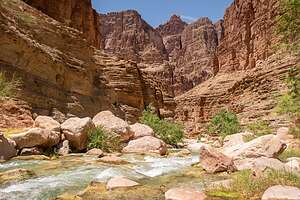 Havasu CreekLike the Little Colorado, the brilliant color of the water is the result of magnesium and calcium being absorbed into the water from the rocks around it and forming calcium carbonate. These minerals in the water reflect the sun, creating the electric blue coloration.
The calcium carbonate also creates a material called tufa, a harder, chalky limestone material called travertine settles out of the water and coats the rocks and boulders in a white hue, adding to the river’s color palette.
 Heading to campThese travertine-coated ledges and boulders have created ledges to sit on and a wonderful array of pools, making it possible to swim in many different places throughout the canyon.
We spent a few leisurely and fun hours hanging out on the ledges and playing in these lovely pools.
Back on the boats, we had seven miles of relatively flat water to get to Tuckup Canyon, our planned camp for the night, so Daniel gave Herb the chance to row as much as he wanted.
 My birthday partyDaniel told him he was good enough to be a river guide, but perhaps that was his way of getting Herb to row more while he got to pretend he was just a passenger laying back against the bags and watching the canyon walls go by. I think Daniel had a little bit of Tom Sawyer in him.
That evening I was really touched when everyone remembered that it was my birthday. Mitchell, one of our assistant guides, even baked me a rice krispie cake, a recipe from his grandmother, complete with candles for me to blow out while they sang Happy Birthday. These people had become very special to me in our short time together.
Day 10- Thunder River Camp (Mile 134) to Olo Canyon Camp (Mile 146)
Thursday, June 6, 2024 - 5:30pm by Lolo12 miles and 0 hours from our last stop - 1 night stay
Travelogue
.thumbnail.jpg) Helicopter evacuationToday was a relatively relaxing day - no major rapids or big hikes. Rather we would spend most of the day at the Deer Creek Patio and Falls, just a relatively short 2-mile hike up from the river.
Helicopter evacuationToday was a relatively relaxing day - no major rapids or big hikes. Rather we would spend most of the day at the Deer Creek Patio and Falls, just a relatively short 2-mile hike up from the river.
After breakfast and packing up the boats, we set off down the river for about 3 miles to a beach from which we could walk up Deer Creek.
Meanwhile, on the other side of the river, there was a lot of excitement going on, as a motor-raft expedition was getting ready for a helicopter evacuation.
 Starting up Deer CreekI spoke to a gentleman from that expedition and he said it was not anything serious. A 9-year-old boy had cut his shin badly on a rock and needed stitches. Hmm… this hit a little too close to home, as I had cut my shin right down to the bone just 5 days ago and was still watching it closely for any signs of infection.
Well I was certainly glad this evacuation wasn’t for anything really serious.
As skilled as the Grand Canyon helicopter pilots are, they can’t just land anywhere, but need a reasonably-sized patch of flat sand. It’s surprising how small that can be.
 A little friend we met along the wayWe watched in awe as a helicopter appeared at the canyon rim and began gradually descending by going back and forth up the canyon several times, each time getting a little lower.
Wow! To think that could have been me.
Ok, back to our hike to Deer Creek Patio and Falls.
From the boats we had to climb up atop several rock ledges and through a prickly pear cactus grove, with barely enough room to navigate through without getting stabbed with one of their very sharp spines.
.thumbnail.jpg) Heading up Deer CreekPrickly pear cactus is found throughout the Grand Canyon, and some evidence suggests that ancient people may have cultivated the cactus and harvested their fruit, which can be eaten raw, or used to make juice, jelly, syrup, candy, or chewing gum. Excess fruit was dried and stored for winter.
Heading up Deer CreekPrickly pear cactus is found throughout the Grand Canyon, and some evidence suggests that ancient people may have cultivated the cactus and harvested their fruit, which can be eaten raw, or used to make juice, jelly, syrup, candy, or chewing gum. Excess fruit was dried and stored for winter.
The Southern Paiute people who live on the North Rim of the Grand Canyon utilized the Deer Creek drainage for hundreds of years before white settlers expanded into the southwest. Perhaps it was these people that planted these prickly pear cactuses as a source of food, or to keep tourists away.
After making it relatively unscathed through the prickly pear cacti (their spines can be 1-2" long), we reached Deer Creek.
.thumbnail.jpg) Nap time on the PatioWe hiked through the actual creek a bit before climbing up and walking along the rocky ledges alongside the creek. One short section was quite narrow with a precarious drop below, so we took our time and carefully made it across.
Nap time on the PatioWe hiked through the actual creek a bit before climbing up and walking along the rocky ledges alongside the creek. One short section was quite narrow with a precarious drop below, so we took our time and carefully made it across.
We eventually got to the patio, a shaded large ledge alongside the creek, where we could sit and relax for a while and swim in the lovely pool.
 View of the River from Deer Creek hikeThe narrow slot canyon downstream from the patio is of spiritual significance to the Southern Paiutes, as they believe it to be a conduit for spirits passing from this life to the next.
I think the group was hitting the wall from all the activity, so everyone decided that it was a good time for a nap, even on hard rock.
Everyone that was except me, the photographer, and Cosmo, who was only 13, and had lots and lots of energy. My God. I just realized that I was more than 5 times older than him.
The gang looked a bit too much like Southern Paiute spirits passing from this life to the next.
 Deer Creek FallsAfter what was apparently a much-needed nap, we continued our hike up towards the waterfall.
But first, we came to an overlook with a beautiful view of the river down below. Wow! I didn’t realize we had hiked up that much elevation.
The water looked so emerald green. I always thought the Colorado River water would be a murky chocolate brown from the sediment, but I guess that depends on the time of year.
We continued on to Deer Creek Falls, the most beautiful falls we had seen so far in the canyon. Yesterday’s Thunder River Falls was more powerful and impressive, but this one was more subtle in its beauty.
 Cooling off in Deer Creek FallsIts 100-foot cascade dropped into a pool surrounded by green vegetation. It was a lovely place to cool off.
What a nice way to spend a few hours - hiking, napping, and then refreshing ourselves beneath a beautiful waterfall.
Then it was back down to the boats to continue downriver for about another 9 miles. There weren’t many rapids today, so Daniel let us each take a turn at the oars.
I found out that there was a lot more to it than appeared. I have rowed a boat before, but never one that weighed about 2,000 pounds, with all the passengers and gear in it.
 Lolo, the river runnerAt Mile 146, we pulled the boats up onto a beach to set up camp at Olo Canyon.
This was probably our most difficult camping spot to date, because there was no real flat spot close to the river to set up the kitchen.
Instead the strongest of the group (mostly the under-40 crowd) had to lug some really heavy equipment up a steep sandy hill. The fire line where we unloaded our bags from the boats and the up above the steep hill was no picnic either.
 Our Olo Canyon campsiteDuring one of those slogs up the sandy hill, the strap on my Teva sandals broke, meaning that I would be spending the rest of the trip in my hiking boots if we couldn't find a way to fix it. Fortunately, Herb is very handy, and one of the guides had a speedy stitcher, so Herb was able to do a make-shift fix that would hopefully get me through the trip.
Finding camping was a bit challenging as well, as we had to go pretty far from the river to find a flat spot.
Herb and I did manage to find a very pretty (albeit inconvenient) spot up against the limestone cliffs, with our own private little waterfall nearby, where spring water from the canyon above spilled over a limestone lip, cascading about 20 - 30 feet down to the sandy ground below.
It was nice falling asleep to the sound of trickling water.
