- Home
- About
- Map
- Trips
- Bringing Boat West
- Migration West
- Solo Motorcycle Ride
- Final Family XC Trip
- Colorado Rockies
- Graduates' XC Trip
- Yosemite & Nevada
- Colorado & Utah
- Best of Utah
- Southern Loop
- Pacific Northwest
- Northern Loop
- Los Angeles to NYC
- East Coast Trips
- 1 Week in Quebec
- Southeast Coast
- NH Backpacking
- Martha's Vineyard
- Canadian Maritimes
- Ocracoke Island
- Edisto Island
- First Landing '02
- Hunting Island '02
- Stowe in Winter
- Hunting Island '01
- Lake Placid
- Chesapeake
- Provincetown
- Hunting Island '00
- Acadia in Winter
- Boston Suburbs
- Niagara Falls
- First Landing '99
- Cape Hatteras
- West Coast Trips
- Bishop & Death Valley
- Kauai
- Yosemite Fall
- Utah Off-Road
- Lost Coast
- Yosemite Valley
- Arizona and New Mexico
- Pescadero & Capitola
- Bishop & Death Valley
- San Diego, Anza Borrego, Joshua Tree
- Carmel
- Death Valley in Fall
- Yosemite in the Fall
- Pacific Northwest
- Utah Off-Roading
- Southern CA Deserts
- Yosemite & Covid
- Lake Powell Covid
- Eastern Sierra & Covid
- Bishop & Death Valley
- Central & SE Oregon
- Mojave Road
- Eastern Sierra
- Trinity Alps
- Tuolumne Meadows
- Lake Powell Boating
- Eastern Sierra
- Yosemite Winter
- Hawaii
- 4WD Eastern Sierra
- 4WD Death Valley +
- Southern CA Deserts
- Christmas in Tahoe
- Yosemite & Pinnacles
- Totality
- Yosemite & Sierra
- Yosemite Christmas
- Yosemite, San Diego
- Yosemite & North CA
- Seattle to Sierra
- Southwest Deserts
- Yosemite & Sierra
- Pacific Northwest
- Yosemite & South CA
- Pacific Northwest
- Northern California
- Southern Alaska
- Vancouver Island
- International Trips
- Index
- Tips
- Books
- Photos/Videos
- Search
- Contact
The Lost Coast, CA
Wednesday, July 26, 2023 - 8:15am by Lolo
230 miles and 8 hours from our last stop - 3 night stay
Travelogue
Day 1 - St. Orres to Usal Beach
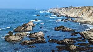 Point ArenaIt was hard to get to the Lost Cost because there were so many beautiful distractions along the way. The drive north from Jenner to Fort Bragg on the Pacific Coast Highway (Route 1) had to be one of the most beautiful stretches of highway I have ever been on.
We stopped briefly at an old favorite, the headlands overlooking the Point Arena Lighthouse, before continuing on.
It was getting near lunchtime, so I looked on Google Maps to find a place that might be nice to have a picnic. I found a photo icon near a place called Pomo Bluffs Park, set on a rocky bluff just south of the Noyo River in Fort Bragg.
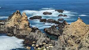 Pomo Bluffs ParkAlthough we have been to Mendocino many times, we have never really stopped or even gone through Fort Bragg.
The two towns are quite different. Mendocino is a tiny, quaint, upscale “New England” type village, set atop a beautiful headland. It is mostly a tourist town and can be quite expensive.
On the other hand, Fort Bragg is a full-service town with about 6,000 residents. However, it too has beautiful headlands, oceanfront walking paths, and lovely beaches - including the famous Glass Beach. Plenty of tourists flock here as well, and the prices are much more reasonable than Mendocino.
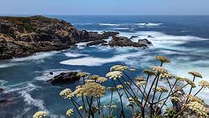 Pomo Bluffs ParkHowever, the views from atop Pomo Bluffs Park are equally, if perhaps even more, beautiful than the headlands along Mendocino.
There was a paved path along the bluff’s edge with several dirt trails branching off to the end of points jutting out over the surf, with waves crashing on the rocks below.
I decided to take this opportunity to play with the Long Exposure feature of my Google Pixel phone to slow down the action of the waves to a softer effect. Wow! It actually worked quite nicely.
 Usal Beach campingI soon became obsessed with it and started taking everything in Long Exposure - not great if Herb walked through my picture though.
Enough distractions - now onto the Lost Coast, one of the only places along the beautiful California coastline that we haven’t seen.
It’s called the Lost Coast, because it is a 50-mile stretch of beautiful coastline from just north of Fort Bragg to the tiny town of Petrolia, which is pretty much inaccessible except for backpackers and 4WD vehicles.
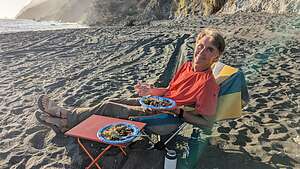 Brats on the BeachEven with a 4WD vehicle, most of the roads are high up along the ridge of the King Range so you can only get down to the coastline in a few places.
Herb and I had watched several YouTube videos of 4WD groups traveling through the Lost Coast, so we pretty much knew what to expect.
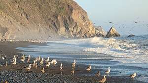 Usal BeachWe were starting our journey at the southern terminus of the park in Usal with the plan of staying overnight at the Usal Campground, or even better yet on Usal Beach.
That still remained to be determined, because there were several blogs that either said you are not allowed to camp on the beach, or worse yet, you were but it was filled with noisy ATVs and people playing with guns. We would just have to wait and see.
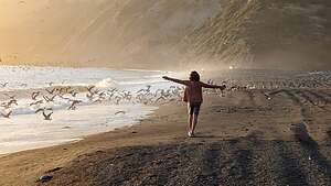 Usal BeachIt’s very easy to miss Usal Road from Route 1, as it is not signed out in any way, and it is merely a narrow dirt road surrounded by bushes. Fortunately, we had navigated to it with Google while we still had cell coverage.
As we turned onto the bumpy, dirt road, we were entering the Sinkyone Wilderness State Park, which borders the Pacific Ocean to the west and the King Range National Conservation Area to the north. The road was only wide enough for one car, so thankfully we didn’t pass anyone on their way out. From Highway 1 it was about a 6.5-mile drive to Usal Beach.
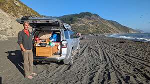
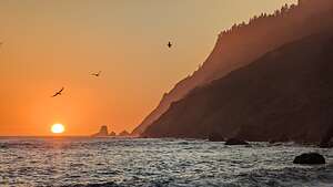 Usal BeachTechnically, you are supposed to camp in the official Usal Campground, in a forest area, but we very much preferred camping on the beach itself, so we continued on. When we got there, there were no “No Camping” signs and there were already three trucks camping on the beach. No sign of ATVs or the potential for wild parties, but just families with kids playing in the surf and building castles on the beach. It looked perfect.
We knew more campers would be arriving as the day went on, so we positioned ourselves near the end so that we would have some degree of privacy and quiet.
Herb cooked some bratwurst on the grill (our go-to meal on our camping trip around Iceland) and then we took a sunset walk along the beach. There was lots of bird activity - pelicans diving and seagulls strutting along the beach.
The sunset was lovely, painting the sky a bright orange. Much better than sitting in our camper in the woods.
Day 2 - Usal Beach to Shelter Cove
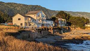 Black Sands InnAfter a very pleasant stay at Usal Beach, we headed out fairly early in the morning to drive the 25-miles of 4WD bumpy, dirt roads over the mountains towards Shelter Cove.
However, that was not meant to be. When we left the beach and turned left on Usal Road, we were stopped by a road block saying Usal Road was closed. Now what? This had pretty much been our purpose for coming up to the Lost Coast in the first place.
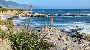 View from Black Sands InnWe saw a ranger on our way out, and he told us that the road was closed so that they could clear some fallen trees. He thought there was a possibility it would re-open today, but we chose not to wait around and see.
Since we had no other choice, we turned around and drove the 6.5 miles that we drove yesterday on Usal Road back out to Highway 1.
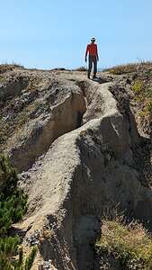 Promontory by Black Sands BeachSince we still wanted to go to Shelter Cove and eventually Mattole, we took the truck out of 4WD and did it the asphalt way. It was quite a big work around. Rather than the 25-mile 4WD road, which would have taken us up along Timber Ridge and Jackass Ridge to get to 4 Corners, we drove north 6.5 miles back on Usal Road from whence we came, then on Highway 1 for 15 miles to the town of Leggett, then another 23 miles north on US 101 to the town of Garberville, before taking the Briceland Road for another 15 miles back towards the Sinkyone Wilderness to Four Corners (also known as Thorn Junction).
I’m not sure how long the more direct, bumpy, 25-mile 4WD Usal Road drive would have taken us, but the asphalt detour version took us 2 hours and 15 minutes.
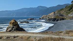 Black Sands BeachIt wasn’t only the extra miles and time that bothered us, but rather missing the opportunity to drive through the southern section of the Lost Coast.
4 Corners is called that because there are 4 roads that meet here: the one we just came down on from Garberville, the one we would have taken if the Usal Road had not been blocked by fallen trees, the Mountain Road to Shelter Cove, and the road to the Needle Rock Visitor Center and Bear Harbor.
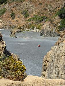 Me looking "Lost"We took a brief detour down to the Needle Rock Visitor Center before turning back and heading to Shelter Cove, the only bit of civilization along the Lost Coast. It’s located in a beautiful location, set on a large south-facing cove, and surrounded by the King Range National Conservation Area.
It is reachable by the 35-mile, paved Shelter Cove Road from the town of Garberville on US 101, the road we partially took before turning off at 4 Corners for a detour to the Visitor Center.
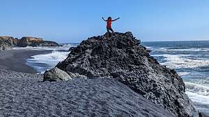 Black Sands BeachShelter Cove is a tiny little seaside town with a campground, several very nice hotels and restaurants, and a very good brewery called the Gyppo Ale Mill.
We knew we wanted to stay here for the night, so we had to make the choice: campground or seaside hotel. Well, that decision took a total of about 5 minutes, and before long we were checking into the Black Sands Hotel right on the water. It was only $218, which isn’t bad for a really nice room right on the water, with a hot tub (not in the room, but pretty close).
Plus, it was low tide and there were tide pools on the beach right in front of us.
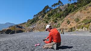 Lost shoes on the Lost CoastHerb has found that alternating camping in the truck with nice hotels every other or 3rd night keeps me happy.
After eating lunch in our room, we drove the short distance to the trailhead for Black Sands Beach, which is the starting (or ending) point for the 25-mile Lost Coast backpacking trip north to Mattole.
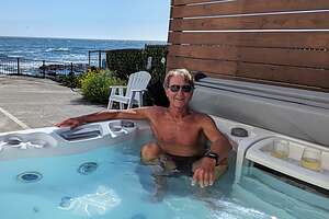 Herb enjoying the hot tubBefore heading out on the beach, Herb crossed an extremely narrow and precarious piece of land to get out onto a promontory with a wonderful view.I did not follow. My hands sweat just watching him.
He did admit that it was probably a very foolish thing to do, with a rather large downside to it, and that the way back was even worse, because it was downsloping and more difficult to control your speed.
He did get a photo of me on the beach from up there looking pretty “Lost”
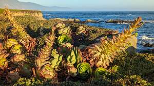 View from Black Sands InnBack on flat ground, we strolled for about a mile and a half north on the beach. Sand is tough to hike on, so kudos to those that backpack this for 25 miles.
Although I was not brave enough to go out on the promontory, I did climb atop a large rock on the beach. I like to climb things.
There were several very nice houses near the edge of the bluff above the beach, looking somewhat precarious as well. We’ve seen what has happened to bluff houses along the Sonoma Coast. It seems to be only a matter of time before erosion takes its toll.
Back from our walk along Black Sands Beach, we spent some time sipping wine (plastic cups of course) in the hotel’s hot tub.
For dinner this evening, we selected the Gyppo Ale Mill, which in addition to a very fine list of beers, had a good food menu as well. Plus, it was the only brewery in town and just a short walk from our hotel
.thumbnail.jpg) Gyppo Ale MillIt turned out to be very good. I had a delicious salmon burger and Herb had his boringly predictable fish and chips, which was also very good. I would have loved to play cornhole, but it was already occupied by other customers.
Gyppo Ale MillIt turned out to be very good. I had a delicious salmon burger and Herb had his boringly predictable fish and chips, which was also very good. I would have loved to play cornhole, but it was already occupied by other customers.
On our way back from the brewery, we passed the Cape Mendocino Lighthouse, which was a bit confusing because we were not on Cape Mendocino.
However, this lighthouse once located on Cape Mendocino before it was moved here. Built in 1868 on the westernmost point of California, it took a beating from storms and even earthquakes for 130 years, before the wise decision was made to save it and relocate it 35 miles south in Shelter Cove.
.thumbnail.jpg) Cape Mendocino LighthouseIn 1998, a National Guard helicopter lifted the lantern room off the lighthouse and flew it to Shelter Cove. The rest of the pieces were dismantled, numbered, and sent by truck to a construction yard where it was reassembled, painted, and fitted with new glass. It was opened to the public in 2001.
Cape Mendocino LighthouseIn 1998, a National Guard helicopter lifted the lantern room off the lighthouse and flew it to Shelter Cove. The rest of the pieces were dismantled, numbered, and sent by truck to a construction yard where it was reassembled, painted, and fitted with new glass. It was opened to the public in 2001.
The original Fresnel lens had a different fate. When the lighthouse was automated in 1947, it was removed and loaned to the city of Ferndale and displayed at the Humboldt County Fairgrounds.
Fearing the lens (valued at $2 million) was not being properly preserved, the Coast Guard has taken it back and placed it in a facility to help preserve it. Ferndale wants to keep it, so it has become quite a controversy. I’m not exactly sure where it is now.
Shelter Cove had been a great stop, and I was now charged up and ready for another day of 4-wheeling and sleeping in the truck.
Day 3 - Shelter Cove to Mattole
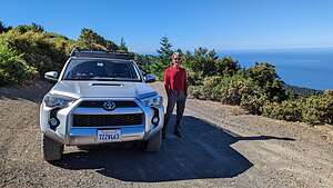 Along King Peaks RoadAfter leaving the Black Sands Inn, we drove about 5 miles on Shelter Cove Road before making a left onto the dirt Kings Peak Road, which would bring us up and over the mountains of the King Range National Conservation Area in the Lost Coast Wilderness..
The beach along the coast that backpackers follow is not very wide, as the mountains of the King Range rise abruptly, practically out of the surf, to a height of 4,088 feet, with King Peak just 3 miles from the ocean. It is a spectacular meeting between land and sea. Literally surf and turf.
 Mattole Campground under constructionThere are really only two ways to experience the King Range area: backpacking along the coast trail (as it is famous for) or driving a 4WD vehicle up and down through the mountains as we were doing.
There are several hiking trails that connect the two, but that was not on our agenda for the day.
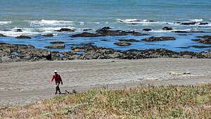 Heading off along the Lost CoastEventually King Peak Road became narrower and bumpier and climbed steeper and steeper along a series of hairpin switchbacks.
After 7 miles, which felt like 20, we got to the junction with Saddle Mountain Road. We had watched an Overtrails YouTube video, in which the 4WD guide said that Saddle Mountain was his favorite part of the trip, so we decided to take it. It joins back up with the King Peak Road in a few miles.
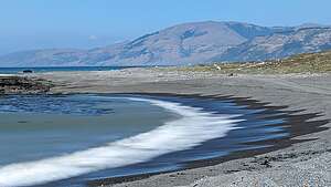 Along the Lost CoastThe video was right. Saddle Mountain Road brought us out of the woods and into the open for sweeping vistas of the Pacific Ocean in one direction and King’s Peak in the other. In a few more miles, we were back on the King Peak Road.
Then it was just a few more miles of dirt before we reached the paved Wilder Ridge Road, which took us to Mattole Road in the little town of Honeydew. From there it took us about 40 minutes to drive the 20 miles to the Mattole Campground.
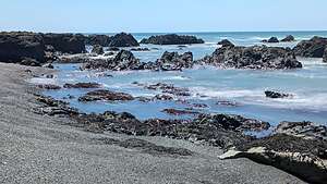 Along the Lost CoastWe passed the A.W. Way County Park along the way, which was another camping choice along the Mattole River. However, we wanted to go all the way to the beach on the actual Lost Coast.
All told, the drive from Shelter Cove to Mattole had taken us about 2 and ½ hours to cover 47 miles, 25 of which were steep, twisting, 4WD dirt roads.
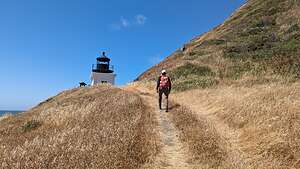 Approaching Punta Gorda LighthouseSo even though we missed the chance to 4WD through the southern portion of the Lost Coast on the Usal Road the other day because of fallen trees, we got our fair chair of bouncing around through the wilderness today.
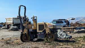
When we finally got to the Mattole Campground we were shocked to find most of its 14 sites full of construction trucks, plus a sign saying that the campground was closed for renovation. However, several campers had tucked themselves in between the trucks.
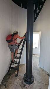 Climbing up the LighthouseNot wanting to drive any more today, and very much wanting to hike along the beach to the Punta Gorda lighthouse, we settled ourselves between a dump truck and a backhoe. We chose an end site so that we would have at least some semblance of a natural surrounding. We didn’t plan to spend much time in the campground anyway.
We packed a lunch and headed out on the Lost Coast trail, which started right from the campground.
Our goal was to hike 3.5 miles to the Punta Gorda Lighthouse and back. Part of this route is under water during high tide, but we were starting our hike just one hour after low tide, so we would have no problem.
.thumbnail.jpg) Punta Gorda LighthouseWalking on sand is not easy, so we give kudos to anyone venturing the 25-mile hike from Mattole to Shelter Cove. We tried to find the easiest surface to walk on. First we tried the wet sand along the water’s edge and eventually transitioned up to the trail that ran along the foothills of the mountains. That too was pretty sandy though.
Punta Gorda LighthouseWalking on sand is not easy, so we give kudos to anyone venturing the 25-mile hike from Mattole to Shelter Cove. We tried to find the easiest surface to walk on. First we tried the wet sand along the water’s edge and eventually transitioned up to the trail that ran along the foothills of the mountains. That too was pretty sandy though.
When we approached the lighthouse, we saw a structure fenced off and covered with scaffolding. Oh no! Thwarted by construction again??
Fortunately, that was not the lighthouse, but the old oil house building. The lighthouse itself was not covered in scaffolding, and we were even able to enter it and climb up to its balcony.
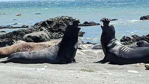 Elephant Seals determining dominanceThis lighthouse, which was built in 1911, is located along a very treacherous section of the Northern California coast, with many dangerous sunken rocks off the shore. In fact, we were admiring some of those rocks right now that weren’t so sunken during low tide.
The overhanging mountains behind us made navigating even more difficult, because the shadows they cast over the shoreline made it hard for ships to see how far they were from shore.
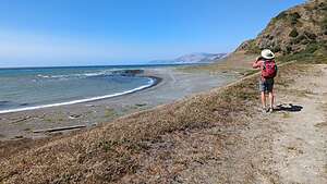 Back to the Mattole CampgroundNine ships were lost along this isolated section of the Lost Coast before the Punta Gorda Lighthouse was finally constructed.
Originally, there were many more structures here: three dwellings, a concrete oil house, a wooden fog signal building, a blacksmith/carpenter shop, three storage sheds and a barn. Today, all that remains is the lighthouse and the oil house, which is the one undergoing renovation today.
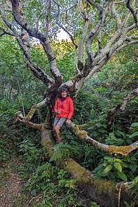 My secret world in Mattole CampgroundAfter World War II, it was decided that this lighthouse was too expensive to maintain, so its functionality was replaced with a lighted buoy offshore. In 1951, the Fresnel lens was removed (they are quite valuable), and the lighthouse was boarded up and deactivated. No one seems to know where that Fresnel lens wound up.
In the late 60s, hippies moved into the quarters and improved them. The Bureau of Land Management, which now had jurisdiction fo this land, booted them out and burned all the buildings except for the two that we see today - the lighthouse and the oil house.
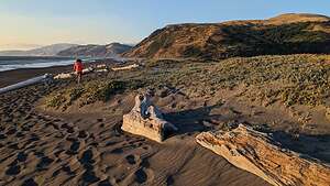 Beach Walk by Mattole CampgroundThe sandy beach by the lighthouse is a popular place for elephant seals to congregate because the rocks in the surf give them some protection from crashing waves.
We found a nice piece of driftwood to sit on and eat our lunch while watching about a dozen elephant seals putting on a show, posturing and sometimes even fighting, in their attempt to establish male dominance. The stakes were high, because the dominant male will get to mate with a majority of the ladies when they arrive.
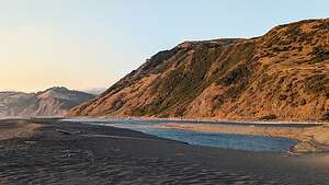 Where the Mattole River flows into the seaThey are large animals, weighing between 1,000 and 3,000 pounds so we made sure to keep our distance. We could have hung around and watched them for hours, but we still had 3 and ½ miles of sand to trudge through on our way back to the campground.
We hiked back in plenty of time to avoid the impassable-during-high-tide portion of the beach. However, what we weren’t able to avoid was the intense wind and sand blowing in our face, which is the reason why many backpackers choose to hike from north to south in order to have the prevailing northwest wind at their backs.
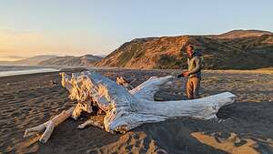 Beach by Mattole CampgroundBack at our campsite, we ate dinner facing the woods behind us rather than the construction trucks to either side. We noticed a small opening in the bushes and decided to check it out.
What we found was a magical little sanctuary, totally hidden from the campground. It looked like a place that elves and gnomes would frequent - you have to excuse me, but we just came back from Iceland where elves, gnomes, and the occasional troll run rampant. It was very peaceful and serene.
.thumbnail.jpg) Sunset on Mattole BeachTowards sunset we took a walk out to the beach and walked down towards where the Mattole River flows into the sea.
Sunset on Mattole BeachTowards sunset we took a walk out to the beach and walked down towards where the Mattole River flows into the sea.
Now we had seen all three of the places that non-backpackers can access the stunning remote Lost Coast - Usal Beach, Shelter Cove, and Mattole.
We were done with the 4WDing portion of our trip, but the 42 miles along Mattole Road up to Ferndale was pretty exciting in its own right, with lots of steep hills and twisty roads.
From Ferndale it was less than 4 hours to get home, although it had taken us at least 12.5 to get here - but those 12.5 were a lot more fun!
- ‹ previous
- 4 of 4
