- Home
- About
- Map
- Trips
- Bringing Boat West
- Migration West
- Solo Motorcycle Ride
- Final Family XC Trip
- Colorado Rockies
- Graduates' XC Trip
- Yosemite & Nevada
- Colorado & Utah
- Best of Utah
- Southern Loop
- Pacific Northwest
- Northern Loop
- Los Angeles to NYC
- East Coast Trips
- Martha's Vineyard
- 1 Week in Quebec
- Southeast Coast
- NH Backpacking
- Martha's Vineyard
- Canadian Maritimes
- Ocracoke Island
- Edisto Island
- First Landing '02
- Hunting Island '02
- Stowe in Winter
- Hunting Island '01
- Lake Placid
- Chesapeake
- Provincetown
- Hunting Island '00
- Acadia in Winter
- Boston Suburbs
- Niagara Falls
- First Landing '99
- Cape Hatteras
- West Coast Trips
- Burning Man
- Utah Off-Roading
- Maui
- Mojave 4WD Course
- Colorado River Rafting
- Bishop & Death Valley
- Kauai
- Yosemite Fall
- Utah Off-Road
- Lost Coast
- Yosemite Valley
- Arizona and New Mexico
- Pescadero & Capitola
- Bishop & Death Valley
- San Diego, Anza Borrego, Joshua Tree
- Carmel
- Death Valley in Fall
- Yosemite in the Fall
- Pacific Northwest
- Utah Off-Roading
- Southern CA Deserts
- Yosemite & Covid
- Lake Powell Covid
- Eastern Sierra & Covid
- Bishop & Death Valley
- Central & SE Oregon
- Mojave Road
- Eastern Sierra
- Trinity Alps
- Tuolumne Meadows
- Lake Powell Boating
- Eastern Sierra
- Yosemite Winter
- Hawaii
- 4WD Eastern Sierra
- 4WD Death Valley +
- Southern CA Deserts
- Christmas in Tahoe
- Yosemite & Pinnacles
- Totality
- Yosemite & Sierra
- Yosemite Christmas
- Yosemite, San Diego
- Yosemite & North CA
- Seattle to Sierra
- Southwest Deserts
- Yosemite & Sierra
- Pacific Northwest
- Yosemite & South CA
- Pacific Northwest
- Northern California
- Southern Alaska
- Vancouver Island
- International Trips
- Index
- Tips
- Books
- Photos/Videos
- Search
- Contact
Portland
Friday, August 13, 2021 - 2:30pm by Lolo209 miles and 3.5 hours from our last stop - 2 night stay
Travelogue
 Japanese GardenOriginally, I thought Portland would be the easiest destination to find overnight accommodations as there were numerous options throughout the city with reasonable prices. But then it hit us. We have a Yakima rooftop box on top of our 4 Runner, making us over 7.5 feet high - too tall for parking garages, which was what most Portland hotels offered. We didn’t want to park a vehicle with most of our belongings in it on the streets of Portland, so we started to panic over whether this was feasible.
I then worked things backwards and went on Booking.com looking for places on the outskirts of the city with free parking. This led me to what seemed to be the ideal option - a studio apartment in the Nob Hill section of Portland in walking distance to Washington Park, with free street parking. The photos of the apartment were lovely and all the reviews raved about its excellent location and proximity to great restaurants.
 Japanese GardenThe price seemed really reasonable too. We were excited, or at least until we saw that after all the fees were added on, the price nearly doubled. I was crestfallen, but we were in too deep, so we decided to just go for it. A few nights of camping would amortize the amount we were spending for sleeping each night.
Since we couldn’t check in our rental until 4:00, we decided to head directly to Washington Park, Portland’s crown jewel. Every city needs its monumental green space. New York has Central Park, San Francisco its Golden Gate Park, etc. Portland has its Washington Park, encompassing 130 acres of forest, a Japanese Garden, the international Rose Test Garden, a zoo, and more. It was modeled on European parks, with winding drives, fountains, statuary, and formal gardens. It was lovely.
 International Rose GardenWe started our visit at the Japanese Garden where we were fortunate enough to find nearby parking. There was a significant crowd waiting to buy tickets. The Gardens are actually five separate gardens linked by winding paths:a Tea Garden, a Strolling Pond Garden, a Natural Garden, a Flat Garden, and a Sand and Stone Garden.
They were designed in the 1960s by Takuma Tono, a renowned Japanese landscape architect, and recognized by the Japanese ambassador to the United States as “the most beautiful and authentic Japanese garden in the world outside of Japan.”
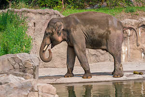 Portland ZooTickets were $18.95 for adults and $16.25 for Seniors (65+).
From there we walked across the road to the International Test Rose Garden, where there are 4.5 acres of beautiful formal rose gardens with over 6,800 rose bushes representing 557 different varieties. It is one of 24 gardens in the U.S. that test new rose varieties for vigor, disease resistance, color, flower production, and fragrance.
From the garden there can on clear days be a wonderful view of Portland with Mount Hood in the background. Unfortunately, the smoke from various wildfires obscured the mountain.
I forgot to mention that Portland was experiencing a heatwave and it was well into the mid-90s, so our next activity was probably not the wisest. We decided to go to Oregon Zoo all the way at the other side of Washington Park, but rather than take the free shuttle, we thought it might be nice to see the whole park by walking there.
 Portland ZooThe walk there was a bit more intense than we anticipated. Rather than winding paths through green areas and play areas, such as in Central or Golden Gate Parks, we were hiking for 3 miles or so up and down steep dirt paths through a pretty thick forest.
Finally, we arrived at the zoo, which was practically empty, due to the heat. We knew animal viewing would not be that great because they would all be hiding in the shade and not moving, but since we were here, we decided to buy tickets and go anyway.
The zoo is arranged in five areas that range across different continents and ecosystems: Great Northwest, Elephant Lands, Africa, Primate Forest and Discovery Zone. Within each zone you’ll find animals and habitats such as Africa Savanna or Polar Passage that recreate the habitats of specific animals.
 Herb enjoying his $5 MargaritaWe did get to see see elephants, primates, giraffes, bears, flamingos, eagles, and much more,
but It was a bit sad, as the animals definitely were not active and did not look particularly happy or comfortable. We weren’t either, so we took the free park shuttle back to our car by the Japanese Garden and drove over to Lovejoy Avenue about a mile and a half away to check into our home for the next two nights.
We had a lovely little studio apartment in the fashionable Nob Hill neighborhood, known for its ornate Victorian houses, tree-lined streets, and a thriving dining scene.
 Walking tour of PortlandThat evening we strolled over to NW 23rd Avenue, the trendy main drag with tons of restaurants, bars, and shops. We didn’t go too far before being drawn in by the bustling crowd at Santa Fe Taqueria and its $5 margaritas enticing sign. We sat at an outdoor table, had a delicious meal and listened to live music from the corner across the street.
The next day was our big walking tour of Portland, so we set off with rather an ambitious itinerary ahead of us.
First stop, the famous Powell’s City of Books. “City” of books was not an overstatement. This place was incredible, taking up an entire block square and three stories tall. Its miles of bookshelves contained new, used, and out-of-print books, and I dare anyone to stump them in having a book in their vast collection. You could literally spend days browsing their shelves and only making a dent in them.
 Herb enjoying his giant box of Voodoo DonutsNext, we moved on to a less cerebral activity - Voodoo Donuts, the iconic and highly popular donut shop that refers to its bakers as artists. Needless to say, there was a very long line wrapping around the corner, but to my surprise, Herb had no hesitation waiting - that man loves a good pastry.
The menu was overwhelming, with over 50 cleverly named, mouth watering choices. We were quite conservative in both quantity and content. I talked Herb down from a dozen to two each of Portland Cream, Apple Fritter, Cinnamon Sugar Cake, and Double Chocolate.
They were packed in a pink box the size of Delaware that we now had to cart around the city on our tour. Herb took one for the team and ate one of the giant Apple Fritters and a Portland Cream immediately upon exiting the store and I joined him in his efforts with one of the Double Chocolates.
 Lan Zu Chinese GardenDown to 5, we asked for some bags instead of the box and stuffed them in our backpacks, discarding the enormous pink box. With temps in the 90s, I was a bit worried about what the state of my other Double Chocolate would be at the end of the day.
We forged on. Next stop, the Lan Zu Chinese Garden, a replica of a formal garden built in the style of the Ming Dynasty. Its creation was a joint effort between craftspeople in Portland and its Chinese sister city. It is the largest traditional Chinese garden in the U.S.
 Portland's Steel BridgeThe peaceful setting served as a sharp contrast to the noisy streets and higher buildings of downtown Portland that surrounded it - an oasis in a sea of modern urban life.
The landscaping, ponds, and buildings were beautiful and if it weren’t for my concerns about my Double Chocolate donut melting in my backpack, I would have been in a state of perfect peace and harmony. .
After leaving the Chinese Gardens we headed to the Tom McCall Waterfront Park. A friend of mine who recently lived in Portland warned us that this was often the location for Proud Boy / Antifa protests, so to be wary. Fortunately, today there were no protesters to be found. Just children cooling off in the fountains. I was very tempted to take a run through them myself.
 Portland Art MuseumWe ended our tour at the Portland Art Museum, which I would have to say wasn’t my favorite art museum. Maybe we were just hot and tired - we had already walked over 8 miles, and were a bit overwhelmed by the degree of homelessness in the city, which is so very sad.
We headed back to our apartment for a well-needed nap, and maybe a donut.
That evening, we headed back out to NW 23rd Avenue to people watch and have dinner. This time we ate at Thai Bloom! (that ! is not a typo - it is actually part of the restaurant’s name) where we had a delicious dinner and my first ever Tamarind Margarita. It will not be my last.
 Sauvie IslandAfter the last two day’s aggressive march though Portland trying to see everything, we needed some down time, so after checking out of our rental, we headed to Sauvie Island, ten miles northwest of Portland at the confluence of the Willamette and Columbia Rivers, reach via the Sauvie Island Bridge on Highway 30.
The southern half of the island is predominantly rural farmland, while the northern half is a wildlife refuge with sandy beaches along the northeastern side of the island. Parking permits are required in all wildlife areas on the island (which includes the beaches). Daily permits are $10 and can be purchased at several convenience stores on the island.
The island was lovely and we saw many bicyclists out enjoying a Sunday morning ride along its 12-mile “hill-less” loop.
 The Floating SaucerWe were early enough to easily find a parking spot along a lovely sandy beach, where we spent the day relaxing, reading, and dipping ourselves in the Columbia River to get cool. It was a well-needed down day.
I did take a short stroll down the beach in search of a geocache that sounded very interesting. It was called "floating saucer." As my phone told me I was getting closer, I glanced towards the edge of the woods where I found a very surprising sight - a large submarine / flying saucer like object colorfully painted all over with graffiti.
A nearby signed gave its history: This 31-foot paddle wheel boat was built in 1973 in Hubbard, Oregon, by an engineer named Richard Ensign. It took him two years and cost $10,000. It could sleep 12 people and had a wood stove. It was launched on the Willamette River, went through the locks at Willamette Falls, and was front page of the Oregonian. It was dubbed the "floating saucer." It mostly likely was left here by the February 1996 flood.
I ever did find the geocache, but I am very glad that the search for it brought me here. Who would have thought?
Now onto more action.
Oregon Dunes National Recreation Area
Thursday, August 12, 2021 - 1:30pm by Lolo40 miles and 0.75 hours from our last stop - 1 night stay
Travelogue
 John Dellenback Trail along the Umpqua DunesOf course before leaving Bandon, I had planned out our next destination and where we could camp. Not only did I find and reserve one campsite, but I reserved two because I wasn’t sure yet which one would be better to accomplish what we wanted to do, which was hike the John Dellenback Dunes Trail in the Oregon Dunes National Recreation Area.
National Park camping is quite inexpensive, and even more so with a Seniors Lifetime Pass, which cuts the price in half. So, the downside of doing this was the loss of $10 on the campsite we did not use.
 From dune to forest to oceanOne campground was the Eel Creek USFS Campground where the John Dellenback trail started. The second one was Umpqua Sand Camping, an OHV area on the beach, which would assuredly be noisy with dune buggies racing up and down the beach all day and night. Also, we weren’t sure if we would be able to find the other end of the John Dellenback Dunes Trail from there. After all, the Oregon Dunes NRA is the largest expanse of coastal sand dunes in North America, stretching 40 miles along the Oregon Coast from Florence to Coos Bay.
So, after first stopping at Eel Creek, we decided to stay there, as it was quiet and the trailhead for our planned hike was just a few campsites away.
 The ocean part of the John Dellenback TrailThe hike was listed as a 3 (out of 5) in difficulty because of having to plod along deep, soft sand, but a 9 (out of 10) in scenic beauty. The campground host we spoke to felt like it was more of a 4 in difficulty.
Ok, so this hike could double as a workout. We set off from the trailhead in the campground and immediately began climbing a steep, yet short, deep sandy section through a conifer-forest before coming out to the dunes.
Theoretically, there were poles with blue stripes on top used as trail markers, but so far we couldn’t see one. Herb had a Gaia trail downloaded on his watch, so we followed that towards a large grouping of conifer trees atop a dune. I’ve been to many deserts on our travels, but never saw one with so many trees.
 Umpqua Dunes along the John Dellenback TrailThese tree islands are a prominent topographic feature of the Oregon Dunes and make for a very different dune visual experience. I don’t quite understand the explanation for these tree islands, but it has something to do with the fact that these are oblique dunes with long gradual slopes on the west (ocean) side and much steeper slopes on the east side. Over many years wind stripped away the sand on the east (inland) side down to the permanently wet sand where water-loving vegetation can thrive. These areas are called deflation plains.As the dunes move eastward, the plants of the deflation plain also spread eastward.
Trudging through the sand was nowhere nearly as difficult as the hiking book or campground host led us to believe. Plus, we finally were able to find and follow the posts with the blue stripe on top. Good thing because we eventually entered a pretty thick forest and I don’t know how we would have found the opening without the post.
 Umpqua DunesThis part of the hike was really cool as it led us on an easy dirt surface with the occasional boardwalk to get us over the wetter areas. There was even Spanish moss hanging from some of the trees. It was hard to believe we had just left sand dunes.
Eventually we popped out on a beautiful beach with crashing surf. There was no sign of OHV vehicles, or anyone for that matter, so I think we made a good choice staying at Eel Creek because we never would have been able to get to this trail from the OHV camping area.
The way back was much easier to navigate now that we knew the way. All in all it was a 6-mile hike, and much less difficult than we anticipated.
Bandon Beach
Tuesday, August 10, 2021 - 11:15am by Lolo240 miles and 5 hours from our last stop - 2 night stay
Travelogue
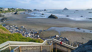 Coquille Point staircase to Bandon BeachI was pretty excited about Bandon. The photos of its uniquely shaped sea stacks were a definite draw. Unlike many of the sea stacks along the coast, which are large mounds with trees sprouting from their tops, these were distinct enough to have names, like Face Rock and Wizard’s Hat.
So, before leaving home, I booked a night at the Lighthouse Cove Inn near Bandon’s historic Old Town. I have to admit I am a sucker for names that imply coziness, so I was a bit disappointed that there was not a lighthouse in sight except on their signage. However, the location was great, and to their credit, there actually technically was a Lighthouse out in the cove beyond the Old Town.
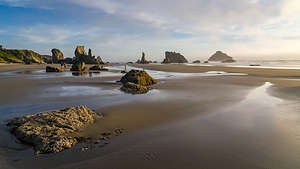 Bandon Beach during sunsetDespite the extremely windy conditions, we decided to head out to the beach anyway. The sea stacks are located between Coquille Point and Face Rock, both of which have parking lots and wooden steps down to the beach. We parked at the nearer Coquille Point next to the Bandon Beach Motel, which had an incredibly good location, perched on the bluff above the beach.
Being the planner I am, I am always plotting where we will sleep the next night, so I walked into the Bandon Beach Motel to inquire about availability for the following night. They had one opening, so I grabbed it. Now, I could relax and enjoy the evening. Tomorrow, however, I would be back to worrying about the next night. I think I definitely need some serious mindfulness practice to learn to be more in the moment.
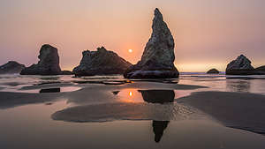
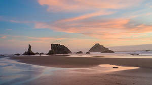
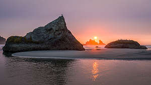
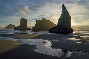 Bandon Beach during sunsetWe headed down the wooden steps to the beach where we were pelted with sand from the 25+ mph winds. Otherwise, conditions were perfect in that it was a receding tide, which allowed for photographing stunning reflections of the stacks in the puddles left behind, while not getting swept out to sea.
The sand was hard, which made for easy walking, so we walked the mile or so to Face Rock. Except for a few dedicated photographers, the beach was pretty deserted - I imagine due to the fierce winds. Despite that, it was an absolutely beautiful sunset and we enjoyed ourselves immensely. It was very exhilarating.
The next morning, I convinced Herb to go for a run with me, so we set off through the Old Town, running along the waterfront, past Coquille Point and onto Face Rock - not on the beach this time, but along the road.
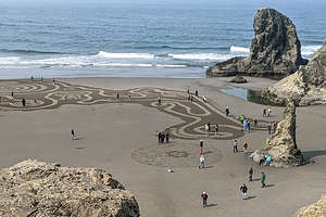 Circles in the SandFrom the overlook above Face Rock, we looked down at a spectacular labyrinth created in the sand, with dozens of people wandering its intricate weaving paths. These labyrinths, which are created on 2 sets of 3 or 4 consecutive days each month during super low tides, are the brain child of Denny Dyke, who has been doing this for over a decade. His intention in creating these “Circles in the Sand” is to share love, joy, and kindness and provide a place for peaceful meditation.
It takes him about 2 hours to create his labyrinth and then the waiting crowd is allowed to enter and wander its twisting paths. He personally greets each person entering the maze and allows them to select one of the many moonstones he has in a basket.
 Bandon Beach Night 2Each afternoon, the tide comes in and washes it away.
For now, we would continue our run, but vowed to come back tomorrow morning to experience it first hand.
We couldn’t check into our 2nd Bandon motel until 4:00, so after showering and checking out of the Lighthouse Cove Inn, we wandered the Old Town and looked for a place to have lunch. Some very positive Yelp reviews led us to the Bandon Fish Market, where a long line extending out into the parking lot confirmed its popularity.
 Bandon Beach during sunsetIt was a bit of a wait, both to place our order and for it to be ready, but it was no hardship wandering along the lovely waterfront during our wait. Bandon is a very artsy town with beautiful wood-carved benches and sculptures to enjoy during a stroll. Also, along the waterfront fence were dozens of original paintings done by both the school children and adults of Bandon. Visitors were encouraged to vote for their favorites.
Finally, our name was called and we sat on one of those beautiful benches to enjoy our Fish and Chips and Dungeness Crab sandwich - the crab was for me as Herb is allergic to shellfish (poor guy).
 Bandon Beach Night 2After lunch, we headed over to the Bandon Beach Motel to check in. What an incredible location!! Besides being just a stone’s throw from the wooden steps leading down to the beach from Coquille Point, there was the lovely ½-mile Coquille Point loop trail atop the bluff with interpretive displays about the ecology of the region.
That evening, we strolled back down to the beach to once again enjoy the sun setting over the sea stacks. Conditions were perfect - low tide and low winds. Pretty perfect. It was an absolutely lovely evening.
 Bandon Beach Night 2The next morning we set out once more down the Coquille Point steps, this time to wander over to and hopefully wander through the Circles in the Sand Labyrinth, about a mile walk along the beach.
Somewhere along that stroll, I left Herb behind to photograph the stacks and entered the maze myself, first collecting my chosen moonstone from Denny Dyke, the creator of this incredible labyrinth. Although the maze was probably smaller than a football field, it took quite a bit of time because of all the twists and turns along the way.
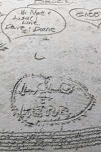 Bandon Beach Night 2When I exited the maze, I stopped to add a heart with “Herb + Lolo” to the large collection at the end of the labyrinth.
I scanned the beach for Herb and finally spotted him in the labyrinth. He was so close but yet so far from finishing due to the growing crowds and twists and turns.
What a wonderful stop Bandon had been and we were so so lucky that our visit took place during one of its super low tides so that we could experience both the sea stack reflections at sunset and the Circles in the Sand labyrinth.
.
Humboldt Redwoods State Park
Tuesday, August 10, 2021 - 11:00am by Lolo180 miles and 3.5 hours from our last stop
Travelogue
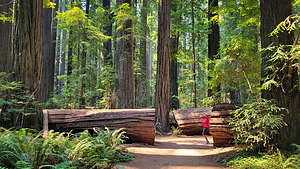 Lolo stalking the fallen Dyerville GiantAfter about 3 and a half hours of driving towards Bandon, we decided to stop and stretch our legs amongst the giant California redwood trees of Northern California.
The fact that there are still so many groves of these incredible trees to enjoy, which happen to be the largest and tallest on earth, was not a given. After the gold rush, many miners that failed to strike it rich with gold turned to harvesting these giant redwoods. By the early 1900s, these priceless forests were badly threatened by years of unrestricted clear cut logging.
However, today, thanks to the foresight and work of the state of California and the Save the Redwoods League, hundreds of groves have been acquired and protected for our enjoyment. In 1968, Redwood National Park was created for the purpose of cooperative forest management with three other state parks: Jedediah Smith, Del Norte, and Prairie Creek. Today Redwood National and State Parks encompasses 133,000 acres and protects 45% of all remaining coast redwood old-growth forests.
Although you don’t even have to leave your car to enjoy these majestic groves along the scenic Redwood Highway, to truly experience them, you need to get out of the car and walk amongst them.
There are so many choices of groves to visit. We chose to drive the 30-mile-auto-tour route known as the Avenue of Giants, which pretty much parallels US 101, stopping to stroll the ½-mile loop through the Founders Grove.
There are two “special trees” along this loop. The Founders Tree, which is a memorial to the Save-the-Redwoods-League, and the Dyerville Giant, which was once the tallest tree in this region, clocking in at 370 feet. Unfortunately, the Giant fell back in 1991.
Refreshed, we continued on US 101 into Oregon. The only noteworthy thing that occurred along the drive is that we thought we saw an orange construction cone in the lane in front of us. The weird thing was the construction cone appeared to be moving - that’s because it was. This faux construction cone was actually a tiny capsule-like motorized vehicle, which definitely did not belong on a highway. At a traffic light, the top opened and a shirtless young man popped up to look around before enclosing himself back in his very strange vehicle and continuing on his merry way. I am glad I am not his mother.
Bishop
Thursday, May 20, 2021 - 5:45pm by Lolo400 miles and 8 hours from our last stop - 4 night stay
Travelogue
As I mentioned in the previous stop, we decided while lunching in Hurricane to drive the estimated 6 ½ hours to Andrew and Celeste's (our son and daughter-in-law) house Bishop. However, as I also mentioned, that lovely lunchtime breeze was gaining some steam and no longer so lovely.
For our entire drive, we had to deal with gusting winds up to 50 mph, strong enough to move trailers and trucks in and out of their lanes. Not exactly relaxing.
We took some roads we hadn’t been on before that were pretty cool as we skirted the northern boundary of Death Valley and climbed up and down over the White Mountains. Finally around 8:30, well over our original ETA, we arrived.
Our other son Tommy and his fiancée Erin would be arriving the following night. Nothing makes me happier than having the whole gang together, and now that we are all vaccinated, it is happening more and more frequently.
I’m not going to go into any great detail about our family time together, but for my own purposes and desire to remember where the heck I have been this year, I added this as a stop on our Utah trip.
This is what we did over those 4 days:
- Herb and Andrew spend the entire first day with some father-son bonding over home maintenance
- Tommy and Erin arrive
- We all go to the Buttermilks to watch the boys and their wives/fiancées boulder
- Afterwards I go for a short run on the lovely Bishop Creek canal near their house
- Drinks at dinner at the Owens Valley Distillery in Bishop
- We all go to Pine Creek Canyon to watch them sport climb
- I go for a 5-mile run along the Bishop Canal
- Tommy and Erin leave to go back home
- The remaining four of us go the the Mountain Rambler Brewery for dinner
- We drive home to Sonoma County
And that's a wrap. Great trip but it will be good to be back in Sonoma Valley too.
Cottonwood Canyon Road, Wahweap Hoodoos, and Old Paria
Wednesday, May 19, 2021 - 5:45pm by Lolo240 miles and 7 hours from our last stop - 1 night stay
Travelogue
 Not a bad view at Kiva KoffeehouseAfter Herb removed me kicking and screaming from the lovely Boulder Mountain Lodge, we continued our journey with the plan of driving the Cottonwood Canyon Road through the Grand Staircase-Escalante National Monument to Kanab.
Our drive along very scenic highway 12 brought us to another highly recommended stop - the Kiva Koffeehouse in Escalante, a beautiful building that blended into the surrounding landscape with fabulous views from its outdoor dining area.
We were not the only ones that had this idea. The line was quite long and the wait for our food was even longer. However, we had no reason to complain, as we had managed to nab two chairs overlooking the red and white striated sandstone rock formations that we had grown so accustomed to over the past week.
 Grosvenor Arch along the Cottonwood Canyon RoadThe final result was a great cup of coffee (mine an indulgent mocha with chocolate) and two salads with chicken to go - perhaps our dinner later tonight.
From there we continued along Route 12 to the town of Cannonville, where we turned off, passing right by Kodachrome Basin State Park (surprise surprise - no vacancy in the campground) to the start of the Cottonwood Canyon Road, a 46-mile drive on a well-graded dirt road, ending at Route 89 between the towns of Big Water and Kanab.
Compared to what we had been driving on, the road was very easy - much less bouncing and climbing. No need for me to get out of the truck to guide Herb over rock ledges.
 Grosvenor Arch along the Cottonwood Canyon Road10 miles into the drive, we took the turnoff for the one-mile spur road to Grosvenor Arch, a unique sandstone double arch, 90 feet across, and 152 feet above the ground. An easy asphalt path led right up to the arch, but we ventured a little further to get right under it.
In 1949, the arch was named after Gilbert Hovey Grosvenor, president of the National Geographic Society and the first-time editor of the National Geographic magazine.
About 3 ½ miles south of the turnoff for Grosvenor Arch, we came to an area with colorful badlands to the east, referred to as Candyland because of its white and red rocks and pinnacles. It was pretty much high noon right now, so the stark lighting was not doing it the justice it deserved.
 Approaching the Wahweap HoodoosTo the west was the Coxcomb, an elongated series of upwardly-pointed ridges that ran parallel to our drive.
The thing that ruined the drive a bit for us after being out in such remote places for the past week, were the very prominent power lines that ran along the entire drive, making it very difficult not to include them in a photo.
Rather than camp along the drive and do the recommended hike to Yellow Rock, we decided to go the whole way and try to find the Wahweap Hoodoos, which we had seen photos of in our Photography Guide.
 Wahweap HoodoosThe directions were quite complicated, but fortunately we had the Gaia app, which pretty much has every remote road, hiking trail, attraction, etc. There were two ways to get there. One was a longer, rougher drive, but only required a 1-mile hike to the main hoodoo area, and the other one was a shorter, easier drive, but it required a 4 ½ mile (each way) hike to best hoodoos.
 The Big FellaWe were very comfortable handling the more difficult road, so we chose the shorter hike direction. Gaia was great. I could follow our progress along the way on my phone, seeing every dirt turnoff we passed. That combined with the written directions in our photography guide brought us to the fence along the Wahweap Wash, with a sign instructing us now to drive in the wash.
The skies were getting ominous and we could see dark clouds and virga in the distance. I have been dying to use the word virga since we learned it a few days back from a park volunteer at the Great Gallery. It means rain that evaporates before reaching the ground.
I had seen photos of the Wahweap Hoodoos, but nothing had prepared me for the surreal otherworldliness. We felt like we had taken a wrong turn and landed on another planet - or better yet, a Dr. Seuss book.
 Wahweap HoodoosThey seemed to spring out of nowhere after making a slight right into an alcove about a mile down a rather prosaic wash. There were about a dozen white hoodoos, but one in particular dominated the scene, rising about 30 feet in the air, topped by its little brown cap.
We’ve seen lots of strange rock formations in the west, but these topped the cake. Plus, it was the whitest rock I have ever seen, except maybe for the tufa castles in mono lake.
These particular hoodoos (also called spires, columns, pillars, and even goblins) were formed from a relatively soft, bright white entrada sandstone with a harder layer of dakota sandstone protecting them from erosion. Over millions of years, weathering has created these amazing formations. The brown caps of stone atop the towers are the harder, less easily erodable dakota sandstone. Hoodoos such as this are mainly found in dry, hot areas.
 Interesting formation near our campsiteGeology is amazing, giving even Michelangelo a run for his money in creating wonders out of stone.
Those ominous clouds were getting closer and darker, so I kept trying to hurry Herb along, which he hates. I definitely think he wanted to spend more time there.
Time to find camping for the night, so we drove back a few miles from whence we came, but this time we turned left on the White Sands Jeep Trail, a very rough 4WD road which we learned about in our photography guide. After 1.3 very rocky, bumpy miles we came to a promontory that looked out over a small canyon that had some impressive, colorful hoodoos just under the rim. We had found our home for the night.
 More Wahweap HoodoosAlthough it didn’t rain, it became extremely windy, to the point where we had to remain in the car, making brief forays out along the canyon rim to visit the little hoodoos.
The next morning, I felt really bad having rushed Herb away from the Wahweap Hoodoos, so we drove back for one more visit. Although they are supposedly best photographed in morning light, I think the drama of yesterday’s dark storm clouds created a better mood and background for these alien-like formations.
From the Wahweap Hoodoos we drove back along BLM roads to the Cottonwood Canyon Road and then out to Highway 89. I have a predilection towards culture and human history with a really nice natural backdrop, so I suggested to Herb that we go to Old Paria where Western movies used to be filmed. Our photography guide showed an awesome photo of an old western building used in the movies with multicolored butte in the background.
 Along the scenic road to the Old Paria movie setUnfortunately, I didn’t read the fine print that building did not exist anymore. However, the drive along the dirt BLM 585 road, which traces the colorful red, white, and purple Chinle formation badlands was worth it. Also, for future reference we found some great dispersed camping sites.
There was, however, an interesting old cemetery with 20 graves of early settlers who tried to eke out a living in this desolate, yet beautiful, area.
From here we weren’t sure what to do. We were supposed to be in Bishop tomorrow night for my son’s birthday, which was about an 8 hour drive away.. We could take our time getting there or go the distance today.
 Old Paria CemeteryWe figured we would just start driving that way and see what we felt like.
We were really getting into this eating lunch out thing, so we stopped in the town of Hurricane at the Main Street Cafe, which turned out to be a truly wonderful dining experience. The food was delicious, but it was really the ambience that felt so right. There was a lovely breeze on the outdoor patio, which was surrounded by green lawn and trees, something I didn’t realize how much I missed until now. It reminded me a bit of Key West, which is crazy, as the towns couldn’t be more different.
It was only 6 ½ hours to Bishop, so we decided to go for it. The problem was that that lovely breeze we had enjoyed so much at lunch wasn’t so lovely anymore.
Notom Bullfrog Road, Upper Muley Twist, and the Burr Trail
Monday, May 17, 2021 - 12:30pm by Lolo83 miles and 3 hours from our last stop - 2 night stay
Travelogue
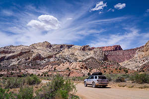 Along the Notom Bullfrog RoadThe Notom Bullfrog Road was a surprise bonus for us. We had never heard of it before, and only did when we Googled how to get to the Strike Valley Overlook and the start of the scenic Burr Trail
Notom Bullfrog Road runs south through the lovely Strike Valley along the eastern boundary of Capitol Reef National Park, between the Henry Mountains and the Waterpocket Fold, all the way to the Bullfrog Marina on Lake Powell. We would only be going as far as the turnoff for the Burr Trail switchbacks.
Google Maps had estimated that we would only be able to travel 20 mph on this road, but it was so well graded that we did it in half the time. The scenery along the way was so unique and beautiful that we stopped several times along the way. The ranches set against the base of the Waterpocket Fold provided a lovely juxtaposition of man-made and natural beauty.
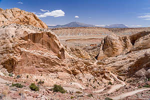 Burr Trail switchbacksAt 34 miles, we turned right towards Strike Valley and began our climb up the Burr Trail switchbacks, which although dirt, were doable in a 2WD car. However, they did climb 1,000 feet in a mile, so they were still pretty exciting. We stopped several times to gaze down at the tiny vehicles winding their way up the twists and turns of the switchbacks.
A short distance after the completion of the switchbacks, we came to the 3-mile spur road to the Strike Valley Overlook, where we planned to start the long 9.4 mile Upper Muley Twist hike tomorrow morning. The guide books said the road was extremely rough, so we decided to not scout it out today, but just do it once when necessary.
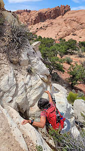 Some rock scrambling along the Upper Muley Twist hikeSince dispersed camping is not allowed in the national parks, we drove a few miles further until we hit asphalt, which told us we were now out of the Park, and camping was allowed. It wasn’t long before we found a nice spot in a pinyon forest, already decorated for us with several creative cairns around the firepit.
We had been going at a ridiculously fast pace so far on this, so we thought some down time would serve us well. It was nice to spend the afternoon without an agenda, just relaxing, reading, and building some cairns of our own.
The next morning we drove the short distance back to the turnoff for the Strike Valley Overlook, stopping first at the 2WD parking lot to walk out for a view over the valley. For those that don’t have 4WD, you have to start the Upper Muley Twist from here, adding 2.5 miles each direction.
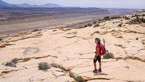 Atop the Waterpocket Fold along the Upper Muley Twist hikeFortunately, we have a 4WD, because I had no desire to add 5 miles to an already long hike. The books were right though. The next 2 miles were very rough and definitely required high clearance. We were the only car in the parking lot.
From the parking lot, we set out north along a wash through Upper Muley Twist Canyon that paralleled the Waterpocket Fold. The initial part of the hike was quite easy, but we knew that wouldn’t last. There were several places along the wash branches off, but we always stayed to the right, as described in the trail guide.
At 1.5 miles we came to an unnamed arch on the left, about 200 feet above the wash, the first of half a dozen arches that we would pass that day.
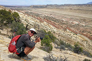 Herb enjoying the view of the Strike ValleyJust 0.2 miles further, we arrived at Saddle Arch, located above a large crack on the canyon wall. This is an important landmark, because it is where the loop portion of the trail begins. An old wood sign points to the right for the Rim Route, but we followed the advice of the hiking guide to do the loop in a clockwise direction and continued straight up the canyon where we would eventually ascend to the rim.
As we continued up the wash, the colors of the canyon kept getting better and better. We kept our eye out to the west for more arches, and counted at least three more of them.
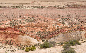 More views of the Strike Valley from atop the Waterpocket FoldAt around 3.2 miles, the canyon constricted dramatically and we arrived at a pouroff. Here we had a choice: squeezing our way through a narrow slot, or taking the recommended well-cairned bypass route on a ledge to our right.
After wandering a few feet into the narrow slot and finding it not to our liking, we chose the bypass route and climbed a slickrock slope up to a shelf about 150 feet above the wash. We followed the cairns for about a mile before it descended back down and joined the wash again.
We continued up the wash, and at 4.9 miles we reached an old wood sign marking the beginning of the Rim Route. From here, we left Upper Muley Twist Canyon and ascended a series of switchbacks through the Navajo sandstone to the ridge atop the Waterpocket Fold.
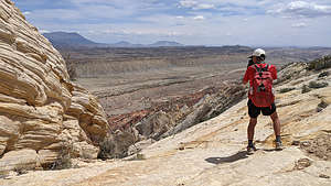 More Strike ValleyWe followed the prolific and well-placed cairns southeast along the top of the Fold. The views along the way were breathtaking - colorful Strike Valley to the east, the white sandstone domes of Capitol Reef to the north, and the red Wingate sandstone canyon walls, which we had just passed through, to the West. We could even see some of the arches we passed while walking up the wash.
After a few more miles of sensory overload and wondering which way to look, as it was all so incredible, at 7.3 miles we finally came to the very welcomed wood sign pointing us back to the Canyon Route, from which we came. After descending steeply over ledges and across slickrock, we were once again back in the Upper Muley Twist Canyon.
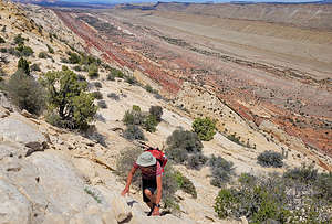 More scrambling along the Upper Muley Twist hikeFrom here we retraced our steps back along the wash to the trailhead. We had only passed three parties that day, and all of them were backpacking, which made us pretty proud to have accomplished this strenuous hike in a single day. The final stats were 10.7 miles with a 1,050 foot elevation gain. Doesn’t sound like that much, but much of that elevation gain (and eventually loss) required a lot of rock scrambling.
What a terrific hike!
After maneuvering back over the rocky Strike Valley Overlook spur road and heading west, we were soon once again on the asphalt of the Burr Trail. We had already done the most exciting part of it when we came up the Burr Trail Switchbacks yesterday, but there was still much great scenery to be had on the remaining 30 miles to the town of Boulder.
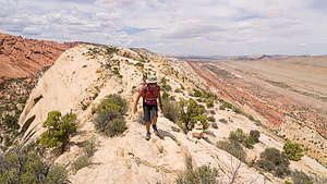 Along the ridge of the Waterpocket FoldThe Burr Trail used to be an old Mormon track used to bring livestock from the high-altitudes of Boulder to the warmer grazing areas of the Waterpocket Fold. The country is still wild and remote, but in the 1980s, the old trail was paved right up to the boundary of Capitol Reef. Today it is strictly used for recreational purposes, and there is nary a sign of a Mormon or a cattle herd to be seen.
There certainly were a lot of people out recreating and the trailhead parking lots were full to overflowing. We had already done more hiking than we needed that day, so we were perfectly satisfied watching the beautiful scenery go by from our car.
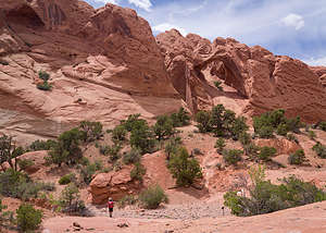 Back down in the Canyon along the Upper Muley Twist hikeThe nicest section of the drive was the last 10 miles or so through Long Canyon, which passed through sheer red sandstone cliffs covered with desert varnish. We stopped at a pullout that looked out over the canyon. It was lovely.
However, we were tired from our big hike that morning, dirty from five days of camping in the back of our 4Runner, and anxious about where we would find a decent hotel room for the night. We had had no cell coverage for days and the only thing we knew about Boulder, the next town we would be coming to, was that we should really try to eat at the Hell’s Backbone Grill.
As soon as we hit the end of the Burr Trail, we got a bit of cell coverage and I immediately jumped on my phone to try to find nearby hotels. While I was busy typing madly into my phone, Herb said, “that place says Vacancy,” and pointed at the rustic Boulder Mountain Lodge with a restaurant on the premises. That restaurant was the Hell’s Backbone Grill. We had struck gold.
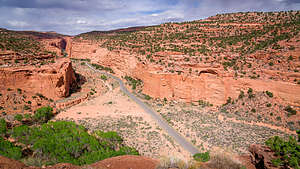 Burr TrailThe woman in the office seemed hesitant at first when we asked if there was a room available. We had clearly seen the Vacancy sign and was wondering if we weren’t passing muster for some reason - I could think of a few. However, her dilemma was that someone had called earlier to inquire about a room and she thought they might still be coming. No money had been put down though, and we were there with credit card in hand. She finally agreed to give us the last room. I think I would have cried if she didn’t.
I thought I couldn’t be any happier, until she asked us if we wanted to book a time in the hot tub, which was now restricted to one couple at a time because of Covid. It was already 6:00 and we wanted to have dinner first, so we booked the 9:00 to 9:30 slot.
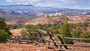 Along the Burr TrailThe place was beautiful. After a well-needed shower, I sat out on our back patio with a glass of wine, looking out over a lovely pond. Eventually, the man one patio over asked me if I was with the bicycle group. When I told him no, and that we had just wandered in off the Burr Trail and seen the Vacancy sign, he almost fell off his chair. He told me that this place was usually booked a year in advance and that I had been extremely lucky to have gotten a room. Whew!
He also advised me to call the restaurant if I was interested in having dinner because they are usually booked up. However, they did give preference to lodge guests, which I was now in the elite company of. I called them and asked for a 7:30 seating and they told me they would call me when my table was ready.
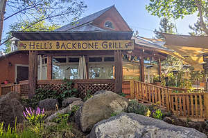 Boy were we happy to find this placeWe were seated at our table promptly at 7:30. It was very hard to believe that we were in Utah, in the town of Boulder (population of 226), one of the most remote towns in America.
This restaurant, which was started by two women from NYC over two decades ago, has been featured in The New Yorker, O: the Oprah Magazine, The New York Times, The Wall Street Journal, Sunset Magazine, Bon Appetit, Gourmet, Organic Gardening, Outside Traveler, Outside, Travel and Leisure, Washington Post, Men’s Journal, More, SLUG Magazine and National Geographic Traveler.
I could go on and on about all the awards and accolades they have rightly earned. The restaurants follow the Buddhist principles of commitment to sustainability, environmental ethics, and community responsibility. Much of their produce is grown on their six acre farm and their meat comes from local ranchers.
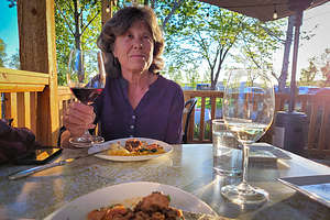 Dinner at the Hell's Backbone GrillNeedless to say, the food was delicious, the service impeccable, and the ambience lovely. I couldn’t stop feeling like we had just won the lottery.
Our perfect day concluded with a half hour of soaking our aching muscles (from our big hike) in the hot tub. It doesn’t get much better than this.
Tonight was certainly a contrast to our last 5 nights camping out in some very remote and beautiful places. However, Life is full of contrasts, and it is those contrasts that make things special. The totally different experiences of those nights in the wild and our cushy night tonight of fine dining followed by a hot tub enhanced our experience of each of them. However, I think a 6th night in the truck might have pushed me over the edge.
Cathedral Valley Loop (Capitol Reef National Park)
Sunday, May 16, 2021 - 7:00pm by Lolo140 miles and 5 hours from our last stop - 1 night stay
Travelogue
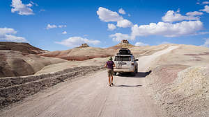 Along the Cathedral Valley LoopWhile browsing through my go-to book of beautiful places in southern Utah (“Photographing the Southwest”), I came across an area in Capitol Reef National Park that I had never heard of before: the Cathedral Valley. Perhaps that's because it’s a 4WD road, and the last time we were in Utah in 2005, we were traveling in a motorhome.
The CV Loop requires a 4WD high clearance vehicle, and it is recommended to drive the loop clockwise, so that you get the Fremont River crossing over with first to make sure it is feasible.
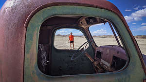 Remnants of a human presence in Cathedral ValleyAs suggested, we stopped at the Capitol Reef Visitor Center to ask about road conditions, river height, and to purchase the “Self-Guided auto-tour of Cathedral Valley.”
Once that was accomplished, we headed back east along Utah 24 for 11.7 miles to Mile Post 91, to the place where we would have to cross the Fremont River. The river looked pretty shallow, but we got out and walked it anyway to make sure. I walked to the other side of the river and filmed Herb drive the recommended 100 feet along the right shoreline and then across. Piece of cake!
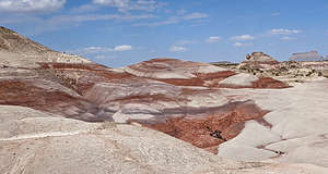 Bentonite HillsOnce across the river, we continued on Hartnet Road as it climbed past the colorful hills of the Waterpocket Fold. 200 million years ago, this area consisted of flat layers of sediment formed at near sea level. Then about 50 to 70 million years ago, tectonic forces uplifted them, forming a 90-mile massive wrinkle in the Earth’s crust, now known as the Waterpocket Fold, North America’s largest monocline.
We hadn’t had a shower in 3 days, so we drove up a wash for a mile or so, set up our helio shower, and washed 3 days of dust and dirt off of us. Now that we were clean and presentable, we continued on
 Lower South Desert OverlookAt about 6 miles into our drive, we came upon an old truck that was once used to drill a well to provide water for their cattle. It would be the only man-made object we would see along the entire drive - except for the pit toilet in the campground.
At about 9 miles from the river ford, we entered the beautiful, multi-colored Bentonite Hills, a series of rounded mounds with bands of brown, red, purple, gray, and green. Fortunately, today was a beautiful sunny day, because when it rains, the Bentonite clay absorbs the water and becomes very slick, making it very difficult to drive on.
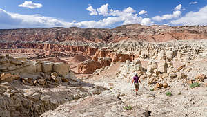
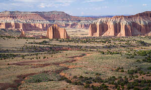 Upper Cathedral Valley14 miles from River Ford, a side road leads to the Lower South Desert Overlook, where a short walk brought us to a scenic view of the lower South Desert, a large valley that runs parallel to the Waterpocket Fold.
The whole time we were driving, we kept thinking about where we might want to camp for the night. Within the bounds of Capitol Reef National Park, camping is restricted to the one first-come, first-served primitive campground near Upper Cathedral Valley, which has only 6 campsites. We had no idea if anything would be available when we arrived there later this afternoon.
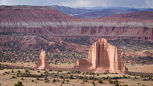 Upper Cathedral ValleyOur other, and Herb’s much preferred, choice was camping on BLM land that borders the park. For now, we just continued on our way. At about 29 miles from River Ford we had a decision to make. Should we continue straight which would bring us out of the park and into the Fishlake National Forest, where we could camp, or should we turn right and try our luck at the Cathedral Valley Campground.
We decided to try our luck, because we knew that there was other BLM land further on, if the campground was full. Well, the campground was definitely full, and a gentleman in the last campsite told us that we were the 7th car in the last half hour unsuccessfully looking for a site.
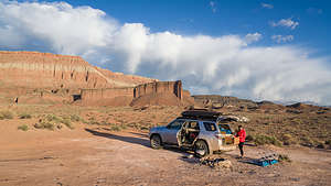 Our BLM campsite just outside the ParkThe photographer who wrote the book where I first discovered the Cathedral Valley Loop, said that he had never seen another soul in the campground. Well, he must not have been traveling post Covid vaccinations, because everyone and their uncle had now discovered the beauty of spending time in the great outdoors.
In our futile attempt to get a campsite, we had passed the turnoff for the spur road to the Upper Cathedral Valley overlook, which was supposed to be one of the highlights of the drive, so we drove back the short distance and walked out to the edge of the plateau. All I can say is “Wow!” The view of the monoliths and high walls of the Upper Cathedral Valley below us were breathtaking.
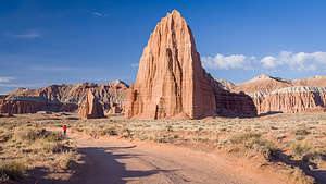 Temples of the Sun and MoonIt was getting late, so the lighting was good, but that also meant we had to find a place to camp soon. We were pretty tired - hard to believe that we had done the 7.5-mile hike to the Great Gallery just that morning. I checked the map and saw that it would be another 13 miles or so before we left the park boundary and entered BLM land again.
We skipped the turnoff for the Gypsum Sinkhole, which would have been interesting, but it was close to getting dark. We wanted to get as close as possible to the turnoff for the Temples of the Sun and Moon in Lower Cathedral Valley, so we could get there early tomorrow to catch the morning light. We found a pretty decent spot about 2 miles shy of that to stop for the night.
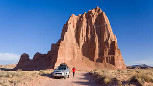 Temple of the SunFortunately, we had had a big lunch at Duke’s Slickrock Grill, which felt like a week ago, so we just made sandwiches for dinner.
The next morning we arose early to drive the two or three miles to the turnoff for the spur road to the Temples of the Sun and Moon, Cathedral Valley’s most impressive monoliths. As we approached, we could have kicked ourselves, as we came across what was an obvious BLM campsite, right at the edge of the national park boundary, very near to the two temples. I think someone had camped there though, because when we pulled into the parking lot, there were two photographers with tripods already leaving. We had just missed the best light of sunrise. We really have to learn to get an earlier start in the morning. We do sunsets much better than sunrises.
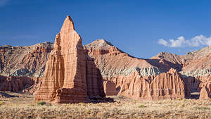 Temple of the MoonHowever, it was still pretty phenomenal. We first pulled into the turnout for Glass Mountain from which you can take a photograph with both monoliths in it. After that we drove down to their base level where we could get up to them close and personal. They are huge. The Temple of the Sun rises 422 feet and the Temple of the Moon 265 feet from the valley floor.
Unlike the monoliths we saw in the Upper Cathedral Valley, these have lost their protective gray caps of Curtis Formation sandstone. This means that they are eroding pretty rapidly, in geological terms anyway. Up close, the face of them looks a bit like flowing mud. That’s because in some way, it actually is. When there is a heavy enough rainstorm, the surface actually turns into mud and oozes down, hardening again when things dry.
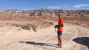 Near the end of the Cathedral Valley LoopAlthough the two Temples are the highlights of the drive, there were still plenty more beautiful rock formations as we continued along. I wish I understood geology better to understand how these beautiful mounds of white, bluish gray, and red bands had formed.
Soon enough we were back to the asphalt of Utah 24. Since we would be heading next to the Burr Trail with no grocery store along the way, we drove back to the Visitor Center to fill up our water jugs to get us through the next few days.
Horseshoe Canyon and the Great Gallery (Canyonlands National Park)
Saturday, May 15, 2021 - 11:00am by Lolo140 miles and 3 hours from our last stop - 1 night stay
Travelogue
 Hike down into Horseshoe Canyon to the Grand GalleryAfter completing three phenomenal days driving the White Rim Trail in Canyonlands, we started heading towards our next destination - the Great Gallery in Horseshoe Canyon, a detached section of Canyonlands National Park, and the site of the single greatest display of prehistoric rock art in North America, dating back to the Fremont period around 1000 BC.
When we reached the town of Green River, we stopped for lunch at Ray’s Tavern, which was pretty hopping with locals, which is usually a good sign. The Burgers and fries were good, but I have now learned to never order coffee in a tavern for lunch. I think I was probably the only one that had ordered a cup in hours - and the coffee tasted like it. Otherwise, the meal was fine, and it was good to be back, if only for a short while, in civilization again.
 Horseshoe GalleryAfter leaving Green River, we headed south on Utah 24 to a turnoff on the left about a ½ mile south of Goblin Valley State Park. From there we drove on a dirt road for 25 miles to a roofed signpost with a junction, where we bore left for another 5 miles. We then turned right and drove another 2 miles to a parking lot and a primitive campground near the top of the mesa.
There were a few cars scattered about, some day hikers and some campers. We chose a good spot at the edge of the mesa looking out at the colorful Horseshoe Canyon below.
The next morning we set off on our hike to the Great Gallery. The air was delightfully cool as we wandered along rock ledges and sand about a mile and a half down to the canyon floor. From there we continued walking up the sandy canyon, surrounded on both sides by red Navajo sandstone cliffs.
About 2 miles into the hike, we took a short spur trail on the left to the High Gallery, the first of four walls with pictographs. This particular panel had several human figures and handprints.
 Lolo approaches the Great GalleryA few minutes further, we came to a right spur trail, which led us to the Horseshoe Shelter pictograph panel, which had more drawings, including several ghost-like figures.
At 2.5 miles, we reached the Alcove Galley, which we had some difficulty finding at first. Finally we found the rather faint on the right wall, at the base of the alcove.
A little over a mile later, (out 3.7 miles from the trailhead), we arrived at the crown jewel of Horseshoe Canyon - the Great Gallery, a large and well-preserved panel of intricately beautiful human and animal figures, about 15 feet above us, stretching over 120 feet along the smooth slickrock wall. There were over 75 pictographs in shades of dark red, brown, and white.
They were painted somewhere between 2,000 and 8,000 years ago (there is still a controversy as to their age) by Desert Archaic Indians that are the ancestors of the Ancestral Puebloans.
 The Holy Ghost on the Great GalleryMost of the pictographs were life-size, ghostlike figures with large tapered torsos, and no arms or legs. They appeared weightless and floating.
My personal favorite was a 7-foot tall figure, with huge, round, empty eye sockets, known as the Holy Ghost. Like the six smaller figures around him, he too had no arms or legs. His great size definitely seemed to define him as an important figure.
Although the meanings of these drawings will never be definitively known, one theory is that the figures are depictions of shamans (religious or mystical leaders) in drug-induced spiritual states on a spiritual journey of transformation from the human world to the realm of the spirit.
 The hike out of Horseshoe CanyonIt was a spiritual experience just gazing up at them, enhanced by having to work to get to them, hiking through what was once their home.
The hike out was much hotter and since this was a hike down into a canyon, the return was mostly up. All in all, the hike was about 7.5 miles with a 1,330-foot elevation gain - but very well worth it!
After leaving Horseshoe Canyon, we drove to the small town of Hanksville where we stopped to have lunch at Duke’s Slickrock Grill. We were really getting into this midday big meal thing.
From there we continued on to Capitol Reef National Park where to do the Cathedral Valley Loop.
White Rim Trail (Canyonlands National Park)
Thursday, May 13, 2021 - 10:30am by Lolo100 miles and 13 hours from our last stop - 2 night stay
Travelogue
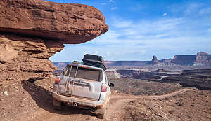 Driving along the White Rim TrailDriving the White Rim Trail has been on Herb’s bucket list since he first gazed down on its switchbacks from the canyon rim of Dead Horse Point State Park back in 2005. It’s supposed to be a phenomenal adventure - 100 miles circling around the Island in the Sky mesa, along cliff edges and past canyons carved out by the Colorado and Green Rivers.
Besides having a high clearance 4WD and some off-roading experience, you also have to have a permit from Canyonlands National Park. If you plan to do it over multiple days, you need to have an overnight backcountry permit. These can be obtained on Recreation.gov.
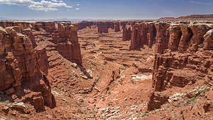 Monument Basin and the "white caps" of the White Rim TrailNormally, planning a trip along the White Rim Trail has to be done months in advance, but I lucked out finding a cancellation, first for one night at Gooseberry (30 miles in), and then later a second cancellation for Murphy Camp about 20 miles further. We were definitely happier about having 3 days to do the drive than 2. You just have to be pretty persistent about revisiting the Recreation.gov each day and seeing if anything has become available.
The direction you drive the trail in is really dependent on your campground reservations. We wanted to drive it clockwise, so we were very happy that we were able to reserve campgrounds that accommodated that.
It doesn’t get too crowded along the trail, because there are only twenty campsites - each of which allows 3 vehicles and 15 people - for a max of 60 vehicles and 300 people. However, that is if each campsite is at full capacity. We, for example, had a campsite, and we were only 1 vehicle with 2 people. Let’s just say that you feel pretty out there and alone.
Day 1 - Shafer Trail Switchbacks, Side Trip to Lathrop Canyon, and Gooseberry A Campground
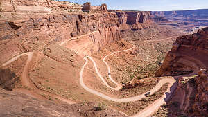 Shafer Trail SwitchbacksThe first part of the journey was a bit of a repeat for us, as we had already driven down the switchbacks a few days ago to get to Potash Road. Zigzagging down the dramatic switchbacks 1,500 feet to the junction of the White Rim Trail and Potash Road was still exciting, even the second time around.
However, this time, rather than bearing left onto Potash Road, we went right and began our journey on the White Rim Trail. From this point on, a permit was required - although no one ever checked.
The White Rim Road was originally constructed in the 1950s by the Atomic Energy Commission to gain access to the uranium deposits in the area. However, the mines didn’t produce much uranium and were soon abandoned. Today it is just used for recreational purposes.
 Musselman ArchThe road got its name from the white sandstone which comprises the rim right below the Island in the Sky mesa.
Around 9 miles into the drive we arrived ato Musselman Arch, which is a six feet wide and five feet thick 187 feet long span, 300 feet above the basin below. Walking out on it makes for a very cool photo, so I made Herb do that.
About 8 miles further, we came to the turnoff for the 4-mile (each way) side trip to Lathrop Canyon, and since we only had another 12 miles to get to our campsite for tonight, we decided to take it.
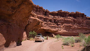 Lathrop CanyonThis was actually the most challenging part of our drive, but it did bring us down to a lovely picnic area on the Colorado River. Fortunately, our timing was perfect for grabbing the only picnic table in the shade. Of course, I had to get my bathing suit on and swim in the river. It was a little tough getting in and out, but there was a nice rock to climb onto a short distance out.
After coming back out of Lathrop Canyon, we passed the large Airport Tower rock formation where there were four campsites.
Along the next portion of the drive, the road got pretty close to the cliff ledges, but fortunately I didn’t know at the time that we were actually driving on a huge overhang with nothing but space below.
 Our Gooseberry campsiteAbout 30 miles from the start of the Shafer Trail Switchbacks (38 if you count the side trip to Lathrop Canyon), we arrived at our campsite at Gooseberry A. Since the campsites are meant to accommodate up to 3 vehicles and 15 people, they are very spacious and private. We even had a nice shade tree to park our chairs under.
Later that afternoon, two motorcycles stopped by, coming from the opposite direction we were doing the Rim in. and asked if they could buy some gas from us. Apparently, at some point during their drive, they realized they wouldn’t make the full loop and turned around. Unfortunately, we don’t carry an extra external gas can and syphoning gas out of our truck doesn’t work. So, they continued on, hopefully finding a Jeep with some external gas. Enough gas and water is something you really have to plan on before embarking on this drive.
Otherwise, the evening passed peacefully. No more cars went by and we felt like we owned the place.
Day 2 - Hike to Island in the Sky, Monument Basin, side trip to White Crack Camp, Ascending Murphy Hogback, and Murphy B Campground
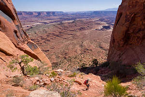 The hike down from Island in the SkyThe next morning, before leaving, we decided to hike the Gooseberry Trail, which started near our campsite and climbed over 1,500 feet up to an overlook at Island in the Sky. In retrospect, I’m not sure why we put so much effort into getting to a spot that 2WD cars drive to, but I guess it’s about the journey.
The first mile and a half of the hike was pretty flat as it followed a wash through Gooseberry Canyon. After that, for the next mile or so it began to climb quite steeply, requiring some rock scrambling and skirting a bit closer to steep drop offs than I like.
We were pretty exhausted by the time we got back to our campsite. Good thing we had less than 20 miles to drive today.
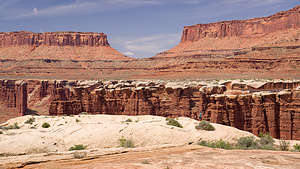 Monument BasinJust after Gooseberry we came to a very cool area called Monument Basin, where there were dozens of spires of red sandstone, capped with more resistant to erosion white tops. These white tops are the “white rim” of the White Rim Trail.
These formations are usually photographed from high above from the Grand View and White Rim Overlooks, but it was much more fun to wander near them more intimately.
After Monument Basin, we took the 1.4 mile spur road to the White Crack Camp, where there is just a single campsite. I would love to have gotten this campsite. Besides having it all to yourself, there is a spectacular view in every direction. - views of the Needles District to the south, the Maze District to the west, and Junction Butte and Grand View Point in the Island in the Sky to the north. It was absolutely lovely, so we stopped here for a picnic lunch.
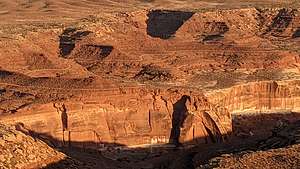 David and Goliath battle on the sandstone cliffsContinuing along our drive, the next challenge was Murphy Hogback, a steep, rocky climb, one where 4WD and high clearance is definitely required. Our campsite at Murphy B was at the top of the climb.
As with Gooseberry, it was a huge site from which we could wander around. The nearest campsite was quite a distance away on the other side of the road. It was filled with a group of mountain bikers and their support vehicles. I forgot to mention that there are probably even more mountain bikers riding the rim than vehicles. It’s quite an epic adventure that most riders do in 3 to 5 days. The record, however, is under 6 hours. I can’t even imagine how that is possible.
During the Golden Hour, we took a walk out to the rim where we could look down on the road we had climbed earlier. I also had a lot of fun photographing the shadows on the canyon walls across the way. One looked a bit like the grim reaper, but I settled into the image of David about to slay Goliath.
Then it was dinner and another lovely sunset.
Day 3- Descending Murphy Hogback, Black Crack, Holeman Slot, Hardscrabble Hill, Mineral Bottom Switchbacks, and back to civilization
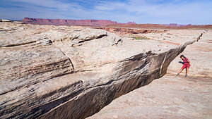 Lolo trying not to fall in ""Black Crack"The next morning we descended the back side of Murphy Hogback. Now when we looked down the canyons at the river below, we were looking at the Green River.
About 7.5 miles from Murphy Camp, we parked in a pullout and walked south about 0.1 mile to the edge of “The Black Crack,” a 3-foot-wide fissure in the sandstone that went down at least 65 feet. It was definitely wide enough to swallow a human being, so we made sure to keep our distance.
Next stop, after another 5 miles of driving, was the Holeman Slot Canyon, formed by a stream cutting into the White Rim sandstone. We went to its entrance and looked down at the smooth slopey sandstone that twisted like a corkscrew through narrow passageways. I don’t know what I was thinking when I got on my butt and slid down this smooth sandstone about 8 feet right into a puddle. I was like a cat that climbs up a tree and can’t get down, but in reverse. Fortunately, Herb followed me down and found an easier way out, or else I would still be in there.
 Driving along the White Rim TrailTen miles more and we were at Hardscrabble Hill, which was much more challenging than Murphy’s Hogback in that besides being 5 miles of extremely rocky ups and downs, it is so narrow that there are no turnouts for vehicles to pass each other - meaning that if you meet another vehicle, someone is going to have to do some hairy driving in reverse.
At the top of the hill, I got out to film Herb driving over the lip of the ledges and down the steep, narrow trail. I even captured the sound of the bottom of our truck scraping over one of those ledges.
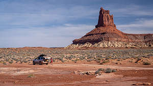 Almost doneThe rest of the drive followed the Green River closely. There were several campgrounds and picnic areas along the river, but I know from past experience that it can get really buggy near the river.
After about 30 miles from Murphy Camp we came to the Canyonlands Park boundary and began our climb up the Mineral Bottom switchbacks. Then the road got easier and after 15 miles we were back on the asphalt of Highway 313.
We had done it!
Our time in Moab was complete, so we headed north to Green River, where we stopped for lunch at Ray’s Tavern, before continuing onto our next destination - Horseshoe Canyon and the Great Gallery (see next stop).
