- Home
- About
- Map
- Trips
- Bringing Boat West
- Migration West
- Solo Motorcycle Ride
- Final Family XC Trip
- Colorado Rockies
- Graduates' XC Trip
- Yosemite & Nevada
- Colorado & Utah
- Best of Utah
- Southern Loop
- Pacific Northwest
- Northern Loop
- Los Angeles to NYC
- East Coast Trips
- Martha's Vineyard
- 1 Week in Quebec
- Southeast Coast
- NH Backpacking
- Martha's Vineyard
- Canadian Maritimes
- Ocracoke Island
- Edisto Island
- First Landing '02
- Hunting Island '02
- Stowe in Winter
- Hunting Island '01
- Lake Placid
- Chesapeake
- Provincetown
- Hunting Island '00
- Acadia in Winter
- Boston Suburbs
- Niagara Falls
- First Landing '99
- Cape Hatteras
- West Coast Trips
- Burning Man
- Utah Off-Roading
- Maui
- Mojave 4WD Course
- Colorado River Rafting
- Bishop & Death Valley
- Kauai
- Yosemite Fall
- Utah Off-Road
- Lost Coast
- Yosemite Valley
- Arizona and New Mexico
- Pescadero & Capitola
- Bishop & Death Valley
- San Diego, Anza Borrego, Joshua Tree
- Carmel
- Death Valley in Fall
- Yosemite in the Fall
- Pacific Northwest
- Utah Off-Roading
- Southern CA Deserts
- Yosemite & Covid
- Lake Powell Covid
- Eastern Sierra & Covid
- Bishop & Death Valley
- Central & SE Oregon
- Mojave Road
- Eastern Sierra
- Trinity Alps
- Tuolumne Meadows
- Lake Powell Boating
- Eastern Sierra
- Yosemite Winter
- Hawaii
- 4WD Eastern Sierra
- 4WD Death Valley +
- Southern CA Deserts
- Christmas in Tahoe
- Yosemite & Pinnacles
- Totality
- Yosemite & Sierra
- Yosemite Christmas
- Yosemite, San Diego
- Yosemite & North CA
- Seattle to Sierra
- Southwest Deserts
- Yosemite & Sierra
- Pacific Northwest
- Yosemite & South CA
- Pacific Northwest
- Northern California
- Southern Alaska
- Vancouver Island
- International Trips
- Index
- Tips
- Books
- Photos/Videos
- Search
- Contact
Gamble Rogers State Park
Sunday, August 9, 2009 - 2:30pm by Lolo214 miles and 3.75 hours from our last stop - 2 night stay
Travelogue
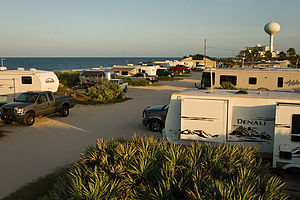 Campground View from Lazy Daze roofWhen we left Savannah on Sunday afternoon, we had no idea where we would be staying that night. It was one of the rare “wing it” parts of my itinerary. However, being the obsessive compulsive trip planner that I am, I had mapped out a list of Georgia and Florida state parks en route from Savannah to John Pennekamp State Park (our next scheduled stop), complete with park descriptions and mileage from Savannah, just so I would be prepared for that inevitable question, “Where are we staying tonight?” I had choices ranging from 20 miles to 400 miles. I was ready.
However, the list was made before I realized that the only criteria I wanted in a state park was easy beach access—not fishing, birding, historical sites, or pristine walks through marshes—just someplace to cool off. After some phone calls to the parks themselves I found out that there was really only one on my list that had a campground right on the beach, and that was Gamble Rogers Memorial State Recreation Area at Flagler Beach. Two problems: it was 215 miles from Savannah (a bit more driving than we had planned for the day), and there were only two campsites left and they couldn’t be reserved on the same day. So it became an anxious drive with me calling the poor park ranger every half hour, asking him “Is there still a campsite for tonight?”
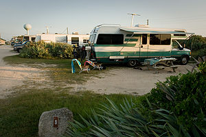 Campsite #8When we finally got there, Herb let me out at the campground gate to try to find out where to check in while he drove into the day-use section of the park on the other side of the road (Highway A1A) to turn around. Well, that turned out to be where the Camper Check-In office was, so Herb wound up going in to inquire about availability rather than me. Herb said it was pretty funny because he could see that the ranger looked a little uncomfortable at the thought of giving away what was now the last campsite to someone other than the crazy lady that had been calling him repeatedly on the phone for the last few hours. He relaxed a bit when Herb told him that his wife had called him several times about a campsite.
The campground really did have a great location, nestled between the Atlantic Ocean on one side and the Intracoastal Waterway on the other, with Highway A1A running in between. The campground was on the ocean side, with 17 campsites directly on the ocean and another 17 across from them. Unfortunately, we didn’t get one of the ones directly on the ocean, but it was still really close to go down to the beach. Meanwhile, on the other side of highway there were nature trails that the boys could go for a run on.
Since it was already close to 7:00 when we arrived, the boys immediately went off for a run, while Herb and I grabbed two glasses of wine and headed down to the beach to hang out until they returned. When they came back they were in great spirits, nothing like the cranky runners of Hunting Island. They said the trails were great and running in the evening was definitely “the ticket.” When they’re happy, I’m happy, so the next morning I went over to the office first thing and booked another night. It would leave us a lot of driving on the following day to get to John Pennekamp State Park, but I know a good thing when I see it, and this place was going to be just what we needed.
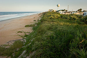 View of beach from campground bluffWe spent the entire next day at the beach, playing in the surf. The waves were much bigger than the kind I really like, because I am a bit of a weenie when it comes to ocean swimming. Usually I’m afraid to go out too far, so I stand waist-deep, looking enviously at everyone else playfully bobbing up and down beyond the break, while getting hammered in the face by these very same waves as they broke right on top of me. The boys, who are really sweet and felt badly that I was missing out on the fun, decided to take me on as their special project and give me some remedial lessons in dealing with the surf.
They introduced me to a game, which I’m sure they just made up, called “washing machine.” The rules were quite simple. The three of us—with me in the middle so I couldn’t escape—sat down in a spot where the water came up to our shoulders. Then we waited, with me clamping my nose shut, for a wave to wash over us and toss us about like laundry in a washing machine. I never had so much fun as I was flipped upside down, sideways, and every which way. Once I had rid myself of some of the fear of what a wave could do to me, they brought me out beyond the breakers, showing me along the way how to just go under a wave if it was about to break on top of me. They were quite proud of my progress.
That day was a total role reversal. As they lay on the beach trying to relax and read, I kept pestering them to come in the water and play “washing machine” with me.
Description
Gamble Rogers is located along Highway A1A in Flagler Beach, nestled between the Atlantic Ocean and the Intracoastal Waterway. The ocean side of the park has a 34-site campground overlooking the Atlantic, with a short walk along a boardwalk to the beach. The Intracoastal Waterway side has a nature trail through a coastal forest of scrub oaks and saw palmettos, a boat ramp, and picnic pavilions along the waterway.
The park is named for Florida folk singer Gamble Rogers who died while attempting to save a drowning man.
Savannah
Sunday, August 9, 2009 - 8:00am by Lolo61 miles and 1.25 hours from our last stop
Travelogue
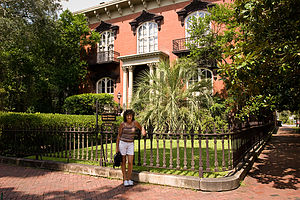 Lolo with Mercer HouseHerb is not a big fan of visiting cities in the RV, so I was very diligent in my planning so as to avoid any possibility of a cranky attack triggered by my navigating him down a narrow cobblestone street, as I once did to him in Salem, Massachusetts. Therefore, prior to our leaving home I confirmed with the Savannah Visitor Center that there was ample room in their parking lot for a motorhome and that it would be a feasible starting point for a bike tour of the city. Unfortunately, I couldn’t avoid the cranky attacks of the boys resulting from my making them bicycle around a city with temperatures in the 90s and about 100% humidity.
The visitor center supplied us with a map of the Historic District and a recommendation as to the best route by bike. I was glad to discover that Savannah was actually quite bike-friendly, which is not often the case in cities. We got to see more than half of the 24 famous squares and also spent some time by the fountain in Forsyth Park. Since I had spent a good portion of my beach time at Hunting Island cramming for our visit to Savannah by reading Midnight in the Garden of Good and Evil, I was pretty anxious to see some of the sites from the book. It makes a visit to a city so much more interesting when you come to intimately know it. Herb and the boys were not nearly as enthusiastic as I was when standing in front of the Mercer House on Bull Street, the scene of the infamous murder in the book.
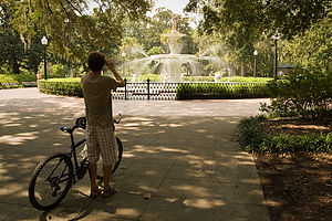 Tom photographing Forsyth Park fountainWe continued our bike tour towards the Riverfront area along the Savannah River. When we got near the river, we had to lug our bikes down a steep set of stairs near Emmet Park. Here we encountered the famous “Waving Girl” statue, which was made to honor a woman named Florence Martus. Legend has it that this woman never missed waving at a passing ship—with a cloth by day and a lantern by night—for the more than forty years between 1887 and 1931. It is said that she wanted to be the first to greet her husband when he returned to port. I find this hard to believe, but romantic none the less. I think I would have given up on Herb after 30 years of being late.
Since River Street is one-way running west to east, and Emmet Park is on the east end, we had to walk our bikes along the Riverfront. A better approach would have been to come in from Factors Walk. However, the bumpy cobblestone streets and the crowds would have made it difficult to ride anyway. The Riverfront was definitely the happening place in Savannah. The parks and squares we had visited earlier had been pretty quiet, as it was a Sunday, but there were plenty of people down by the river where old cotton warehouses had been converted to nice restaurants, shops, and art galleries.
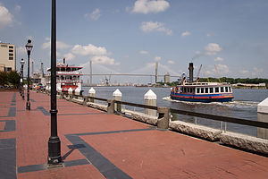 Savannah waterfrontOne of those nice air-conditioned restaurants was exactly what we had in mind about then, so after consulting our Frommer’s guide, we joined the line outside Huey’s in the River Street Inn to put our names on the list to enjoy its highly coveted Sunday brunch. The ½-hour wait was well worth it. The choice of southern-style omelettes was extensive and we each tried something fairly adventurous. The food was delicious.
After lunch we strolled along River Street peering into its many shops and galleries. One window in particular caught Tommy’s eye: the Savannah Candy Kitchen where gooey confections were being manufactured right before his very eyes, and his very sweet tooth. The rest of us were so full from brunch that we couldn’t understand how he could possibly even consider candy at this time, but he has been known to be hungry again within minutes of finishing a meal. Herb and Andrew just couldn’t face it, so I accompanied him into the store. He was like a kid in a candy shop—literally and figuratively. The store was huge and really did have some tempting items for a chocoholic like myself. Tommy is much more into sweeter things, so he finally settled on a large candy apple.
Andrew does not deal well with the heat and was getting pretty annoyed waiting for Tommy as he lingered over his sticky apple. I suggested continuing our bike tour to see more of the city, but was overridden. The consensus was to go back to the RV and get to a beach as quickly as possible.
Description
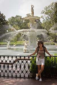 Lolo with Forsyth Park fountainThe city of Savannah is located 18 miles inland on the Savannah River at the South Carolina border.
Savannah was Georgia’s first settlement and became its colonial capital. It was founded in 1733 by James Oglethorpe who designed the city on a grid plan in which every other street had a scenic 1-acre square. There are 24 squares in total.
Today the city is considered one of America’s top 10 tourist cities. That might not have been the case if it hadn’t been for seven Savannah women who banded together in the 1950s to stop the demolition of historic buildings. They formed the Historic Savannah Foundation and began a program of purchasing historical buildings and reselling them to private owners who promised to restore them. As a result of their efforts, more than 800 of Savannah’s 1,100 historic buildings have been restored, and 2 ½ square miles of the old city have been designated a National Historic Landmark District.
The Historic District is the main draw for visitors to the city. One of the most popular areas is the Riverfront. This part of the city was once lined with cotton warehouses, but a massive urban renewal project in the 1970s converted it to a row of restaurants, bars, shops, and art galleries.
A good place to begin a visit to Savannah is the Savannah Visitor Center located at 301 Martin Luther King, Jr. Blvd.
Hunting Island State Park
Friday, August 7, 2009 - 10:15am by Lolo186 miles and 4 hours from our last stop - 2 night stay
Travelogue
 Campsite under palms at duskI know this trip was supposed to be an exploration of new places, but we just couldn’t resist going back to Hunting Island, an old favorite of ours from the days when spring breaks were not consumed by track meets. Besides, the last time we were there the boys were 11 and 13, so I am going to stretch it a bit and count their going back as 18 and 20 year olds as a totally new experience.
Hunting Island is a pretty unique place. The entire 5-mile barrier island is a state park. That means no commercialization of any sort—just pristine beaches, miles of mountain biking trails through maritime forests, boardwalks through the salt marshes, a fishing pier, and even an historic lighthouse to climb. In other words, it’s pretty close to paradise for those that prefer natural untouched beauty to fancy resorts and spas.
 Lolo & Boys getting ready to bike on beachThe campground is probably one of my all-time favorites. It’s situated right next to the beach, which is a rarity in most state parks, and gets plenty of shade from the palmetto trees. There is always a nice sea breeze and you can hear the surf from your campsite. This year we were fortunate enough to get one of the campsites just a mere 20 yards from the beach.
The beach is pretty unique as well, especially for someone coming from New Jersey. The waves are not huge, but rather the kind that seem to roll in forever, making it perfect for boogie boarding. We came very close to not packing the boogie boards at all this year. Andrew said we wouldn’t need them—I guess he thought he was too old—and Herb is always in favor of packing less. Tommy and I chose fun over practicality and packed them anyway. My feeling is that you are never too old to boogie board and I will continue to do so until I become too much of a spectacle—the boys think I’m almost there. I made Andrew suffer for awhile waiting for his chance to use the boogie board, only giving it up when he admitted that “Mom is always right.”
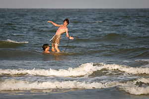 Boys goofing on boogie boardAnother unique feature of this beach is that the sand is hard enough to ride bikes on, which is really a wonderful thing. Also, there are so many fallen palmetto trees on the beach from past storms that it’s kind of fun to weave in and out of them while trying to avoid the surf.
The amount of driftwood on the beach has definitely increased over the years, but I kind of like it. It adds a lot of visual texture. It also provides some privacy if you don’t want the entire beach to see what you’re doing—no not that, I mean exercising. Herb and the boys have been doing this abdominal workout program to give themselves “six packs” and didn’t want vacation to get in the way. So, they settled between two fallen palmettos and went to work. I, however, remained in my beach chair, greatly amused at the occasional sight of their six legs rising and falling in unison above the driftwood. They looked a bit like some giant six-legged crustacean that had been left behind by the tide.
 Andrew biking under tree on beachThe next best thing after beaching and swimming on Hunting Island is mountain biking along its wonderful trails. Herb and the boys really wanted to photograph the driftwood on the beach when the sun got low, so we decided to bike the trail through the forest on our way out and then ride back along the beach. The forest trail starts right near the entrance to the campground and winds its way through a forest of oaks, pines, and palmettos. It’s really lots of fun, weaving between trees and jumping over roots. After about 2 miles we came out to the parking lot by the Visitor Center and said hello to the same lonely alligator that’s been the sole occupant of the little swamp outside the center since we started coming here 9 years ago. He appears to be aging well.
From there rather than continue through the forest, we decided to go out to the main road that crosses the island so that we could explore the salt marshes on the west side. I must say that I wasn’t very comfortable riding along the narrow shoulder of the road with cars whizzing past at 60 mph. I definitely wouldn’t recommend this route for families with small children. The salt marshes were nice though and we rode our bikes, probably against state park regulations, out across a long boardwalk to a viewing platform quite a ways out on the marsh. From there we continued on the road to the fishing pier on the southern tip of the island.
 Hunting Island Campsite with Lazy DazeThe best part of the bike ride was the ride back on the beach in the low light. I had always known that there were a few rental cabins on the south end of the island, but I had never seen them before. I admit I was quite surprised to see in what bad condition they were. The cabins closer to the water stood on stilts, but despite this precaution were pretty damaged from storms, and several of them were roped off and not currently in use. Hopefully, they will be repaired because their location is truly stunning. In the meantime, they do make great photographic subjects, as does the driftwood that covers much of this section of the beach.
On the way back to the campground along the beach, we had to do some fancy maneuvering to get through the fallen trees which the surf was now reaching, but except for wet tires we managed just fine.
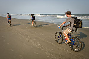 Family biking along shorelineComing back to Hunting Island had been a wonderful experience for us, bringing back some old memories while creating some new ones as well. The only possible negative I have to say about our visit to Hunting Island was the boys’ crankiness about running in the heat and humidity. I knew this trip South would be a problem for their summer training, but I figured that after running here, it would feel really good to run in New England when they got back to school—kind of like when someone’s hitting you in the head, it feels so good when they stop. I don’t think they shared my enthusiasm for this logic. It took us awhile to figure out the running thing. Knowing running mid-day would be unbearable, they decided to run in the mornings. However, their definition of morning was 9:00 pr 10:00, which was already too late. You really had to be out there by 7:00 while the sun was still low. Finally, by the time we hit Florida, they figured out that the sun was also low at 7:00 pm, so they switched their schedule to nighttime. This worked out much better except for the fact that we didn’t have dinner until almost 9:00 every night. So let’s just say, that despite the beautiful trails through the maritime forests, they do not have particularly fond memories of their runs at Hunting Island. Everything else, however, was just great.
Description
 Beach erosion with fallen palmettosHunting Island State Park is located on a 3-mile barrier island just east of Beaufort, South Carolina. It offers one of the most tropical settings to be found on the entire South Carolina coast. This 5000-acre park contains 3 miles of pristine sandy beaches along the Atlantic shoreline, salt marshes, a lagoon, and a dense forest of oak, bayberry, and palmetto. Storms have eroded much of the shoreline, bringing the lush forests closer to the sea.
A good place to begin a trip to the island is at the Visitor Center, which has exhibits on the cultural history of the island, its beach habitats, and the historic lighthouse. Right across from the Visitor Center is a small swamp where you are very likely to spot an alligator or two.
Another interesting stop is the historic Hunting Island lighthouse, the only lighthouse in South Carolina open to the public. For a $2 fee, you can climb its 167 spiral steps for a tremendous view of the Atlantic Ocean and the surrounding marshes. A unique feature of this lighthouse is that it was constructed of cast iron and designed to be dismantled and moved in case of erosion. In 1889, the lighthouse was moved 1 ¼ miles inland to its current location. The lighthouse was in operation until 1933.
 Rental cabin on stiltsFrom the lighthouse, it is a short walk to the beach where there are picnic shelters, restrooms, and a concessionaire. The beaches of Hunting Island are nesting grounds for Loggerhead turtles. Around mid-May, Loggerheads come up on the beach, dig a hole, and lay about 100 – 160 eggs each before returning to the sea. At night, Hunting Island personnel comb the beach for new nests and bring the eggs back to a hatching facility, safe from predators. After hatching, they are released to the sea.
The western part of the island contains the salt marshes, which many people believe to be the most beautiful part of the island. The Hunting Island marsh boardwalk extends across the marsh to a small island with a magnificent platform for observing the wildlife. The wildlife and the beautiful sunsets make this a lovely place to come in the evenings.
On the south end of the island, the beach is sandwiched between the ocean and a long inlet lagoon. The lagoon is home to hundreds of birds and other wildlife species—deer, raccoons, blue herons, egrets, pelicans, sand pipers, etc. It is also a great spot to crab or to fish for trout, bass, and puppy drum. The jungle-like setting of the lagoon was the filming site for the battle scenes in “Forrest Gump.”
 Palmetto Palm TreeNear the lagoon is a 2.3 mile nature trail (good for hiking or biking) that meanders through the maritime forest and along the lagoon.
On the very southern tip of the island is a fishing pier which extends 1,120 feet out into Fripp Inlet. Fishing from the pier is excellent for drum, shark, whiting, trout, and bass. Next to the pier is a Nature Center with exhibits on the local marine life. There are saltwater tanks with live snakes, turtles, and other reptiles.
On the northern tip of the island is a 200-site beachfront campground nestled amidst the palmettos. Each campsite has water and electric.
The island is totally explorable by bike. In addition to the 8 miles of trails, the sand on the beach is hard enough to ride on. From the campground, there is a 1-mile bumpy, dirt trail through a semi-tropical forest to the Visitor Center. From there, a trail continues south along the lagoon and eventually out to the fishing pier.
Flying J - Latta
Thursday, August 6, 2009 - 6:00pm by Lolo641 miles and 12 hours from our last stop - 1 night stay
Travelogue
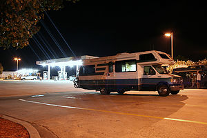 Lazy Daze Camping in Flying JI read once that smell triggers more memories than any other sense. We’ve all been transported back to our grandmas’ kitchens with the mere whiff of an apple pie baking in an oven or to days on the seashore as a kid with the first waft of salt air near the Jersey shore. Less common perhaps is my reaction to noxious fumes of diesel fuel. No matter how old I get, I am sure that a whiff of diesel and the rumble of an 18-wheeler’s generator will make me smile, because for at least a moment I will be transported back to my trusty little motorhome on its first night out on a road trip.
Our trips very often start out with a first night stay at a Flying J Travel Plaza. They’re perfect for long driving days where all you need is a safe place to sleep after a long day of driving—and they’re free. This particular Flying J in Latte, South Carolina, is one that we have often stayed at on our trips South during spring break when the kids were younger. It’s about 12 hours from our home in New Jersey, which is a long enough driving day for me, and it positions us near enough to the fabulous South Carolina coastline, so that we can arrive at our destination—in this case Hunting Island State Park—early enough to enjoy a full day.
One thing we didn’t consider in our planning, however, was that a steamy August night in a truck stop (without electrical hookup) is a lot less inviting than our previous experiences on April nights. We did manage to get through, but it did get me questioning again the wisdom of heading South in August.
Description
Flying J's are Travel Plazas that cater to truckers and RV's. Their numerous services include gas, dump station, propane, fast food restaurant, limited groceries, and even showers and a barber shop. However, the best feature of all is the section for overnight RV parking.
They are conveniently located on most of the interstates (except for the northeast).
Bryce Canyon National Park
Thursday, July 9, 2009 - 3:45pm by Tommy558 miles and 10 hours from our last stop - 2 night stay
Travelogue
Day 9
Along with Day 9 came shower number 2.
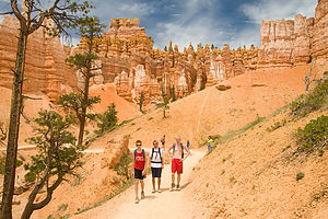 Hiking OutWe left Grand Teton around 6am to start the 10 hour drive to Bryce Canyon. For the 10 hours through Utah we basically didn’t pass another car and the only things we saw were cow’s backsides and street signs with shotgun holes through them.
We did however pass, and then stop, at the Mecca of all outdoors stores: Cabela's. Our planned short pit-stop turned into quite an event. After touring the store’s aquarium and looking through every imaginable section, we went upstairs to discover more sections and a restaurant that we continued to eat lunch at. We ended up buying a couple pair of socks, but it was a good break in the day.
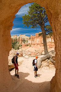 Through The WallWe also started to escape the unpredictable and cold weather of Yellowstone and the Tetons. The in-car thermometer read between 95 and 98 the whole drive.
We arrived at Ruby’s Inn (our campground) in the late afternoon and were pleasantly surprised. Not only did campground have free showers (which everyone but John utilized), but they also had an indoor and an outdoor pool with accompanying hot tubs.
I would have to guess that no one there had ever seen five teenagers from New Jersey before, because almost everyone else who was there camping in their Opera Houses (what we have nicknamed RV’s) was just blatantly starring at us while we were hanging around the campsite. It may have also had something to do with the fact that we were the only English speaking people there.
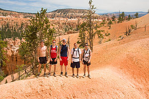 Group PictureOn our way over to the pool, John showed us that there are few things in life better than a good Speedo. Tommy packed this fluorescent orange Speedo that was made to fit what looked like a 12 year old and John wore it over to the pool. And we though people were staring earlier.
Just like the campground we were the only English speaking people at the pool and we struck up a conversation with a kid who looked about our age from France. Tommy was the translator.
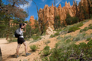 John Taking A PictureAfter we cooled off we ate at this little place they had at the campground and showered. When we got back to our site the decision was made to not set up the tent. Firstly because, Bryce Canyon is one of the best places in the country to see stars. But more importantly, we were just too lazy to want to set up and then take down our (broken) tent.
So we fell asleep, under the stars, to me giving a wonderful astronomy lesson to the crew. And we all have the amazing science department at Northern Highlands to thank for that.
Day 10
Tommy slept through the alarm so we ended up sleeping in and not getting up until 8:30.
We ate breakfast, with the same families as the day before still staring at us, and then headed off to our new campground in the Park, Sunset View. On the way in there was a “Take Some, Leave Some” table, so we grabbed a spare gas can for the car and left some Lysol wipes. (Thanks Mrs. Marotta!)
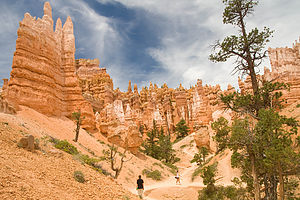 Victorias GardenInstead of doing one of the hikes that are planned and mapped for visitors, Tommy figured out a “best of” hike that traversed certain parts of a bunch of different hikes. So we kept switching trails all the way down and back up the Canyon based on which ones offered the best beginning, middle, and end.
After the hike we decided to try and sneak back into the pool that the campground we stayed in the night before offered. We were victorious. After, again, being the only English speaking people at the pool, we tried our luck again at sneaking into the showers. We got the lock combination to the bath house and we all (John included) successfully showered.
We did some more shopping and then John burned the rice for dinner, and we ended up eating pasta.
For the second night, we didn’t want to make the “tent-ball” appear again because we’re lazy, so we slept under the stars again. Unfortunately for the group, I was fresh out of astronomy knowledge from the night before.
- Jake
Description
Bryce Canyon National Park, which is located in southern Utah, is a geological fairyland, an intricate maze of wondrous shapes and formations. The oddly shaped pinnacles of rock, called hoodoos, display a mysterious blend of colors--warm yellows and oranges, and more dramatic pinks and reds--that provide a continuous show of changing colors with the rising and setting sun.
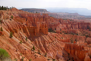 Bryce amphitheaterLike Zion National Park, Bryce is part of the Grand Staircase, which is a series of plateaus formed by the uplifting and tilting of the Colorado Plateau millions of years ago. Bryce occupies part of one of these plateaus of the Grand Staircase called the Paunsaugunt Plateau. Bryce Canyon is not really a canyon at all, but rather a series of amphitheaters cut into the Pink Cliffs of the Paunsaugunt Plateau by millions of years of erosion from flowing streams. The centerpiece of the park is the 6-mile square Bryce Amphitheater with its intricate maze of whimsically-shaped hoodoos.
The rock spires (hoodoos) are the result of erosion in rock layers that vary in hardness. When water flowed through the cracks in these rocks, the softer rock wore away leaving behind the harder, erosion-resistant caps. The ongoing cycle of freezing and thawing continues to dissolve the softer rock, constantly changing the shape of the hoodoos. This continuous erosion is also causing the plateau cliffs to recede at the rate of about one foot every 60 years.
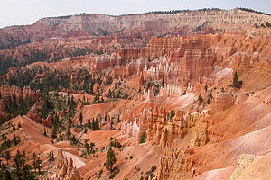 Colorful hoodoos in the amphitheaterBryce is much smaller and less intimidating than Zion and the Grand Canyon and much easier to explore. You can stand at the edge of the plateau rim and gaze down into the maze of hoodoos below or descend the trails from the rim and wander around among them. There are several good hiking trails. The Rim Trail runs 5.5 miles along the edge of the canyon, rather than taking you down into it, providing splendid views from above. Another great choice for a hike is the Queen's Garden Trail down into the canyon itself. Or if hiking isn't your thing, you can take the 17-mile scenic drive through the park, stopping at the numerous viewpoints along the way. You can either take your own vehicle or the free shuttle bus.
There are 2 campgrounds in the park. Both of them work on a first-come first-serve basis.
- Lolo
Grand Teton National Park
Tuesday, July 7, 2009 - 7:30am by Tommy109 miles and 2.5 hours from our last stop - 2 night stay
Travelogue
Day 7
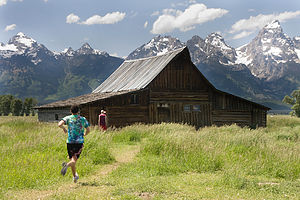 Moulton BarnWas our first of two days at Grand Tetons. It’s an amazing park. It is so close to Yellowstone, but much different and smaller so it’s not quite as overwhelming.
We arrived late morning and choose to check out some of the viewpoints instead of setting up camp right away. We headed to the Oxbow Bend, Jenny Lake, and Cathedral Group Turnout along with a few others.
We stopped at the Cottonwood creek picnic area for some lunch, and then headed right down to the river to check it out. It turned out to be some great swimming. It was very cold, but still fun. We body surfed/floated down the rapids for most of the afternoon.
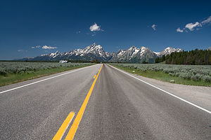 Road up to TetonsWhen we dried off and warmed up we headed to where Ansel Adams took the famous “Snake River and the Tetons” picture so Tommy and John could get their own versions.
After picture taking we set up camp in the Gros Ventre campground, made dinner, and went to the Snake River Overlook to watch the sunset.
When it got dark we went into Jackson to do some food shopping. John led us on an “interesting” way home, and by the time we got back to the tent it was really late.
Day 8
We woke up with the sun again so that we could head over to the very crowded, very popular, very nice Jenny Lake Campground. We picked out our spot and self-registered.
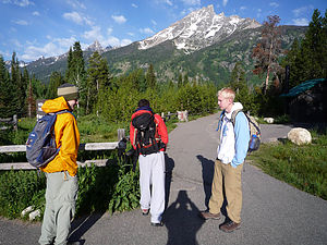 Setting Out From the CarAfter camp was set up we drove over to the Jenny Lake Ferry so we could get over to the start of our hike for the day: Cascade Canyon. It was absolutely stunning. It’s hard to say which was better: Mt. Washburn (Yellowstone hike) or Cascade Canyon because the two were so different. Mt. Washburn was simply a hike up the mountain and the views just kept getting better and better the higher you went. Cascade Canyon was a trail through a canyon in Teton park and followed the Cascade River.
We got to the 9 mile fork in the trail and instead of heading the extra 5 miles to Lake Solitude, a threat of thunderstorms made us stop there so we weren’t stuck atop a mountain during the monsoon.
It never rained.
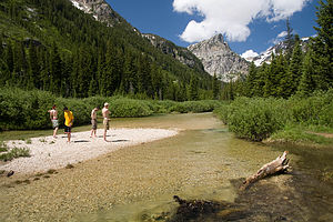 Our Little IslandBut we still have no regrets with our decision to stop where we did. Instead we took our time on the hike back and stopped to spend some time by the river. We saw a little rock island in the middle of a relatively wide section and left out gear and our shoes on the shore to wade through the glacial waters to the island. We estimated that the water was about 40 degrees, and then decided to go swimming. The water wasn’t deep enough and the current wasn’t strong enough to ride the rapids down like the Cottonwood Creek the day before. But the water temperature made it so we could only stay in for about 10 seconds at a time. Through the freezing water and the strange looks we got from passing people on the trail, it was a great time.
The only negative part of the trail was how crowded it gets in the beginning. One of the biggest tourist attractions, Inspiration Point, is only a mile down the trail. So basically every grandparent, parent, child and infant who enters the park, goes to see it. Luckily for us we got one of the first couple ferry’s across the lake in the morning and the trail was empty when we started the hike. But when we headed back down the trail, our last mile (the mile between the beginning and Inspiration Point) was so packed that we couldn’t wait to get to the end.
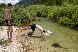 John Diving Into Glacial RunoffNow remember from the Badlands post, we have no tent stakes. So we arrived back at our campsite only to find no tent. It had been blown about forty feet from its original spot and was flat as a pancake. We picked it up only to realize that it broke. It’s very difficult to describe how it broke, but long explanation short, our tent normally has four main poles. When we set it up it only has three now. But morale remained high and we bought some stakes.
We went back to Jackson to walk around a little bit and eat dinner. We told some strange lady who runs an art gallery in Jackson that we were basically broke and asked where we should eat. She recommended this “world famous” burger place, “Billy’s Famous Burgers.” So we went. Now I don’t know if it’s actually world famous, but it was delicious. And we met some sweet vagabond who hitchhikes his way around the country and plays the accordion.
We were then going to hit up a biker bar for some free music and go crusin’ for chicks, but we went back to our tent, made a fire, and I gave the group an astronomy lesson. They can all thank Mr. Cimmino for my vast knowledge in the field.
- Jake
Description
Grand Tetons National Park's 485 square miles encompasses the Jackson Hole Valley and the Teton Mountain Range which towers 7,000 feet above the valley floor. Although the park is best known for its three most prominent peaks, the Grand, Middle, and South Tetons, there are other equally spectacular mountains in the Teton Range, 12 of which are higher than 12,000 feet.
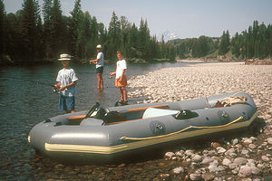 Herb and boys fishing for trout on the Snake RiverAt the base of the mountains lies a string of 7 glacier-carved lakes, fed by mountain streams. Beyond the lakes lies the beautiful Jackson Hole Valley with 50 miles of the Snake River winding through it. The wetlands along the braided sections of the river provide a rich habitat for wildlife, such as moose, elk, pronghorn, bison, black bear, deer, bald eagles, blue herons, river otters, and even pelicans.
Most of the major observation points and attractions can be seen from the Teton Park and Jenny Lake Loop Roads, which meander 25 miles along the Jackson Hole Valley from Moran Junction to Moose Junction, providing spectacular views of the Tetons along the way.
The 4-mile paved Signal Mountain Summit Road climbs 1,000 feet to the summit of Signal Mountain, where there is a tremendous 360 degree panoramic view of the Tetons and Valley below. A mile before the summit is the Jackson Lake Overlook, from which William Henry Jackson took his famous photographs of the Grand Tetons. Unfortunately, the Signal Mountain Summit Road is so narrow and windy that RV's are prohibited.
The one-way scenic drive on the Jenny Lake road along the shores of the lake brings you to one of the busiest and most popular sports in the park. A very popular hike from this area is the Cascade Canyon Trail to Hidden Falls and Inspiration Point. To get to the trailhead you can either walk the 2.5 miles around the southern end of the lake or take the shuttle boat, which runs every ½ hour, across to the West Shore Boat Dock. From there, the fairly strenuous trail climbs 420 feet over one mile. At the ½ mile point is Hidden Falls, one of the most beautiful spots in the park. A ½ mile further is the aptly named Inspiration Point with a spectacular view of the lake, surrounding mountains, and the valley. If you wish to continue further, the trail levels out after this point and the views get even better. On the way back, you have the same choice of hiking the lakeshore or taking the shuttle boat.
- Lolo
Yellowstone National Park
Sunday, July 5, 2009 - 9:30am by Tommy60 miles and 1.5 hours from our last stop - 2 night stay
Travelogue
Day 5
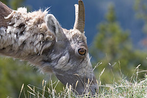 Bighorn on Mount WashburnIf only for one reason, was a success simply because we all got to shower. It did cost us $3.25 each (it wasn’t included in our campground fee) and John almost didn’t shower based on principal. He finally decided that it was worth the price.
Even though we hardly slept the night before because it was so cold on the Beartooth Highway, we got up early so we could finish the drive to Yellowstone and check in to our campsite at the Canyon Village before lunch.
We entered the park through the Northeast entrance and saw some great wildlife (Bison and Pronghorn Antelope) while driving through Lamar Valley.
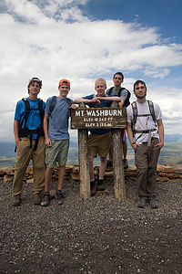 Group Picture on Mount WashburnAfter lunch we hiked up the Dunraven Pass up Mount Washburn. The hike was great, and the views all the way up were outstanding, but about a half mile from the top we turned a corner and a herd of Big Horn Sheep were walking up the path. We had to slowly follow them up the rest of the hike(about 20 feet back) because a first attempt at passing angered a few of them and they backed us down the mountain a little. It was cool to watch and created some great photo opportunities for Tommy and John, but slowed our pace to the point that we had to really hurry down the mountain to beat the thunderstorm that was coming.
We beat the rain, which pretty much blew over the park, and did some quick food shopping at the Canyon Village food store before dinner.
After we ate we took a short drive over to see the sunset over the Upper and Lower falls of the Yellowstone River. The falls were great and over the years the river has formed a small canyon which has been named The Grand Canyon of Yellowstone.
We then got back to our tent and pretty much just passed out for the night.
Day 6
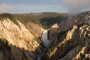 Grand Canyon of YellowstoneTommy and John decided that the sunset last night over the Upper and Lower falls simply didn’t create enough photo opportunities, and they got up around 5:30am to catch the sun rise over the falls. Christian, Colin and myself decided we would sleep the extra couple hours.
After breakfast we drove the scenic loop for the day to see the Park’s “highlights.” The major draws were the geysers and thermal pools that are throughout the park. And boy there is nothing like the fresh smell of sulfur in the morning.
A couple of group favorites were the Castle Geyser and, of course, Old Faithful along with the rest of the upper geyser basin area. We tried climbing up to the Old Faithful look-out area, but it decided that it would erupt 15 minutes earlier then predicted so after the climb, we missed it. Instead of waiting up there for an hour and a half until the next eruption, we walked around the rest of the Basin area and watched from the ground. As for thermal pools, the Black Sands Basin was a particular stand out.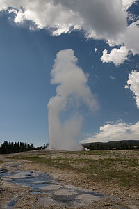 Old Faithful
Another great thing that the driving loop allowed for was seeing some amazing wildlife. We saw a ton of elk and Big Horn sheep. We even saw even saw a couple of elusive moose in the park. At one point bison were so close to the road that we could reach out and touch them—we opted not to.
Later in the day we wanted to try out some swimming at a place Tommy had heard about. He wasn’t positive if swimming in the area was “allowed” because he had heard about it through the grapevine. It was supposedly some sort of thermal pool that was cool enough to swim in. We headed to the area that he believe it was at and we thought we were in luck. But unfortunately, the Firehole River swimming area was closed because the water level was too high creating too strong of a current.
We then made some dinner and just relaxed by the campsite for the rest of the night..
- Jake
Description
Yellowstone National Park, in the northwestern corner of Wyoming, is literally like no other place on earth. It has more thermal springs and geysers than the rest of the world combined. Most of the southern part of the park lies on top of a collapsed crater, or caldera, that resulted from a devastating volcanic explosion around 600,000 years ago. It is within this caldera that most of the thermal activity--geysers, boiling hot springs, fumaroles, etc.--in Yellowstone occurs.
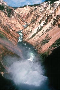 Grand Canyon of the YellowstoneHowever, the park is not just geysers. There is a canyon almost on par with the Grand Canyon, a waterfall taller than Niagara Falls, a lake that is the largest mountain lake in North America, and an incredible amount of wildlife to see. In order to protect these treasures, President Ulysses S. Grant made it the first national park in the world in 1872.
A 142-mile Grand Loop Road winds in a figure-eight pattern through the park, past most of the main attractions, including the wildlife. It is not uncommon to have traffic jams caused by a buffalo herd crossing the road or gridlock from people stopping their cars to observe a grizzly bear. Unfortunately, being such a popular destination, Yellowstone is extremely crowded in the summer causing much traffic congestion. Therefore, it's best to do your sightseeing early in the morning or late in the afternoon. Starting from the north and going clockwise, these are some of the highlights:
Mammoth Hot Springs, located by the north entrance to the park, has one of Yellowstone's most unique features--the beautiful white limestone terraces that are continuing to be formed by the constant flow to the surface of the mineral-rich hot springs below. The 1 ½ mile roundtrip Lower Terrace Interpretive Trail is the best way to see this area. It climbs 300 feet through a thermal region to the Upper Terrace, where you have an outstanding view of the terraces and springs below.
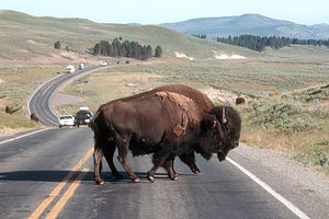 Bison crossing the roadThe Grand Canyon of the Yellowstone is a narrow canyon with 1,000-foot-high cliffs plunging down to the Yellowstone River gorge. An excellent way to view the canyon is to take the North Rim Drive from Canyon Village, stopping at Inspiration Point. From here there is a fairly strenuous descent down 57 steps to an overlook with views of the Lower Falls and canyon. Another option to view the canyon is the South Rim Drive. Along this drive is Uncle Tom's Trail, a steep 328 steps descent to the river's edge, and Artists Point, one of the best viewpoints of the canyon.
Hayden Valley, along the park road between Canyon Village and Yellowstone Lake, is one of the best places to see wildlife. In the beautiful green meadows of the valley there are herds of bison and antelope, often blocking the road, and the occasional grizzly bear.
Yellowstone Lake is North America's largest high-altitude lake. It also contains the continent's largest population of native cutthroat trout, which makes it a very popular place for fishing. Although the waters of the lake are too cold to swim in, it is great to explore by boat. Along the northwest shore of the lake stands the majestic 100-year-old Lake Yellowstone Hotel, one of the most beautiful buildings in the park. Lodging and dining are available there.
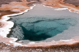 Midway Geyser BasinOld Faithful is what everyone thinks of when they hear Yellowstone National Park. The geyser got its name Old Faithful because of the predictability of its eruptions--approximately every 79 minutes. A typical eruption lasts from 2 to 5 minutes during which the water reaches heights of up to 180 feet. There is always a large crowd on the benches outside the Old Faithful Inn when it is time for it to erupt. A good way to see the other geysers in this area is to walk the 1.3 mile Upper Geyser Basin Loop trail or climb the .5 mile Observation Point Trail up to an area with great views of the entire geyser basin. The historic Old Faithful Inn is a must see. It is a six-story log building with sitting areas overlooking the lobby and a three-story stone fireplace.
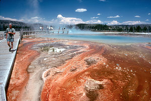 Midway Geyser BasinNorris Geyser Basin contains the park's highest concentration of thermal features. There are two loop trails here, both on flat boardwalks: the .75-mile Porcelain Basin Trail and the 1.5-mile Back Basin Loop, which takes you past Steamboat Geyser, the world's largest geyser. Unfortunately, the interval between its eruptions is often more than one year.
There are 12 campgrounds throughout the park. However, since Yellowstone is so highly visited, it is a good idea to make reservations well in advance. The only campground in the park with RV hookups is Fishing Bridge at the north end of Yellowstone Lake..
- Lolo
Beartooth Highway
Saturday, July 4, 2009 - 4:15pm by Tommy560 miles and 9 hours from our last stop - 1 night stay
Travelogue
Day 4
We woke up on Day 4 to what has been a very familiar sight on the trip so far: rain. But luckily it wasn’t long after we left the Badlands until we hit some nicer weather.
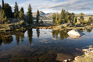 View From CampsiteBecause of the rain and infamous Badlands mud we opted not to stay and cook breakfast, but to just pick up something on the drive. We had to get gas at a truck stop in the-middle-of-no-where, South Dakota and we all enjoyed Subway sandwiches at about nine in the morning for breakfast.
We had then been truckin’ along when our directions had us pull off the highway and go through Belle Fourche, South Dakota en route to the Bear Tooth Highway. Belle Fourche was a very nice town, but unfortunately for us it was the Fourth of July. And Belle Fourche has a parade through the towns’, essentially, only road. And luckily for us, we didn’t find out until we were right in the middle of that road, and they stop traffic, where ever it happens to be, for the duration of the parade. So not only did we get front row seats to the parade (the car was literally parked right in the middle of the road that the parade was coming down) which puts Upper Saddle River’s Memorial Day Parade to shame, but we also lost about two hours of travel time.
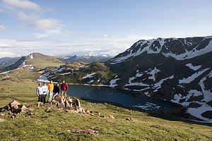 Group Picture on Beartooth PassWith our entrance into Big Sky Country, Montana we found ourselves fighting with the gas gauge and pulled off into Broadus Montana to fuel up. The gas pumps again were older than carbon but our previous experience using very similarly outdated equipment led us through to a successful fill-up. We pulled out of the station and stared heading back towards the highway when John, who was driving at the time, looked in the rear-view mirror and said, “Is that for us?” Everyone looked back and saw the flashing lights pulling us over. We got a speeding ticket for doing 50mph in a 40mph through town. We decided to plead guilty, pay the fine, and not attend out July 14 court date. We shrugged it off and moved on.
About two hours later, still in Montana and with John still behind the wheel, it was de ja vu. The flashing lights, us being pulled over, the ticket (85 in a 75), the whole deal. So that made two tickets in two hours (both in Montana), both for doing a lousy ten miles an hour over the speed limit. And for the second one cruise control was set at 80. I guess we were just paying the price for being New Jerseyians in Montana, literally.
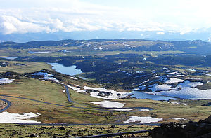 Winding RoadFinally, we made it to our destination, the Bear Tooth Highway, which snakes through parts of Montana and Wyoming, is so high that we were driving through clouds and past snow drifts on the side of the road. Now although I can’t speak for everyone, the various views from this road were the most majestic and beautiful things I have ever seen. And although Tommy and John are both great photographers I don’t think that any picture could ever substitute for seeing it all in person.
Our plan was to continue as far on the road as we wanted until we saw a campground that we could stay the night in. It was getting dark when we spotted a prospective site and headed over to check it out. We thought about heading farther to find a site that was a bit more populated (we were the only people at this one), and maybe a little less secluded because we were right in the middle of Grizzly Bear country with no cell service and were tens of miles from any sort of civilization. But while we were checking out the prospective site we got a tip from some locals that all the larger campsites farther down the road were full. So instead of driving more to a probably full campsite and then having to set up camp in the dark, we decided to try our luck where we were.
Other than the fact that it probably got below freezing and our tent was still soaked from the night before in the Badlands, it wasn’t a bad night.
- Jake
Description
A Narrative of general information would go here.
Home
Sunday, May 2, 2004 - 12:00pm by Lolo380 miles and 7 hours from our last stop - 1 night stay
Travelogue
I felt pretty satisfied. We had made the most of our abbreviated Spring Break. We had discovered some new places (some planned and some unplanned) and spent some time with some very dear old friends. Now we were recharged and ready to get back to the business of normal life.
Description
Our home in Upper Saddle River, a suburb of New York City.
Friends' House in Virginia Beach
Friday, April 30, 2004 - 8:00am by Lolo168 miles and 4 hours from our last stop - 2 night stay
Travelogue
This was not our first time to Virginia Beach. In fact, we had spent several vacations at First Landing State Park, right on the Chesapeake Bay overlooking the Bridge. However, this time we had come to visit our friends who had recently moved to a house right on one of the lagoons that lead out to the Chesapeake. So rather than stay in our usual State Park, this time our campground would be their driveway. It’s always a nice bonus when our travels take us to places where we can visit old friends.
Most of the time was spent just catching up on old times, but we did take a ride on their boat, which they kept right at the dock in front of their house. What a great setup to be able to just hop on your boat in your own backyard and cruise out to either the Chesapeake Bay or all the way out to the Atlantic Ocean.
Description
Friend's house along a lagoon in Virginia Beach
