- Home
- About
- Map
- Trips
- Bringing Boat West
- Migration West
- Solo Motorcycle Ride
- Final Family XC Trip
- Colorado Rockies
- Graduates' XC Trip
- Yosemite & Nevada
- Colorado & Utah
- Best of Utah
- Southern Loop
- Pacific Northwest
- Northern Loop
- Los Angeles to NYC
- East Coast Trips
- Martha's Vineyard
- 1 Week in Quebec
- Southeast Coast
- NH Backpacking
- Martha's Vineyard
- Canadian Maritimes
- Ocracoke Island
- Edisto Island
- First Landing '02
- Hunting Island '02
- Stowe in Winter
- Hunting Island '01
- Lake Placid
- Chesapeake
- Provincetown
- Hunting Island '00
- Acadia in Winter
- Boston Suburbs
- Niagara Falls
- First Landing '99
- Cape Hatteras
- West Coast Trips
- Burning Man
- Utah Off-Roading
- Maui
- Mojave 4WD Course
- Colorado River Rafting
- Bishop & Death Valley
- Kauai
- Yosemite Fall
- Utah Off-Road
- Lost Coast
- Yosemite Valley
- Arizona and New Mexico
- Pescadero & Capitola
- Bishop & Death Valley
- San Diego, Anza Borrego, Joshua Tree
- Carmel
- Death Valley in Fall
- Yosemite in the Fall
- Pacific Northwest
- Utah Off-Roading
- Southern CA Deserts
- Yosemite & Covid
- Lake Powell Covid
- Eastern Sierra & Covid
- Bishop & Death Valley
- Central & SE Oregon
- Mojave Road
- Eastern Sierra
- Trinity Alps
- Tuolumne Meadows
- Lake Powell Boating
- Eastern Sierra
- Yosemite Winter
- Hawaii
- 4WD Eastern Sierra
- 4WD Death Valley +
- Southern CA Deserts
- Christmas in Tahoe
- Yosemite & Pinnacles
- Totality
- Yosemite & Sierra
- Yosemite Christmas
- Yosemite, San Diego
- Yosemite & North CA
- Seattle to Sierra
- Southwest Deserts
- Yosemite & Sierra
- Pacific Northwest
- Yosemite & South CA
- Pacific Northwest
- Northern California
- Southern Alaska
- Vancouver Island
- International Trips
- Index
- Tips
- Books
- Photos/Videos
- Search
- Contact
Beluga Point / Turnagain Arm
Tuesday, July 18, 2006 - 10:30am by Lolo281 miles and 6 hours from our last stop
Travelogue
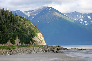 Turnagain ArmSouth of Anchorage, the Seward Highway traces the north shore of the Turnagain Arm and becomes incredibly scenic. If you are fortunate, you'll time your drive to coincide with one of the phenomenal bore tides, in which an 8 foot wall of water rushes in from Cook Inlet covering the exposed mudflats at a speed of 10 mph. Unfortunately, our timing was not so good, but we did get to see it at low tide right before sunset, which was a pretty spectacular sight as well. Herb and the boys must have spent close to an hour photographing the flats.
Description
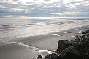 Turnagain Arm mud flatsThe drive along the Seward Highway from Anchorage to Portage traces the north coast of Turnagain Arm. The Turnagain Arm got its name from Captain James Cook in 1778 when instead of finding the Northwest Passage, he was forced to "turn again" when he hit a dead end.
There are many scenic turnouts along the stretch from Milepost 115 to 90. Beluga Point at Milepost 110.4 is one of the best of them. It's called Beluga Point because it's a great place to see the beluga whales chase the salmon into Turnagain Arm in late May and late August.
Turnagain Arm is also known for its phenomenal bore tides. When the incoming tide flows from Cook Inlet into the much shallower and narrower Turnagain Arm, a wall of water as high as 8 feet tall and ½ mile wide across comes surging into the Arm at a speed of 10 mph. The bore tide is best seen between Girdwood and Beluga Point about 2 hours after the Anchorage low tide.
Warning: It is extremely dangerous to wander out onto the mud flats at any time because the mixture of silt and mud acts as a kind of quicksand.
Homestead RV Park
Saturday, July 15, 2006 - 1:30pm by Lolo42 miles and 1 hour from our last stop - 1 night stay
Travelogue
About 35 miles north of Anchorage, we found a pleasant campground overlooking the Matanuska Valley. The views were lovely, even at 10 o'clock at night, as the sun didn't set until well after midnight. In fact, during out entire trip, I can count the times we saw darkness on one hand.
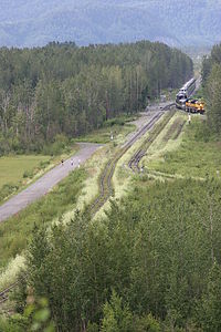 Boy's running in valleyHerb and I strolled a short distance to a picnic area overlooking the valley and had a glass of wine. As I watched a freight train pass below us through the picturesque valley, I felt quite peaceful and relaxed, despite our long day. I knew I was going to love Alaska.
The next morning before departing for Denali, the boys and I decided to go for a run. Herb, my usual trusty running partner, was still suffering from a pulled hamstring, so I had to go it alone--the boys were just too fast for me. Finding places to run was going to be a challenge for us this trip. Both boys are training for their cross country season and have to get lots of mileage in each day. The problem was that bears are very common in Alaska and they tend to view running mammals as prey. This decision of where and when to run would be the source of some tension during this trip as Andrew wanted to run no matter where he was and Tom, always the more prudent one, often felt it just wasn't worth the risk. Herb and I weren't about to put them in any danger, so we always tried to gain some local knowledge about if and where it would be safe to run. Tom, however, still questioned our parenting and Andrew's sanity.
In any case, the campground manager assured us that this area was not one frequented by bears. The boys and I initially set out together and found ourselves down in that valley that Herb and I had looked down upon the night before. In fact, we could see Herb up above in the picnic area with his tripod and camera pointing down at us. He got some good shots of the boys running together with me huffing and puffing about 100 yards behind.
Before leaving, we took advantage of what the campground manager claimed to be "the cleanest campground showers in Alaska." I think he was right.
Description
64-site Good Sam campground in a beautiful, wooded setting overlooking the scenic Matanuska Valley. Has the "cleanest bathrooms in Alaska," showers, laundry, and jogging trails.
Great Alaskan Holidays RV Rentals
Saturday, July 15, 2006 - 8:00am by Lolo0 miles and 0 hours from our last stop
Travelogue
It was a very long day, as we knew it would be, but we had nothing to complain about--our flights were smooth and on-time, none of our luggage was lost, and we were promptly picked up at the airport by a friendly employee of Great Alaskan Holidays.
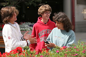 Lolo and boys waiting for pickup at the airportGreat Alaskan Holidays turned out to be as efficient and quality-run as we had hoped it would be. I wouldn't expect anything otherwise. Herb does not do anything without researching it to the fullest, and his inquiries among various RV groups had all pointed to using this organization.
After watching the obligatory 45-minute video on our motorhome (which actually was quite informative), we were given the keys to our 2006 Winnebago and sent on our way. The only extras we asked for were a BBQ, for an additional $18, and a toaster for $5. Everything else--linens, towels, pots and pans, plates, glasses, and utensils, coffeemaker, etc.--was included.
From Great Alaskan, out first stop was food shopping at a Fred Meyer's (similar to a Wal-Mart Supercenter) about 2 miles away. We were so tired and hungry at this point that we went right to the deli, ordered some dinner, and ate it right at dining area there. Now we were ready to get down to some serious food shopping. I always find this part of the trip stressful. It's difficult enough trying to figure out everything you need for the next 4 or 5 days, but it's even worse when you're dealing with an unfamiliar supermarket. We must have run back and forth through each aisle at least 3 times. However, the pleasant surprise was that all the rumors that food in Alaska was so expensive didn't appear to be true. In fact, the prices didn't really seem that much different from back home. Our friends, who were meeting us in a few days, were shipping out a cooler full of meat for this very reason, but it really wasn't necessary after all.
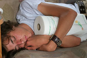 Tired Andrew post travel with paper towelsOne thing I must say about the Winnebago vs. the Lazy Daze is that there is plenty of storage in the bottom compartments. I could have stored enough food there to last the whole 2 weeks. However, there is a price to pay for all that storage. Our Lazy Daze is much more stable, low to the ground, and smoother riding. For now though, I was really grateful to have all that space.
Fully loaded with supplies to last us the next couple of days, we headed north out of Anchorage on the Glenn Highway (Route 1) to look for a place to spend the night.
Description
Great Alaskan Holidays is one of the largest motorhome rental companies in Alaska. It has a large fleet of slide-out and conventional class C late-model Winnebagos which they rent from April 1st to October 5th. Their rental fees are among the lowest in Alaska, and they also offer the greatest number of free essentials, such as housekeeping and linen packages, brand name cookware, color TV/DVD players, lawn chairs, unlimited use of power generator, free cleaning and dumping of holding tanks upon return, and complimentary airport pickup.
They are located at 9800 Old Seward Highway about halfway between Diamond Blvd. and O'Malley Road in Anchorage.
Home
Wednesday, August 3, 2005 - 10:00am by Lolo378 miles and 6.5 hours from our last stop - 1 night stay
Travelogue
Well we made it home safely--exactly 3 weeks on the road. As always, it had been a truly wonderful and priceless experience. I'm not so sure I'm ready for it to be our last long trip with the kids. We'll have to rethink this one carefully.
Description
Our home in Upper Saddle River, a suburb of New York City.
Fallingwater
Tuesday, August 2, 2005 - 6:30am by Lolo300 miles and 6 hours from our last stop
Travelogue
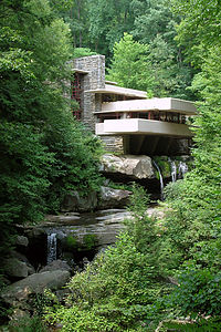 FallingwaterAs we continued our journey east, Herb asked the question that he always seems to ask when we enter Pennsylvania--"Why haven't we been to Fallingwater?" He followed this question with an accusatory look, implying that I am somehow to blame for this void in his travel experiences. Since I'm the one that plans the trips, I guess he had a point. I quickly looked through the piles of guidebooks we had along, but couldn't find anything about it--it's times like these that I really wish we had Internet access in the RV. However, since we didn't, I did the next best thing. I called a friend back home and got information on tours and most importantly, a phone number for reservations. Fortunately, we were able to book a tour for later that afternoon.
For those not familiar with Fallingwater, it's Frank Lloyd Wright's famous house built on top of a waterfall. The house was built for the Edgar J. Kaufmann family (of Kaufmann furniture fame) back in the 1930s. Members of the family lived in it until the 1960s, after which it was given to the Western Pennsylvania Conservancy to maintain and manage. Today it is open to the public for tours, and it is definitely well worth it.
We arrived about an hour early for our tour, so we spent the time wandering the lovely grounds over towards the viewpoint of the house below the waterfall. Unfortunately, photographing the house wasn't as good as we had hoped. The waterfall over which the house was built was barely flowing because of the summer-long drought that had hit most of the east coast, and there were workmen clambering about on ladders along the upper terraces smack in the middle of our pictures. So like all photos must, we captured the reality of the moment--or at least, that's how things used to work. We might have captured workmen on ladders, but Herb made them disappear with the wonderful technology of Photoshop. Unfortunately, he couldn't do much about the waterfall. That would be too much cheating.
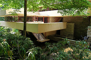 FallingwaterFallingwater was truly unique. The most notable feature was a series of cantilevered balconies protruding from every side and level of the house. Since there was no visible support, they seemed to just magically extend from the walls of the house. Frank Lloyd Wright believed in organic design, which meant that he wanted the structure to blend in and be a part of its surrounding environment. To accomplish this he used sandstone quarried right on the property so that it matched perfectly with the surrounding stone. Also the horizontal ledges of the balconies mimicked the rock ledges behind it. It reminded me of the way that some of the best National Park lodges (like Yellowstone, the North Rim of the Grand Canyon, and the Awahnee in Yosemite) also seem to be extensions of their surroundings rather than intrusions on it.
When the time came for our house tour, we were escorted by our very pleasant and knowledgeable tour guide into the home along with about 12 others--a very reasonably-sized group. Herb had to reluctantly part with his video camera at the entrance as no photography, either still or video, is allowed on this tour. There is another more in-depth 2-hour tour that does allow still photography.
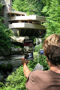 Tommy photographing FallingwaterWe immediately fell in love with the interior of the house, which didn't really feel like an interior at all, but rather, once again, an extension of the rocks and woods around it. The colors in the house were all earth tones. The floors were made of polished stone, like the stone surrounding the house. The hearth of the large fireplace in the living room was actually a boulder which protruded into the house. Most of the walls to the outside were made up of large casement windows so that there was always a great view outside. Also, every room lead out onto one of the large cantilevered balconies so there was always easy access to the outdoors. My personal favorite was the staircase leading down from the living room to a small platform on the stream, from which you could take a dip in the very cool waters. Everything about this house was a nature lover's paradise. It must have been an amazing opportunity for the Kaufmann's to have lived in it.
Before leaving, we stopped in the gift shop to see if we could get a hat pin to add to our collection. We soon found that this was no mere tacky gift shop, but an impressive museum shop filled with collectibles relating to Frank Lloyd Wright or Fallingwater in some way. There were beautiful lamps, dishes, clocks, furnishings, jewelry, etc. There wasn't a snow globe to be found.
Our last highlight at Fallingwater was found in the restrooms. As we sat on the benches outside the museum shop, a noise very much like that of a jet engine would periodically emanate from the restroom, followed by a person walking out of the door. After this pattern repeated itself about half a dozen times, the boys just had to have a look-see. What they discovered inside was a very powerful, turbo-charged hand dryer that actually dried your hands without having to wipe them on your pant legs. During their absence, Herb and I heard the roar of the jet engines going off again and again and again with no one exiting in between. Gee, I wonder why.
Description
Frank Lloyd Wright's Fallingwater is one of the most famous works of architecture in the United States. Wright designed it in 1935 as a vacation home for the Edgar J. Kaufmann family. In designing their home, Wright tried to satisfy the Kaufmann family's love of nature by building the house directly over the waterfall and stream on their property in Mill Creek, Pennsylvania. It is a masterpiece of modern architecture and a symbol of the importance of living in harmony with the natural world.
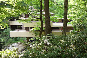 FallingwaterFrank Lloyd Wright is considered one of the greatest architects of the 20th century. However, his unique and non-traditional style, which you can see in the design of Fallingwater, also made him one of the most controversial. Wright believed that a building should not be a static structure, but rather a dynamic one that relates to its natural surroundings. This principle, which is known as organic architecture, tries to promote the harmony between man and nature by having the building and its furnishings blend in with its surroundings.
Fallingwater not only blends in, but it almost seems to mimic its surroundings. The series of horizontal balconies protruding from it appear to be extensions of the rock ledges around it. Also the materials from which the walls were constructed were Pottsville sandstone quarried right on the property. This was the same type of sandstone as the rock ledges surrounding the house, making it blend in even more perfectly.
Interestingly, the balconies seemed to just magically extend unsupported from the walls of the house, like a series of trays. Wanting to avoid vertical supports, Wright used a technique known as cantilevering, in which the balconies were only supported on one end--the wall of the house. There are several of these balconies at different levels and orientations, providing almost as much floor space as the interior of the house.
Even the interior of the house blends in with its surroundings. The colors in the house, in keeping with the nature theme, are all earth tones. The floors are all made of polished stone, like the stone surrounding the house. The hearth of the large fireplace in the living room is actually a boulder which protrudes into the house. Unlike the high ceilings found in many impressive homes, Wright kept the ceilings of Fallingwater low so that your eyes would be guided outside towards nature rather than up. Most of the walls to the outside are made up of large casement windows so that there is always a great view outside. Also, every room has one of the large cantilevered balconies off of it so that it is easy to have access to the outdoors. There is even a staircase leading down from the living room to a small platform on the stream from which you could take a dip in its cool waters.
In 1963, Edgar Kaufmann, Jr. gave the house to the Western Pennsylvania Conservancy under the condition that they preserve it and open it for public visitation. Today, tours are available on Tuesdays - Sundays from mid-March through Thanksgiving. The most popular tour is the regular tour, which lasts approximately one hour and includes all of the major rooms of the house. Ticket prices are: Weekdays: Adults $13.00, youth 6-18 $ 8.00 and Weekends: Adults $15.00, youth 6-18 $10.00. For more detailed information on all their tours and to make advance reservations, go to www.paconserv.org.
Brookville - KOA
Monday, August 1, 2005 - 12:00pm by Lolo343 miles and 6.5 hours from our last stop - 1 night stay
Travelogue
Every Ohio campground we have ever stopped in has been top notch, and this one was no exception. Unfortunately, we got there so late in the day that there was barely time to enjoy its many facilities. However, we decided to give it a try.
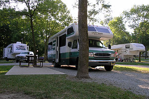 Brookville KOA campsiteThe boys and I started off with a round of mini-golf, followed by a dip in the pool, and then ended with Herb and Tom fishing in the pond while Andrew went for a run. All that was followed by a dinner, which didn't get eaten until after 9:00. It was like one last frantic effort to squeeze more fun into the last remaining days of our trip.
Tomorrow we would decide whether we were going to make the push for home--in which case this would be our final night--or linger one more day on the road. I was for lingering and selfishly having the boys for one more night to ourselves. I knew that as soon as we hit the driveway, the phone would be ringing, and they would off and running. I wasn't sure if I was ready for that yet.
Description
The Brookville KOA is an award winning 204-site campground just minutes from I70. Within its lovely park-like setting, the campground has a heated 80-foot swimming pool, a fishing pond with paddleboat rentals, and mini-golf.
Gateway Arch / St. Louis
Monday, August 1, 2005 - 7:00am by Lolo82 miles and 1.5 hours from our last stop
Travelogue
The Gateway Arch was a long overdue stop for us. It was the monumental symbol of westward journeys, yet in our own numerous journeys west, we had yet to visit it. I felt inadequate in my role as a traveler. This year's eastward route took us on I70 right through St. Louis, so we decided to finally see it--even if it was our Gateway to the East rather than the West.
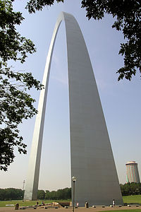 Gateway ArchHerb is never that excited about visiting cities in the motorhome. Parking is often a challenge and maneuvering in and out of traffic can often be nerve racking. However, he too realized that this was something that must be done. Fortunately, we found an area on the street along the Mississippi where several RVs were parked. From there it was just a short walk to the Arch, which was actually part of the 97-acre Jefferson National Expansion Memorial.
The Arch was even more impressive than I had imagined. It was huge--630 feet high and 630 feet between its legs. That's over two football fields wide. Its stainless steel glistened in the sunlight. We approached it from the Mississippi River, up an impressive Grand Staircase, as wide as the distance between the legs of the Arch, to its base.
By the southern leg, we found a ramp that led down to an underground visitor center beneath the Arch. The center contained the Museum of Westward Expansion, theaters with interpretive movies on the Arch's construction, a large gift shop, and most importantly the start of the "pod" ride to the top of the Arch. This is what we'd come here for, but when I got my first glance at a pod, I wasn't so sure.
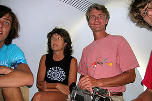 Family ascending Arch in the PODI'm not a big fan of tightly enclosed spaces, so I admit my palms were a bit sweaty as we waited to board our family pod. Each family (or group of up to 5) was given a number from 1-8 and instructed to stand in front of their pod door, which looked like an elevator door for midgets. I felt like I was in a Jetsons cartoon episode. After a few minutes, we heard the whirring sound of our pod's arrival, the tiny door opened, and current podians disembarked. The pod was actually quite cute and cozy, with 5 seats and a small window from which we could watch the inside of the arch whiz by. In a mere 4 minutes of travel, our pod doors opened, and we were let out into an observation area at the top. The view was quite impressive and it was quite weird to think that we were actually standing in the top of the Arch. There were 16 windows looking east over the Mississippi River and another 16 looking west over the city of St. Louis. My favorite was looking down into the stadium where the St. Louis Cardinals play.
After enjoying the view, we got back on the pod line to make our descent. This time when our pod door opened, the largest family I have ever seen in my life exited the pod. There were 5 of them and one large baby. I don't even want to think about what went on during their 4-minute ascent.
Back safely on the ground, we took a quick walk through the Museum of Westward Expansion and then got on our way. We still had a long way to go, and I think that now that the trip was sort of psychologically over, the boys were getting more and more anxious to get home to their friends.
Description
The Gateway Arch is part of the 97-acre Jefferson National Expansion Memorial, which is run by the National Park System. The park was established to celebrate our westward expansion and to honor the man that inspired it--Thomas Jefferson.
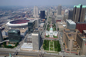 View from top of the ArchThis majestic stainless steel Arch towers 630 feet above the banks of the Mississippi River. The distance between the outer faces of its legs is also 630 feet. Each leg is an equilateral triangle with sides 54 feet long at ground level, tapering to 17 feet at the top. The foundations of the Arch are sunk 60 feet into the ground in order to withstand high winds and earthquakes. In a 20 mph wind, it sways about one inch, but it is built to be able to sway up to 18 inches. A Grand Staircase, as wide as the distance between the legs of the Arch, leads from the Mississippi levee up to its base.
The Gateway Arch was designed in 1947 by Eero Saarinen. It was the winning entry in a national competition to design a monument to represent the spirit of the western pioneers. At 630 feet, it is the tallest monument in the United States. It was completed in 1965 at a total cost of $15 million.
The highlight of a visit to Jefferson National Expansion Memorial is a ride one of the unique tram cars ("or pods") to the top of the 630-foot Gateway Arch, for a panoramic view of the Mississippi River and the city of St. Louis. Each of the 16 "pods" holds 5 people. During the 4-minute journey to the top, passengers can look out the small window for a view of the interior of the Arch. At the top you exit the pod into the observation area, where you can stay as long as you like. The observation area has 16 windows looking east over the Mississippi River and 16 looking west over the city of St. Louis. The cost of the tram ride is $10 for adults ($7 with a National Park Pass), $7 for youths 13-16, and $3 for children 12 and under.
In addition to the Arch, the Jefferson National Expansion Memorial has an underground visitor center directly beneath the Arch. The center contains the Museum of Westward Expansion, as well as theaters with movies on westward expansion and the Arch's construction. The museum has an extensive collection of artifacts, mounted animal specimens, an authentic American Indian tipi, and an overview of the Lewis and Clark expedition.
Spencer Art Museum - University of Kansas
Sunday, July 31, 2005 - 6:00am by Lolo145 miles and 2.5 hours from our last stop
Travelogue
Part way through our trip, Andrew informed us that he had to visit two art museums this summer for his AP Art History course. Not wanting to have to rush around when we got home and desperately wanting to find things to break up our long driving days home, I searched the guidebooks for some ideas. The first one I came up with was the Spencer Art Museum at the University of Kansas in Lawrence. The campus was only a short distance off of I70 so it was hardly out of our way at all.
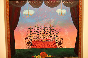 Haunted by the Ghosts of Our Own MakingWe parked in the large campus parking lot on Mississippi Street, right next to the museum. The campus was totally deserted--probably because it was a Sunday in late July--but fortunately the museum was open. Being photography buffs, we were delighted to see the Exhibit banner over the doorway announcing that the "Daguerreotype to Digital" exhibit was going to be there until July 31. That was today! How fortunate. The exhibit, which surveyed the history of photography from the 1840s to the present, was fabulous.
I had to tear Andrew away to concentrate on his AP Art History assignment, which was to select a painting to analyze. We wandered through the various gallery rooms looking for something that struck his interest. In the 20th and 21st century gallery, we were attracted to a brightly colored painting of a table set with food with a sunset colored background. It was entitled "Haunted by the Ghosts of Our Own Making." Upon closer inspection, we noticed that the painting was a lot more than just a pleasant dinner scene. Two barely visible skeletons were serving the food, the letters "DDT" were written faintly above the table, and the frame was covered with scripted writing warning of the dangers of cancer-causing pesticides. We then learned that the artist, Hollis Sigler, was struggling with breast cancer when she made this painting and that she died shortly afterwards. Now that we knew more about its meaning and context, the painting seemed totally different to us than our first impression of it. The boys were starting to really get into it. I love art history, so I was delighted.
As soon as we got back in the RV, I started looking for our next art museum to visit.
Description
The Spencer Art Museum is located at 1301 Mississippi Street, on the northeast corner of the University of Kansas campus in Lawrence. Since the museum is part of the University and serves as a resource for teaching art history, humanities, and fine arts, its collection is quite comprehensive.
There are seven galleries that display selections from the more than 25,000 works of art in the museum's permanent collection. These pieces span the history of European, North American, and East Asian art. Areas of particular strength are medieval art; European and American paintings, sculpture, and prints; photography, Japanese painting and prints; and 20th century Chinese painting.
More than half of the Western paintings and sculpture are on permanent exhibit. The much more numerous Western and Asian prints, drawings, photographs, and the Museum's renowned quilt collection, are shown on a rotating basis in short-term, thematic exhibitions.
Gallery hours are:
Tuesday - Saturday 10 a.m. - 5 p.m.
Sunday Noon - 5 p.m.
Closed on Mondays
Breckenridge
Thursday, July 28, 2005 - 11:00am by Lolo31 miles and 0.75 hours from our last stop - 2 night stay
Travelogue
Breckenridge was a discovery that we had made two years ago on the return leg of another one of our cross country journeys and one that we vowed to come back to if given the chance. The setting of the village is lovely, with its quaint Victorian Main Street, the Blue River running through the heart of it, and snow-covered peaks rising right from its edge. Also, it has a great personality--kind of like Moab--funky and down to earth. Vail might have been just as pretty, but it was a bit too ritzy and ostentatious for our taste. Breckenridge fit us much better.
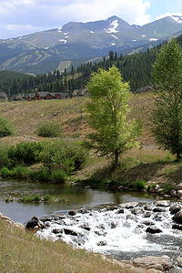 Andrew photographing along the Blue River BikewayAlso, unlike Vail, Breckenridge has a campground (the Tiger Run RV Resort), and what a campground it is. It's more like RV land for the rich and famous, with million dollar RVs as far as the eye can see. It was even featured on the Travel Channel as one of the top campgrounds in the county. It definitely was the most beautiful commercial campground we have ever stayed in--although I still do prefer the National Parks. The resort was meticulously maintained. The sites, which were quite spacious, each had a concrete pad surrounded by a manicured lawn, and all of them had views of the snow-capped mountains. Many of the sites were located right along the scenic Blue River. In addition to the nice aesthetics, there were plenty of recreational facilities to entertain guests of all ages. Besides the basketball and tennis courts, there is an incredible 12,000 square foot clubhouse, complete with indoor swimming pool, two hot tubs, game room, TV lounge, and live entertainment on the weekends. It was definitely more like a resort than a campground. In fact, almost all the sites are owned and many of them have more permanent log cabin or chalet type structures on them. One thing we did notice this time though compared to our last visit was that many more of the sites were for sale--probably more than 10% of them. Something must be going on here for so many people to want out. I don't understand it though, because it really is spectacular, and I'm sure that in the winter it's even better being that it is so close to one of the best ski resorts in the country.
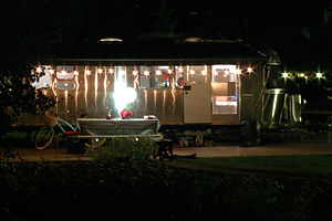 Tiger Run neighbors in an AirstreamFortunately, we were able to get one of the last available sites, and it was right on the river. We were pretty exhausted from our mountain biking at Vail and then the ride down from Vail Pass, so the only activity we were up for that evening was a soak in the hot tub.
When we woke up the next morning we decided to book another night at Tiger Run so that we could spend the entire day wandering around Breckenridge. It was Friday, so I was surprised that we were able to get anything for the night, but we did. We just had to move the RV to a different site.
We left the RV at the campground and rode our bikes along the Blue River Bikeway to the village, about 4 miles away. Once in town, we found a place to lock our bikes up and wandered along Main Street browsing in the shops. The boys were in search of a shop we had visited last time that had some really unique rock and reggae t-shirts and other paraphernalia. We weren't sure of the name, but we were sure we would recognize it when we saw it. Sure enough, we found it - The Space Cowboy. The shop felt like a throwback to the 60s. This was my teenage heritage that the kids were mooching in on--Pink Floyd, the Who, the Rolling Stones, and so on and so on. Andrew, especially, is really into classic rock and it's really all he plays. At least it makes picking a radio station to listen to really easy.
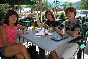 Lolo and boys dining at Fatty's PizzeriaThe owner of Space Cowboy recommended Fatty's Pizzeria as a good place for a lunch, and he was right. We always like to avoid the touristy places and eat at a place that the locals like. The pizza was good and the prices were reasonable.
The next new discovery was Bubba Gump's, a gift shop specializing in everything related to Forrest Gump. There was even a bench outside with a sculpted suitcase and box of chocolates on it. If you sat on the bench, you could slip your feet into a large pair of sneakers just like the ones Forrest wore when he just ran and ran and ran. I never realized there was so much merchandising from this movie--there were glasses, mugs, kitchen magnets, bumper stickers, shrimp beanie babies, boxes of chocolate (of course), license plates, BBQ sauce, and on and on. We got off easy with a Run Forrest Run t-shirt.
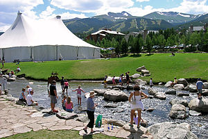 Lolo and Tommy in the Blue RiverEventually, we found our way back to the lovely riverside park where we had locked our bikes. There were now dozens of people lounging happily on the steps and a few brave souls who had taken off their shoes and were wading in the ankle-deep, frigid water of the Blue River. That looked fun. I finally convinced Tommy to join me in wading out to a copper moose statue standing in the water. It was a lot harder than it looked, and I'm sure I didn't look very graceful slipping and sliding over the slimy rocks to get there. I made Herb take out his camera again to get a picture of us.
What a great place! Breckenridge has definitely earned a place on our list of all-time favorite towns to visit. I'm sure we'll be back again someday.
Description
Breckenridge is located approximately 75 miles west of Denver in one of the premier skiing areas in the country. Most of the surrounding area is part of the Arapaho National Forest. The town itself is located in the beautiful Blue River Valley at the base of the Ten Mile Range of the Rockies.
Before it became a premier ski resort, Breckenridge was a thriving mining camp. In 1859, when word got out that gold was discovered in the Blue River near current day Breckenridge, hundreds of miners flocked here from Denver and set up a mining camp. In an attempt to get their own post office, the miners named their camp after the current Vice President, John C. Breckinridge (note the difference in spelling). Flattery worked and soon they had their own mail service. When the Civil War began, the town of Breckinridge sided with the South. No longer feeling loyalty to the Federal Government, they changed the spelling of the town to Breckenridge.
In many ways, the village, with its crowded bars and restaurants along its funky main street has maintained that frontier feeling. It was also one of the first ski areas in Colorado to allow snowboarding.
Besides the spectacular skiing, Breckenridge is an outdoor lover's paradise in all four seasons with such adventure highlights as:
- Hiking the many trails in the Arapaho National Forest
- Bicycling the paved Blue River Bikeway along the river between Frisco and Breckenridge
- Biking the 20-mile Vail Pass Bikeway over the 10,600 foot pass into Vail
- Sailing and windsurfing in the Dillon Reservoir just north of Breckenridge
- Fishing for trout and salmon in the Dillon Reservoir
- Fishing for trout in the world-class trout waters of the Blue River
- Rafting the Blue River
- Skateboarding in the outdoor, free skateboard park at the recreation center
- Testing your kayak skills in the man-made rapids section of the Blue River near the recreation center
A few miles north of the town of Breckenridge is the Tiger Run RV Resort, one of the premier RV campgrounds in the country. Most of the sites are owned, but there are some sites available for transients. Some of the many amenities include: landscaped sites with patios, a beautiful clubhouse with fireplace, an indoor pool and hot tub, and lake and stream fishing.
Arches National Park
Tuesday, July 26, 2005 - 3:00am by Lolo23 miles and 0.5 hours from our last stop - 1 night stay
Travelogue
We left Moab early, hoping to get one of the highly coveted campsites in Devils Garden, Arches only campground. Since the campground works on a first-come-first-serve basis and there are only 52 sites, we knew that if we didn't get their early, we would be disappointed again as we had been the day before. Fortunately, there were a few sites left. However, the rule is that they'll hold the site for you until noon, but if you haven't claimed it by then, you forfeit it. Since the campground is located at the very end of the 17-mile scenic drive, this didn't leave us too much time for sightseeing along the way. Fortunately, we had been to Arches twice before and pretty much had seen all there was to see along the drive, so we didn't feel too bad whizzing by what were some truly incredible sights. We did make a brief stop though at one of our old favorites--Double Arch, where we took the short hike from the parking lot and scrambled up the rocks to a ledge right underneath the arch.
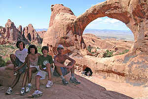 Family Portrait at Double O ArchNot wanting to risk losing our campsite, we continued on, driving right past the beautiful fiery furnace section along the way. At the end of the drive, we circled through the campground looking on each site's post for the little smiley face that indicated that it was available. Where the heck were the smiley faces? Finally, after driving through the entire loop, we asked a ranger. He pointed us towards the only remaining site. Fortunately it was a good one. It backed right up against red sandstone formations and even had a small tree that provided some well-needed shade. So much for the usual angst we experience in trying to select the absolutely best site. This time it was decided for us.
We met some fellow campers from New Jersey that told us about the wild happenings that went on here the night before. That big thunderstorm that we had just missed on the Colorado River had whipped through here big time, ripping tents from their stakes and canopies off of RVs. Maybe it was a good thing that we weren't able to get in here last night. These people were really good sports though. Their tent was destroyed, their sleeping bags and belongings were soaked, but they were getting ready to go on a hike. All that stuff could be replaced, and it wasn't often that you got a chance to hike through the kind of scenery that you find in Arches, so they were going to have a great day no matter what. I admire their spirit.
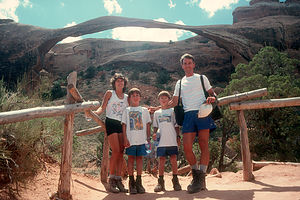 Gaidus Family in 1999The last time we were here, it was so hot that hiking during the afternoon just wasn't viable. All we could do was spray ourselves with the RV outside shower and wait for the sun to go down. This time, the temperature was reasonable enough (low 90s) to do some hiking during the mid part of the day, allowing us to do two long hikes rather than just one. Needless to say, the kids were thrilled. We decided to hike to the Double O Arch in the afternoon, a hike we had never done before, and repeat an old favorite for sunset--the hike to Delicate Arch.
The hike to Double O was pretty long and strenuous--about 5 miles roundtrip. Approximately a mile or so into the hike, there is a turnoff for Landscape Arch, one of the most beautiful arches in the park. This is the arch in the park that really deserves the name Delicate Arch. It is 306 feet long, but so thin that it looks like it could break at any minute. In fact, in 1991 it almost did when a giant 73-foot slab came tumbling off of it. It is now only 11 feet wide at is narrowest point. Since that incident, walking under the arch is prohibited and it must be admired from behind a wood-rail fence. When we first visited this arch in 1999, we took a family photo posed in front of this fence. Since that was our first cross country trip as a family and this one might be our last, we thought it would be a nice idea to repeat the original photo 6 years later. After arguing for awhile about what sequence we should stand in, we called a friend back home and had him look it up on our website. We then lined up appropriately and smiled. I don't think we've changed a bit--well, maybe the kids have a little.
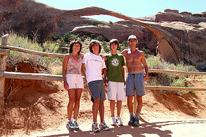 Gaidus Family in 2005The remainder of the hike got a little bit rougher and even somewhat confusing to follow at times, but we eventually scrambled up through an opening, which was the lower O of the Double O Arch. Once through the arch, we crossed over slick rock to a rocky ledge with the best view of this beautiful pair of arches, in which one big arch stands atop a rock wall with another arch cut out of it--definitely one of the most impressive arches in the park.
Every year we say we're going to take a family vacation picture to use on our Christmas cards, but we never do. Thinking that maybe this would be the year, Herb began setting up his tripod and lining us up on the ledge. About halfway through this process, a young--and very good looking I might add--man approached us and offered to take our picture for us. Not wanting some stranger to mess up our Christmas shot, Herb politely told him that he had it under control. "I am a photographer," the stranger said. That got my attention. After some further conversation, he modestly informed us that he was a photographer for Outside Magazine, which as any outdoor enthusiast knows, is a very prestigious magazine. Despite the fact that Herb has every issue of Outside since it first came out over 20 years ago, he still wanted to compose and take his own family shot. He did and I think we might actually use it this year.
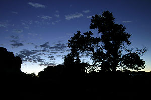 Andrew's night shot experimentThat evening, we hiked to Delicate Arch to watch the sunset--so did most of the visitors to the park. When we had done this hike 2 years ago, it was late afternoon and we practically had the whole Arch to ourselves. Now, there were crowds gathered as if waiting for a fireworks display to begin. Although I definitely prefer hogging it to myself, Delicate Arch is awesome under any circumstances.
Herb had been playing around a bit with creating Quick-Time panorama movies and thought that this would be the ideal spot for one. So he placed his camera on the tripod, leveled it, and proceeded to take a series of overlapping pictures in a complete circle around him. These pictures can then be manipulated by software to create a Quick-Time movie. It's a great effect that is the closest thing to actually being there that I have ever seen. I've already started bugging him to put it up on the website for all to see.
That night, back at campground, we took out our beach chairs and just hung out watching the stars. The evening had cooled down nicely, as it does in the desert, so it was very comfortable to be outside. We saw more stars that night than we have ever seen in our lives. The Milky Way was so clear that it seemed like you could reach out and touch it. Andrew used Herb's tripod and took some black and white pictures with long exposures. Later when he developed them, we were quite surprised to see how clearly the stars appeared.
As always, Moab and Arches had been a great stop, and one that I am sure we will return to time and time again. For now though, it was time to start heading east towards home.
Description
Arches National Park contains the greatest concentration of natural arches in the world--more than 2,000, and more are being discovered every day. The park is more than just arches, however. There are also numerous brilliantly-colored balanced rocks, spires, fins, and domes made of the same soft red sandstone.
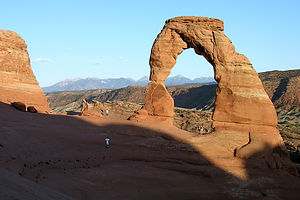 The required Delicate Arch photographThe park's 77,000 acres are part of southern Utah's canyonlands, which have been carved and shaped through millions of years of erosion. About 300 million years ago, a 3,000 foot thick layer of salt was left behind in this region when the inland seas evaporated. Over millions of years, debris covered the salt bed and compressed into rock. The salt layer shifted, thrusting the rock layers upward into domes. Further pressures from within the earth produced vertical cracks in the domes. Millions of years of surface erosion gradually stripped away the younger layer of these domes, exposing the salmon-colored Entrada Sandstone and yellow Navajo Sandstone below. The cycle of freezing and melting of water within the cracks in the rocks caused bits of them to break away forming free-standing fins. Wind and water continued to do their job on these fins, breaking off chunks of rock and forming the arches we see today.
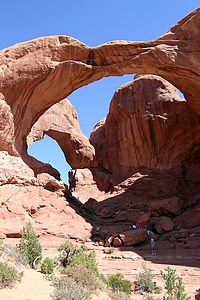 Double ArchUnlike Canyonlands, Arches is much more visitor-friendly in that its treasures are easily accessible. A 41-mile round-trip paved road in the park leads to the major sights, including Balanced Rock, the Windows Section, the Fiery Furnace, and Devil's Garden. From these stops, relatively short trails lead to most of the park's main attractions.
From the Windows Parking lot you can take the 1 ¼ mile Windows Loop past North and South Windows and Turret Arch. Another choice from there is the ½ mile hike to the spectacular Double Arch.
Delicate Arch is probably the best-known feature in the park--it's even on Utah license plates. The hike to Delicate Arch, which is probably the most scenic hike in the park, is a 3-mile round trip, fairly strenuous one across slickrock and along a narrow cliff. However, the dramatic and spectacular view of 45-foot-high, 33-foot-wide Delicate Arch perched on the very edge of a slickrock bowl at the end make every bit of it worthwhile. Because of the heat, this hike should be done either early morning or late afternoon. That's also when the lighting is best for photography.
In the summer, rangers lead a 1 1/2 hour guided walk into the Fiery Furnace, which is named for its sandstone fins that turn flaming red when the lighting is low. Reservations and a fee are required and must be made at the visitor center.
At the end of the scenic drive at Devil's Garden, there is a 52-site campsite which works on a first-come, first-serve basis. It usually fills up quickly, so get there early in the day. The campground is surrounded by spectacular red sandstone rock formations and is the starting point for several hikes into the Devil's Garden.
