- Home
- About
- Map
- Trips
- Bringing Boat West
- Migration West
- Solo Motorcycle Ride
- Final Family XC Trip
- Colorado Rockies
- Graduates' XC Trip
- Yosemite & Nevada
- Colorado & Utah
- Best of Utah
- Southern Loop
- Pacific Northwest
- Northern Loop
- Los Angeles to NYC
- East Coast Trips
- Martha's Vineyard
- 1 Week in Quebec
- Southeast Coast
- NH Backpacking
- Martha's Vineyard
- Canadian Maritimes
- Ocracoke Island
- Edisto Island
- First Landing '02
- Hunting Island '02
- Stowe in Winter
- Hunting Island '01
- Lake Placid
- Chesapeake
- Provincetown
- Hunting Island '00
- Acadia in Winter
- Boston Suburbs
- Niagara Falls
- First Landing '99
- Cape Hatteras
- West Coast Trips
- Burning Man
- Utah Off-Roading
- Maui
- Mojave 4WD Course
- Colorado River Rafting
- Bishop & Death Valley
- Kauai
- Yosemite Fall
- Utah Off-Road
- Lost Coast
- Yosemite Valley
- Arizona and New Mexico
- Pescadero & Capitola
- Bishop & Death Valley
- San Diego, Anza Borrego, Joshua Tree
- Carmel
- Death Valley in Fall
- Yosemite in the Fall
- Pacific Northwest
- Utah Off-Roading
- Southern CA Deserts
- Yosemite & Covid
- Lake Powell Covid
- Eastern Sierra & Covid
- Bishop & Death Valley
- Central & SE Oregon
- Mojave Road
- Eastern Sierra
- Trinity Alps
- Tuolumne Meadows
- Lake Powell Boating
- Eastern Sierra
- Yosemite Winter
- Hawaii
- 4WD Eastern Sierra
- 4WD Death Valley +
- Southern CA Deserts
- Christmas in Tahoe
- Yosemite & Pinnacles
- Totality
- Yosemite & Sierra
- Yosemite Christmas
- Yosemite, San Diego
- Yosemite & North CA
- Seattle to Sierra
- Southwest Deserts
- Yosemite & Sierra
- Pacific Northwest
- Yosemite & South CA
- Pacific Northwest
- Northern California
- Southern Alaska
- Vancouver Island
- International Trips
- Index
- Tips
- Books
- Photos/Videos
- Search
- Contact
Pipestone Campground
Monday, July 24, 2000 - 12:00pm by Lolo180 miles and 3.5 hours from our last stop - 1 night stay
Travelogue
It was a long day of driving so we were happy to just rest our weary butts in the campground hot tub. The kids were appalled that it was an adults-only hot tub and kept glaring at us over the fence.
We made it an early night because we had an exciting day ahead of us -- Yellowstone.
Description
Good Sam campground in Whitehall, MT (Butte Area) with a heated pool and adults-only hot tub.
National Bison Range
Monday, July 24, 2000 - 9:00am by Lolo77 miles and 1.5 hours from our last stop
Travelogue
Stopping at the Bison Range seemed like a good idea on paper. However, after we got there, none of us really wanted to add the extra 2-hour scenic loop through the range onto an already 8-hour long driving day. Also, Herb, always the pragmatist, reminded us that we were going to see enough buffalo for a lifetime when we got to Yellowstone, so there was no need to seek them out here.
Wanting to do something to justify our stopping here, we drove the short 1.5 mile West Loop behind the Visitor Center, but there were no buffalo to be found. Back in the Visitor Center, the kids did manage to purchase a hat pin with the famous albino buffalo on it.
I know that we did not do this stop justice, and I'm sure that the Red Sleep Mountain Scenic Drive through the range would have been great, but it was just too much driving for one day. Perhaps we'll do it the next time we're passing through Montana.
Description
The National Bison Range, in western Montana, consists of 18,500 acres of natural rolling prairie that was set aside as a National Wildlife Refuge in 1908.
Besides the herd of 350 to 500 bison that range here, there are elk, deer, pronghorn, black bear, and coyote. It is also home to over 200 species of birds, including eagles, hawks, meadowlarks, bluebirds, ducks, and geese.
The Red Sleep Mountain Drive takes you on a self-guided tour through the refuge with much wildlife viewing along the way. The drive is one-way and quite steep in places. Allow about 2 hours.
Flathead Lake
Monday, July 24, 2000 - 8:00am by Lolo160 miles and 3.5 hours from our last stop
Travelogue
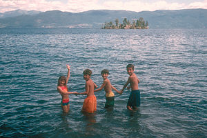 Kids in Flathead LakeWe had a long day of driving planned--about 8 hours--so we needed to find something fun along the way. Flathead Lake along our route through Montana was just what we needed. The lake was beautiful, set along the base of the very scenic Mission Mountain Range.
After a nice picnic lunch in the state park along the western shore of the lake, the kids ran down the boat ramp and jumped into the lake. The water was surprisingly warm considering it was in the Rocky Mountains. The kids had a great time. I'm kind of glad that we only read later about the "swimmer's itch" parasite that is found in the lake or the kids never would have gone in. Fortunately, none of them encountered it..
Description
Flathead Lake, in northwestern Montana, is the largest natural freshwater lake west of the Mississippi. Stretching for 28 miles along the base of the scenic Mission Range, it is one of the few lakes in the Rocky Mountains that is warm enough for swimming.
One problem with swimming in the lake is the "swimmer's itch" parasite found in the shallow water. Make sure you wipe off with a towel or shower right after you come out of the water.
The state park has six separate sections scattered around the lake, each of them with a campground, picnic area, boat ramp, and swimming beach. Two units are on the west shore, three on the east shore, and one on While Horse Island..
Waterton-Glacier National Park
Thursday, July 20, 2000 - 1:00pm by Lolo800 miles and 17 hours from our last stop - 4 night stay
Travelogue
We were very pleasantly surprised to find out that the map program's 17-hour estimate of the time it would take us to get to Glacier from Theodore Roosevelt was way over. Rather than the 40 mph speed it used, we were able to cruise along the 700 miles across Montana at 65 mph, getting us there in under 12 hours--still a very long day. The drive through Montana was much different than I expected, flat, dry, and somewhat boring. Where were the mountains? The blue sky? I hadn't realized that most of Montana was plains and that it stayed that way until you hit Glacier all the way in the western part of the state. Most of the ride was on Route 2, a two-lane highway with no divider, with only a handful of small towns scattered along the way. This was cattle ranch country and every 20 minutes or so we would pass the entrance to another ranch, with names like Big Timber, Three Forks, Round Up, etc. Sometimes we would drive for almost an hour without seeing another car. Then, and this is Herb's favorite part, we would pass a pickup truck and the driver never failed to wave and give us a big smile. Herb was skeptical at first as to why they were waving--was something wrong with the RV? Were they trying to tell us something? After a few more waving ranchers, we realized that they were just being friendly, happy to see another human being on this lonely stretch of road.
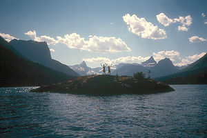 Kid's on Island in St Mary's LakeFinally, after many, many hours of driving, we were thrilled to see the tall, jagged, snow-covered mountain peaks in the distance which meant that we were finally getting close to Glacier. We were going to make it a day ahead of schedule--a bonus day--and fortunately, the St. Mary's KOA where we had reservations for the next couple of days had room for us that night. Tommy was appalled when he saw the campground. There were RVs all around, kids riding bikes, and not a buffalo in sight--not anything like the peace and solitude of our campsite at Theodore Roosevelt. I told Tom about the hot tub and the volleyball court, but that didn't do. Not even the mention of a gift shop could cheer him up--this was serious. How was I supposed to know that he was going to morph into "Nature Tom" this trip. We had chosen to stay here rather than inside the park because besides the hot tub and activities that we thought the kids would enjoy, we could also rent a Suburban to take on the RV-restricted Going to the Sun Road through the park. Tom got over it soon enough, but Herb and I were actually quite happy that he had been able to appreciate what the natural beauty of T.R. had to offer.
We woke up early the next morning determined to make the best of our bonus day. We just needed to get back to the campground by dinner to meet up with our friends from New Jersey, the Kalchbrenners, who had traveled with us the previous year, and had decided to come back for more. They rented an RV from Cruise America in Idaho and were making the long drive to Glacier that day. The plan was for them to spend the Glacier/Yellowstone portion of our trip with us.
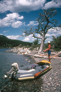 Herb with Avon at St Mary's LakeWe decided to spend the morning exploring the Many Glacier section of the park. Along the Many Glacier Road we just had to pull over when we got our first glimpse of the aquamarine waters of one of the park's many glacial lakes, Lake Shelburne, set at the base of a jagged, snow-covered mountain. After some photos, we continued on to the Many Glacier Hotel at the end of the road. I don't think I've ever met a National Park hotel I didn't like. This one was in the style of a Swiss Chalet and was perched at the edge of the glacial Swift Current Lake, surrounded, as we've come to expect here, by awesome glacier-covered mountain peaks. I wasted no time making dinner reservations for us and the Kalchbrenners the following evening.
I had read that grizzlies were pretty common in this area, so I refused to hike until we had purchased some bear bells in the gift shop. The theory behind these bear bells, which look an awful lot like sleigh bells, is that the bears really don't want to eat you, so if they hear you coming, they'll run away. I'm not sure if I like the idea of the bear knowing where I am when I don't know where he is, but we figured they knew what they were talking about. We hiked the very scenic 2.5-mile loop trail around Swift Current Lake, me wildly jingling the bells the entire way. Great hike, and no bears. Maybe the bells do work.
We found out that we could drive our RV on the Going to the Sun Road as far as St. Mary's Lake, so we headed back down to the St. Mary's entrance to the park and drove along the shores of St. Mary's Lake, yet another aquamarine, glacial lake, complete with surrounding snow-capped mountains. Taking pictures of it was not going to be enough this time; we just had to get the boat out on it.
We immediately drove down to the Rising Sun boat launch and assembled our 12-foot inflatable Avon raft and 6 hp motor. As we putted out into the lake, there was a fair number of people watching us--I'm not sure if they thought we were crazy or whether they were envious. It was extremely windy and the lake water was ice cold (probably about 48 degrees), so we knew we had to be careful because you could get hypothermic real quick in this water.
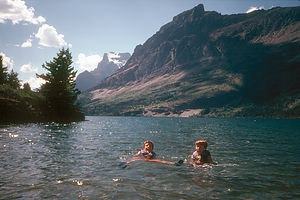 Cold swim in St Mary's LakeWe headed across the lake to what looked like a small beach. The kids had brought their spinning rods along, so they spent some time wandering up and down the bushes along the shore casting, sometimes hitting the water, more often getting caught in the bushes. In one of the casts that actually made it to the water, Andrew pulled in his first rainbow trout--not exactly a lunker, but a Montana rainbow trout nonetheless.
Unable to avoid the temptation, we decided to go for what turned out to be a very quick dip. You had to do it fast--there was no gradual entry into this water. We all ran in quickly dunking ourselves. The water was so frigid that our bodies tingled all over. At least it felt warm when we got out.
When we got back in the boat, the kids convinced us to drop them off at a rock island in the middle of the lake so that we could take their pictures. This is probably one of my favorite photos of all time--the kids standing arms raised and legs spread, silhouetted against the snow-covered jagged peaks behind them, the only people in sight for miles.
What a great day! Another great boating experience. That was two already this trip--first Pictured Rocks and now this. The boat was certainly earning its keep and providing us with some major trip highlights.
Back at the campground that night, we did some serious hot tubbing and waited for the Kalchbrenners to arrive. The drive from Idaho took quite a bit longer than anticipated, so they didn't get into the campground until after 9:00, quite tired and hungry. Fortunately, this KOA served pizzas and burgers until 10:00 every night, so they were able to grab a bite to eat. Despite their long, tiring travel day, the Kalchbrenners were excited about being in this terrific place and ready for a week of adventure.
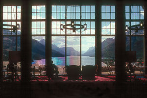 Lobby view inside Prince of Wales HotelThe next morning, we picked up our rental suburban at the campground office, which I had reserved weeks in advance, and headed back into the park to drive the scenic 50-mile Going to the Sun Road. St. Mary's Lake appeared different to us this time--not just another incredible sight, but something more familiar that we had been fortunate enough to personally experience in our little boat the day before. The road continued on through meadows before it began to climb. We stopped at the Jackson Glacier Overlook to see one of the few glaciers visible from the road. Unfortunately, in the last 50 years, it has shrunk to ¼ its size. It's sad to think that someday, maybe even in our lifetime, many of these glaciers will be gone, remembered only by the beautiful mountains, valleys, and basins that they helped to carve. We continued on to Logan Pass, atop the Continental Divide. From here we took a great 3-mile roundtrip hike to the Hidden Lake Overlook.
The hike started out on a boardwalk through a glacier-carved basin of rock terraces. Although not actually a glacier, the entire area was still covered in snow, much to the kids' delight. Snow in July was something new and not to be passed up. After about a half hour, they reluctantly finished their snowball fight so that we could continue our hike to the overlook. When we got to the end, we were greeted by several very friendly Dahl sheep who willingly posed for their pictures. Jonathan blew an entire roll of film on them. We ate a picnic lunch, perched at the edge of the hanging valley that overlooked Hidden Lake.
After Logan Pass, the road started to descend past a knife-edged wall of rock called the Garden Wall and then doubled back on itself in the tightest hairpin turn I have ever experienced. The map referred to this turn as The Loop--Jonathan named it the "Haiwy Turn." We descended into the McDonald Valley and stopped at the northern end of McDonald Lake, the largest lake in the park, before turning around to go back.
That night we had a great dinner at the Many Glacier Hotel. After dinner, we stepped out onto the porch to enjoy the scenery of the lake and mountains. The brief storm that we had heard while eating dinner had added a rainbow to the already incredible view.
The next day we drove up the Chief Mountain International Highway to Waterton Lakes, the Canadian counterpart to Glacier. We stopped at the Visitor Center and from there hiked the Bear Hump Trail to a great panoramic view of the area. It was so windy on top that we had to crouch down to stop from being blown over. In the distance we could see the majestic, alpine-style Prince of Wales Hotel sitting on a bluff overlooking Upper Waterton Lake. It's one of the most photographed hotels in the world, and I can certainly see why.
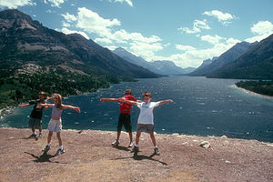 Kids in Wind on Bluff by Prince of Wales HotelIt was Tommy's 9th birthday, so we decided to celebrate with a lunch at the Prince of Wales Hotel. Fearing that we wouldn't be able to get a table, we hurried down to get there by noon, only to find a completely empty dining room. Unknown to us, Canada did not practice daylight savings time, so it was actually only 11:00 their time, way ahead of the lunch crowd. We were seated at the best table in the house, next to the giant picture windows overlooking the lake. Actually, we were seated at two tables. Rather than sitting on one long table where it's hard to converse, we find that splitting up into an adult table and a kids table works out great. The view was so incredible that I hardly even remember what I ate. What I do remember most is Tommy's expression when the waitress brought out four giant sundaes for the kid table, and the entire dining room, which had by now completely filled, sang Happy Birthday to him.
After lunch we walked out on the lawn outside the dining room to the edge of the bluff overlooking the lake. The winds coming off the lake were so incredibly strong that we had to stoop down into them to walk. If they had been blowing in the other direction, we would have flown right off the edge for sure. It was exhilarating. We captured the moment in one of my favorite photos of all time--the four kids, arms and legs spread, leaning backwards into the wind, looking like they would tip off the edge if the wind stopped. I don't think the wind ever stops here. In fact, the locals say that they only consider it windy when there are whitecaps in the toilets at the Prince of Wales Hotel.
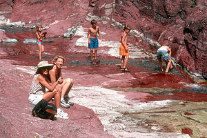 Ladies and Kids in Red CanyonBack in the RV, we drove the 10-mile Red Canyon Parkway to the end where there was a stream flowing over the red rock that the canyon is named for. Michelle and I lounged on the red rock ledges that had been nicely warmed by the sun, while the kids swam in the chilly waters of the stream. In the meantime, Herb and Hans went for a hike into the canyon. They had been gone for awhile, when I overhead some hikers say that there was a grizzly spotted along the trail. I started to panic. Hadn't they been gone an awfully long time? Michelle and I started to worry that something had happened to them. I think they were quite surprised by the warmer than usual greeting they got upon their return. They were totally unaware that a grizzly had been spotted.
We spent our last night at Glacier relaxing around the campground--more hot tubbing and a pickup volleyball game that kept growing as more families wandered by and joined in the fun. Our visit to Waterton-Glacier had more than lived up to our expectations.
Description
In 1932, Glacier National Park in northwestern Montana and Waterton Lakes National Park in Alberta, Canada united to become the world’s first international peace park. Together they encompass more than 2,000 square miles of jagged, glacier-covered mountain peaks, 650 ice-cold glacial lakes, numerous waterfalls, beautiful forested valleys, and more than 800 miles of hiking trails.
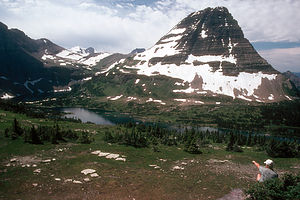 Hidden Lake at Logan PassThis area was once part of the plains until about 60 million years ago when the North American continent collided with the Pacific Ocean floor, pushing giant rock layers over the softer, younger rock layers in the plains to the east, creating the 300-mile-long Lewis Overthrust. The landscape was further sculpted during the Ice Age by giant glaciers that shaped and dug the deep valleys, basins, and lakes and carved the mountains into thin, jagged ridges. Today there are no glaciers left in Waterton Lakes, and those remaining in Glacier are gradually shrinking each year.
The major activities in the park include hiking the more than 800 miles of hiking trails, boating and fishing in the lakes (motor size limited to 10 hp), and wildlife viewing (moose, elk, bighorn sheep, mountain goats, black bear, grizzly bear). Although there are numerous lakes, they are glacial, so the water is too cold for swimming.
Going to the Sun Road (Glacier)
An excellent way to see many of the park’s highlights is to drive the scenic 50-mile Going to the Sun Road, which crosses the park from West Glacier to St. Mary’s, climbing more than 3,400 feet. Since the road is so winding and narrow, vehicles over 21-feet long are prohibited. However, rental cars are available at West Glacier and St. Mary’s,
Starting from the west, the road hugs the shore of 10-mile-long Lake McDonald (largest lake in the park), past McDonald Falls, and then climbs to the high country along the jagged cliffs of the Garden Wall to its highest point, Logan Pass atop the Continental Divide.
 Family at Logan PassA very popular hike from the Logan Pass Visitor Center is the moderately strenuous 3-mile roundtrip Hidden Lake Nature Trail, which climbs 800 feet on a series of boardwalks to a beautiful overlook of Hidden Lake. Along the way the trail crosses the Hanging Gardens of Logan Pass, which is an area filled with wildflowers and surrounded by jagged mountain peaks. There is usually snow alongside the trail all year long. At the Hidden Lake Overlook, you are almost guaranteed to see mountain goats.
After leaving Logan Pass, the road starts to steeply descend, passing Going to the Sun Mountain (the highest peak in the park), Jackson Glacier (one of the few glaciers visible from the road), and Going to the Sun Point, where there are fabulous vistas of St. Mary’s Lake. The road comes to an end at the St. Mary’s entrance to the park.
Many Glacier (Glacier)
The Many Glacier section of the park is reached from the town of Babb, about 10 miles north of St. Mary’s. It got its name from the six glaciers that cover the surrounding mountains. It is a hiker’s paradise as well as a good place to spot wildlife, such as bighorn sheep and mountain goats. Grizzly bears are also quite common in this area.
 Many Glacier HotelA very popular hike in Many Glacier is the 2.5-mile loop trail around Swift Current Lake. Another popular, but much longer hike from this area, is the 11-mile roundtrip hike to Grinnell Glacier, one of the largest and most accessible glaciers in the park.
A wonderful place for lodging or dinner in this area is the picturesque, alpine-style Many Glacier Hotel, which was built in 1915 by the Great Northern Railway in an attempt to promote tourism. This Swiss Chalet type hotel is the most photographed building in the park. From the lobby and dining room, there are tremendous views of the mountains and lake.
Waterton Lakes
Waterton Lakes, the Canadian counterpart to Glacier, is reached by driving the 75-mile Chief Mountain Highway from the town of Babb across the border to Waterton Village. There is no real park center at Waterton, but rather a scattering of facilities in the Village. The park’s main visitor information center is on the right about 4 miles past the entrance to the park. A popular hike from the Visitor Center is the 1.5-mile roundtrip Bears Hump Trail, which climbs to a great panoramic view of the area.
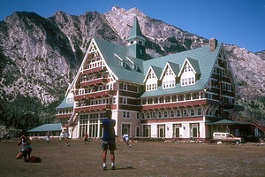 Prince of Wales HotelNear the Visitor Center is the historic and majestic Prince of Wales Hotel, one of the most photographed hotels in the world. Like the Many Glacier Hotel, this alpine-style hotel was built by the Great Northern Railway in 1927. It sits on top of a bluff looking out over Upper Waterton Lake. From the two-story high picture windows in the lobby and dining room, the views are incredible. In true British tradition, British high tea is served every afternoon at 3:00. A short walk out to the edge of the bluff overlooking the lake, let’s you experience the incredible gusts of wind that are common here. In fact, it is so windy here that locals only acknowledge that it’s windy when there are whitecaps in the toilets at the Prince of Wales Hotel.
There are two different drives into the park. The Akamina Parkway is a 10-mile-long drive from the Visitor Center through the Cameron Valley to Cameron Lake, which lies in a large glacier-carved basin. The 2-mile-long Cameron Lakeshore Trail takes you through forests around the lake. There are many grizzlies in the area.
The 10-mile-long Red Rock Canyon Parkway starts about 2 miles north of the Visitor Center and takes you along the Blackstone Creek to Red Rock Canyon, where there is a beautiful stream flowing over the red rock that the canyon is named for. The water is cold, but fun to swim in. The .5 mile Red Rock Canyon Loop hiking trail takes you past waterfalls and into the canyon. There are also many grizzlies in this area.
Theodore Roosevelt National Park (South Unit)
Wednesday, July 19, 2000 - 4:00am by Lolo237 miles and 4 hours from our last stop - 1 night stay
Travelogue
We began our visit to Theodore Roosevelt National Park at the Painted Canyon Visitor Center about 7 miles east of the entrance to the South Unit of the Park. There we got our first glance of the multicolored buttes and mounds that make up the badlands of North Dakota. Gazing down at them, I couldn't help thinking that "badlands" was the wrong name for something so strikingly beautiful. I guess it's what you expect from them. The early settlers were looking for lands to farm; they didn't have the luxury of just sitting back to enjoy their beauty as we did.
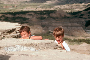 Boys climbing Theodore Roosevelt ParkWe took the trail down from the Visitor Center to hike the loop trail through the Painted Canyon. This really was wild country and so remote that you felt like you had it all to yourself. We could see that we were really going to like this place.
Back in the Visitor Center after our hike, Tommy wandered over to the nature book section and starting poring over the many field guides they had on display. This was something new and something I definitely wanted to encourage. After much deliberation, he selected the Peterson Field Guide to Animal Tracks, and spent the rest of the day with his nose buried in the book, blurting out interesting information as he read along. This loss of his little brother to a book started to bug Andrew, who chose to support Tom's new-found hobby by singing a song about "Nature Tom." After we pulled Tommy off of Andrew's neck, we strongly suggested that they try to enjoy animal tracking together.
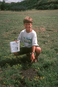 Tom with Bison ScatWe stopped at the Medora Visitor Center in the park and took the brief tour of the Maltese Cross Cabin, which was used by Teddy Roosevelt during his ranching days here. Apparently, Roosevelt came here in 1883 to hunt bison and then eventually went into a partnership on a cattle ranch. He loved these badlands so much that he said he wouldn't have been president if it hadn't been for his experiences here. Fortunately for us, the park is so remote and unspoiled that it hasn't changed much from the days that Roosevelt spent here.
We decided to stop at our campground for lunch so that we could select a site before taking the scenic drive through the park. As usual, I had my campground reservation papers ready, happy knowing that we would have a place to stay. Herb was quite amused as we pulled into the totally empty Cottonwood Campground and had our choice of any site we wanted. After a brief drive around the entire campground, we agreed on the perfect site, nestled among the cottonwood trees overlooking the Little Missouri River. Upon closer inspection we noticed that there was one problem, or advantage depending on how you looked at it. A very large bison was lying in the grass alongside the river about 50 feet away, totally disinterested in the fact that he had new neighbors. I at first questioned the wisdom of this site, but was quickly overruled by "Nature Tom" and his new partner. What better place to start animal tracking.
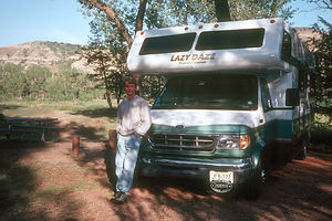 Herb with Lazy DazeAndrew and Tom immediately wanted to go down to the river and look for tracks, but I was a little nervous about this large bison charging them or something. We stopped a ranger driving by and asked him about the bison. "Oh, that's George," he replied. "He lives here." He then explained to us that George was an old bull kicked out of his herd by the younger male bulls. Apparently, that's the destiny that awaits all male bison. Rather than fearing George, I now felt sorry for him and wanted to invite him over for dinner or something.
On the path down to the river, Tommy found a large animal track, which he immediately began to study. He got down on his knees, methodically analyzing and measuring it and comparing it to tracks in his field guide, obviously truly enjoying himself. "Maybe elk or moose," he mumbled. At this point, his ever faithful brother picked a tuft of bison hair from the track and yelled, "It's a bison track, you idiot, and it's right over there!" This triggered another one of our talks with Andrew about being supportive of his little brother.
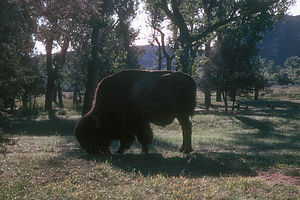 George, the lonely bisonWe decided it was time to take the scenic drive through the park. Our first stop was a prairie dog town, where we watched cute little prairie dog heads popping up out of hundreds of mounds in a field. Apparently, there is an intricate system of tunnels underground connecting these holes, creating an entire city for these little creatures. Along the edge of prairie dog town, the kids performed their first "scat" identification of an animal. We found prairie dog turds, bison pies, elk droppings, and much more. Now Andrew was getting into it.
We continued our drive stopping to hike the Ridge Trail and Buck Hill. It really was beautiful country--so unspoiled and remote. There was nobody here--nothing like our previous experiences at national parks and surely not what we would find at Yellowstone.
That night back at the campsite, we actually got some real neighbors, an elderly couple from Phoenix traveling on a Honda Gold Wing, complete with a little trailer for their camping gear. I know that is what Herb has planned for me some day when the kids are grown and gone. I told him to be careful or George's fate was what I had planned for him.
After dinner, rather than going back in the RV to watch TV, the kids stayed out with us, passing the time talking and whittling poker chips out of cottonwood branches. These chips are still in the RV--a treasured memory of the brief but special time we had spent here. The evening was perfect--filled with a sense of contentment.
Nothing had prepared us for the way we would feel about the badlands of North Dakota. We had no special expectations about our visit here--it was merely a stop along the way to Glacier National Park. Yet something about the remoteness and rugged beauty of this strange land touched us in a way that few places ever would again.
Description
Theodore Roosevelt National Park encompasses more than 70,000 acres of the rugged badlands of North Dakota. This strange landscape is the result of a process that began more than 60 million years ago when sediment washed down from the young Rocky Mountains and covered the dense vegetation on the Great Plains, turning it into lignite coal. Sometimes this lignite would ignite, baking the gray clay above it into a reddish material known as scoria. As sediment continued being deposited, the Little Missouri River and its tributaries carved and sculpted the softer strata into the buttes, tablelands, and valleys that you see in the park today. The alternating process of depositing sediment and erosion resulted in the multicolored horizontal stripes you see running across them.
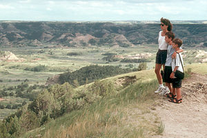 Theodore Roosevelt Park overlookA first place to experience the beauty of the badlands is at the Painted Canyon Visitor Center and Overlook, 7 miles east of Modora, where there is a magnificent panoramic view down into the strange colorful mounds that make up the badlands. There is also a short loop hike from here that goes down into Painted Canyon.
The park is divided into a North and a South Unit, neither one of which ever gets crowded because of the remoteness of this park. The entrance to the more accessible South Unit is located right off 94 in the town of Modora. Near the Visitor Center you can tour the Maltese Cross Cabin, which is the cabin that was used by Teddy Roosevelt when he was a cattle rancher here back in the 1880s. Teddy Roosevelt spent much time here as a young man, hunting and working his ranch. He came to love and respect the badlands and said that without his experiences here he would never have been president. The park was named in his honor because he did more for the National Park System than any other president. The South Unit also has a 36-mile scenic drive which takes you onto a high plateau for excellent views of the badlands. There are overlooks and places to hike along the way.
The even more remote North Unit of the park is located about 50 miles north. It too has a scenic drive that winds through badlands considered by some to be even more beautiful than those in the South Unit.
Jamestown - KOA
Tuesday, July 18, 2000 - 10:00am by Lolo432 miles and 8.5 hours from our last stop - 1 night stay
Travelogue
After a long day driving from Wisconsin through Minnesota and into North Dakota, we were ready for a break. I didn't know anyone that had ever been to North Dakota, so it felt kind of exciting being in real cowboy country.
After a refreshing swim in the campground pool, Herb and I decided that we should go for a run. Usually at home we run at least 5 times a week, but on the road it's difficult to find the time. We have to really make a conscious effort to schedule one in.
Anyway, the kids decided to accompany us on their bikes. The campground was located in the middle of nowhere, so we headed away from the highway onto a long country road alongside some farmland. It was fun because it felt so different from the roads back home. Unlike our winding tree-lined streets, these roads were straight as an arrow and so wide open that you could see for miles in every direction.
After a mile or so we came to a farmhouse. How pretty and quaint I thought--like a typical tourist--until I noticed the two very large dogs on the porch staring at us. From the look they gave us, I had the feeling that lycra-clad runners were probably not a common sight for them. Remain calm I thought, praying that they had one of those invisible doggy fences that every dog owner in New Jersey has. Who was I kidding--this was the wide open spaces of North Dakota. Not being dog people, we all began to get quite nervous. Luckily for us, just as the dogs were about to make their move, two small children came out of the farmhouse and called them back. We waved a hello and thank you and made a beeline back to the safety of the KOA.
One of the things I like best about traveling is the chance to see how different parts of the country live and to have the kids realize that not every place is like their home town. That's what makes things interesting.
Description
KOA Campground in Jamestown, North Dakota, on frontage road right off I94 with nice heated pool.
Apostle Islands National Lakeshore
Monday, July 17, 2000 - 9:00am by Lolo242 miles and 5.5 hours from our last stop - 1 night stay
Travelogue
Our drive to Apostle Islands took us across the rather remote Upper Peninsula of Michigan and into Wisconsin. Along the way, I couldn't help but notice dozens of signs inviting us to stop in for the best "pasties" in the U.P. Now my curiosity was up--what the heck was a pasty? When we stopped at the Visitor Center in Bayfield, I was determined to find out. Herb was quite entertained when I asked the ranger what a pasty was, pronouncing it with a long a, like the little things that strippers wear on their breasts. The ranger tactfully corrected my pronunciation--apparently it's pah stee--and explained that it was a meat pie, a very traditional and popular dish in this region. Now I was mad that we hadn't stopped to try one when we had the chance--I hate being an ignorant tourist.
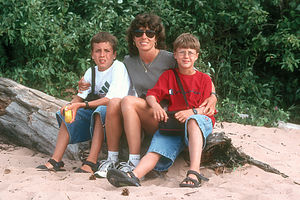 Lorry and boys at Apostle Islands beachWe took a ride up to Little Sand Bay along the Lake Superior shoreline to check things out. The day was pretty cool and dreary so we decided against trying to launch the blow-up boat to explore the islands and sea caves. Normally this might have been a big disappointment, but we had had such a great time out on the boat the previous day at Pictured Rocks that we didn't feel compelled to take it out in what were pretty lousy conditions.
Unfortunately, I'm afraid we didn't do Apostle Islands justice. On a beautiful day with a sea kayak to explore the islands, this place would have been paradise.
We headed back to our campground in Bayfield and decided to just relax and have a nice dinner and maybe watch a movie. While we were making dinner, we were startled when the owner of the campground knocked on our RV. "Do you like country music?" he asked with a big grin on his face. Rather a random question, we thought. Somewhat taken off guard, and never known for his tact, Herb replied, "Not particularly." "Oh, well I'll be performing some in about an hour right out there," he said pointing to two giant speakers next to the campground office. First the pasty thing, and then this. We really have to work at blending in with the locals better.
Description
The Apostle Islands National Lakeshore, which is the northernmost point in Wisconsin, encompasses 11 miles of Lake Superior shoreline as well as 21 remote islands off the Bayfield Peninsula. It has miles of pristine sand beaches, sandstone cliffs, spectacular sea caves, and six historic lighthouses to explore.
While there are some hiking trails in the park, the more popular recreational activities center around the water, such as boating, sea kayaking, scuba diving, and fishing. The waters of Lake Superior are generally too cold for swimming, except in shallow, protected bays.
The main Visitor Center is located in the city of Bayfield, just south of the Lakeshore. Bayfield contains most of the other facilities needed for a visit to the Apostle islands: marinas with boat rentals, a boat launch, the Apostle Island Cruise Service which offers excursion trips to the islands, a water taxi service, and campgrounds. There is another visitor center and boat launch in the park at Little Sand Bay.
The only overnight facilities in the park are campsites on the islands, which can be reached by boat, sea kayak, or water taxi. A permit, which can be acquired in advance, is required to camp on the islands.
Pictured Rock National Lakeshore
Sunday, July 16, 2000 - 9:00am by Lolo180 miles and 5 hours from our last stop - 1 night stay
Travelogue
Pictured Rocks has the unique distinction in my memory of containing both one of our all time vacation low points as well as one of our all time vacation highlights all within the span of one afternoon.
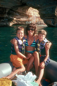 Spouse and boys on raftThe day started off innocently enough with the scenic drive across the impressive 5-mile long Mackinaw Bridge into the Upper Peninsula of Michigan. Not knowing much about Pictured Rock, we headed to the visitor center in Grand Marais at the east end of the park to get some information and ideas as to what to see and do. The good news was the Lakeshore contained 40-miles of Lake Superior shoreline with colorful sculptured cliffs ("picture rocks") rising 50 to 200 feet above the lake. The bad news was there were only 3 points along the shoreline that you could get to by car, and they were only reached via the 30-mile long sandy road that ran from the eastern end of the park.
We really didn't want to come all this way without seeing the pictured rocks so we decided to take the unpaved road. Our goal was to get to Miner's Beach on the west end of the Lakeshore to at least see the pictured rocks and hopefully either swim or launch our inflatable boat to get a better view of the cliffs. We knew our chances of boating were slim because Lake Superior is more like an ocean than a lake, and usually not the place for a small boat such as ours.
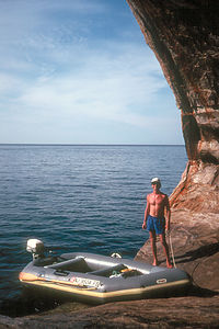 Herb with Avon RedshankThe road didn't start off too bad--that was just its evil way of luring us into complacency until it was too far to turn back. For awhile, we were able to bounce along at about 20 mph on the hard packed sand. About 10 miles into our journey, the road worsened becoming a continuous series of washboard-like bumps, causing everything that wasn't bolted down in the RV to bounce around madly. We had to reduce our speed to 5 mph. I remember following our route on the map on our laptop/GPS setup and watching the excruciatingly slow progress of the little arrow (that represented our motor home) moving along our planned route. I eventually had to turn the laptop off because the jarring was risking doing damage to our hard drive. Four agonizing hours later, with nerves completely shattered, we reached the pavement near the turnoff for Miner's Beach. By this point, Herb hated this park so intensely, that it took some convincing to get him to spend even one more minute here and drive down the short paved road to the Miners Castle Overlook.
He was fried. He didn't even want to get out of the motor home to the see the cliffs. The kids and I walked out to the fenced-in overlook and got our first glimpse of the "pictured rock" cliffs dropping off into the aquamarine waters of Lake Superior, which were uncharacteristically like a sheet of glass. It was an awesome sight. As Herb reluctantly approached the overlook, I turned to him and said, "You're gonna wanna launch the boat," which has since become our rallying cry whenever we see spectacular rivers, lakes, or oceans to launch our boat in.
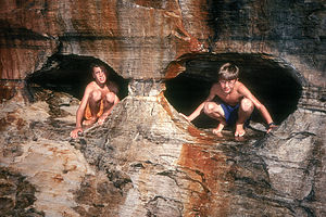 Boys in Pictured Rock EyesI think Pictured Rocks was trying to make up for the ordeal it put us through by giving us the gift of calm waters so that we could explore the cliffs in our inflatable. We lost no time. We quickly drove down to the Miners Beach to set up.
We had packed our12-foot Avon inflatable raft and 6 hp motor on this trip in the hopes that we would come across some opportunities to use it. The raft was stored in a big bag at the foot of the kids' bed over the cab, the wooden floorboard was stored next to the refrigerator, and the 6 hp motor was attached to the back ladder of the RV often eliciting inane comments from strangers, such as, "Can that little motor really power this big vehicle," as if we were some kind of Magic School Bus.
Like a precision team, desperate to extract some fun from the depths of despair, we setup and launched the raft in under a ½ hour. We putted happily along a 4-mile stretch of the pictured rocks between Miner's Castle, a beautiful rock formation in the shape of a castle, and Mosquito Beach. Along the way, we cruised through arches carved out of the cliffs, stopped in caves, and experienced some of the best views the park had to offer. At Mosquito Beach we splashed around in the waters where the Mosquito River flowed into Lake Superior. It was a fabulous experience--worth every bounce along our way here.
Back at Miners Beach while putting away the raft, the fickle Pictured Rocks tried to turn on us again. Our first suspicion that something bad was coming was the approach of a couple strolling along the beach clothed in full mosquito netting from head to toe. How ridiculous we all thought, but as dusk approached we ate our words. We became so covered in mosquitoes that we could barely carry the raft back to the RV because we had to constantly stop to slap the mosquitoes off.
However, not even the mosquitoes could put us in a bad mood after the great day we had had out on the lake.
Description
Pictured Rock National Lakeshore, on Michigan's Upper Peninsula, encompasses 40 miles of sandstone cliffs, beaches, and dunes along Lake Superior's southern shoreline. The name "pictured rock" comes from the colorful streaks of mineral stains that decorate the face of these colorful sculptured cliffs, which tower 50 to 200 feet above the aquamarine waters of Lake Superior. Erosion from the winds and the waves has sculpted these rocks over time, forming caves, arches, and formations resembling fortresses and castles.
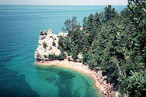 Pictured Rock National LakeshoreThe Pictured Rocks are best seen by boat or by air. However, if that is not an option, the best view of the rocks from land is from the Miners Castle Overlook, where there is an overlook platform directly above a castle-shaped formation in the cliffs. Another way to view the cliffs is to hike along the Lakeshore Trail, which runs the entire length of the park's shoreline.
The only road through Pictured Rocks is an inland 40-mile sandy road that connects Grand Marais in the northeast with Munising in the southwest. Most of the shoreline itself is inaccessible by car, except for Miners Beach, Twelvemile Beach, and Hurricane River.
Activities at the Lakeshore include hiking, boating, kayaking, canoeing, fishing, and swimming in the somewhat chilly waters of Lake Superior.
Mackinac Island
Saturday, July 15, 2000 - 9:00am by Lolo0 miles and 0 hours from our last stop
Travelogue
My absolute favorite way of exploring is on my bike, so a trip to Mackinac Island, where no cars are allowed, was something I was greatly looking forward to.
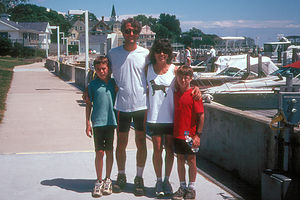 Family at Mackinac IslandWe woke early to a bright sunny day and rode our bikes from the campground to the ferry terminal just a few blocks away. For some reason, having nothing but our bikes beneath us gave us a feeling of freedom, a sense of adventure. Ferries make us happy too--they always seem to take us to special places we learn to love. So needless to say, spirits were high and we were ready for a day of fun.
Then, to our dismay, while filming our approach to the Island, Herb's camcorder went on the fritz--he couldn't see anything through the viewfinder. This was not good. Immortalizing our vacations on film is a passion with us, so this was not a mere inconvenience but a possible catastrophe. After putzing around with it for awhile, Herb came to the conclusion that the camera was probably recording, but he just couldn't see what the heck he was filming. He would just have to aim and hope that he wasn't just filming the tops of our heads or our feet.
The island was great--a step back in time to the Victorian Age. Horse-drawn carriages were bustling up and down Market Street, the main drag through the historic part of town. We strolled through the town, past its historic buildings and quaint shops--this was right up my alley. Herb wasn't quite as enamored with the quaintness as I was and kept mumbling something about the smell of horse piss. I think he was still in a bad mood about his camcorder.
The kids, however, loved it--especially the fudge shops. I've never in my life seen so many fudge stores, and they all had little tables outside offering free samples--which the kids took great advantage of. After filling our faces with about a pound of free samples, we purchased enough chocolate chip mint and death by chocolate (or some name like that) to last us the rest of our vacation, or so we thought--it was so good, that it never made it past Montana.
Now that we had our fill of fudge, it was time to do some exploring. Having spent many visits to historical forts in the past, we chose to skip the tour of Fort Mackinac and use the time we had on the island to bicycle the 8.2 mile Shoreline Trail, which goes completely around the island.
We first took a side trip up the hill past the fort to Skull Cave, because the name sounded pretty appealing to our 8 and 10-year old boys. According to legend, an English fur trader named Alexander Henry hid out in this cave during an Indian uprising in 1763. Unfortunately for him, the local Indian tribe used the cave to bury its dead, so he had to spend the night sleeping on a bed of skulls. The kids were hoping to see some skulls, but no such luck. If there ever were any, they are now long gone. They did, however, have fun climbing around on the rock above the cave.
We then headed off on the shoreline trail, which, as its name implies, ran right along the shore of the lake, with no cars to deal with, just the occasional horse-drawn carriage. After a short distance, we stopped at Arch Rock, a limestone arch that rises 149 feet above the water and has a span of 50 feet. Very impressive--I hope Herb managed to film it. We spent the next hour or two meandering along the rest of the Shoreline Trail, enjoying the views of the lake. Almost back in town, we rode past the very impressive 1887 Grand Hotel, with its very inviting 660-foot verandah. Unfortunately, it wasn't that inviting--for non-hotel guests, they charge an admission fee to even set your foot on the porch.
Back in town again, we had an early dinner at the Pink Pony Bar and Grill, which we learned is the end destination for the sailors in the Chicago to Mackinac Island sailboat race each year. I can see why. The food was great and the views out over the harbor to Mackinaw Bridge were lovely. It was a perfect ending to a near perfect day.
Description
Mackinac Island, one of Michigan's most popular state parks, is located in the western portion of Lake Huron near where it meets Lake Michigan. A visit to Mackinac Island is like a step back to the Victorian Age. There are no cars on the island--transportation is limited to horse-drawn carriage, bike, or foot. However, that isn't a problem as the island is quite small. In fact, there is an 8.2 mile "round-the-island" shoreline road for biking, hiking, and running.
The island is reached by ferry either from St. Ignace or Mackinaw City. The ferry docks at the southern part of the island in the historic downtown where most of the action is. Here you can stroll along Market Street visiting the historic buildings dating back to the early 1800s when the American fur trade was centered here, or stop in one of the many fudge shops which line the street. To the west of Market Street stands the impressive 1887 Grand Hotel with its 660-foot verandah, which unfortunately only hotel guests are allowed to sit on. In true Victorian fashion, guests receive afternoon tea and are expected to wear formal attire after 6:00 pm.
On a hill 150 feet above the town stands Fort Mackinac, which played an important role in the War of 1812. There are 14 historic buildings to visit within the fort and live history presentations where soldiers costumed in American uniforms from that time recreate military life in the 1800s, complete with music and musket demonstrations.
Past the fort is Skull Cave, which according to legend, is the cave where the English fur trader Alexander Henry hid out during an Indian uprising in 1763. According to Henry, the floor of the cave was covered with the human skulls. Apparently, the local Native Americans, used this cave to bury their dead.
The best way to see the rest of the island is to bike the 8.2 mile trail that runs around the entire island's shoreline. Bikes can be brought over on the ferry or rented right in town. One of the highlights along the shoreline trail is Arch Rock, a natural limestone formation with a span of 50 feet that rises 149 feet above the water. It is one of the most photographed spots on the Island. Other stops include a Nature Center and British Landing, where the British came ashore in 1814 on their midnight raid.
Cherry Orchards Drive / Mackinaw City
Friday, July 14, 2000 - 9:00am by Lolo170 miles and 4 hours from our last stop - 2 night stay
Travelogue
After leaving Sleeping Bear, we decided to take the scenic Cherry Orchards Drive along the shores of Lake Michigan to Mackinaw City.
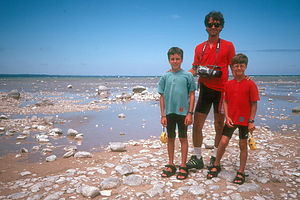 Herb and boys at Old Mission PeninsulaWe took the side drive out to Old Mission Peninsula, which juts out into Grand Traverse Bay. The peninsula road wanders through vineyards and the greatest concentration of cherry orchards in the country. Everywhere you looked there were roadside stands selling cherries and cherry pies. At the end of the road we stopped at the 1870 Old Mission Lighthouse and walked out on a boulder-strewn beach. Right by the lighthouse, there was a sign proudly displaying the fact that we were standing on the 45th parallel, exactly halfway between the Equator and the North Pole.
Back off Mission peninsula, we drove through pretty lakeside resort towns such as Traverse City and Charlevoix on our way to Mackinaw City, which we were going to use a base from which to explore Mackinac Island.
In Mackinaw City, we stayed at TeePee campground, right on Lake Huron. That evening, we wandered down to the small rocky beach, but none of us was in the mood to swim in the cool lake waters. There were lots of kids running around the campground, so after a little nudging we got the kids to mingle a little and play some volleyball and horseshoes with the other kids.
The next morning we rode our bikes from the campground to catch the ferry to Mackinac Island.
Description
The Cherry Orchards Drive is a 100-mile drive between Sleeping Bear Dunes National Lakeshore and Mackinaw City that winds along the eastern shore of Lake Michigan through lakeside resort towns and cherry orchards.
Mackinaw City is a good base for exploring Mackinac Island. TeePee Campground is conveniently located in biking distance to the ferry.
