- Home
- About
- Map
- Trips
- Bringing Boat West
- Migration West
- Solo Motorcycle Ride
- Final Family XC Trip
- Colorado Rockies
- Graduates' XC Trip
- Yosemite & Nevada
- Colorado & Utah
- Best of Utah
- Southern Loop
- Pacific Northwest
- Northern Loop
- Los Angeles to NYC
- East Coast Trips
- Martha's Vineyard
- 1 Week in Quebec
- Southeast Coast
- NH Backpacking
- Martha's Vineyard
- Canadian Maritimes
- Ocracoke Island
- Edisto Island
- First Landing '02
- Hunting Island '02
- Stowe in Winter
- Hunting Island '01
- Lake Placid
- Chesapeake
- Provincetown
- Hunting Island '00
- Acadia in Winter
- Boston Suburbs
- Niagara Falls
- First Landing '99
- Cape Hatteras
- West Coast Trips
- Burning Man
- Utah Off-Roading
- Maui
- Mojave 4WD Course
- Colorado River Rafting
- Bishop & Death Valley
- Kauai
- Yosemite Fall
- Utah Off-Road
- Lost Coast
- Yosemite Valley
- Arizona and New Mexico
- Pescadero & Capitola
- Bishop & Death Valley
- San Diego, Anza Borrego, Joshua Tree
- Carmel
- Death Valley in Fall
- Yosemite in the Fall
- Pacific Northwest
- Utah Off-Roading
- Southern CA Deserts
- Yosemite & Covid
- Lake Powell Covid
- Eastern Sierra & Covid
- Bishop & Death Valley
- Central & SE Oregon
- Mojave Road
- Eastern Sierra
- Trinity Alps
- Tuolumne Meadows
- Lake Powell Boating
- Eastern Sierra
- Yosemite Winter
- Hawaii
- 4WD Eastern Sierra
- 4WD Death Valley +
- Southern CA Deserts
- Christmas in Tahoe
- Yosemite & Pinnacles
- Totality
- Yosemite & Sierra
- Yosemite Christmas
- Yosemite, San Diego
- Yosemite & North CA
- Seattle to Sierra
- Southwest Deserts
- Yosemite & Sierra
- Pacific Northwest
- Yosemite & South CA
- Pacific Northwest
- Northern California
- Southern Alaska
- Vancouver Island
- International Trips
- Index
- Tips
- Books
- Photos/Videos
- Search
- Contact
Rocky Mountain National Park, CO
Thursday, July 16, 2009 - 1:45pm by Tommy
337 miles and 6.5 hours from our last stop - 1 night stay
Travelogue
Day 16
Six of us left Arches and we knew that only five would be arriving in Rocky Mountain National Park.
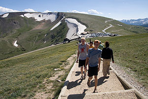 Hiking to a ViewpointNils was headed to Denver which was not in our direction so at some point we would have to say good-bye. We ended up stopping for lunch in a small town in Colorado, and that’s where he would look for his next ride. It was weird saying good-bye. In his very short stay he just seemed to fit right in and become another guy in the crew. What makes that so remarkable is that two days earlier he was a complete stranger. We hope he found another ride and is doing well.
The drive itself was very good. Western Colorado has some of the most amazing scenery. The high Rocky Mountains, rivers and vegetation were a very different sight from the Red Rock and Cacti that we had become accustomed to.
We arrived at Rocky Mountain National Park in the early afternoon and instead of doing a hike we just took the scenic drive through the Park. Our campground was at the opposite end of where we entered so it worked out well. It is also one of the highest paved roads in the US and had some views that were similar, but not nearly as spectacular, to the Bear Tooth Highway.
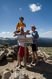 12005 Feet UpIt was during the ride that John had been informed that he forgot to schedule for his classes for next year and the deadline was about a month ago. So it was unfortunate that there was no cell service in the park because he had an important phone call to make. So we ended up leaving our campsite and driving into the town of Estes Park which is right outside the Park. There we searched for some service and John make the epic 2 hour phone call.
When he was finished we went to a local restaurant that looked good. We didn’t really fit in because it was full of old people that were all dressed up and we were kids in backwards hats and cutoffs but decided to stay. Since it was our last dinner out we saw it fitting to spend a little more money and order some steaks and fish.
During Johns call earlier in the night we walked around the town a little and saw a mini golf place that was $2.50 a person and simply couldn’t afford not to play. Colin brought up the rear with a 128 and John won with a 49. It was fierce competition.
We set up the broken tent one last time and it was off to bed.
- Jake
Description
Rocky Mountain National Park in north central Colorado encompasses 415 square miles of towering mountain peaks, alpine glaciers, dense forests, beautiful alpine meadows, and pristine lakes. Within the park there are more than 75 peaks above 12,000 feet, the highest of which is Longs Peak, at 14,255 feet. One-third of the park is above the treeline, where tundra predominates.
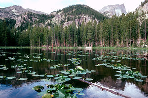 Bear LakeThe major activities in the park include hiking and backpacking along the more than 355 miles of trails, mountain climbing the many peaks, and wildlife viewing (mountain goats, elk, deer, bear, and bighorn sheep, which have become the symbol of the park).
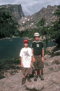 Boy's at Emerald LakeAn excellent way to see many of the park's highlights is to drive the scenic 50-mile-long Trail Ridge Road, which rises to over 12,000 feet and crosses the Continental Divide. The road crosses the park from Estes Park in the east to Grand Lake in the southwestern corner of the park winds it way 12,183 feet above sea level into a world similar to the arctic regions of Alaska and Siberia. Along the way there are spectacular views of snow-covered peaks, alpine meadows full of wildflowers, deep forests, and much wildlife. Because of snow, the road usually does not open until Memorial Day and closes again in October.
About halfway along Trail Ridge Road, at a 12,110 elevation, is the Rock Cut parking area, which is the trailhead for the Tundra Nature Trail, an easy ½ mile hike that provides a close-up look at the hardy plants and animals that survive the harsh tundra environment at this elevation. A little further along the road is the Alpine Visitor Center. From here the short Alpine Ridge Trail climbs from the Visitor Center up a series of steps through the tundra to an excellent viewpoint.
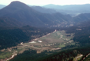 Lookout off Trail Ridge RoadThere are many other excellent hiking opportunities in the park, including several along the Bear Lake Road. Most of these hikes offer tremendous views of mountain lakes and waterfalls. The 3.6 mile round trip Emerald Lake Hike starts at Bear Lake and goes past 2 more lakes before its final destination, Emerald Lake. The 1.2 mile round trip Alberta Falls Trail is an easy hike along a creek to the very pretty Alberta Falls.
There are 4 RV campgrounds in the park, only 2 of which take reservations. Campgrounds usually fill up by noon. - Lolo
- ‹ previous
- 10 of 12
- next ›
Rocky Mountain National Park location map
Javascript is required to view this map.
