- Home
- About
- Map
- Trips
- Bringing Boat West
- Migration West
- Solo Motorcycle Ride
- Final Family XC Trip
- Colorado Rockies
- Graduates' XC Trip
- Yosemite & Nevada
- Colorado & Utah
- Best of Utah
- Southern Loop
- Pacific Northwest
- Northern Loop
- Los Angeles to NYC
- East Coast Trips
- Martha's Vineyard
- 1 Week in Quebec
- Southeast Coast
- NH Backpacking
- Martha's Vineyard
- Canadian Maritimes
- Ocracoke Island
- Edisto Island
- First Landing '02
- Hunting Island '02
- Stowe in Winter
- Hunting Island '01
- Lake Placid
- Chesapeake
- Provincetown
- Hunting Island '00
- Acadia in Winter
- Boston Suburbs
- Niagara Falls
- First Landing '99
- Cape Hatteras
- West Coast Trips
- Burning Man
- Utah Off-Roading
- Maui
- Mojave 4WD Course
- Colorado River Rafting
- Bishop & Death Valley
- Kauai
- Yosemite Fall
- Utah Off-Road
- Lost Coast
- Yosemite Valley
- Arizona and New Mexico
- Pescadero & Capitola
- Bishop & Death Valley
- San Diego, Anza Borrego, Joshua Tree
- Carmel
- Death Valley in Fall
- Yosemite in the Fall
- Pacific Northwest
- Utah Off-Roading
- Southern CA Deserts
- Yosemite & Covid
- Lake Powell Covid
- Eastern Sierra & Covid
- Bishop & Death Valley
- Central & SE Oregon
- Mojave Road
- Eastern Sierra
- Trinity Alps
- Tuolumne Meadows
- Lake Powell Boating
- Eastern Sierra
- Yosemite Winter
- Hawaii
- 4WD Eastern Sierra
- 4WD Death Valley +
- Southern CA Deserts
- Christmas in Tahoe
- Yosemite & Pinnacles
- Totality
- Yosemite & Sierra
- Yosemite Christmas
- Yosemite, San Diego
- Yosemite & North CA
- Seattle to Sierra
- Southwest Deserts
- Yosemite & Sierra
- Pacific Northwest
- Yosemite & South CA
- Pacific Northwest
- Northern California
- Southern Alaska
- Vancouver Island
- International Trips
- Index
- Tips
- Books
- Photos/Videos
- Search
- Contact
Shasta Lake, CA
Wednesday, July 17, 2019 - 1:45pm by Lolo
213 miles and 4 hours from our last stop - 6 night stay
Travelogue
Day 1 - Launch at Packers Bay and camp in cove on Sacramento Arm
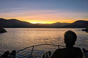 Herb enjoying his first sunset on Shasta LakeSince we moved the boat West in 2016, we had been anxiously searching for a place to use our Grady White. Of course, there is the ocean, and I’m sure we will eventually get to that, but we were more interested in finding a place to waterski, swim, and camp.
We would have loved to put the boat in Lake Tahoe, but they are quite strict as to what types of engines can be used. The lake is incredibly pristine, so I can see their motivation for keeping it so. Unfortunately, our carbureted, two-stroke engine is not allowed on the lake.
So that pretty much pointed us to Shasta Lake, California’s largest reservoir, which because of the heavy snows the last two winters was pretty close to capacity and back to having over 300 miles of shoreline and dozens of coves to explore and camp in. As a result, it is one of California’s top recreational destinations.
Another thing we think about when trailering our boat is the drive. For example, Lake Berryessa is nearer to us but requires us to drive up some pretty steep, twisty hills. The drive to Shasta Lake, on the other hand, is pretty straightforward - just under 4 hours and most of it on I5.
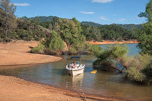 Our cove in O'Brien's InletThere are seven boat launches on the lake, but we chose to launch at Packers Bay, as it was the closest and had the biggest parking lot.
Our only mission that day was to find a place to camp for the night, so we cruised a bit up the Sacramento Arm before finding a little rocky cove to camp in, where we tied up to some dead trees near the shoreline.
Later that evening, a deer climbed down the steep rocks surrounding the cove to visit us. We had know idea as to why - there was no food and he didn’t even take a drink in the lake. However, he did take a swim to the other side of the cove. Strange.
Even stranger, after it got dark we noticed two shiny circles at the top of the rocks surrounding the cove, which we eventually realized were a pair of eyes staring down at us. As far as we knew, it had to be some kind of cat, as they are the only animals I know whose eyes glow in the dark. Mountain lions are found around Shasta Lake, so we were pretty sure that that was what was looking down at us. I just hoped he didn’t know how to swim and climb a boat ladder.
Day 2 - Cruise Sacramento Arm, select camping spot, and swim
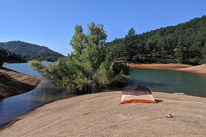 Tommy and Erin's home for the nightTommy and Erin were planning on joining us for the weekend, so we set out today on a cruise to look for shoreline for them to camp on, as our 20-foot Grady White is not big enough to fit four people - although if necessary, they could sleep out on the back deck.
It wasn’t long before we realized this was going to be harder than we thought. Unlike Lake Powell, where there are miles of flat, sandy shoreline upon which to set up a tent, the shores of Shasta Lake are not only steep, but thickly forested with pine and oak trees.
Finally we found something that might work up the Sacramento Arm, along the O’Brien Creek Inlet. It had a small sandy beach with a small hill with a flat enough spot on top to pitch a tent. Not perfect, but workable. Plus, the cove was really nice for swimming.
We continued our cruise to see if we could find something better, but there really wasn’t, so we came back and anchored for the night. The rest of the afternoon was quite relaxing, as we spent it reading, swimming, and floating.
Day 3 - Set up Camp and relax in our cove
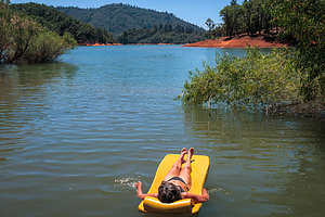 Lolo enjoying her floatWe were kind of afraid that if we left someone would take the camping spot we had found for Tommy and Erin, especially since it was Friday and flat shoreline was extremely scarce. So, pretty early in the morning we cruised back to the Packers Bay boat launch to pick up our tent, so we could set it up on the spot we wanted to save. That way we wouldn't have to hang out and guard our spot the whole day.
Once that was done, we pretty much just chilled the rest of the afternoon reading, swimming, snorkeling, and floating.
Later in the day, two large houseboats invaded our private cove and anchored along the shoreline about 50 yards north of us. Still, it wasn’t too invasive in that we were at the very end, so no boats would be cruising by us, kicking up a wake. Plus, there was a large tree in the water between us and them providing quite a bit of shade and privacy.
Day 4 - Pickup Tommy and Erin, Birthday Lunch at Bridge Bay Restaurant, and waterskiing
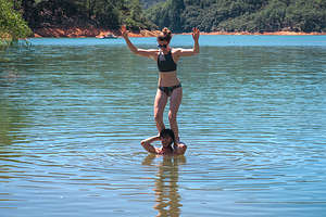 Tommy and Erin have arrivedTommy and Erin had driven up the night before and camped in the van nearby, so they were ready for us to pick them up at the boat launch bright and early.
We brought them back to our home in the O’Brien’s Creek Inlet, where we spent the morning swimming. Afterwards, we headed out on the boat for a cruise around the lake and a stop at the Bridge Bay Restaurant to celebrate Tommy’s 28th birthday, which was coming up next week.
The view from our table on the outdoor patio of the lake was fantastic, and the food was quite good as well. We each indulged a bit with a celebratory cocktail, something we normally wouldn’t do mid-day, but it was after all Tommy’s birthday.
After lunch, we went for a cruise up the McCloud Arm of the lake. Shasta Lake has three major arms, each created by a river that flows into it: the Sacramento River, the McCloud River, and the Pit River. Taking it a step further back, The Sacramento River's source is the Klamath Mountains, the McCloud River's source is Mt. Shasta, and the Pit River flows from Alturas.
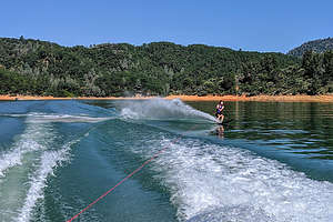 Tommy slalom skiingI think Tommy was anxious to waterski, as he had done it, on our boat at least, since he moved out West in 2013. We headed back up the Sacramento Arm and into O’Brien’s Inlet where the water was a bit more protected and calm as it wasn’t out in the major channel.
I had forgotten how much fun water skiing can be. It was quite a successful afternoon, as each of us got up the very first time - Tommy and I each on a slalom ski and Erin on two skis.
I used to try to slalom at least once every year just to prove that I still wasn’t old. With the boat living on the opposite coast for the past few years, I hadn't had a chance to try, so I was quite excited (and relieved) that I could still do it.
Then it was back to our campsite in the cove for more swimming and fun with Tommy and Erin. Not a bad life.
Day 5 - Waterski some more, drop Tommy and Erin off, and camp in Pit Arm
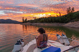 Our new campsite near the mouth of the Pit ArmBefore dropping Tommy and Erin off to at the Packers Bay Boat Launch so they could go back to their real working lives, we did another round of waterskiing in O’Brien’s Inlet. Another successful session as we each got up first time again. I still got it!!
After saying our goodbyes at the boat launch, Herb and I decided to cruise around the lake and find a different spot to camp. We would have a lot more options now that we didn’t have to worry about a flat shoreline to set up a tent. All we need was a place to toss an anchor.
We found a nice spot to anchor near the mouth of the Pit Arm where we were oriented towards the sunset. Sure enough, it put on quite a show for us. Lovely
Day 6 - find camping with view of Mt. Shasta
 View of Mt. Shasta from our campsite on Slaughterhouse IslandThis morning we went in search of a view of Mount Shasta from the lake. We had seen it the other from near the Dam, but wanted to see if we could find a campsite with a view.
We did find a pretty cool spot near the mouth of the Sacramento Arm on the north end of Slaughterhouse Island - it had a nice ring to it. I think this is only an island when water levels are high as Google Maps showed it as a peninsula. Whatever it was, it was a good spot with a nice view up the lake of snow-covered Mount Shasta. Plus there was even a nice pine forest behind us that we could take a stroll through. It was good to use the legs after sitting in a boat so long.
There was even a small bluff with a flat top where we set up our chairs and a beach umbrella - the sun was really quite hot. It did require us, however, to step through some pretty mucky quick-sandy like stuff at the shoreline - tough to keep the sandals on
We spent the rest of the afternoon swimming, reading, and looking at Mt. Shasta.
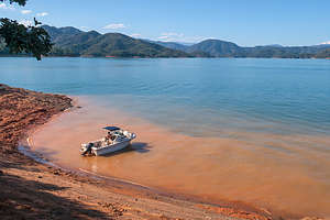 Our campsite on Slaughterhouse Island (with view of Mt. Shasta on the right)
Day 7 - Cruise up McCloud River Arm and home
After 6 nights sleeping on a small boat, I get a bit antsy, especially when there was really no place to anchor and hike, as we had been able to do in Lake Powell and Lake Mead.
We decided to take one more cruise, this time all the way up the McCloud River Arm before pulling the boat and driving home.
Description
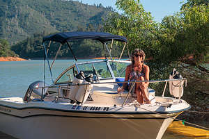 The first mateShasta Lake, located near the town of Redding, is California’s largest reservoir. When at full capacity it has 365 miles of shoreline and dozens of coves to explore and camp in.
Shasta Lake was created in 1948 when the Shasta Dam was constructed across the Sacramento River. As a result of the dam, the lake has four major arms, each created by an approaching river: the Sacramento River, the McCloud River, Squaw Creek, and the Pit River.
In addition to providing electrical power, flood control, and water storage, the lake has become one of California’s top recreational destinations. There are nine marinas offering a variety of services, including houseboat rentals and seven boat launches.
- 1 of 1
Shasta Lake location map in "high definition"
Javascript is required to view this map.
