- Home
- About
- Map
- Trips
- Bringing Boat West
- Migration West
- Solo Motorcycle Ride
- Final Family XC Trip
- Colorado Rockies
- Graduates' XC Trip
- Yosemite & Nevada
- Colorado & Utah
- Best of Utah
- Southern Loop
- Pacific Northwest
- Northern Loop
- Los Angeles to NYC
- East Coast Trips
- Martha's Vineyard
- 1 Week in Quebec
- Southeast Coast
- NH Backpacking
- Martha's Vineyard
- Canadian Maritimes
- Ocracoke Island
- Edisto Island
- First Landing '02
- Hunting Island '02
- Stowe in Winter
- Hunting Island '01
- Lake Placid
- Chesapeake
- Provincetown
- Hunting Island '00
- Acadia in Winter
- Boston Suburbs
- Niagara Falls
- First Landing '99
- Cape Hatteras
- West Coast Trips
- Burning Man
- Utah Off-Roading
- Maui
- Mojave 4WD Course
- Colorado River Rafting
- Bishop & Death Valley
- Kauai
- Yosemite Fall
- Utah Off-Road
- Lost Coast
- Yosemite Valley
- Arizona and New Mexico
- Pescadero & Capitola
- Bishop & Death Valley
- San Diego, Anza Borrego, Joshua Tree
- Carmel
- Death Valley in Fall
- Yosemite in the Fall
- Pacific Northwest
- Utah Off-Roading
- Southern CA Deserts
- Yosemite & Covid
- Lake Powell Covid
- Eastern Sierra & Covid
- Bishop & Death Valley
- Central & SE Oregon
- Mojave Road
- Eastern Sierra
- Trinity Alps
- Tuolumne Meadows
- Lake Powell Boating
- Eastern Sierra
- Yosemite Winter
- Hawaii
- 4WD Eastern Sierra
- 4WD Death Valley +
- Southern CA Deserts
- Christmas in Tahoe
- Yosemite & Pinnacles
- Totality
- Yosemite & Sierra
- Yosemite Christmas
- Yosemite, San Diego
- Yosemite & North CA
- Seattle to Sierra
- Southwest Deserts
- Yosemite & Sierra
- Pacific Northwest
- Yosemite & South CA
- Pacific Northwest
- Northern California
- Southern Alaska
- Vancouver Island
- International Trips
- Index
- Tips
- Books
- Photos/Videos
- Search
- Contact
Moab, UT
Monday, May 10, 2021 - 1:00pm by Lolo
416 miles and 7 hours from our last stop - 3 night stay
Travelogue
Day 1 - Shafer Trail Switchbacks / Potash Road
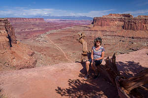 Just before the Shafer Trail SwitchbacksOur main reason for coming to Moab, besides its being an awesome place, was that we had been fortunate enough to get Overnight Backcountry Permits for two consecutive nights along the highly coveted White Rim Trail in Canyonlands National Park, a 100-mile rocky, twisting road down from the rim along switchbacks to the Colorado River, which is done by both 4WD vehicles and mountain bikes. We, of course, were doing it in our 4Runner.
I will explain our travels along the White Rim Trail in the next stop, but for now we had four nights to spend in and around Moab before hitting the White Rim Trail.
 Shafer Trail SwitchbacksSince we had stayed in a hotel last night, we decided that tonight we would try to disperse camp somewhere on Bureau of Land Management (BLM) land. This is something we could never do in the Lazy Daze, but now that we are doing much of our travels in our 4WD 4Runner, the camping opportunities are endless.
Most people don’t know that the BLM maintains and manages over 73,000 miles of roads compared to the measly 47,000 miles in the Interstate Highway System. With that many miles, it’s easy to find an incredibly scenic spot and have it all to yourselves.
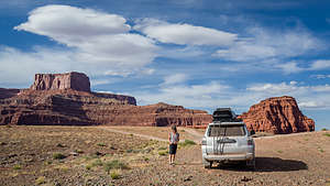 Along the Potash RoadWe have several guides to 4WD Trails that we use to select dirt back roads that are scenic, but won’t require us to do ridiculous feats of rock crawling. The Shafer Trail Switchbacks to Potash Road to Moab checked all the boxes for what we were looking for.
After checking in at the Canyonlands Visitor Center to find out about dispersed camping options along the way (and getting contradictory answers from two different rangers), we started our journey from the rim of the canyon zigzagging down the exciting and dramatic switchbacks 1,500 feet to the junction of the White Rim Trail and Potash Road. It actually looks a lot scarier from above than it actually is.
 At our campsite at Thelma and Louise Point on the Potash RoadFor now, we would take the Potash Road to Moab, but later this week, we would have to descend these switchbacks again to take our 3 day trip along the White Rim Trail. An overnight backcountry permit is required for that, but the Shafer Trail and Potash Road can be done without one.
The Shafer Trail / Potash Road trail began as a cattle trail in 1917, but when uranium ore was discovered in the late 1940s, the old cattle routes became truck routes to bring ore to Moab.
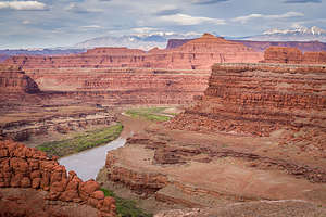 View from our campsite along the Potash RoadOnce done with the switchbacks, we were on flatter ground tracing the Colorado River and looking up at Dead Horse Point State Park. The road was fairly rough, but very doable in our 4Runner. The scenery was incredible.
It was hard to believe that just this morning we had been cruising along at 80 mph on the Bonneville Salt Flats, and now here we were bouncing along the Colorado River with canyon rims towering above us.
 Colorado River from Pyramid ButteThat also meant that we were pretty exhausted and wanted to find a place to settle down and camp for the night. Dispersed camping is not allowed in national parks, so we had to get beyond the boundaries of Canyonland and into BLM land before we could start looking for a campsite for the night.
Herb had done a lot of research before leaving on this trip using Google Earth and Gaia to scout out potential camping spots. His work definitely paid off. That night we camped all by ourselves on a bluff overlooking the Colorado River in the location where the final scene of the movie Thelma and Louise was filmed - the one where they drive their car off the cliff.
The next morning we continued along Potash Road, taking a side trip to Pyramid Butte and another awesome overlook of the river, where we watched several boats cruise by below us.
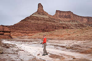 Herb playing in the potashNot long after that we came to the potash evaporation ponds, owned and operated by the Intrepid Potash company. Potash is a potassium rich salt which is used to make fertilizer and as a component of feed supplement to enhance cows’ milk production.
The way it works is miners pump water from the Colorado River about 4,000 feet underground to reach the potash ore. The water dissolves the soluble potash into a brine, which is then pumped into underground caverns. Once it is fully dissolved, the potash brine is pumped to one of the evaporation ponds.
Here’s where it gets interesting. The water in the ponds is dyed a bright blue to help it absorb sunlight and heat, thereby reducing the time it takes for it to crystallize and be removed for processing.
 We have arrivedSo these were the psychedelic blue ponds we had seen in the distance as we drove along the Potash Road. The stark contrast of the dazzling electric blue water against the surrounding red desert was pretty amazing.
There was also quite a bit of the white powdery potash on the ground near the ponds. And here we thought we had left the salt flats back in Bonneville.
Soon we were back on the pavement of Utah 279, which winded its way along the Colorado River to our right, and rock walls filled with climbers on our left. There was even a wall with petroglyphs along the way.
Since we would be doing a lot of camping in the truck later in the week, we decided to set up a Moab base camp for the next few nights at the Expedition Lodge in Moab.
Day 2 - Arrival in Moab and the Fisher Towers hike
 Fisher TowersIt felt good to be back in Moab, one of my favorite towns of the West. There's just something special about this place, especially if you love the outdoors. The scenery is incredible, the recreational opportunities are endless, and the town itself is full of life, not to mention some great shops and restaurants. Moab has a personality of its own. We had been to Moab several times before, but it’s the kind of place that you can come back to time and time again and always find something new to do.
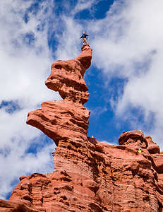 Climber atop the corkscrew summit of the Ancient Art formationHowever, Moab had changed a bit since our last visit in 2005 - many more hotels and crowds. Perhaps part of the reason for the crowds was pent-up demand for travel because of Covid easing, and the fact that so many people had come to appreciate outdoor activities when indoor ones had been restricted. We would definitely have to get off the beaten track a bit.
As I mentioned in the overview, Herb and I have been transitioning our mode of travel away from the motorhome towards camping in more remote areas in the 4Runner. However, since there are only so many nights I can take without some basic creature comforts, we try to alternate with stays in nice hotels.
 Along the Fisher Towers hikeSince later this week we would be camping out two nights on the White Rim Trail and probably a few nights afterwards, we decided to spoil ourselves and use the Expedition Lodge in Moab as a base camp for the next 3 days and to day excursions from there.
Another change in our usual routine is eating out more often. When convenient, we like to get the big meal out of the way during lunch so that we are freer to wander around and take photos during the evening golden hour.
So, after checking into our hotel, which they very nicely let us do early, we looked at Tripadvisor for nearby restaurant recommendations and chose Arches Thai, which had excellent reviews.
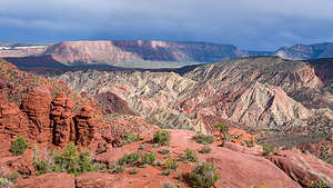 Onion Creek Canyon and the La Sal MountainsAfter lunch, and a brief nap, we set out for our activity of the day - the Fisher Towers hike, which I had selected during my pre-trip research as a must do. Our younger son Tommy, who like his brother is an avid rock climber, climbed this tower a few years back with his girlfriend. We, however, would be admiring it from below.
To get to the trailhead, we drove north on 191 to Highway 128, which we followed for 21 miles along the Colorado River to the turnoff for Fisher Towers Road on the right. The 2.2-mile dirt road to the trailhead is in good condition for passenger cars.
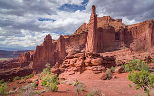 The hike back along the Fisher Towers trailWe were worried about finding parking at the trailhead for this very popular hike, but it was 4:00 already, so we had no trouble finding a spot.
The trailhead is at the base of the towers, so we didn’t have to hike very far before being rewarded with these amazingly stunning hardened-mud monoliths, which look more like ornate baroque architecture than geological formations.
After 1 mile, we reached the base of the 900-foot high Titan, the tallest of the towers. This is the turn around point for many hikers, as it is the most dramatic, but there was still so much more good stuff to come.
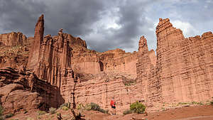 Stormy skies on the hike backBy far my favorite rock formation was the corkscrew summit of the Ancient Art formation. This was the climb that my son and his girlfriend had done, and I remember seeing photos of them finishing that climb, on what really did look like a corkscrew. There was a climber on it now.
After about 45 minutes, we reached a metal ladder which we used to climb down into a gully from which we then climbed out of via a short set of rock ledges.
From there, we ascended to a level saddle on a peninsula that brought us to an overlook above Onion Creek Canyon with sweeping vistas across the Colorado River Canyon and into the La Sal Mountains. It was absolutely lovely.
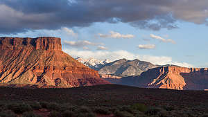 Golden hour along Onion Creek RoadFrom there we retraced our way 2.5 miles back to the trailhead. I never mind out-and-back trails because the views coming back are always different. In this case, the lighting had completely changed, so everything looked different - not the brilliant red of golden hour that we were still too early for, but some pretty dramatic storm clouds over the towers.
Rather than head directly back from Moab, I convinced Herb to stick around for the golden hour, when the rocks light up a brilliant red. To do that, we drove a short distance down Onion Creek Road, which was just a few miles down the road from the Fisher Towers Road. We made sandwiches for dinner and watched as the nearby formations put on a bit of a show. I kept wondering what was happening now at the Fisher Towers, but you never know.
Now back to the Expedition Lodge to rest up for the next day’s adventure.
Day 3 - Mountain Biking the single-track trails of Dead Horse Point State Park and Off-roading through Onion Creek
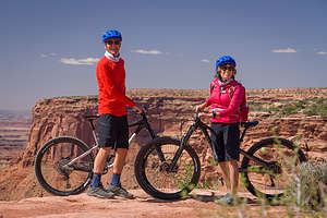 Mountain Biking the single-track trails at Dead Horse Point State ParkI love mountain biking and Moab is pretty much the definitive mountain biking capital of the United States, with hundreds of miles of epic trails and slickrock to ride, including its world famous Slickrock Bike Trail.
However, we are now pushing 65 years old, and although we are in good shape, I think the time for riding those trails has long passed.
While researching the trip, I came very close to giving up on finding a mountain biking option, both for fear of killing ourselves and also the logistics of getting a rental bike to an appropriate trailhead.
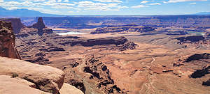 View along our mountain bike rideThen, while searching for easy mountain bike trails in Moab, I came up with the ultimate solution - the Intrepid Trail System at Dead Horse Point State Park, which has 17 miles of singletrack trails with beginner to intermediate trails. My joy was complete when I further discovered Bighorn Mountain Bikes, a rental facility located within the Park right at the trailhead. I was very, very excited.
May is high season in Moab, so just to ensure that we wouldn’t be disappointed, we called two days ahead of time to reserve our bike rentals.
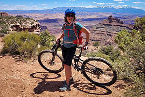 Overlook along the mountain bike trailWe got there around 9:30, anxious to take full advantage of our day. The bikes had to be returned by 3:00. It was a perfect weather day, not too windy and about 10 degrees cooler than in Moab, since we were about 1,500 feet higher.
The guy that was running the shop was very helpful, both in terms of setting us up with very good mountain bikes and with making recommendations as to the trails we should start out on.
We soon found out that Moab’s view of a beginner trail is different from ours. Fortunately, we are pretty experienced mountain bikers, so although some of the trails might have been a little challenging, they were certainly doable - and lots of fun!
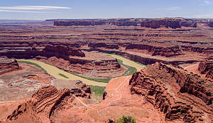 Grand View Point, Dead Horse Point State ParkThe trails on the east side of the main park road were easier than those on the west, so we started off on the Great Pyramid, a beginner/intermediate trail that took us to the lovely Pyramid Canyon Overlook, where we dragged our bikes to the rim’s edge for a photo opp. It was sort of like standing on the rim of a mini Grand Canyon.
I think the intermediate parts were the rock ledges that we had to navigate. The scariest ones for me were when there were a series of them, like steps. If it got too challenging, I just got off and walked the bike through them.
 Setting out on the Onion Creek RoadBack on our bikes, we continued on the Great Pyramid Trail to the Desert View Overlook, another awesome spot where we once again dragged our bikes.
Rather than continue on to the Visitor Center, we headed north on the Raven Roll trail, which was rated Beginner - no big ledges to climb here.
When we got back to the Great Pyramid junction, we took a right so that we could do the Big Chief Loop in the recommended counter-clockwise direction. This trail was rated Intermediate/Beginner as opposed to the Beginner/Intermediate Great Pyramid trail, which I guess meant that it was a little harder. However, now we were warmed up and ready to handle a bit more challenging situations.
This trail brought us to the Big Chief Overlook, another amazing view, where we took a break and ate our lunch and took in the scenery.
 Along the Onion Creek RoadRather than head directly back to return our bikes, we came to the Crossroads (Intermediate/Beginner) trail 8.8 miles into our ride and decided to take it. It was called Crossroads because it crossed the main park road and brought us towards the more difficult trails on the west side of the road.
That trail was so much fun, roller coasting along a sandy trail through sagebrush and pinyon trees. No big views of canyons and rivers, but just a fun ride. I’m not sure why this was rated Intermediate at all, as it was probably the easiest trail we had been on.
 Along the Onion Creek RoadWe went about a mile and a half out and then back again, before taking the right on Raven Roll which led us back to Bighorn Mountain Bikes.
Our total distance for the day was 12 ½ miles with a 750-foot elevation gain.
It was absolutely awesome. Definitely a trip highlight for us.
After we returned our bikes, we drove our car to the Dead Horse Point Overlook, which is the main attraction at the State Park because of its incredible views. From the overlook parking lot, we walked a short distance in both directions to take in the breathtaking views of an oxbow in the Colorado River and the adjacent canyon country.
 Along the Onion Creek RoadWe could even see the Potash Road which we had driven on two days ago and Thelma and Louise Point where we had camped. So, I guess this was the view we were looking up at.
That evening, rather than just relaxing in our hotel room, we decided to drive back up HIghway 128 along the Colorado River to drive the off-road portion of Onion Creek Road up through the Canyon. We certainly were running this vacation at a pretty frenetic pace, and it was only Day 4. Hopefully, we could keep this up without crashing and burning.
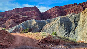
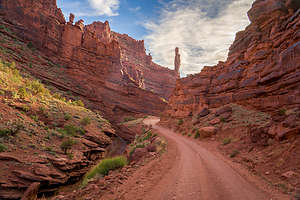
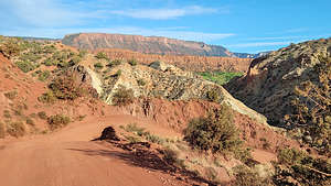
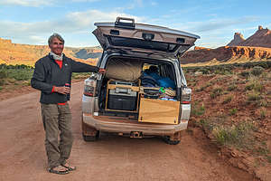 Dinner with a viewAlthough we had been on Onion Creek Road last night, we hadn’t driven the off-road portion which starts near the Onion Creek Campground. The road follows the creek, crossing and recrossing it about two dozen times. Fortunately, the water was low enough to not be an issue.
After a couple of miles, the canyon got quite narrow, surrounded by red sandstone walls and tall spires. After about 7 miles the canyon opened up to a lovely valley, the same one that we had looked out on from the end of our Fisher Towers hike.
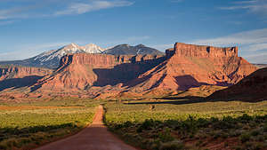 The dinner viewAt this point, we turned around and retraced our steps back out through the narrow canyons, crossing the stream another two dozen times.
The light was getting good, so Herb and I pulled over on the main on-road portion of Onion Creek Road to make dinner - weisswurst and roasted vegetables that we had made and vacuum sealed before leaving (very very handy for a healthy meal).
I would say that it was a pretty full day, and we had one more before starting the real reason for us being in Moab - driving the 100-mile White Rim Trail.
Time to get back to base camp at the Expedition Lodge.
Day 4 - Grandstaff Trail hIke to Morning Glory Natural Bridge and Arches National Park
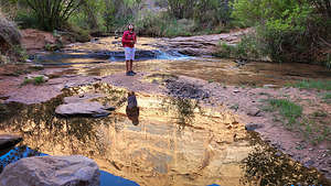 Setting off on the Grandstaff Trail hIke to Morning Glory Natural BridgeThis was our last full day in Moab before hitting the White Rim Trail. Originally, I thought I would like to spend a day in Arches National Park, but because of the big surge in tourists in Moab, the lineup of cars to get in each morning extended all the way back to Highway 191. Crazy!
Instead we chose the Grandstaff Canyon hike to Morning Glory Bridge. The trailhead is three miles east on HIghway 128.
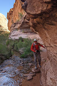 Along the Grandstaff Trail to the Morning Glory Natural BridgeIt was a wonderfully cool morning, the perfect day for a hike. This is a very popular hike, so we were pleased to find that there was plenty of parking at the trailhead.
We set off on the trail, which briefly led us over slickrock before becoming a sandy path that ran through lush vegetation (mostly cottonwoods, Gambel oaks, and poison ivy) along a lovely perennial creek. About a mile into the hike, we had to cross the stream, for what would be the first of about ten crossings.
The beautiful steep canyon walls of Navajo sandstone provided us with shade throughout most of the morning.
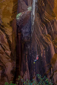 Rappeller descending from top of Morning Glory Natural BridgeAt about 1.3 miles, there is a brushy tributary canyon to the right, but we continued on along the sandy main trail towards the Morning Glory Natural Bridge.
At 1.9 miles we came to a junction, where we left the main canyon and took a right into the tributary canyon at the end of which lay the Morning Glory Natural Bridge. The trail climbed a bit and soon the Bridge came into view.
Since it crosses the back of the canyon and is narrowly separated from the rock wall behind it, it was difficult to appreciate until we stood directly beneath its very impressive 243-foot-long span. In fact, it's the 6th longest rock span in the U.S.
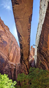 Rappeller descending from top of Morning Glory Natural BridgeWhen we approached the bridge, we noticed some people rappelling down from the top of it. I spoke to one of them, who informed me that they were on a guided trip in which they were bussed to a trailhead, hiked to the top of the arch, rappelled down it, and now would hike out on the path that we had just hiked in on. In Moab, there are guided tours for everything.
Although Morning Glory looked very much like an arch, it is more correctly a natural bridge. The major difference is that arches are formed by weathering and erosion, while natural bridges are formed by water. While most bridges are formed by streams, Morning Glory is a bit unique in that it was carved at the base of a waterfall. That is why it is so close (15 feet) to the cliff behind it over which the waterfall once cascaded.
The waterfall doesn’t flow much these days, but there is a seep spring near the bridge which feeds Morning Glory pool.
From there, we turned around and retraced our steps 2.5 miles back to the trailhead. It was much hotter and more crowded on our way back - two reasons to get started early on a hike.
 Poison Spider Mesa Dinosaur TracksBack in Moab, we stopped for lunch at the Moab Brewery, a place we had visited on past visits to Moab. It has good food, great beers, an upbeat atmosphere, and friendly service. They brew their beers right on site and most of them are quite good. I personally enjoyed the Juicy Johnnie IPA while Herb had a Hefeweizen.
We had an afternoon to kill, so we decided to take the advice of our favorite trip planning book - Photographing the Southwest, as it has never failed to take us to beautiful places. This was a questionable one, however, in that it required us to drive a short portion of the Poison Spider Mesa 4WD road, one of the most challenging trails in Moab. The author assured us that the first 2 miles weren’t that bad and that it would bring us to an amazing set of rocks and fins known as “Behind the Rocks.”
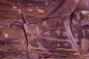 Poison Spider Mesa PetroglyphsWell, after crawling along over rocks of all shapes and sizes at about 3 mph on the first mile, we said it just wasn’t worth it. It’s not as if we had had a shortage of beautiful rocks and fins.
We would just have to settle for the dinosaur tracks and petroglyphs that could be reached via a 0.3-mile hike from the Poison Spider Mesa parking lot. The petroglyphs, which were similar in style to the others we had seen along the Colorado River around Moab, were easy to find
The dinosaur tracks were a little more challenging, but still pretty obvious. Herb, who has a much greater love for dinosaurs than me, was extremely pleased when he found them.
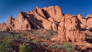 Fiery Furnaces - Arches NPThe tracks represent up to 10 different individual animals. The rocks containing the tracks fell from the cliffs above us, spitting along the bedding plane where they were preserved.
The larger tracks were from a dinosaur called Eubrontes, which was just over 5.6 feet tall at the hip. The smaller ones were that of a Grallator, which was just 1.5 feet tall, similar in size to a modern-day turkey. Not exactly T-Rex. Still it was quite cool.
 Sand Dune ArchOn the way back to the hotel, we passed the entrance to Arches National Park at around 5:30 and noticed that there was no long line of cars like we had seen on other afternoons, so we decided to drive in. We had no real agenda, as we had been here many times before, but we felt it was definitely worth a drive through again.
We drove directly to the Fiery Furnace section, where a group of huge red sandstone fins form a maze of narrow canyons and dead-end passageways. It is so confusing, that visitors are only allowed in the maze on a ranger-led tour. We had been on one of these tours back in 2005, and it was pretty awesome. For now, we satisfied ourselves with looking at the exterior of them from the overlook.
 Balance Rock with a Lenticular "fish" cloudBased on our photo guide, we did discover a new place that we had never known about - the Sand Dune Arch, a hidden arch, just a mile and a half before the end of the park road.
From the Sand Dune Arch trailhead, we followed a path for a short distance toward a section of sandstone fins. At the junction, we turned right onto a sandy path which brought us between two rows of sandstone fins to a beautiful arch flanked by the fins. Beneath the arch is its namesake sand dune.
On the drive out of the park, we noticed a lenticular (flying saucer like) cloud hovering over Balanced Rock. It looked like a giant fish. I told Herb to pull over as soon as he could, and I proceeded to run up and down the road like a maniac trying to position the cloud so that it would appear to be sitting atop Balanced Rock, like a cap.
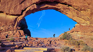 North Window ArchOur last stop on the park drive was a side trip to the Windows section where there are a series of easy to reach, impressive arches. We were starting to lose the light, so I made a mad dash from the car up to the North Window, hoping to capture the iconic shot of the Turret Arch framed within the arch’s opening. Too late. Also, I forgot that it is a bit precarious positioning oneself on a rock behind North Arch to capture this shot.
Well, Arches National Park had definitely been an unexpected bonus to an already action-packed day.
Tomorrow we would start the 100-mile drive along the White Rim Trail in Canyonlands National Park.
- ‹ previous
- 2 of 8
- next ›
Moab location map in "high definition"
Javascript is required to view this map.
